Category:Ringsfield
Vai alla navigazione
Vai alla ricerca
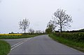
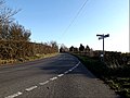
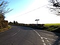
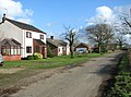
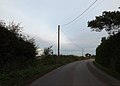
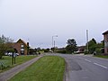
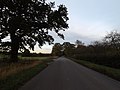
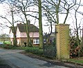
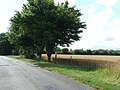
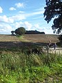
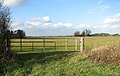
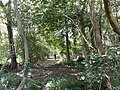
English: Ringsfield is a village and civil parish in the English county of Suffolk located approximately 2 miles (3km) south-west of Beccles in the District of Waveney. The mid-2005 population estimate for Ringsfield parish was 340. The modern village is concentrated around Ringsfield Corner crossroads, about 1 mile (1½km) south of the parish church. Weston is 1⅓ miles (2km) to the east, Redisham 2 miles (3km) to the south and Ilkesthall St Andrew 2 miles (3km) to the west.
village and civil parish in Suffolk, England, UK  | |||||
| Carica un file multimediale | |||||
| Istanza di | |||||
|---|---|---|---|---|---|
| Luogo |
| ||||
 | |||||
Sottocategorie
Questa categoria contiene le 3 sottocategorie indicate di seguito, su un totale di 3.
File nella categoria "Ringsfield"
Questa categoria contiene 200 file, indicati di seguito, su un totale di 214.
(pagina precedente) (pagina successiva)-
-
 Alpacas in field, Ringsfield - geograph.org.uk - 5020706.jpg 1 024 × 683; 262 KB
-

-
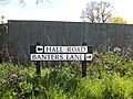
 Ash trees beside Hall Road - geograph.org.uk - 3834264.jpg 480 × 640; 231 KB
-
 Banters Lane, Ringfield - geograph.org.uk - 4961079.jpg 3 072 × 2 142; 3,66 MB
-
 Bridlepath along beck - Redisham Hall Estate - geograph.org.uk - 6168912.jpg 4 128 × 3 096; 3,1 MB
-
-
 Bridleway to Church Road - geograph.org.uk - 4960787.jpg 3 072 × 2 304; 1,98 MB
-
 Bungalow in School Road, Ringsfield - geograph.org.uk - 3834002.jpg 640 × 413; 165 KB
-
 Bus Shelter on Redisham Road - geograph.org.uk - 3469405.jpg 2 304 × 3 072; 1,64 MB
-
 Chapel at Ringsfield - geograph.org.uk - 542707.jpg 640 × 426; 117 KB
-
 Chapel off School Road - geograph.org.uk - 3469685.jpg 2 998 × 2 305; 1,46 MB
-
 Chapel off School Road - geograph.org.uk - 3469687.jpg 3 072 × 2 304; 1,34 MB
-
 Children's Play Area at Ringsfield Village Hall - geograph.org.uk - 3469203.jpg 3 072 × 2 304; 1,38 MB
-
 Church Road near the bridleway - geograph.org.uk - 3466833.jpg 3 072 × 2 304; 1,32 MB
-
 Church Road sign - geograph.org.uk - 3469262.jpg 3 072 × 2 304; 1,47 MB
-
 Church Road sign - geograph.org.uk - 3861559.jpg 3 072 × 2 304; 2,37 MB
-
 Church Road ^ footpath to Memory Cottage - geograph.org.uk - 3466853.jpg 3 072 × 2 304; 1,31 MB
-
 Church Road ^ footpath to School Road - geograph.org.uk - 3467371.jpg 3 072 × 2 304; 1,31 MB
-
 Church Road ^ The Church Victorian Postbox - geograph.org.uk - 3467354.jpg 3 072 × 2 304; 1,55 MB
-
 Church Road, Ringsfield - geograph.org.uk - 3467063.jpg 3 072 × 2 304; 1,52 MB
-
 Church Road, Ringsfield - geograph.org.uk - 3467330.jpg 3 072 × 2 304; 1,53 MB
-
 Church Road, Ringsfield - geograph.org.uk - 3468219.jpg 3 072 × 2 075; 1,33 MB
-
 Church Road, Ringsfield - geograph.org.uk - 3468238.jpg 3 072 × 2 304; 1,22 MB
-
 Church Road, Ringsfield - geograph.org.uk - 3468257.jpg 3 072 × 2 005; 1,06 MB
-
 Church Road, Ringsfield - geograph.org.uk - 3861545.jpg 3 072 × 2 304; 1,61 MB
-
 Church Road, Ringsfield - geograph.org.uk - 3861557.jpg 2 857 × 2 141; 1,35 MB
-
 Church Road, Ringsfield - geograph.org.uk - 3861706.jpg 2 890 × 2 166; 1,22 MB
-
 Church Road, Ringsfield - geograph.org.uk - 3861713.jpg 3 072 × 2 304; 1,82 MB
-
 Church Road, Ringsfield - geograph.org.uk - 3861719.jpg 3 072 × 2 304; 1,38 MB
-
 Church Road, Ringsfield - geograph.org.uk - 3948616.jpg 3 072 × 2 304; 1,14 MB
-
 Church Road, Ringsfield Corner - geograph.org.uk - 3469250.jpg 3 072 × 2 304; 1,29 MB
-
 Cottages in Polls Lane, Ringsfield - geograph.org.uk - 3833969.jpg 640 × 474; 164 KB
-
 Cromwell Road near The Horseshoes, Ringsfield - geograph.org.uk - 5020733.jpg 3 648 × 2 432; 2,85 MB
-
 Cromwell Road sign - geograph.org.uk - 3469380.jpg 3 072 × 2 304; 1,61 MB
-
 Cromwell Road ^ bridleway - geograph.org.uk - 3734280.jpg 3 072 × 2 205; 656 KB
-
 Cromwell Road ^ footpath - geograph.org.uk - 3733781.jpg 3 072 × 2 304; 1,82 MB
-
 Cromwell Road ^ footpath - geograph.org.uk - 3734262.jpg 3 072 × 2 253; 1,13 MB
-
 Cromwell Road, Ringsfield Corner - geograph.org.uk - 3469503.jpg 3 072 × 2 304; 1,25 MB
-
 Cromwell Road. Ringsfield - geograph.org.uk - 3733813.jpg 3 072 × 2 304; 1,9 MB
-
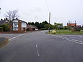
 Crossroads at Ringsfield Corner - geograph.org.uk - 2899810.jpg 3 264 × 2 448; 1,81 MB
-
 Crossways - geograph.org.uk - 4569436.jpg 1 024 × 768; 382 KB
-
 Ditch beside Polls Lane, Ringsfield - geograph.org.uk - 3833966.jpg 640 × 480; 179 KB
-
 Driveway to Redisham Hall - geograph.org.uk - 3836796.jpg 640 × 547; 249 KB
-
 East Lodge - geograph.org.uk - 3836795.jpg 640 × 530; 240 KB
-
 East Lodge at Redisham Hall - geograph.org.uk - 3538168.jpg 3 072 × 2 304; 1,54 MB
-
 Entering Ilketshall St.Andrew on School Road - geograph.org.uk - 3470497.jpg 3 072 × 2 304; 1,24 MB
-
 Entering Ringsfield on School Road - geograph.org.uk - 3470461.jpg 3 072 × 2 304; 1,33 MB
-
 Entrance of Ringsfield Village Hall - geograph.org.uk - 3469224.jpg 3 072 × 2 304; 1,44 MB
-
 Entrance to Flint House - geograph.org.uk - 3538204.jpg 3 072 × 2 304; 1,48 MB
-
 Entrance to Hall Farm, Redisham - geograph.org.uk - 2157946.jpg 640 × 480; 73 KB
-
 Entrance to Lemans Farm - geograph.org.uk - 3834278.jpg 640 × 480; 235 KB
-
 Entrance to Lemans Farm - geograph.org.uk - 4961082.jpg 3 072 × 2 304; 1,89 MB
-
 Entrance to Meadow Cottage - geograph.org.uk - 3538190.jpg 3 072 × 2 304; 1,35 MB
-
 Entrance to Pound Farm, Redisham Road - geograph.org.uk - 2899817.jpg 3 264 × 2 448; 2,36 MB
-
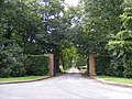
 Entrance to Redisham Hall - geograph.org.uk - 2021125.jpg 640 × 480; 103 KB
-
 Entrance to Redisham Hall - geograph.org.uk - 3537486.jpg 3 072 × 2 304; 1,66 MB
-
 Entrance to Redisham Hall - geograph.org.uk - 3538166.jpg 2 304 × 3 072; 1,53 MB
-
 Entrance to Ringsfoeld Hall - geograph.org.uk - 4960798.jpg 3 072 × 2 304; 1,79 MB
-
 Farm shed beside Ringsfield Road - geograph.org.uk - 3833953.jpg 640 × 480; 154 KB
-

-
 Field beside Hall Road - geograph.org.uk - 3834298.jpg 640 × 480; 204 KB
-
 Field beside Hall Road - geograph.org.uk - 3834299.jpg 640 × 480; 205 KB
-
 Fields by Grove Farm, Ringsfield - geograph.org.uk - 3833986.jpg 640 × 480; 169 KB
-
 Fields by Little Common - geograph.org.uk - 3834266.jpg 640 × 480; 183 KB
-
 Fields by Ringsfield Hall - geograph.org.uk - 3834294.jpg 640 × 480; 151 KB
-
 Fields north of Ringsfield Road - geograph.org.uk - 3833962.jpg 640 × 600; 211 KB
-
 Fields north of School Road - geograph.org.uk - 3834028.jpg 640 × 480; 178 KB
-
 Fields south of Redisham Road - geograph.org.uk - 3836791.jpg 640 × 480; 216 KB
-
 Fields west of Barnaby Farm - geograph.org.uk - 3833960.jpg 640 × 480; 212 KB
-
 Footpath - geograph.org.uk - 4310148.jpg 1 024 × 768; 225 KB
-
 Footpath along Great Wood, Redisham - geograph.org.uk - 4883396.jpg 3 648 × 2 736; 4,6 MB
-
 Footpath between Polls Lane ^ Cromwell Road - geograph.org.uk - 2557534.jpg 2 448 × 3 264; 1,98 MB
-
 Footpath Junction - geograph.org.uk - 4310094.jpg 1 024 × 768; 233 KB
-
 Footpath Junction - geograph.org.uk - 4310137.jpg 768 × 1 024; 326 KB
-
 Footpath off Church Road - geograph.org.uk - 3861567.jpg 2 989 × 2 240; 2,51 MB
-
 Footpath off Church Road - geograph.org.uk - 3861716.jpg 3 048 × 2 284; 2,01 MB
-
 Footpath Off Polls Lane - geograph.org.uk - 4310109.jpg 1 024 × 768; 188 KB
-
 Footpath Off School Road - geograph.org.uk - 4594382.jpg 1 024 × 768; 243 KB
-
 Footpath through farmland - geograph.org.uk - 2557519.jpg 2 448 × 3 264; 2,49 MB
-
 Footpath through farmland in Ringsfield - geograph.org.uk - 2557524.jpg 2 448 × 3 264; 2,3 MB
-
 Footpath to Cromwell Road - geograph.org.uk - 3861526.jpg 3 072 × 2 304; 1,4 MB
-
 Footpath to Great Wood - geograph.org.uk - 2190602.jpg 700 × 525; 191 KB
-
 Footpath to Memory Cottage - geograph.org.uk - 3466858.jpg 3 072 × 2 304; 1,31 MB
-
 Footpath to Polls Lane - geograph.org.uk - 3733783.jpg 3 072 × 2 304; 1,77 MB
-
 Footpath to School Road - geograph.org.uk - 3467374.jpg 3 072 × 2 304; 1,22 MB
-
 Footpath to St.Andrew's ^ Ringsfield Halls - geograph.org.uk - 3470495.jpg 3 072 × 2 304; 1,39 MB
-
 Footpath to the A145 London Road - geograph.org.uk - 3734266.jpg 3 072 × 2 304; 1,86 MB
-
 Footpath ^ Farmland near Barsham - geograph.org.uk - 2899755.jpg 3 264 × 2 448; 2,18 MB
-
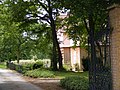
 Ringsfield Church - geograph.org.uk - 222794.jpg 640 × 480; 121 KB
-
-
 Grain silos at Ringsfield - geograph.org.uk - 1858240.jpg 640 × 480; 37 KB
-
 Grain Silos at School Farm - geograph.org.uk - 3470479.jpg 3 072 × 2 304; 1,29 MB
-

-
 Grass Meadow - geograph.org.uk - 4576031.jpg 1 024 × 768; 239 KB
-
 Great Wood footpath looking south - geograph.org.uk - 6168882.jpg 4 128 × 3 096; 3,67 MB
-
-
 Grove Farm - the farmhouse - geograph.org.uk - 3833980.jpg 640 × 542; 298 KB
-
 Hall Road past Ringsfield Hall - geograph.org.uk - 3834288.jpg 640 × 480; 250 KB
-
 Hall Road ^ Bridleway - geograph.org.uk - 4960785.jpg 3 072 × 2 142; 4,07 MB
-
 Hall Road, Ringsfield - geograph.org.uk - 4960796.jpg 3 067 × 2 277; 6,08 MB
-

-
-
 Information Sign - geograph.org.uk - 4310162.jpg 1 024 × 768; 155 KB
-
 Into Great Wood - geograph.org.uk - 4576042.jpg 768 × 1 024; 436 KB
-
 John John's Wood, Ringsfield - geograph.org.uk - 3833999.jpg 480 × 640; 225 KB
-
 Lane ^ Bridleway to Lodge Farm Lane - geograph.org.uk - 3466816.jpg 3 072 × 2 304; 1,4 MB
-
 Lodge at the entrance to Redisham Hall - geograph.org.uk - 2021136.jpg 640 × 480; 106 KB
-
 Long Close sign - geograph.org.uk - 3469409.jpg 2 304 × 3 072; 1,65 MB
-
 Looking back at Redisham Hall Park and beck from bridlepath - geograph.org.uk - 6168920.jpg 4 128 × 3 096; 2,97 MB
-

-
 Marshy Ground - geograph.org.uk - 4576044.jpg 1 024 × 768; 303 KB
-
 Meadow - geograph.org.uk - 4569443.jpg 1 024 × 768; 217 KB
-
 Meadow Cottage - geograph.org.uk - 4569453.jpg 1 024 × 768; 320 KB
-
 Newly ploughed fields in Ringsfield - geograph.org.uk - 2557522.jpg 3 264 × 2 448; 2,51 MB
-
 Oak trees beside Ringsfield Road - geograph.org.uk - 3833951.jpg 640 × 480; 255 KB
-
 Playing Field at Ringsfield Village Hall - geograph.org.uk - 3469216.jpg 3 072 × 2 304; 1,26 MB
-
 Polls Lane sign - geograph.org.uk - 3468263.jpg 3 072 × 2 304; 1,51 MB
-
 Polls Lane sign - geograph.org.uk - 3735666.jpg 2 774 × 2 081; 900 KB
-
 Polls Lane sign - geograph.org.uk - 3861555.jpg 3 028 × 2 269; 2,73 MB
-
 Polls Lane ^ Cottages - geograph.org.uk - 3861532.jpg 2 907 × 2 178; 1,25 MB
-
 Polls Lane ^ footpath - geograph.org.uk - 3861521.jpg 3 072 × 2 304; 1,39 MB
-
 Polls Lane, Ringsfield - geograph.org.uk - 3468272.jpg 3 072 × 2 304; 1,38 MB
-
 Polls Lane, Ringsfield - geograph.org.uk - 3733822.jpg 3 072 × 2 304; 1,94 MB
-
 Polls Lane, Ringsfield - geograph.org.uk - 3735664.jpg 3 072 × 2 304; 1,77 MB
-
 Polls Lane, Ringsfield - geograph.org.uk - 3735673.jpg 3 072 × 2 304; 1 MB
-
 Polls Lane, Ringsfield - geograph.org.uk - 3861533.jpg 2 907 × 2 178; 1,21 MB
-
 Polls Lane, Ringsfield - geograph.org.uk - 3861552.jpg 3 072 × 2 304; 1,58 MB
-
 Polls Lane, Ringsfield - geograph.org.uk - 3948621.jpg 3 072 × 2 304; 1,19 MB
-
 Pound Farm sign - geograph.org.uk - 3469630.jpg 2 931 × 2 201; 1,1 MB
-
 Primrose Lane - geograph.org.uk - 978180.jpg 640 × 477; 116 KB
-
 Primrose Lane sign - geograph.org.uk - 3861737.jpg 3 072 × 2 304; 1,62 MB
-
 Primrose Lane ^ bridleway to Cromwell Road - geograph.org.uk - 3861738.jpg 3 008 × 2 254; 1,04 MB
-
 Primrose Lane, Ringsfield - geograph.org.uk - 2169282.jpg 640 × 480; 104 KB
-

-
 Redisham Hall, from bridlepath - geograph.org.uk - 6168905.jpg 4 128 × 3 096; 800 KB
-
 Redisham Parva, St Peter's church - geograph.org.uk - 1904492.jpg 640 × 480; 105 KB
-
 Redisham Parva, St. Peter's church - geograph.org.uk - 1905996.jpg 640 × 480; 97 KB
-
 Redisham Road Postbox - geograph.org.uk - 3469315.jpg 2 304 × 3 072; 1,65 MB
-
 Redisham Road Postbox ^ Telephone Box - geograph.org.uk - 3469479.jpg 3 072 × 2 304; 1,54 MB
-
 Redisham Road sign - geograph.org.uk - 3469277.jpg 3 072 × 2 304; 1,52 MB
-
 Redisham Road sign - geograph.org.uk - 3469483.jpg 2 304 × 3 072; 1,52 MB
-
 Redisham Road ^ Bridleway sign - geograph.org.uk - 3469624.jpg 3 072 × 2 304; 1,39 MB
-
 Redisham Road ^ entrance to Redisham Hall - geograph.org.uk - 3537476.jpg 3 072 × 2 209; 1,43 MB
-
 Redisham Road ^ entrance to Redisham Hall - geograph.org.uk - 3537493.jpg 3 072 × 2 304; 1,5 MB
-
 Redisham Road ^ Redisham Road Postbox - geograph.org.uk - 3469448.jpg 3 072 × 2 304; 1,4 MB
-
 Redisham Road, Bridleway ^ entrance to Pound Farm - geograph.org.uk - 3469616.jpg 3 072 × 2 304; 1,33 MB
-
 Redisham Road, Ringsfield - geograph.org.uk - 3538188.jpg 3 072 × 2 304; 1,38 MB
-
 Redisham Road, Ringsfield - geograph.org.uk - 3538202.jpg 3 072 × 2 304; 1,49 MB
-
 Redisham Road, Ringsfield - geograph.org.uk - 3538470.jpg 3 072 × 2 304; 1,24 MB
-
 Redisham Road, Ringsfield Corner - geograph.org.uk - 3469271.jpg 3 072 × 2 304; 1,38 MB
-
 Redisham Road, Ringsfield Corner - geograph.org.uk - 3469327.jpg 3 072 × 2 304; 1,26 MB
-
 Ringsfield - geograph.org.uk - 3307502.jpg 640 × 480; 104 KB
-
 Ringsfield Bridle path - geograph.org.uk - 388057.jpg 640 × 480; 114 KB
-
 Ringsfield Hall - geograph.org.uk - 2017231.jpg 640 × 480; 88 KB
-
 Ringsfield Hall sign - geograph.org.uk - 4960799.jpg 3 072 × 2 304; 1,76 MB
-
 Ringsfield Road - geograph.org.uk - 4310086.jpg 1 024 × 768; 367 KB
-
 Ringsfield Road sign - geograph.org.uk - 3861704.jpg 3 072 × 2 304; 2,54 MB
-
 Ringsfield Road, Ringsfield - geograph.org.uk - 3861568.jpg 3 072 × 2 304; 1,72 MB
-
 Ringsfield Road, Ringsfield - geograph.org.uk - 3861730.jpg 3 028 × 2 269; 1,9 MB
-
 Ringsfield Road, Ringsfield - geograph.org.uk - 3861742.jpg 3 072 × 2 304; 1,78 MB
-
 Ringsfield to Beccles Road, Ringsfield - geograph.org.uk - 5060868.jpg 3 648 × 2 432; 4,18 MB
-
 Ringsfield Village Name sign on School Road - geograph.org.uk - 3470476.jpg 2 304 × 3 072; 1,36 MB
-
 Ringsfield Village Name sign on School Road - geograph.org.uk - 3470480.jpg 2 304 × 3 072; 1,33 MB
-
 Ringsfield Village Notice Board - geograph.org.uk - 3469331.jpg 2 304 × 3 072; 1,45 MB
-
 Ringsfield Way Station - geograph.org.uk - 4310159.jpg 768 × 1 024; 309 KB
-

-

-
 Roadsign on Banters Lane - geograph.org.uk - 4960813.jpg 3 072 × 2 304; 1,88 MB
-
 Roadsign on Church Road - geograph.org.uk - 3468223.jpg 2 138 × 2 854; 862 KB
-
 Roadsign on Church Road - geograph.org.uk - 3468267.jpg 2 304 × 3 072; 1,39 MB
-
 Roadsign on Church Road - geograph.org.uk - 3861542.jpg 2 253 × 3 004; 1,47 MB
-
 Roadsign on Church Road - geograph.org.uk - 3861562.jpg 2 062 × 2 749; 672 KB
-
 Roadsign on Cromwell Road - geograph.org.uk - 3469374.jpg 2 304 × 3 072; 1,31 MB
-
 Roadsign on Cromwell Road - geograph.org.uk - 3733820.jpg 2 304 × 3 072; 1,79 MB
-
 School Farm - the farmhouse - geograph.org.uk - 3834008.jpg 640 × 480; 192 KB
-
 School Road name sign on School Road - geograph.org.uk - 3470481.jpg 3 072 × 2 304; 1,67 MB
-
 School Road sign - geograph.org.uk - 3469270.jpg 3 072 × 2 304; 1,66 MB
-
 School Road ^ footpath to St.Andrew's ^ Ringsfield Halls - geograph.org.uk - 3470486.jpg 3 072 × 2 304; 1,31 MB
-
 School Road, Ringsfield Corner - geograph.org.uk - 3469265.jpg 3 072 × 2 304; 1,3 MB
-
 School Road, Ringsfield Corner - geograph.org.uk - 3469386.jpg 3 072 × 2 304; 1,33 MB
-
 School Road, Ringsfield Corner - geograph.org.uk - 3469918.jpg 3 072 × 2 304; 1,66 MB
-
 Seagulls in field by Blacksmith's Corner - geograph.org.uk - 3834273.jpg 640 × 578; 158 KB
-
 Shed by St Andrew's Hall Farm - geograph.org.uk - 3834043.jpg 640 × 480; 159 KB
-

-
 Sheds by Grove Farm, Ringsfield - geograph.org.uk - 3833983.jpg 640 × 444; 193 KB
-
 Sodden field beside Hall Road - geograph.org.uk - 3834296.jpg 640 × 480; 213 KB
-
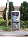 Telephone Box on Redisham Road - geograph.org.uk - 3469458.jpg 2 304 × 3 072; 1,45 MB
-
 Telephone Box ^ Redisham Road Postbox - geograph.org.uk - 3469290.jpg 3 072 × 2 304; 1,47 MB
-
 Telephone Box ^ Redisham Road Postbox - geograph.org.uk - 3469291.jpg 3 072 × 2 304; 1,51 MB
-
 Telephone Box ^ Redisham Road Postbox - geograph.org.uk - 3469474.jpg 2 304 × 3 072; 1,3 MB
-

-
 Tennis Courts at Ringsfield Village Hall - geograph.org.uk - 3469214.jpg 3 072 × 2 304; 1,3 MB
-
 Tennis Courts at Ringsfield Village Hall - geograph.org.uk - 3469220.jpg 3 072 × 2 304; 1,22 MB
-
 The Church Victorian Postbox - geograph.org.uk - 3467357.jpg 2 304 × 3 072; 1,63 MB
-
 The Church Victorian Postbox - geograph.org.uk - 3467359.jpg 2 304 × 3 072; 1,68 MB
-
 The Church Victorian Postbox - geograph.org.uk - 3467362.jpg 2 304 × 3 072; 1,67 MB
-
 The Church Victorian Postbox - geograph.org.uk - 3467364.jpg 2 304 × 3 072; 1,54 MB
-
 The road to Redisham Hall - geograph.org.uk - 5955086.jpg 4 032 × 2 268; 5,86 MB
-
 To Ringsfield Corner on Redisham Road - geograph.org.uk - 3836789.jpg 640 × 480; 152 KB


