Category:Ringwood
Zur Navigation springen
Zur Suche springen
Ort in England  | |||||
| Medium hochladen | |||||
| Ist ein(e) | |||||
|---|---|---|---|---|---|
| Ort | New Forest, Hampshire, Südostengland, England | ||||
| Liegt am oder im Gewässer | |||||
| Eventuell gleichwertig | Ringwood (Wikimedia-Dublette, Civil Parish in England) | ||||
 | |||||
Deutsch: Ringwood bezeichnet
English: Ringwood is an historic market town in Hampshire, England, located on the River Avon, west of the New Forest and north of Bournemouth. The town features a weekly market in the traditional market place. A cattle market ran in the Furlong until 1989, which is now home to a Waitrose supermarket, coffee shops and fashion outlets.
Nederlands: Ringwood kan verwijzen naar de volgende plaatsen in de Verenigde Staten:
Polski: Miejscowości w USA:
Română: Ringwood este un oraş în comitatul Hampshire, regiunea South East England, Anglia. Oraşul se află în districtul New Forest.
Volapük: Dabinons:
Unterkategorien
Es werden 12 von insgesamt 12 Unterkategorien in dieser Kategorie angezeigt:
In Klammern die Anzahl der enthaltenen Kategorien (K), Seiten (S), Dateien (D)
Medien in der Kategorie „Ringwood“
Folgende 200 Dateien sind in dieser Kategorie, von 572 insgesamt.
(vorherige Seite) (nächste Seite)-
 -Finger Post on the Avon Valley Path - geograph.org.uk - 6087152.jpg 534 × 800; 402 KB
-
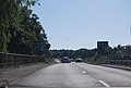
 A busy A31 descends towards Ringwood - geograph.org.uk - 2969760.jpg 3.648 × 2.736; 1,43 MB
-
 A31 - geograph.org.uk - 4242682.jpg 640 × 376; 33 KB
-
 A31 approaching Ringwood - geograph.org.uk - 3648876.jpg 640 × 400; 46 KB
-

-
 A31 at the bottom of Poulner Hill - geograph.org.uk - 5017757.jpg 640 × 427; 80 KB
-
 A31 passes Ringwood - geograph.org.uk - 3207659.jpg 640 × 428; 72 KB
-
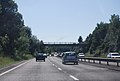
 A31, eastbound - geograph.org.uk - 4242683.jpg 640 × 347; 36 KB
-
 A31, Ringwood - geograph.org.uk - 2702492.jpg 640 × 481; 55 KB
-
 A31, Ringwood - geograph.org.uk - 3416079.jpg 640 × 480; 369 KB
-
 A31, Ringwood - geograph.org.uk - 3648928.jpg 640 × 430; 45 KB
-
 A31, Southampton Road Bridge - geograph.org.uk - 3648877.jpg 640 × 430; 52 KB
-
 A31, westbound - geograph.org.uk - 3648872.jpg 640 × 380; 45 KB
-
 A31, westbound - geograph.org.uk - 3648873.jpg 640 × 430; 52 KB
-
 A31, westbound - geograph.org.uk - 3648883.jpg 640 × 396; 42 KB
-
 Abandoned railway tracks - geograph.org.uk - 3727969.jpg 3.648 × 2.736; 4,2 MB
-

-
 Alleyway to Ringwood Social Club - geograph.org.uk - 5300642.jpg 480 × 640; 166 KB
-
 Allum ^ Siddaway, High Street - geograph.org.uk - 2676343.jpg 480 × 640; 75 KB
-
 Almshouses, Ringwood - geograph.org.uk - 10779.jpg 640 × 481; 136 KB
-
 Anna Lane on a Wet Day - geograph.org.uk - 6087154.jpg 800 × 534; 336 KB
-
 Approaching A31 bridge at Ringwood - geograph.org.uk - 1865630.jpg 640 × 480; 74 KB
-
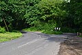
 Approaching Ringwood northwards on B3347 - geograph.org.uk - 1924274.jpg 640 × 427; 143 KB
-

-

-

-
 Around Ringwood, Hampshire (150228) (9456099244).jpg 3.372 × 2.426; 2,06 MB
-
 Around Ringwood, Hampshire (150229) (9456101710).jpg 3.220 × 2.344; 2,06 MB
-
 Around Ringwood, Hampshire - panoramio.jpg 2.048 × 1.474; 635 KB
-
 Avon Valley Path - geograph.org.uk - 1942353.jpg 427 × 640; 286 KB
-
 Avon Valley Path - geograph.org.uk - 1942358.jpg 640 × 427; 237 KB
-
 Avon Valley Path - geograph.org.uk - 21815.jpg 640 × 481; 158 KB
-
 Avon Valley Path - geograph.org.uk - 3968369.jpg 1.024 × 700; 1,13 MB
-
 Avon Valley Path - geograph.org.uk - 5376822.jpg 1.600 × 1.200; 1,1 MB
-
 Avon Valley Path - geograph.org.uk - 5376826.jpg 1.600 × 1.200; 1,06 MB
-
 Avon Valley Path - geograph.org.uk - 6087151.jpg 800 × 534; 475 KB
-
 Avon Valley Path through fields - geograph.org.uk - 1942397.jpg 640 × 427; 200 KB
-
 B ^ B Dairies, Christchurch Road - geograph.org.uk - 1926450.jpg 640 × 427; 153 KB
-

-
 Bales beside track near Sandford Copse - geograph.org.uk - 5965510.jpg 1.024 × 683; 311 KB
-
 Bench Mark, Salvation Army Citadel - geograph.org.uk - 2592170.jpg 480 × 640; 68 KB
-
 Benchmark on the bridge - geograph.org.uk - 2703098.jpg 800 × 742; 251 KB
-
 Bend in Hightown Hill - geograph.org.uk - 5017763.jpg 640 × 427; 99 KB
-
 Bickerley Mill Stream - geograph.org.uk - 1540893.jpg 640 × 480; 121 KB
-
 Bickerley Mill Stream - geograph.org.uk - 1540896.jpg 480 × 640; 118 KB
-
 Bickerley Millstream - geograph.org.uk - 1942347.jpg 640 × 427; 167 KB
-
 Bickerley Millstream - geograph.org.uk - 2397986.jpg 1.024 × 768; 104 KB
-
 Bickerley Millstream - geograph.org.uk - 2398126.jpg 1.024 × 747; 148 KB
-

-
 Bickerley Millstream, Ringwood, Hampshire, England.jpg 3.745 × 2.779; 4,54 MB
-
 Bickerley Pocket Park - geograph.org.uk - 1540626.jpg 640 × 497; 140 KB
-
 Bikes within The Furlong Car Park - geograph.org.uk - 2676354.jpg 640 × 480; 150 KB
-
 Black Firs plantation - geograph.org.uk - 1942947.jpg 640 × 427; 162 KB
-
 Bogbodia uda 377969.jpg 4.570 × 3.046; 6,13 MB
-

-

-
 Bridge over A31 in Ringwood - geograph.org.uk - 3992457.jpg 1.536 × 1.024; 846 KB
-
 Bridge over stream in Dragon Lane - geograph.org.uk - 5965517.jpg 1.024 × 683; 318 KB
-
 Brixey's Farmhouse - geograph.org.uk - 5965491.jpg 1.024 × 683; 221 KB
-
 Broken Milepost, B3347 - geograph.org.uk - 268172.jpg 480 × 640; 83 KB
-

-
 Buildings across field at Brixey's Farm - geograph.org.uk - 5965486.jpg 1.024 × 683; 212 KB
-

-

-
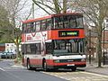 Bus img 7757 (16020750570).jpg 2.419 × 1.814; 2,82 MB
-
 Bus img 7760 (16206232351).jpg 2.788 × 2.091; 3,02 MB
-
 Bus img 7763 (15585704744).jpg 2.762 × 2.072; 3,12 MB
-
 Bus img 7766 (16022016349).jpg 2.596 × 1.947; 3,14 MB
-
 Bus img 7769 (16020613798).jpg 3.072 × 2.304; 2,62 MB
-
 Bus img 7773 (15585713414).jpg 3.072 × 2.304; 1,79 MB
-
 Bus img 7777 (16182253716).jpg 2.720 × 2.040; 3,33 MB
-
 Bus stand Ringwood Hampshire - geograph.org.uk - 184674.jpg 640 × 418; 166 KB
-
 Car park Ringwood Hampshire - geograph.org.uk - 184912.jpg 640 × 480; 116 KB
-

-
 Carvers recreation grounds, Ringwood - geograph.org.uk - 176002.jpg 640 × 480; 113 KB
-
 Castleman Trailway - geograph.org.uk - 1541507.jpg 640 × 467; 120 KB
-
 Castleman trailway - geograph.org.uk - 3544557.jpg 3.648 × 2.736; 4,18 MB
-
 Castleman Way, Ringwood - geograph.org.uk - 1541722.jpg 640 × 480; 66 KB
-
 Castleman Way, Ringwood - geograph.org.uk - 4162152.jpg 1.024 × 659; 635 KB
-
 Ceramic House Name Plate - geograph.org.uk - 4162215.jpg 1.024 × 691; 716 KB
-
 Charles Copse, seen from footpath - geograph.org.uk - 5878690.jpg 1.024 × 683; 256 KB
-
 Charles's Lane by Gadden's Close Farm - geograph.org.uk - 2869319.jpg 3.648 × 2.688; 2,38 MB
-
 Charles's Lane disused railway bridge - geograph.org.uk - 2869909.jpg 3.506 × 2.449; 1,6 MB
-
 Charles's Lane junction at Knave's Ash - geograph.org.uk - 2869294.jpg 3.443 × 2.458; 1,4 MB
-
 Cherry blossom by River Avon, Ringwood - geograph.org.uk - 385508.jpg 427 × 640; 120 KB
-
 Chimney stack, The White Hart - geograph.org.uk - 2700038.jpg 480 × 640; 81 KB
-
 Christmas lights, Fairlie Park, Ringwood - geograph.org.uk - 89275.jpg 640 × 480; 135 KB
-
 Church Hatch - Ringwood - geograph.org.uk - 668234.jpg 640 × 470; 199 KB
-

-
 Colourful bungalow at Poulner - geograph.org.uk - 4920595.jpg 640 × 427; 73 KB
-
-
 Construction site in The Furlong - geograph.org.uk - 2676375.jpg 640 × 480; 64 KB
-
 Corn straw hay ^ much more - panoramio.jpg 2.592 × 1.944; 2,2 MB
-
 Cranes Moor, bogland - geograph.org.uk - 2965616.jpg 1.024 × 768; 217 KB
-
 Crossing the Avon - geograph.org.uk - 2703128.jpg 800 × 600; 120 KB
-
 Crow Hill - geograph.org.uk - 2214483.jpg 1.024 × 736; 232 KB
-
 Crow Hill, barn - geograph.org.uk - 2337630.jpg 1.024 × 768; 233 KB
-
 Crow Hill, farmhouse - geograph.org.uk - 2337616.jpg 1.024 × 768; 304 KB
-
 Crow Hill, footpath - geograph.org.uk - 2214493.jpg 768 × 1.024; 297 KB
-
 Crow Hill, molehills - geograph.org.uk - 2214555.jpg 1.024 × 768; 237 KB
-
 Crow Hill, open land - geograph.org.uk - 2337601.jpg 1.024 × 768; 195 KB
-
 Crow Hill, Woodend Road - geograph.org.uk - 2214489.jpg 1.024 × 768; 278 KB
-
 Crow Lane passes Aivly Country Store - geograph.org.uk - 4081867.jpg 3.541 × 2.535; 1,17 MB
-
 Crown Cottages, Ringwood - geograph.org.uk - 2652511.jpg 480 × 640; 80 KB
-
 Cut mark on the bank - geograph.org.uk - 2703249.jpg 800 × 632; 178 KB
-
 Date stone, Ringwood - geograph.org.uk - 2652419.jpg 640 × 481; 85 KB
-
 Dean's Farm - geograph.org.uk - 1942482.jpg 640 × 427; 224 KB
-
 Depot of New Forest District Council - geograph.org.uk - 1926607.jpg 640 × 427; 182 KB
-
 Digivan in Ringwod Market Place - geograph.org.uk - 5300748.jpg 640 × 480; 178 KB
-
 Dismantled railway bridge - geograph.org.uk - 3728047.jpg 3.648 × 2.736; 4,23 MB
-
 Disused buildings on Kingston Farm - geograph.org.uk - 1942474.jpg 640 × 427; 192 KB
-

-

-

-
 Duck Island Lane - geograph.org.uk - 1942465.jpg 529 × 640; 210 KB
-
 East to Southampton - geograph.org.uk - 1865631.jpg 640 × 480; 74 KB
-
 Electricity sub-station by the Avon - geograph.org.uk - 782761.jpg 640 × 480; 57 KB
-

-
 Embankment Way - end of the road - geograph.org.uk - 3728092.jpg 3.648 × 2.736; 4,28 MB
-
 End of the tarmac path - geograph.org.uk - 5878683.jpg 1.024 × 683; 299 KB
-
 Entering Moortown - geograph.org.uk - 4167723.jpg 1.024 × 616; 674 KB
-
 Farmland, Ringwood - geograph.org.uk - 21823.jpg 640 × 481; 152 KB
-
 Field and footpath west of Nouale Lane - geograph.org.uk - 6013458.jpg 640 × 427; 204 KB
-
 Field and house at Poulner - geograph.org.uk - 5017754.jpg 640 × 427; 99 KB
-
 Field of Young Corn - geograph.org.uk - 3968383.jpg 1.024 × 704; 802 KB
-
 Field west of Nouale Lane - geograph.org.uk - 6013437.jpg 640 × 427; 128 KB
-
 Field west of Nouale Lane - geograph.org.uk - 6013441.jpg 640 × 427; 168 KB
-
 Field west of Nouale Lane - geograph.org.uk - 6013446.jpg 640 × 427; 143 KB
-
 Field west of sewage treatment works - geograph.org.uk - 1924220.jpg 640 × 427; 163 KB
-
 Fields at Brixey's Farm - geograph.org.uk - 5965482.jpg 1.024 × 683; 201 KB
-

-
 Fields between Nouale Lane and Eastfield Lane - geograph.org.uk - 6013491.jpg 1.024 × 683; 263 KB
-
 Fields between Nouale Lane and Eastfield Lane - geograph.org.uk - 6013493.jpg 1.024 × 683; 261 KB
-
 Fields west of Nouale Lane - geograph.org.uk - 6013470.jpg 640 × 427; 152 KB
-
 Firemark, Market Place - geograph.org.uk - 2652634.jpg 479 × 640; 78 KB
-
 Footbridge on Avon Valley Path - geograph.org.uk - 1942392.jpg 640 × 427; 190 KB
-
 Footbridge over A31 - geograph.org.uk - 3207649.jpg 640 × 428; 86 KB
-
 Footbridge over A31 in Ringwood - geograph.org.uk - 3991354.jpg 1.536 × 1.024; 942 KB
-
 Footbridge over Bickerley Mill Stream - geograph.org.uk - 1540894.jpg 480 × 640; 130 KB
-
 Footbridge over the A31 - geograph.org.uk - 2834960.jpg 640 × 430; 36 KB
-
 Footbridge over the A31 - geograph.org.uk - 3648879.jpg 640 × 430; 48 KB
-
 Footbridges over Bickerley Millstream - geograph.org.uk - 1942340.jpg 640 × 427; 360 KB
-
 Footpath 38 through the gate on the right - geograph.org.uk - 6136709.jpg 576 × 1.024; 219 KB
-
 Footpath at Kingston - geograph.org.uk - 5965476.jpg 1.024 × 683; 241 KB
-
 Footpath at the end of Hurst Road - geograph.org.uk - 5297202.jpg 1.280 × 960; 605 KB
-
 Footpath behind New Road, Moortown - geograph.org.uk - 1924182.jpg 640 × 427; 215 KB
-
 Footpath behind Shires Close - geograph.org.uk - 1924151.jpg 640 × 427; 294 KB
-

-
-
 Footpath on edge of Sandford Copse - geograph.org.uk - 5965511.jpg 1.024 × 683; 288 KB
-
 Footpath on edge of Sandford Copse - geograph.org.uk - 5965512.jpg 1.024 × 683; 333 KB
-
 Footpath on the old trackbed - geograph.org.uk - 3728114.jpg 3.648 × 2.736; 4,29 MB
-
 Footpath to Castle View Farm - geograph.org.uk - 1924239.jpg 454 × 640; 204 KB
-
 Footpath, Ringwood - geograph.org.uk - 1540174.jpg 480 × 640; 90 KB
-

-
 Ford at Kingston - geograph.org.uk - 5349852.jpg 4.500 × 3.000; 7,05 MB
-
 Ford at North Poulner - geograph.org.uk - 5114774.jpg 1.440 × 960; 2,2 MB
-
 Ford at North Poulner - geograph.org.uk - 5114784.jpg 1.440 × 960; 2,29 MB
-
 Ford at Ringwood - geograph.org.uk - 5349802.jpg 4.032 × 3.024; 4,59 MB
-
 Ford over Bickerley Millstream - geograph.org.uk - 1942331.jpg 640 × 427; 284 KB
-
-
 Former level crossing in Barrack Lane - geograph.org.uk - 5878674.jpg 1.024 × 683; 291 KB
-
 Former level crossing in Barrack Lane - geograph.org.uk - 5878680.jpg 1.024 × 683; 193 KB
-
 Former railway bridge - geograph.org.uk - 3727720.jpg 3.648 × 2.736; 4,28 MB
-
 Former railway bridge at Ringwood - geograph.org.uk - 4920666.jpg 640 × 427; 78 KB
-

-
 Foulford Bottom - geograph.org.uk - 2040104.jpg 2.272 × 1.704; 1,77 MB
-
 Framptons Mill now a tea bar - geograph.org.uk - 1960257.jpg 640 × 468; 79 KB
-
 Framptons Mill, Ringwood - geograph.org.uk - 2652255.jpg 480 × 640; 78 KB
-
 From railway to river - geograph.org.uk - 5965746.jpg 1.024 × 683; 331 KB
-
 Furlong Shopping Centre - geograph.org.uk - 5723140.jpg 5.152 × 4.000; 5,08 MB
-
 Gantry, A31 - geograph.org.uk - 4242680.jpg 640 × 397; 36 KB
-
 Gated track at Sandford - geograph.org.uk - 5965503.jpg 1.024 × 683; 342 KB
-
 Globe House, on B3347 at Moortown - geograph.org.uk - 1924314.jpg 640 × 427; 192 KB
-
 Goat in field behind garden centre - geograph.org.uk - 2639649.jpg 640 × 480; 114 KB
-
 Green and houses in Shires Close - geograph.org.uk - 1924157.jpg 640 × 373; 169 KB
-
 Green at Moortown - geograph.org.uk - 4167703.jpg 1.024 × 619; 698 KB
-
 Green beside the A31 at Ringwood - geograph.org.uk - 4920599.jpg 640 × 427; 84 KB
-
 Green between Gorley Road and Cowpits Lane - geograph.org.uk - 4081888.jpg 3.112 × 2.484; 1,14 MB
-
 Green gate opposite Dean's Farm - geograph.org.uk - 5965522.jpg 1.024 × 683; 268 KB
-
 Greyfriars - Ringwood - geograph.org.uk - 858492.jpg 640 × 456; 411 KB
-
 Hampshire border, A31 - geograph.org.uk - 3666144.jpg 630 × 640; 58 KB
-
 Hampshire Hatches Farm - geograph.org.uk - 1942324.jpg 640 × 427; 217 KB
-
 Hampshire Hatches Lane - geograph.org.uk - 1942309.jpg 640 × 427; 186 KB
-
 Hangersley Hill in Winter - geograph.org.uk - 2803681.jpg 2.016 × 1.512; 746 KB
-
 Hatches on the Avon at Ringwood - geograph.org.uk - 782772.jpg 640 × 480; 71 KB
-
 Hedge cutting, Crow Hill - geograph.org.uk - 1186741.jpg 640 × 480; 189 KB
-
 High St, Ringwood, Hampshire, England.jpg 3.904 × 2.925; 3,24 MB
-
 High Street- The Granary - geograph.org.uk - 2676644.jpg 480 × 640; 69 KB
-
 Holly berries - geograph.org.uk - 5965528.jpg 1.024 × 683; 178 KB
-
 House named Oak Cottage on Hightown Road - geograph.org.uk - 6013589.jpg 640 × 427; 175 KB
-
 House named Three Elms - geograph.org.uk - 1942988.jpg 640 × 427; 259 KB
-
 Houses beside Bickerley Common - geograph.org.uk - 4920683.jpg 640 × 427; 88 KB
-
 Houses in Hurst Road - geograph.org.uk - 4920745.jpg 640 × 427; 83 KB
-
 Houses in New Street - geograph.org.uk - 1926492.jpg 640 × 427; 191 KB
-
 Houses in New Street - geograph.org.uk - 1926498.jpg 640 × 427; 211 KB
-
 Houses on Christchurch Road, Kingston - geograph.org.uk - 5965542.jpg 1.024 × 683; 245 KB
-
 Houses set back from Christchurch Road - geograph.org.uk - 1926618.jpg 640 × 427; 171 KB
-
 HSBC, Ringwood - geograph.org.uk - 2703212.jpg 800 × 600; 121 KB
-
 ICT business in Christchurch Road - geograph.org.uk - 2677524.jpg 640 × 480; 70 KB


_(9456099244).jpg)
_(9456101710).jpg)


.jpg)
.jpg)
.jpg)
.jpg)
.jpg)
.jpg)
.jpg)


