Category:Ringwood
Jump to navigation
Jump to search
historic market town and civil parish in Hampshire, England  | |||||
| Upload media | |||||
| Instance of | |||||
|---|---|---|---|---|---|
| Location | New Forest, Hampshire, South East England, England | ||||
| Located in or next to body of water | |||||
| Population |
| ||||
| Said to be the same as | Ringwood (Wikimedia duplicated page, civil parish) | ||||
 | |||||
Deutsch: Ringwood bezeichnet
English: Ringwood is an historic market town in Hampshire, England, located on the River Avon, west of the New Forest and north of Bournemouth. The town features a weekly market in the traditional market place. A cattle market ran in the Furlong until 1989, which is now home to a Waitrose supermarket, coffee shops and fashion outlets.
Nederlands: Ringwood kan verwijzen naar de volgende plaatsen in de Verenigde Staten:
Polski: Miejscowości w USA:
Română: Ringwood este un oraş în comitatul Hampshire, regiunea South East England, Anglia. Oraşul se află în districtul New Forest.
Volapük: Dabinons:
Subcategories
This category has the following 12 subcategories, out of 12 total.
Media in category "Ringwood"
The following 200 files are in this category, out of 576 total.
(previous page) (next page)-
 -Finger Post on the Avon Valley Path - geograph.org.uk - 6087152.jpg 534 × 800; 402 KB
-
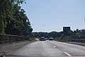
 A busy A31 descends towards Ringwood - geograph.org.uk - 2969760.jpg 3,648 × 2,736; 1.43 MB
-
 A31 - geograph.org.uk - 4242682.jpg 640 × 376; 33 KB
-
 A31 approaching Ringwood - geograph.org.uk - 3648876.jpg 640 × 400; 46 KB
-

-
 A31 at the bottom of Poulner Hill - geograph.org.uk - 5017757.jpg 640 × 427; 80 KB
-
 A31 passes Ringwood - geograph.org.uk - 3207659.jpg 640 × 428; 72 KB
-
 A31, eastbound - geograph.org.uk - 4242683.jpg 640 × 347; 36 KB
-
 A31, Ringwood - geograph.org.uk - 2702492.jpg 640 × 481; 55 KB
-
 A31, Ringwood - geograph.org.uk - 3416079.jpg 640 × 480; 369 KB
-
 A31, Ringwood - geograph.org.uk - 3648928.jpg 640 × 430; 45 KB
-
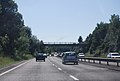 A31, Southampton Road Bridge - geograph.org.uk - 3648877.jpg 640 × 430; 52 KB
-
 A31, westbound - geograph.org.uk - 3648872.jpg 640 × 380; 45 KB
-
 A31, westbound - geograph.org.uk - 3648873.jpg 640 × 430; 52 KB
-
 A31, westbound - geograph.org.uk - 3648883.jpg 640 × 396; 42 KB
-

-
 Abandoned railway tracks - geograph.org.uk - 3727969.jpg 3,648 × 2,736; 4.2 MB
-

-
 Alleyway to Ringwood Social Club - geograph.org.uk - 5300642.jpg 480 × 640; 166 KB
-
 Allum ^ Siddaway, High Street - geograph.org.uk - 2676343.jpg 480 × 640; 75 KB
-
 Almshouses, Ringwood - geograph.org.uk - 10779.jpg 640 × 481; 136 KB
-
 Anna Lane on a Wet Day - geograph.org.uk - 6087154.jpg 800 × 534; 336 KB
-
 Approaching A31 bridge at Ringwood - geograph.org.uk - 1865630.jpg 640 × 480; 74 KB
-
 Approaching Ringwood northwards on B3347 - geograph.org.uk - 1924274.jpg 640 × 427; 143 KB
-

-

-

-
 Around Ringwood, Hampshire (150228) (9456099244).jpg 3,372 × 2,426; 2.06 MB
-
 Around Ringwood, Hampshire (150229) (9456101710).jpg 3,220 × 2,344; 2.06 MB
-
 Around Ringwood, Hampshire - panoramio.jpg 2,048 × 1,474; 635 KB
-
 Avon Valley Path - geograph.org.uk - 1942353.jpg 427 × 640; 286 KB
-
 Avon Valley Path - geograph.org.uk - 1942358.jpg 640 × 427; 237 KB
-
 Avon Valley Path - geograph.org.uk - 21815.jpg 640 × 481; 158 KB
-
 Avon Valley Path - geograph.org.uk - 3968369.jpg 1,024 × 700; 1.13 MB
-
 Avon Valley Path - geograph.org.uk - 5376822.jpg 1,600 × 1,200; 1.1 MB
-
 Avon Valley Path - geograph.org.uk - 5376826.jpg 1,600 × 1,200; 1.06 MB
-
 Avon Valley Path - geograph.org.uk - 6087151.jpg 800 × 534; 475 KB
-
 Avon Valley Path through fields - geograph.org.uk - 1942397.jpg 640 × 427; 200 KB
-
 B ^ B Dairies, Christchurch Road - geograph.org.uk - 1926450.jpg 640 × 427; 153 KB
-

-
 Bales beside track near Sandford Copse - geograph.org.uk - 5965510.jpg 1,024 × 683; 311 KB
-
 Bench Mark, Salvation Army Citadel - geograph.org.uk - 2592170.jpg 480 × 640; 68 KB
-
 Benchmark on the bridge - geograph.org.uk - 2703098.jpg 800 × 742; 251 KB
-
 Bend in Hightown Hill - geograph.org.uk - 5017763.jpg 640 × 427; 99 KB
-
 Bickerley Mill Stream - geograph.org.uk - 1540893.jpg 640 × 480; 121 KB
-
 Bickerley Mill Stream - geograph.org.uk - 1540896.jpg 480 × 640; 118 KB
-
 Bickerley Millstream - geograph.org.uk - 1942347.jpg 640 × 427; 167 KB
-
 Bickerley Millstream - geograph.org.uk - 2397986.jpg 1,024 × 768; 104 KB
-
 Bickerley Millstream - geograph.org.uk - 2398126.jpg 1,024 × 747; 148 KB
-

-
 Bickerley Millstream, Ringwood, Hampshire, England.jpg 3,745 × 2,779; 4.54 MB
-
 Bickerley Pocket Park - geograph.org.uk - 1540626.jpg 640 × 497; 140 KB
-
 Bikes within The Furlong Car Park - geograph.org.uk - 2676354.jpg 640 × 480; 150 KB
-
 Black Firs plantation - geograph.org.uk - 1942947.jpg 640 × 427; 162 KB
-
 Bogbodia uda 377969.jpg 4,570 × 3,046; 6.13 MB
-

-

-
 Bridge over A31 in Ringwood - geograph.org.uk - 3992457.jpg 1,536 × 1,024; 846 KB
-
 Bridge over stream in Dragon Lane - geograph.org.uk - 5965517.jpg 1,024 × 683; 318 KB
-
 Brixey's Farmhouse - geograph.org.uk - 5965491.jpg 1,024 × 683; 221 KB
-
 Broken Milepost, B3347 - geograph.org.uk - 268172.jpg 480 × 640; 83 KB
-

-
 Buildings across field at Brixey's Farm - geograph.org.uk - 5965486.jpg 1,024 × 683; 212 KB
-

-

-
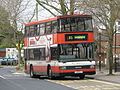 Bus img 7757 (16020750570).jpg 2,419 × 1,814; 2.82 MB
-
 Bus img 7760 (16206232351).jpg 2,788 × 2,091; 3.02 MB
-
 Bus img 7763 (15585704744).jpg 2,762 × 2,072; 3.12 MB
-
 Bus img 7766 (16022016349).jpg 2,596 × 1,947; 3.14 MB
-
 Bus img 7769 (16020613798).jpg 3,072 × 2,304; 2.62 MB
-
 Bus img 7773 (15585713414).jpg 3,072 × 2,304; 1.79 MB
-
 Bus img 7777 (16182253716).jpg 2,720 × 2,040; 3.33 MB
-
 Bus stand Ringwood Hampshire - geograph.org.uk - 184674.jpg 640 × 418; 166 KB
-
 Car park Ringwood Hampshire - geograph.org.uk - 184912.jpg 640 × 480; 116 KB
-

-
 Carvers recreation grounds, Ringwood - geograph.org.uk - 176002.jpg 640 × 480; 113 KB
-
 Castleman Trailway - geograph.org.uk - 1541507.jpg 640 × 467; 120 KB
-
 Castleman trailway - geograph.org.uk - 3544557.jpg 3,648 × 2,736; 4.18 MB
-
 Castleman Way, Ringwood - geograph.org.uk - 1541722.jpg 640 × 480; 66 KB
-
 Castleman Way, Ringwood - geograph.org.uk - 4162152.jpg 1,024 × 659; 635 KB
-
 Ceramic House Name Plate - geograph.org.uk - 4162215.jpg 1,024 × 691; 716 KB
-
 Charles Copse, seen from footpath - geograph.org.uk - 5878690.jpg 1,024 × 683; 256 KB
-
 Charles's Lane by Gadden's Close Farm - geograph.org.uk - 2869319.jpg 3,648 × 2,688; 2.38 MB
-
 Charles's Lane disused railway bridge - geograph.org.uk - 2869909.jpg 3,506 × 2,449; 1.6 MB
-
 Charles's Lane junction at Knave's Ash - geograph.org.uk - 2869294.jpg 3,443 × 2,458; 1.4 MB
-
 Cherry blossom by River Avon, Ringwood - geograph.org.uk - 385508.jpg 427 × 640; 120 KB
-
 Chimney stack, The White Hart - geograph.org.uk - 2700038.jpg 480 × 640; 81 KB
-
 Christmas lights, Fairlie Park, Ringwood - geograph.org.uk - 89275.jpg 640 × 480; 135 KB
-
 Church Hatch - Ringwood - geograph.org.uk - 668234.jpg 640 × 470; 199 KB
-

-
 Colourful bungalow at Poulner - geograph.org.uk - 4920595.jpg 640 × 427; 73 KB
-
-
 Construction site in The Furlong - geograph.org.uk - 2676375.jpg 640 × 480; 64 KB
-
 Corn straw hay ^ much more - panoramio.jpg 2,592 × 1,944; 2.2 MB
-
 Cranes Moor, bogland - geograph.org.uk - 2965616.jpg 1,024 × 768; 217 KB
-
 Crossing the Avon - geograph.org.uk - 2703128.jpg 800 × 600; 120 KB
-
 Crow Hill - geograph.org.uk - 2214483.jpg 1,024 × 736; 232 KB
-
 Crow Hill, barn - geograph.org.uk - 2337630.jpg 1,024 × 768; 233 KB
-
 Crow Hill, farmhouse - geograph.org.uk - 2337616.jpg 1,024 × 768; 304 KB
-
 Crow Hill, footpath - geograph.org.uk - 2214493.jpg 768 × 1,024; 297 KB
-
 Crow Hill, molehills - geograph.org.uk - 2214555.jpg 1,024 × 768; 237 KB
-
 Crow Hill, open land - geograph.org.uk - 2337601.jpg 1,024 × 768; 195 KB
-
 Crow Hill, Woodend Road - geograph.org.uk - 2214489.jpg 1,024 × 768; 278 KB
-
 Crow Lane passes Aivly Country Store - geograph.org.uk - 4081867.jpg 3,541 × 2,535; 1.17 MB
-
 Crown Cottages, Ringwood - geograph.org.uk - 2652511.jpg 480 × 640; 80 KB
-
 Cut mark on the bank - geograph.org.uk - 2703249.jpg 800 × 632; 178 KB
-
 Date stone, Ringwood - geograph.org.uk - 2652419.jpg 640 × 481; 85 KB
-
 Dean's Farm - geograph.org.uk - 1942482.jpg 640 × 427; 224 KB
-
 Depot of New Forest District Council - geograph.org.uk - 1926607.jpg 640 × 427; 182 KB
-
 Digivan in Ringwod Market Place - geograph.org.uk - 5300748.jpg 640 × 480; 178 KB
-
 Direction Sign – Signpost - geograph.org.uk - 6517239.jpg 720 × 960; 283 KB
-
 Dismantled railway bridge - geograph.org.uk - 3728047.jpg 3,648 × 2,736; 4.23 MB
-
 Disused buildings on Kingston Farm - geograph.org.uk - 1942474.jpg 640 × 427; 192 KB
-

-

-

-
 Duck Island Lane - geograph.org.uk - 1942465.jpg 529 × 640; 210 KB
-
 East to Southampton - geograph.org.uk - 1865631.jpg 640 × 480; 74 KB
-
 Electricity sub-station by the Avon - geograph.org.uk - 782761.jpg 640 × 480; 57 KB
-

-
 Embankment Way - end of the road - geograph.org.uk - 3728092.jpg 3,648 × 2,736; 4.28 MB
-
 End of the tarmac path - geograph.org.uk - 5878683.jpg 1,024 × 683; 299 KB
-
 Entering Moortown - geograph.org.uk - 4167723.jpg 1,024 × 616; 674 KB
-
 Farmland, Ringwood - geograph.org.uk - 21823.jpg 640 × 481; 152 KB
-
 Field and footpath west of Nouale Lane - geograph.org.uk - 6013458.jpg 640 × 427; 204 KB
-
 Field and house at Poulner - geograph.org.uk - 5017754.jpg 640 × 427; 99 KB
-
 Field of Young Corn - geograph.org.uk - 3968383.jpg 1,024 × 704; 802 KB
-
 Field west of Nouale Lane - geograph.org.uk - 6013437.jpg 640 × 427; 128 KB
-
 Field west of Nouale Lane - geograph.org.uk - 6013441.jpg 640 × 427; 168 KB
-
 Field west of Nouale Lane - geograph.org.uk - 6013446.jpg 640 × 427; 143 KB
-
 Field west of sewage treatment works - geograph.org.uk - 1924220.jpg 640 × 427; 163 KB
-
 Fields at Brixey's Farm - geograph.org.uk - 5965482.jpg 1,024 × 683; 201 KB
-

-
 Fields between Nouale Lane and Eastfield Lane - geograph.org.uk - 6013491.jpg 1,024 × 683; 263 KB
-
 Fields between Nouale Lane and Eastfield Lane - geograph.org.uk - 6013493.jpg 1,024 × 683; 261 KB
-
 Fields west of Nouale Lane - geograph.org.uk - 6013470.jpg 640 × 427; 152 KB
-
 Firemark, Market Place - geograph.org.uk - 2652634.jpg 479 × 640; 78 KB
-
 Footbridge on Avon Valley Path - geograph.org.uk - 1942392.jpg 640 × 427; 190 KB
-
 Footbridge over A31 - geograph.org.uk - 3207649.jpg 640 × 428; 86 KB
-
 Footbridge over A31 in Ringwood - geograph.org.uk - 3991354.jpg 1,536 × 1,024; 942 KB
-
 Footbridge over Bickerley Mill Stream - geograph.org.uk - 1540894.jpg 480 × 640; 130 KB
-
 Footbridge over the A31 - geograph.org.uk - 2834960.jpg 640 × 430; 36 KB
-
 Footbridge over the A31 - geograph.org.uk - 3648879.jpg 640 × 430; 48 KB
-
 Footbridges over Bickerley Millstream - geograph.org.uk - 1942340.jpg 640 × 427; 360 KB
-
 Footpath 38 through the gate on the right - geograph.org.uk - 6136709.jpg 576 × 1,024; 219 KB
-
 Footpath at Kingston - geograph.org.uk - 5965476.jpg 1,024 × 683; 241 KB
-
 Footpath at the end of Hurst Road - geograph.org.uk - 5297202.jpg 1,280 × 960; 605 KB
-
 Footpath behind New Road, Moortown - geograph.org.uk - 1924182.jpg 640 × 427; 215 KB
-
 Footpath behind Shires Close - geograph.org.uk - 1924151.jpg 640 × 427; 294 KB
-

-
-
 Footpath on edge of Sandford Copse - geograph.org.uk - 5965511.jpg 1,024 × 683; 288 KB
-
 Footpath on edge of Sandford Copse - geograph.org.uk - 5965512.jpg 1,024 × 683; 333 KB
-
 Footpath on the old trackbed - geograph.org.uk - 3728114.jpg 3,648 × 2,736; 4.29 MB
-
 Footpath to Castle View Farm - geograph.org.uk - 1924239.jpg 454 × 640; 204 KB
-
 Footpath, Ringwood - geograph.org.uk - 1540174.jpg 480 × 640; 90 KB
-

-
 Ford at Kingston - geograph.org.uk - 5349852.jpg 4,500 × 3,000; 7.05 MB
-
 Ford at North Poulner - geograph.org.uk - 5114774.jpg 1,440 × 960; 2.2 MB
-
 Ford at North Poulner - geograph.org.uk - 5114784.jpg 1,440 × 960; 2.29 MB
-
 Ford at Ringwood - geograph.org.uk - 5349802.jpg 4,032 × 3,024; 4.59 MB
-
 Ford over Bickerley Millstream - geograph.org.uk - 1942331.jpg 640 × 427; 284 KB
-
-
 Former level crossing in Barrack Lane - geograph.org.uk - 5878674.jpg 1,024 × 683; 291 KB
-
 Former level crossing in Barrack Lane - geograph.org.uk - 5878680.jpg 1,024 × 683; 193 KB
-
 Former railway bridge - geograph.org.uk - 3727720.jpg 3,648 × 2,736; 4.28 MB
-
 Former railway bridge at Ringwood - geograph.org.uk - 4920666.jpg 640 × 427; 78 KB
-

-
 Foulford Bottom - geograph.org.uk - 2040104.jpg 2,272 × 1,704; 1.77 MB
-
 Framptons Mill now a tea bar - geograph.org.uk - 1960257.jpg 640 × 468; 79 KB
-
 Framptons Mill, Ringwood - geograph.org.uk - 2652255.jpg 480 × 640; 78 KB
-
 From railway to river - geograph.org.uk - 5965746.jpg 1,024 × 683; 331 KB
-
 Furlong Shopping Centre - geograph.org.uk - 5723140.jpg 5,152 × 4,000; 5.08 MB
-
 Gantry, A31 - geograph.org.uk - 4242680.jpg 640 × 397; 36 KB
-
 Gated track at Sandford - geograph.org.uk - 5965503.jpg 1,024 × 683; 342 KB
-
 Globe House, on B3347 at Moortown - geograph.org.uk - 1924314.jpg 640 × 427; 192 KB
-
 Goat in field behind garden centre - geograph.org.uk - 2639649.jpg 640 × 480; 114 KB
-
 Green and houses in Shires Close - geograph.org.uk - 1924157.jpg 640 × 373; 169 KB
-
 Green at Moortown - geograph.org.uk - 4167703.jpg 1,024 × 619; 698 KB
-
 Green beside the A31 at Ringwood - geograph.org.uk - 4920599.jpg 640 × 427; 84 KB
-
 Green between Gorley Road and Cowpits Lane - geograph.org.uk - 4081888.jpg 3,112 × 2,484; 1.14 MB
-
 Green gate opposite Dean's Farm - geograph.org.uk - 5965522.jpg 1,024 × 683; 268 KB
-
 Greyfriars - Ringwood - geograph.org.uk - 858492.jpg 640 × 456; 411 KB
-
 Hampshire border, A31 - geograph.org.uk - 3666144.jpg 630 × 640; 58 KB
-
 Hampshire Hatches Farm - geograph.org.uk - 1942324.jpg 640 × 427; 217 KB
-
 Hampshire Hatches Lane - geograph.org.uk - 1942309.jpg 640 × 427; 186 KB
-
 Hangersley Hill in Winter - geograph.org.uk - 2803681.jpg 2,016 × 1,512; 746 KB
-
 Hatches on the Avon at Ringwood - geograph.org.uk - 782772.jpg 640 × 480; 71 KB
-
 Hedge cutting, Crow Hill - geograph.org.uk - 1186741.jpg 640 × 480; 189 KB
-
 High St, Ringwood, Hampshire, England.jpg 3,904 × 2,925; 3.24 MB
-
 High Street- The Granary - geograph.org.uk - 2676644.jpg 480 × 640; 69 KB
-
 Holly berries - geograph.org.uk - 5965528.jpg 1,024 × 683; 178 KB
-
 House named Oak Cottage on Hightown Road - geograph.org.uk - 6013589.jpg 640 × 427; 175 KB
-
 House named Three Elms - geograph.org.uk - 1942988.jpg 640 × 427; 259 KB
-
 Houses beside Bickerley Common - geograph.org.uk - 4920683.jpg 640 × 427; 88 KB
-
 Houses in Hurst Road - geograph.org.uk - 4920745.jpg 640 × 427; 83 KB
-
 Houses in New Street - geograph.org.uk - 1926492.jpg 640 × 427; 191 KB
-
 Houses in New Street - geograph.org.uk - 1926498.jpg 640 × 427; 211 KB
-
 Houses on Christchurch Road, Kingston - geograph.org.uk - 5965542.jpg 1,024 × 683; 245 KB
-
 Houses set back from Christchurch Road - geograph.org.uk - 1926618.jpg 640 × 427; 171 KB


_-_geograph.org.uk_-_6326123.jpg)


_(9456099244).jpg)
_(9456101710).jpg)


.jpg)
.jpg)
.jpg)
.jpg)
.jpg)
.jpg)
.jpg)


