Category:River Dodder
Jump to navigation
Jump to search
The River Dodder is one of the tributaries of the River Liffey in County Dublin, Ireland.
river in Ireland  | |||||
| Upload media | |||||
| Instance of | |||||
|---|---|---|---|---|---|
| Location |
| ||||
| Length |
| ||||
| Mouth of the watercourse | |||||
| Tributary | |||||
 | |||||
Subcategories
This category has the following 2 subcategories, out of 2 total.
B
- Bohernabrenna Reservoirs (10 F)
O
- Owendoher River (8 F)
Media in category "River Dodder"
The following 67 files are in this category, out of 67 total.
-
 River Dodder at Springfield Avenue.jpg 2,048 × 1,536; 965 KB
-
 River Dodder (sign).jpg 1,000 × 1,000; 138 KB
-
 A Bridge on the River Dodder P5019.jpg 2,480 × 1,910; 4.75 MB
-
 A WALK ALONG THE RIVER DODDER ( CLONSKEAGH TO MILLTOWN )-146727.jpg 5,168 × 3,448; 18.21 MB
-
 A WALK ALONG THE RIVER DODDER ( CLONSKEAGH TO MILLTOWN )-146732.jpg 5,168 × 3,448; 17.79 MB
-
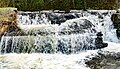
 A weir on the River Dodder.jpg 4,752 × 3,168; 1.86 MB
-
 ALONG THE BANKS OF THE DODDER (Between Clonskeagh and Milltown) (518681939) (3).jpg 2,048 × 1,365; 1.23 MB
-
 And a river runs through it (Dodder, Dublin) (26633960659).jpg 2,000 × 1,425; 1.54 MB
-
 AngleseaBridge.JPG 5,184 × 3,456; 10.31 MB
-
 Austin Clarke Bridge, Templeogue - geograph.org.uk - 447177.jpg 640 × 480; 141 KB
-
 Aviva Stadium(Dublin Arena).JPG 2,433 × 1,518; 1.68 MB
-
 Ball's Bridge (Ballsbridge) - panoramio.jpg 6,000 × 2,742; 12.5 MB
-
 Ballsbridge (Dublin) - panoramio (1).jpg 6,000 × 4,000; 16.81 MB
-
 Ballsbridge - panoramio (1).jpg 6,000 × 4,000; 16.87 MB
-
 Ballsbridge In Dublin (Ireland) - Ball's Bridge - panoramio.jpg 6,000 × 4,000; 18.97 MB
-
 Bushy Park, Dublin -146470 (31538466187).jpg 4,896 × 3,672; 17.09 MB
-
 Castlekelly Bridge - geograph.org.uk - 304233.jpg 640 × 478; 132 KB
-
 Clonskeagh Bridge - geograph.org.uk - 420814.jpg 640 × 480; 145 KB
-
 ClonskeaghBridge.JPG 5,184 × 3,456; 8.84 MB
-
 Couple seated by a weir - River Dodder (19732202922).jpg 2,000 × 1,432; 1.95 MB
-
 DartBridgeAtDodder.JPG 5,184 × 3,456; 6.53 MB
-
 Derrynane Gardens On The Banks Of The Dodder - panoramio.jpg 6,000 × 3,109; 16 MB
-
 Dodder Milltown.jpg 4,320 × 3,240; 3.92 MB
-
 Dodder Stepping Stones - geograph.org.uk - 402723.jpg 640 × 480; 138 KB
-

-
-
 Dodder Valley Burnt-out Cars - geograph.org.uk - 466682.jpg 640 × 480; 119 KB
-
 Dodder Valley Park Pond - geograph.org.uk - 402726.jpg 640 × 480; 102 KB
-
 Dodder.JPG 2,592 × 1,944; 1.22 MB
-
 DodderStones.JPG 5,184 × 3,456; 13.2 MB
-
 Failboat is resting - panoramio.jpg 1,830 × 1,373; 2.34 MB
-
 Flooding In Dublin - River Dodder, The Day After.jpg 4,592 × 3,056; 8.47 MB
-
 Flooding In Dublin - The River Dodder.jpg 4,592 × 3,056; 12.27 MB
-
 FootbidgeAtDonnybrook.JPG 5,184 × 3,456; 9.69 MB
-
 FootbridgeAtDartry.JPG 5,184 × 3,456; 11.6 MB
-
 FootbridgeAtDartryPark.JPG 5,184 × 3,456; 11.7 MB
-
 FootbridgeAtFirhouse.JPG 5,184 × 3,456; 10.36 MB
-
 FootbridgeAtMilltown.JPG 5,184 × 3,456; 10.2 MB
-
 FootbridgeAtOrwellPark.JPG 5,184 × 3,456; 13.65 MB
-
 Irl BallsbridgeDodderRiver.jpg 640 × 480; 85 KB
-
 Little Dargle River in northern Churchtown (geograph 3546705).jpg 1,024 × 768; 319 KB
-
 Londonbridge Road On The Banks Of The Dodder - panoramio.jpg 6,000 × 3,227; 15.77 MB
-
 LondonBridgeDublin.JPG 5,184 × 3,456; 6.36 MB
-
 MilltownBridge.JPG 5,184 × 3,456; 8.19 MB
-
 NineArchesBridge.JPG 5,184 × 3,456; 7.3 MB
-
 Owendoher-mouth.JPG 5,184 × 3,456; 11.53 MB
-
 Ringsend Bridge (Dublin) - panoramio.jpg 6,000 × 4,000; 23.16 MB
-
 Ringsend Bridge.JPG 5,184 × 3,456; 6.04 MB
-
 Ringsend Church and Flats with Dodder.jpg 4,896 × 3,264; 6.02 MB
-
 River Dodder (Milltown).jpg 9,646 × 5,564; 47.44 MB
-
 River Dodder - geograph.org.uk - 189869.jpg 640 × 480; 62 KB
-
 River Dodder - geograph.org.uk - 290235.jpg 640 × 479; 62 KB
-
 River Dodder in Dartry area, at weir (geograph 3545192).jpg 1,024 × 576; 174 KB
-
 River Dodder Rathgar snow.JPG 4,000 × 3,000; 4.05 MB
-
 River Dodder.jpg 2,592 × 1,944; 1.5 MB
-
 Rivers and Streams of Dublin (incl. Raheny), (1999, leaflet, scan).jpg 3,265 × 1,252; 2.4 MB
-
 Slang (Dundrum) River approaching the M50 (geograph 3545593).jpg 768 × 1,024; 240 KB
-
 Springfield Avenue Bridge, Templeogue - geograph.org.uk - 447172.jpg 640 × 480; 142 KB
-
 The Dodder River, with statuary, towards Classons Bridge (geograph 3545761).jpg 1,024 × 576; 193 KB
-
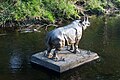 The Rhino On The River (Milltown).jpg 4,592 × 3,056; 10.06 MB
-
 The River Dodder - 300 metres from its Liffey confluence.jpg 3,264 × 2,448; 1.88 MB
-
 The River Dodder In Flood.jpg 1,024 × 683; 316 KB
-
 The River Dodder Near The Aviva Stadium - panoramio.jpg 6,000 × 4,000; 18.97 MB
-
 Upper Dodder.JPG 960 × 1,280; 354 KB
-
 Waterrivver.jpg 3,024 × 4,032; 4.81 MB
-
 Weir on the Dodder - geograph.org.uk - 402507.jpg 640 × 480; 144 KB
-
 Weir on the River Dodder below Orwell Bridge (8364225928).jpg 2,000 × 1,852; 1.56 MB

.jpg)

-146727.jpg)
-146732.jpg)

_(518681939)_(3).jpg)
_(26633960659).jpg)


.JPG)
_-_panoramio.jpg)
_-_panoramio_(1).jpg)
.jpg)
_-_Ball%27s_Bridge_-_panoramio.jpg)
.jpg)


.jpg)


.jpg)


_-_panoramio.jpg)


.jpg)


.jpg)

_River_approaching_the_M50_(geograph_3545593).jpg)

.jpg)
.jpg)


.jpg)
,_(1999,_leaflet,_scan).jpg)