Category:River Maun
Jump to navigation
Jump to search
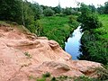
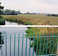
The River Maun in Nottinghamshire is a tributary of the River Idle.

river in Nottinghamshire, United Kingdom  | |||||
| Upload media | |||||
| Instance of | |||||
|---|---|---|---|---|---|
| Location |
| ||||
| Mouth of the watercourse | |||||
 | |||||
Subcategories
This category has only the following subcategory.
K
- King's Mill Viaduct, Mansfield (49 F)
Media in category "River Maun"
The following 29 files are in this category, out of 29 total.
-
 Bridge over the River Maun at Eaton - geograph.org.uk - 1132071.jpg 640 × 448; 55 KB
-

-
 Eel Pie Bridge - geograph.org.uk - 1758028.jpg 640 × 426; 105 KB
-
 Footbridge over the River Maun - geograph.org.uk - 1261214.jpg 640 × 480; 130 KB
-
 Inlet into river Maun - geograph.org.uk - 459443.jpg 640 × 480; 184 KB
-
 Mansfield - Maun Valley Trail - geograph.org.uk - 1163620.jpg 640 × 431; 57 KB
-
 Ordnance Survey One-Inch Sheet 112 Nottingham, Published 1947.jpg 10,875 × 12,765; 15.9 MB
-
 Ordnance Survey One-Inch Sheet 112 Nottingham, Published 1960.jpg 8,289 × 9,973; 11.75 MB
-
 Ordnance Survey One-Inch Sheet 112 Nottingham, Published 1968.jpg 8,327 × 9,898; 11.61 MB
-
 River Maun - geograph.org.uk - 1758032.jpg 640 × 426; 75 KB
-
 River Maun - geograph.org.uk - 227502.jpg 640 × 425; 96 KB
-
 River Maun at Kings Mill - geograph.org.uk - 856924.jpg 640 × 426; 133 KB
-
 River Maun from the footbridge - geograph.org.uk - 1320091.jpg 640 × 480; 113 KB
-
 River Maun, New Mill Lane, Mansfield - geograph.org.uk - 116498.jpg 640 × 480; 80 KB
-
 River Meden - geograph.org.uk - 1623438.jpg 640 × 426; 84 KB
-
 Road Closed - geograph.org.uk - 1441144.jpg 640 × 480; 132 KB
-
 The River Maun - geograph.org.uk - 463155.jpg 640 × 480; 170 KB
-
 The river Maun nr Eel pie farm - geograph.org.uk - 1330443.jpg 640 × 427; 73 KB
-
 The River Maun. - geograph.org.uk - 494499.jpg 640 × 480; 180 KB
-
 Titchfield Park, Mansfield - geograph.org.uk - 535910.jpg 480 × 640; 78 KB
-
 Titchfield Park, Nottingham Road, Mansfield (2).jpg 2,160 × 3,840; 3.29 MB
-
 Titchfield Park, Nottingham Road, Mansfield (3).jpg 2,160 × 3,840; 4.84 MB
-
 Two into One - geograph.org.uk - 219052.jpg 640 × 480; 97 KB
-
 Bridge over River Maun - geograph.org.uk - 494505.jpg 480 × 640; 181 KB
-
 River Maun - geograph.org.uk - 494534.jpg 640 × 480; 198 KB
-
 River Maun Bridge, Ollerton - geograph.org.uk - 117312.jpg 640 × 460; 108 KB
-
 River Maun, near Snake Hill - geograph.org.uk - 494518.jpg 640 × 480; 190 KB
-
 River Whitewater - geograph.org.uk - 255832.jpg 640 × 480; 108 KB
-
 The River Maun near Eel Pie Farm - geograph.org.uk - 595948.jpg 640 × 613; 135 KB


.jpg)
.jpg)


