Category:River Parrett
Jump to navigation
Jump to search

river in the United Kingdom  | |||||
| Upload media | |||||
| Instance of | |||||
|---|---|---|---|---|---|
| Location | Somerset, South West England, England | ||||
| Length |
| ||||
| Mouth of the watercourse | |||||
| Tributary |
| ||||
 | |||||
Subcategories
This category has the following 14 subcategories, out of 14 total.
B
- River Parrett at Bridgwater (31 F)
D
- Dunball Wharf (4 F)
E
- East Quay, Bridgwater (14 F)
G
- Great Bow Bridge, Langport (7 F)
L
- Langport railway bridge (10 F)
P
R
S
- Somerset Bridge, Bridgwater (8 F)
T
- Town Bridge, Bridgwater (21 F)
W
Media in category "River Parrett"
The following 103 files are in this category, out of 103 total.
-

-
 Banks of the River Parrett - geograph.org.uk - 1721430.jpg 640 × 480; 88 KB
-
 BridgewaterBay.jpg 2,272 × 1,704; 1.01 MB
-
 Burrow Bridge.jpg 640 × 480; 136 KB
-
 Burrow Mump 03.jpg 5,152 × 3,864; 4.52 MB
-
 Burrowbridge 01.jpg 5,152 × 3,864; 4.37 MB
-
 Burrowbridge 02.jpg 5,152 × 3,864; 4.4 MB
-
 Burrowbridgeconfluence.jpg 972 × 648; 153 KB
-
 BurrowBridgeView2.jpg 972 × 648; 260 KB
-
 Combwich harbour.jpg 640 × 428; 48 KB
-
 Confluence of the Parrett and Tone at Burrowbridge during flooding in February 2014.jpg 3,456 × 2,304; 1.31 MB
-
 Coombe Bridge, Kingsbury Episcopi - geograph.org.uk - 989545.jpg 640 × 458; 76 KB
-
 Coombe Bridge, Kingsbury Episcopi - geograph.org.uk - 989550.jpg 640 × 458; 132 KB
-

-
 Emergency pumps on the Parrett (geograph 4120711).jpg 640 × 427; 86 KB
-
 Evening on the River Parrett - geograph.org.uk - 1166775.jpg 640 × 480; 59 KB
-
 Gawbridge - geograph.org.uk - 16007.jpg 640 × 480; 130 KB
-
 Hay Moor on the Parrett Trail - geograph.org.uk - 591663.jpg 640 × 480; 40 KB
-
 Huntspill Sluice.jpg 800 × 533; 80 KB
-
 Kingsbury Episcopi, Thorney Mill - geograph.org.uk - 1324058.jpg 640 × 427; 426 KB
-
 Langport - geograph.org.uk - 11907.jpg 640 × 480; 123 KB
-
 Langport from Huish Bridge - geograph.org.uk - 451790.jpg 480 × 640; 72 KB
-
 Langport Parrett.jpg 1,600 × 1,200; 364 KB
-
 Marshland by the River Parrett - geograph.org.uk - 1373866.jpg 640 × 480; 83 KB
-
 Meander of the River Parrett, Somerset from the Air.jpg 5,152 × 3,864; 3.9 MB
-
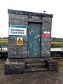
 Monksleaze Clyce Sluice, River Parrett 01.jpg 5,152 × 3,864; 4.33 MB
-
 Monksleaze Clyce Sluice, River Parrett 02.jpg 3,864 × 5,152; 8.63 MB
-
 Monksleaze Clyce Sluice, River Parrett 03.jpg 5,152 × 3,864; 8.09 MB
-
 Monksleaze Clyce Sluice, River Parrett 04.jpg 5,152 × 3,864; 9.47 MB
-
 Monksleazeclyce.jpg 640 × 480; 117 KB
-
 Mouth of the River Parrett - geograph.org.uk - 22062.jpg 640 × 395; 236 KB
-
 Mud banks, on the River Parrett - geograph.org.uk - 1008064.jpg 640 × 480; 82 KB
-
 Mudbanks on the River Parrett - geograph.org.uk - 1166782.jpg 640 × 480; 59 KB
-
 Mudbanks on the River Parrett - geograph.org.uk - 1166788.jpg 640 × 480; 66 KB
-
 Mudflats at Combwich.jpg 539 × 371; 55 KB
-
 National Cycle Network Sign Post - geograph.org.uk - 129287.jpg 640 × 426; 53 KB
-
 Oath - geograph.org.uk - 17128.jpg 640 × 480; 105 KB
-
 Oath - geograph.org.uk - 17143.jpg 640 × 480; 90 KB
-
 Oath Lock - geograph.org.uk - 450126.jpg 640 × 480; 101 KB
-
 Oath near Langport - geograph.org.uk - 591850.jpg 640 × 480; 53 KB
-
 OathLockRiverParrett.jpg 2,202 × 1,468; 2.04 MB
-
 Ordnance Survey One-Inch Sheet 120 Bridgwater, Published 1918.jpg 12,176 × 8,381; 10.87 MB
-
 Ordnance Survey One-Inch Sheet 165 Weston-Super-Mare, Published 1946.jpg 8,197 × 9,554; 10.63 MB
-
 Ordnance Survey One-Inch Sheet 165 Weston-super-Mare, Published 1958 2.jpg 8,612 × 10,667; 18.2 MB
-
 Ordnance Survey One-Inch Sheet 165 Weston-super-Mare, Published 1958.jpg 8,353 × 9,932; 9.88 MB
-
 Ordnance Survey One-Inch Sheet 165 Weston-super-Mare, Published 1971.jpg 11,013 × 13,098; 42.47 MB
-
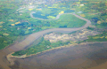
 Parrett Estuary from the air (geograph 5110175).jpg 2,048 × 1,536; 399 KB
-
 Parrett Ironworks.jpg 640 × 480; 98 KB
-
 Pumping Floodwater into the River Parrett at Burrowbridge MOD 45157062.jpg 3,351 × 2,001; 934 KB
-

-
 Reeds by the River Parrett - geograph.org.uk - 1628101.jpg 640 × 480; 81 KB
-
 Rhyne Outfall Pipe - geograph.org.uk - 1500072.jpg 640 × 480; 97 KB
-
-
 River Parrett - geograph.org.uk - 103047.jpg 640 × 480; 54 KB
-
 River Parrett - geograph.org.uk - 120475.jpg 640 × 426; 105 KB
-
 River Parrett - geograph.org.uk - 1208539.jpg 640 × 480; 91 KB
-
 River Parrett - geograph.org.uk - 1260682.jpg 640 × 480; 47 KB
-
 River Parrett - geograph.org.uk - 129247.jpg 640 × 426; 102 KB
-
 River Parrett - geograph.org.uk - 1500071.jpg 640 × 480; 80 KB
-
 River Parrett - geograph.org.uk - 1503778.jpg 640 × 480; 142 KB
-
 River Parrett - geograph.org.uk - 1606533.jpg 640 × 480; 68 KB
-
 River Parrett at bankful discharge - geograph.org.uk - 759350.jpg 640 × 480; 127 KB
-
 River Parrett at Creedy Bridge - geograph.org.uk - 1503750.jpg 640 × 480; 112 KB
-
 River Parrett at Tutyate - geograph.org.uk - 438516.jpg 640 × 480; 121 KB
-
 River Parrett at Westover bridge - geograph.org.uk - 443480.jpg 640 × 480; 100 KB
-
 River Parrett below Broom Croft Copse - geograph.org.uk - 680804.jpg 640 × 390; 115 KB
-
 River Parrett below Dunwear - geograph.org.uk - 1691198.jpg 640 × 453; 74 KB
-
 River Parrett in south Bridgwater - geograph.org.uk - 1193215.jpg 640 × 480; 98 KB
-
 River Parrett looking up stream - geograph.org.uk - 120500.jpg 640 × 426; 93 KB
-
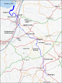 River Parrett map.png 765 × 1,018; 585 KB
-
 River Parrett near Burrowbridge - geograph.org.uk - 1400119.jpg 640 × 480; 155 KB
-
 River Parrett near Chilton Trinity - geograph.org.uk - 1606476.jpg 640 × 385; 59 KB
-
 River Parrett near Dunball - geograph.org.uk - 1500075.jpg 640 × 480; 89 KB
-
 River Parrett near Pawlett.jpg 640 × 426; 68 KB
-
 River Parrett north of Petherton Bridge.jpg 640 × 480; 129 KB
-
 River Parrett relief map.png 1,507 × 947; 1.23 MB
-
 River Parrett Tidal Bore - geograph.org.uk - 1733016.jpg 640 × 427; 186 KB
-
 River Parrett Trail - geograph.org.uk - 1690888.jpg 640 × 480; 84 KB
-
 River Parrett Trail at Little Load.jpg 640 × 480; 47 KB
-
 River Parrett, from Burrow Bridge - geograph.org.uk - 450157.jpg 480 × 640; 73 KB
-
 River Parrett.jpg 4,000 × 2,848; 2.61 MB
-
 Riverparrett.jpg 622 × 414; 83 KB
-
 Riverparrettseat.jpg 640 × 412; 73 KB
-
 Saltmoor Farm - geograph.org.uk - 231116.jpg 640 × 480; 96 KB
-
 Sluice on the river Parrett near Drayton - geograph.org.uk - 598151.jpg 640 × 480; 112 KB
-
 Sluice on the River Parrett, Port Moor 01.jpg 5,152 × 3,864; 4.33 MB
-
 Sluice on the River Parrett, Port Moor 02.jpg 5,152 × 3,864; 7.64 MB
-
 Southlakemoor.jpg 640 × 443; 192 KB
-
 Steart Peninsula.gif 2,200 × 1,421; 1.81 MB
-
 SwanAndcygnets.jpg 2,024 × 1,635; 1.43 MB
-

-
 The Parrett Trail - geograph.org.uk - 591689.jpg 640 × 480; 51 KB
-
 The Parrett Trail and river - geograph.org.uk - 1373900.jpg 640 × 480; 129 KB
-
 The River Parrett at Bridgwater - geograph.org.uk - 929836.jpg 640 × 480; 257 KB
-
 The River Parrett at Oath - geograph.org.uk - 1400100.jpg 640 × 480; 125 KB
-
 The River Parrett at Stathe Bridge - geograph.org.uk - 1400042.jpg 640 × 480; 126 KB
-
 The River Parrett near Burrowbridge - geograph.org.uk - 1400113.jpg 640 × 480; 133 KB
-
 The River Parrett north of Bridgwater - geograph.org.uk - 940137.jpg 640 × 480; 275 KB
-
 The River Parrett north of Combwich - geograph.org.uk - 1071553.jpg 640 × 480; 79 KB
-
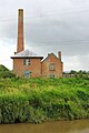 WestonZoylandpumpingstation.jpg 1,319 × 1,981; 784 KB
-
 Westonzoylandpumpingstation.jpg 461 × 614; 19 KB
-
 Footbridge over River Parrett - geograph.org.uk - 680798.jpg 640 × 421; 143 KB
-
 The Estuary of the River Parrett - geograph.org.uk - 253292.jpg 640 × 421; 55 KB


.jpg)


.jpg)


