Category:River Avon, South-West England
Zur Navigation springen
Zur Suche springen

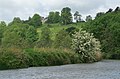
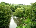
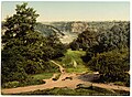
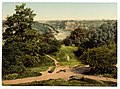
English: The River Avon is a river in the south west of England. In its lower reaches the river is navigable and known as the Avon Navigation. Because of a number of other River Avons in England, this river is often also known as the Lower Avon or Bristol Avon.
Fluss in England  .png) | |||||
| Medium hochladen | |||||
| Ist ein(e) | |||||
|---|---|---|---|---|---|
| Ort |
| ||||
| Länge |
| ||||
| Mündet in | |||||
| Nebenfluss |
| ||||
 | |||||
Unterkategorien
Es werden 18 von insgesamt 18 Unterkategorien in dieser Kategorie angezeigt:
In Klammern die Anzahl der enthaltenen Kategorien (K), Seiten (S), Dateien (D)
*
- River Avon in Chippenham (20 D)
A
- Abbey Mill, Bradford-on-Avon (52 D)
B
C
H
- Horseshoe Bend, Shirehampton (4 D)
N
- Netham Weir (18 D)
S
- St. Vincent's Rock, Clifton (14 D)
- Swineford weir (5 D)
T
V
W
- Warleigh Weir (8 D)
Medien in der Kategorie „River Avon, South-West England“
Folgende 200 Dateien sind in dieser Kategorie, von 306 insgesamt.
(vorherige Seite) (nächste Seite)-

-
 Above Hanham Lock - geograph.org.uk - 181388.jpg 640 × 415; 112 KB
-
 Accident to Ship Demerara, River Avon, 1851.jpg 680 × 398; 75 KB
-
 Across the River Avon - Leigh Woods - May 2012 - panoramio.jpg 4.000 × 3.000; 2,58 MB
-
 Ashton Gate & Bridge.jpg 1.024 × 768; 49 KB
-
 Avon (Bristol).png 1.178 × 609; 1,24 MB
-
 Avon and Severn from Clifton Down 1842.jpg 4.378 × 2.666; 2,61 MB
-

-
 Avon river 2.jpg 2.424 × 1.251; 1,18 MB
-
 Avon River in Bristol.jpg 5.184 × 3.456; 8,59 MB
-
 Avon River Panorama in winter.png 12.689 × 1.720; 42,45 MB
-
 Avon signal.jpg 2.536 × 3.913; 1,78 MB
-
 Avon Valley Country Park - geograph.org.uk - 548401.jpg 640 × 426; 119 KB
-

-
 Avon weir - geograph.org.uk - 379551.jpg 640 × 480; 132 KB
-
 Avoncliff Weir - geograph.org.uk - 434163.jpg 640 × 456; 72 KB
-
 Avoncliff weir - geograph.org.uk - 446160.jpg 640 × 477; 101 KB
-
 Back of Nestles - Bath Road - geograph.org.uk - 944241.jpg 640 × 486; 241 KB
-
 Boat moored on the River Avon - geograph.org.uk - 548403.jpg 640 × 426; 142 KB
-
 Boat on the River Avon - geograph.org.uk - 610577.jpg 640 × 480; 62 KB
-
 Boat trip on the River Avon. - geograph.org.uk - 497051.jpg 640 × 480; 87 KB
-
 Boats moored above Hanham Lock - geograph.org.uk - 555041.jpg 640 × 426; 132 KB
-
 Boatyard at Keynsham - geograph.org.uk - 551433.jpg 426 × 640; 96 KB
-
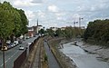
 Bradford on Avon railway bridge.jpg 1.024 × 768; 345 KB
-
 Brick Building and River Avon from near the Ashton Ave Bridge - Feb 2, 2014.jpg 3.908 × 2.602; 2,75 MB
-
 Bristol , The River Avon - geograph.org.uk - 1524766.jpg 640 × 480; 50 KB
-
 Bristol , The River Avon - geograph.org.uk - 1524973.jpg 640 × 459; 48 KB
-
 Bristol and the River Avon (29096598004).jpg 5.184 × 3.456; 5,03 MB
-
 Bristol Ariel Rowing Club - geograph.org.uk - 182012.jpg 640 × 424; 113 KB
-
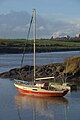
 Bristol Avon Sailing Club, Saltford - geograph.org.uk - 181069.jpg 640 × 417; 96 KB
-
 Bristol Avon Sailing Club, Saltford - geograph.org.uk - 1830138.jpg 2.288 × 1.503; 648 KB
-
 Bristol MMB 30 Sea Mills.jpg 954 × 1.399; 382 KB
-
 Bristol MMB 47.jpg 2.400 × 1.600; 2,45 MB
-
 Bristol MMB 48.jpg 2.400 × 1.600; 2,29 MB
-
 Bristol MMB R8 Clifton Down Tunnel.jpg 1.728 × 2.304; 1,17 MB
-
 Bristol MMB R9 Clifton Down Tunnel.jpg 2.304 × 1.728; 1,46 MB
-
 Bristol MMB V9 Cumberland Basin.jpg 2.304 × 1.728; 1,85 MB
-
 Bristol MMB W1 Cumberland Basin.jpg 2.304 × 1.728; 1,15 MB
-
 Bristol MMB W2 Cumberland Basin.jpg 2.304 × 1.728; 1,22 MB
-
 Bristol MMB W5 Cumberland Basin.jpg 2.304 × 1.728; 1,68 MB
-
 Bristol MMB «39 Rivers Avon and Trym.jpg 2.400 × 1.436; 1,6 MB
-
 Bristol MMB «40 Sea Mills signal station.jpg 2.400 × 1.600; 1,04 MB
-
 Bristol MMB «42 River Avon.jpg 2.400 × 1.600; 1,34 MB
-
 Bristol MMB «43 River Avon.jpg 2.400 × 1.600; 698 KB
-
 Bristol MMB «44 River Avon.jpg 2.291 × 1.470; 1,34 MB
-
 Bristol MMB «45 Rivers Avon and Trym.jpg 1.600 × 2.400; 696 KB
-
 Bristol MMB «D7 Rivers Avon and Trym.jpg 3.936 × 2.624; 3,33 MB
-
 Bristol MMB «D8 River Trym.jpg 2.344 × 3.660; 3,34 MB
-
 Bristol MMB «E6 River Trym.jpg 2.585 × 3.896; 4,02 MB
-
 Bristol MMB «Z3 River Avon.jpg 4.461 × 2.805; 4,2 MB
-
 Bristol MMB «Z4 River Avon.jpg 4.672 × 2.613; 3,85 MB
-
 Bristol MMB «Z7 River Avon.jpg 4.412 × 2.712; 4,04 MB
-
 Bristol. Bathurst basin and St. Mary Redcliffe.jpg 6.000 × 4.000; 11,06 MB
-
 Bristol. Bathurst basin.jpg 6.000 × 4.000; 9,99 MB
-
 Bristolharbourmap.png 2.040 × 525; 251 KB
-
 Cadbury's chocolate factory, Somerdale - geograph.org.uk - 555035.jpg 640 × 426; 120 KB
-
 Castle Park and Castle Bridge 2.jpg 4.881 × 2.726; 3,47 MB
-
 Castle Park and Castle Bridge.jpg 5.184 × 3.456; 3,63 MB
-
 Clifton and Hot Wells 1833.jpg 4.272 × 2.098; 11,96 MB
-
 Clifton Avon Gorge.jpg 4.243 × 2.818; 3,36 MB
-
 Clifton from across the Avon - geograph.org.uk - 24542.jpg 640 × 431; 290 KB
-
 Confluence of the Avon and the New Cut - geograph.org.uk - 3522920.jpg 2.304 × 1.704; 1,59 MB
-
 Converted Mill-Factory near Swineford - geograph.org.uk - 548315.jpg 426 × 640; 114 KB
-
 Cormorant on the River Avon (4946090261).jpg 1.835 × 2.724; 2,67 MB
-
 Corston MMB 01 River Avon.jpg 3.723 × 2.189; 1,94 MB
-
 Corston MMB 02 River Avon.jpg 4.089 × 2.625; 2,12 MB
-
 Corston MMB 03 River Avon.jpg 4.113 × 2.463; 2,15 MB
-
 Cottages, Kelston Mills - geograph.org.uk - 181049.jpg 640 × 424; 100 KB
-
 Demerara shipwreck 1851.jpg 776 × 446; 161 KB
-
 Entrance to Swineford Lock - geograph.org.uk - 181242.jpg 640 × 424; 133 KB
-
 Flotilla of boats - geograph.org.uk - 1216961.jpg 640 × 433; 74 KB
-
 Freshford Viaduct - panoramio.jpg 3.600 × 2.400; 9,62 MB
-
 Funeral of the late Lord Raglan 1, the water procession - ILN 1855.jpg 1.734 × 1.202; 1,07 MB
-

-
 Grey Avon on a Grey Day - May 2012 - panoramio.jpg 3.000 × 4.000; 3,39 MB
-
 GWR arches, below Conham Ferry - geograph.org.uk - 181452.jpg 640 × 409; 102 KB
-
 GWR embankment below Brislington - geograph.org.uk - 181417.jpg 640 × 424; 121 KB
-

-
 Harbour view of St. Vincents rock taken from the hot wells, Wellcome V0012276.jpg 3.100 × 2.255; 3,87 MB
-

-
 House by the Avon, Swineford - geograph.org.uk - 181073.jpg 640 × 424; 130 KB
-
 Kellaways MMB 01.jpg 4.796 × 2.736; 3 MB
-
 Kelston lock weir.JPG 2.576 × 1.952; 1,29 MB
-
 Kelston Park, from across valley.jpg 3.072 × 2.176; 2,7 MB
-
 Kelstonbrassmill.JPG 2.576 × 1.952; 1,34 MB
-
 Keynsham Lock in a flood - geograph.org.uk - 1159107.jpg 640 × 417; 116 KB
-
 Keynsham MMB 01 River Avon.jpg 4.664 × 2.920; 3,67 MB
-
 Keynsham MMB 02 River Avon.jpg 4.612 × 2.936; 3,58 MB
-
 Keynsham MMB 03 River Avon.jpg 4.709 × 2.868; 3,64 MB
-
 Keynsham Weir - geograph.org.uk - 145363.jpg 640 × 480; 215 KB
-
 Londonderry Wharf Bridge.jpg 640 × 424; 156 KB
-

-
 Looking down the River Avon - geograph.org.uk - 424542.jpg 480 × 640; 57 KB
-
 Looking towards the Suspension Bridge - geograph.org.uk - 331246.jpg 480 × 640; 134 KB
-
 Looking upstream on the River Avon - geograph.org.uk - 145354.jpg 480 × 640; 205 KB
-

-
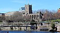
 Malmesbury Abbey from below-2.jpg 1.165 × 773; 826 KB
-
 Marden, millstream - geograph.org.uk - 1757016.jpg 1.024 × 768; 342 KB
-
 Melksham Gate and weir - geograph.org.uk - 497016.jpg 640 × 480; 94 KB
-
 Melksham weir - geograph.org.uk - 497026.jpg 640 × 480; 88 KB
-
 Messing about in boats - geograph.org.uk - 181070.jpg 640 × 424; 131 KB
-
-
-
 Narrow boats in Avon Gorge - geograph.org.uk - 768458.jpg 640 × 480; 97 KB
-
 Narrowboats moored on the Avon - geograph.org.uk - 548404.jpg 640 × 426; 107 KB
-
 Near Plucking Grove - geograph.org.uk - 1337005.jpg 640 × 480; 107 KB
-
 New Bridge on the River Avon. - geograph.org.uk - 33976.jpg 640 × 426; 53 KB
-
-
 Old mill, at Swineford - geograph.org.uk - 394003.jpg 640 × 458; 100 KB
-
 Old Soap Factory, Keynsham - geograph.org.uk - 1754624.jpg 1.024 × 704; 186 KB
-
 Ordnance Survey One-Inch Sheet 111 Bath & Bristol, Published 1919.jpg 12.119 × 8.418; 10,8 MB
-
 Ordnance Survey One-Inch Sheet 155 Bristol & Newport, Published 1946.jpg 10.929 × 12.822; 17,45 MB
-
 Ordnance Survey One-Inch Sheet 155 Bristol & Newport, Published 1953.jpg 8.282 × 9.952; 12,01 MB
-
 Ordnance Survey One-Inch Sheet 155 Bristol & Newport, Published 1972.jpg 11.058 × 13.150; 47,6 MB
-
 Ordnance Survey One-Inch Sheet 156 Bristol & Stroud, Published 1946.jpg 10.939 × 12.823; 18,14 MB
-
 Ordnance Survey One-Inch Sheet 156 Bristol & Stroud, Published 1953.jpg 8.245 × 9.924; 10,47 MB
-
 Ordnance Survey One-Inch Sheet 156 Bristol & Stroud, Published 1972.jpg 11.086 × 13.175; 48,11 MB
-
 Pill harbour (Som) on backwater of Bristol Avon. Wellcome M0015013.jpg 4.261 × 2.492; 3,9 MB
-
 Pill MMB 09 Harbour.jpg 1.600 × 2.400; 2,12 MB
-
 Pill-avon.jpg 323 × 250; 7 KB
-

-
 Portishead MMB 14.jpg 2.926 × 1.826; 1,86 MB
-
 Railing avon river.jpg 2.558 × 1.748; 4,12 MB
-
 Reflections on the River Avon - geograph.org.uk - 80709.jpg 640 × 480; 57 KB
-
 Rey Bridge 2.jpg 4.080 × 3.072; 3,22 MB
-
 River Avon - geograph.org.uk - 1263494.jpg 640 × 426; 107 KB
-
 River Avon - geograph.org.uk - 203976.jpg 640 × 480; 91 KB
-
 River avon - geograph.org.uk - 276139.jpg 640 × 480; 89 KB
-
 River Avon - geograph.org.uk - 395139.jpg 640 × 480; 118 KB
-
 River Avon - May 2012 - panoramio.jpg 4.000 × 3.000; 2,98 MB
-
 River Avon - panoramio (4).jpg 4.288 × 2.848; 5,17 MB
-
 River Avon - panoramio (5).jpg 4.288 × 2.848; 5,21 MB
-
 River Avon - panoramio (6).jpg 4.288 × 2.848; 5,08 MB
-
 River Avon above Keynsham Lock - geograph.org.uk - 181282.jpg 640 × 418; 111 KB
-
 River Avon above Saltford - geograph.org.uk - 180858.jpg 640 × 423; 79 KB
-
 River Avon above Saltford Lock - geograph.org.uk - 181071.jpg 640 × 422; 70 KB
-
 River Avon above Swineford - geograph.org.uk - 181229.jpg 640 × 418; 89 KB
-
 River Avon above Swineford Lock - geograph.org.uk - 181231.jpg 640 × 469; 91 KB
-
 River Avon and Clifton Suspension Bridge - geograph.org.uk - 238155.jpg 640 × 480; 118 KB
-
 River Avon and Great Bradford Wood - geograph.org.uk - 716522.jpg 640 × 526; 187 KB
-
 River Avon and Kelston Park - geograph.org.uk - 547644.jpg 426 × 640; 132 KB
-
 River avon at keynsham arp.jpg 2.122 × 1.502; 2,88 MB
-
 River Avon at Lacock Bridge - geograph.org.uk - 1336899.jpg 640 × 480; 65 KB
-
 River Avon at Limpley Stoke - geograph.org.uk - 1775132.jpg 640 × 427; 66 KB
-
 River Avon at low tide, Bristol - geograph.org.uk - 2386000.jpg 873 × 660; 118 KB
-
 River Avon at Melksham - geograph.org.uk - 1346143.jpg 488 × 640; 84 KB
-
 River Avon at Monkton Park - geograph.org.uk - 1545796.jpg 640 × 480; 83 KB
-
 River Avon at Reybridge - geograph.org.uk - 1346196.jpg 640 × 498; 108 KB
-
 River Avon at Reybridge - geograph.org.uk - 942202.jpg 640 × 496; 274 KB
-
 River Avon at Reybridge - geograph.org.uk - 942207.jpg 640 × 453; 206 KB
-
 River Avon at Saltford - geograph.org.uk - 180868.jpg 640 × 424; 110 KB
-
 River Avon at Saltford - geograph.org.uk - 548303.jpg 640 × 426; 100 KB
-
 River Avon at Sea Mills - geograph.org.uk - 1705337.jpg 640 × 463; 41 KB
-
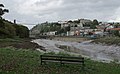
 River Avon at Swineford - geograph.org.uk - 1309257.jpg 640 × 426; 123 KB
-
 River Avon below Broad Mead - geograph.org.uk - 181308.jpg 640 × 424; 138 KB
-
 River Avon below Hanham - geograph.org.uk - 181428.jpg 640 × 424; 82 KB
-
 River Avon below Saltford Lock - geograph.org.uk - 181072.jpg 640 × 424; 121 KB
-
 River Avon below Saltford Railway Bridge - geograph.org.uk - 180988.jpg 640 × 424; 107 KB
-
 River Avon beneath Sea Walls - geograph.org.uk - 329794.jpg 640 × 419; 112 KB
-
 River Avon by Sherston - geograph.org.uk - 1745947.jpg 640 × 480; 84 KB
-

-
 River Avon east of Brislington - geograph.org.uk - 181432.jpg 640 × 424; 100 KB
-
 River Avon east of Kelston - geograph.org.uk - 180224.jpg 640 × 424; 129 KB
-
 River Avon East of Shirehampton Park - geograph.org.uk - 86875.jpg 640 × 480; 79 KB
-
 River Avon from Avoncliff Aqueduct - geograph.org.uk - 944106.jpg 640 × 542; 298 KB
-
 River Avon from Avoncliff Aqueduct - geograph.org.uk - 944116.jpg 640 × 490; 284 KB
-
 River Avon from Bridge in Monkton Park - geograph.org.uk - 947125.jpg 640 × 538; 270 KB
-
 River Avon from Clifton Down.jpg 3.602 × 2.644; 2,91 MB
-
 River Avon from Clifton Downs, Bristol, England-LCCN2002696424.jpg 3.670 × 2.727; 3,5 MB
-
 River Avon from Clifton Downs, Bristol, England-LCCN2002696424.tif 3.670 × 2.727; 28,64 MB
-
 River Avon from Dundas Aqueduct - geograph.org.uk - 178547.jpg 640 × 424; 107 KB
-
 River Avon from Dundas Aqueduct - geograph.org.uk - 178549.jpg 640 × 424; 104 KB
-
 River Avon from Monkton Park Bridge - geograph.org.uk - 947120.jpg 640 × 480; 312 KB
-
 River Avon from railway bridge. - panoramio.jpg 2.816 × 2.112; 3,14 MB
-
 River Avon from the Avonmouth Bridge - geograph.org.uk - 130808.jpg 640 × 453; 169 KB
-
 River Avon in Bristol.jpg 5.184 × 3.456; 9,1 MB
-
 River Avon in winter.jpg 5.184 × 3.456; 8,07 MB
-
 River Avon near Avoncliff. - panoramio.jpg 3.648 × 2.736; 3,79 MB
-
 River Avon near Chippenham - geograph.org.uk - 1337210.jpg 480 × 640; 109 KB
-
 River Avon near Chippenham sewage works - geograph.org.uk - 1337031.jpg 640 × 480; 117 KB
-
 River Avon near Corston - geograph.org.uk - 180846.jpg 640 × 424; 101 KB
-
 River Avon near Corston - geograph.org.uk - 34172.jpg 640 × 426; 112 KB
-
 River Avon near Durleypark - geograph.org.uk - 181368.jpg 640 × 414; 86 KB
-
 River Avon near Hanham - geograph.org.uk - 34000.jpg 640 × 426; 126 KB
-
 River Avon near Kelston Park - geograph.org.uk - 547163.jpg 426 × 640; 149 KB
-
 River Avon near Lacock (2) - geograph.org.uk - 1346185.jpg 640 × 480; 114 KB
-
 River Avon near Lacock - geograph.org.uk - 1346180.jpg 640 × 480; 111 KB
-
 River Avon near Miles Dock - geograph.org.uk - 396993.jpg 640 × 453; 114 KB
-
 River Avon near Saltford - geograph.org.uk - 33970.jpg 640 × 426; 118 KB
-
 River Avon north of St Anne's Park - geograph.org.uk - 182047.jpg 640 × 424; 77 KB
-
 River Avon passing St Annes Park, Bristol - geograph.org.uk - 33996.jpg 640 × 426; 115 KB
-
 River Avon past Kelston Park - geograph.org.uk - 547534.jpg 640 × 426; 139 KB
-
 River Avon Reflections - geograph.org.uk - 605909.jpg 640 × 479; 147 KB
-
 River Avon Trail - geograph.org.uk - 1754740.jpg 3.888 × 2.592; 5,33 MB
-
 River Avon west of Hanham Green - geograph.org.uk - 181438.jpg 640 × 424; 82 KB
-
 River Avon West of Shirehampton Park - geograph.org.uk - 86873.jpg 640 × 480; 48 KB
-

-
 River Avon with high water levels - geograph.org.uk - 147515.jpg 480 × 640; 203 KB
-
 River Avon, above Kelston Lock - geograph.org.uk - 180928.jpg 640 × 424; 122 KB
-
 River Avon, Broadmead - geograph.org.uk - 181287.jpg 640 × 419; 85 KB
.jpg)


.jpg)


.jpg)


_on_backwater_of_Bristol_Avon._Wellcome_M0015013.jpg)


.jpg)
.jpg)
.jpg)


_-_geograph.org.uk_-_1346185.jpg)


