Category:Bristol
Jump to navigation
Jump to search
| Index: | * - A - B - C - D - E - F - G - H - I - J - K - L - M - N - O - P - Q - R - S - T - U - V - W - X - Y - Z 0–9 - a - b - c - d - e - f - g - h - i - j - k - l - m - n - o - p - q - r - s - t - u - v - w - x - y - z - ~ |
city in South West England, United Kingdom    | |||||
| Upload media | |||||
| Instance of |
| ||||
|---|---|---|---|---|---|
| Location |
| ||||
| Located in or next to body of water | |||||
| Official language | |||||
| Head of government |
| ||||
| Inception |
| ||||
| Significant event |
| ||||
| Population |
| ||||
| Area |
| ||||
| Elevation above sea level |
| ||||
| Different from | |||||
| official website | |||||
 | |||||


Subcategories
This category has the following 14 subcategories, out of 14 total.
!
B
C
G
H
M
- Bristol Mercury (newspaper) (2 F)
N
P
- Postcards of Bristol (12 F)
S
T
- Tourist signs in Bristol (3 F)
V
Pages in category "Bristol"
The following 2 pages are in this category, out of 2 total.
Media in category "Bristol"
The following 200 files are in this category, out of 6,406 total.
(previous page) (next page)-
 "Clifton on Ice" - geograph.org.uk - 5308202.jpg 640 × 480; 233 KB
-
 "No cigarettes left overnight in this shop" - geograph.org.uk - 6182344.jpg 2,167 × 2,525; 362 KB
-
 "Roll for the soul" - geograph.org.uk - 5310000.jpg 640 × 480; 283 KB
-
 "Spartacus" street art - geograph.org.uk - 5309948.jpg 480 × 640; 221 KB
-
 "The Matthew" replica, Bristol - geograph.org.uk - 5497689.jpg 2,015 × 1,950; 1.14 MB
-
 "Vandal" by Nick Walker - geograph.org.uk - 5310003.jpg 480 × 640; 244 KB
-
 "Welcome to Bristol" Horse Mural - geograph.org.uk - 4421973.jpg 2,954 × 2,485; 3.14 MB
-
 'Harbour Inlet' - geograph.org.uk - 4138784.jpg 5,135 × 3,667; 5.71 MB
-
 'Little Halt' - geograph.org.uk - 5533328.jpg 2,304 × 1,704; 1.33 MB
-
 'The Avenue', Durdham Down - geograph.org.uk - 5242444.jpg 2,592 × 1,944; 1.63 MB
-
 007 Travellers Hostel in Bedminster, Bristol - geograph.org.uk - 5921927.jpg 1,024 × 1,024; 188 KB
-
 090 Bri.jpg 1,156 × 805; 110 KB
-
 1 Temple Back East, Bristol - geograph.org.uk - 3609691.jpg 800 × 731; 153 KB
-

-

-
 1-9 Harley Place, Bristol - geograph.org.uk - 3785657.jpg 640 × 515; 179 KB
-
 1092 atrium (34305925321).jpg 5,472 × 3,648; 11.69 MB
-
 1122 jubilee evening party 2 (7383309300).jpg 1,258 × 899; 645 KB
-
 115 Queen's Road, Clifton, Bristol - geograph.org.uk - 3626046.jpg 799 × 800; 107 KB
-
 12 ^ 13 Buckingham Vale - geograph.org.uk - 5443926.jpg 1,280 × 981; 416 KB
-
 12-13 Buckingham Vale, Bristol - geograph.org.uk - 3786210.jpg 640 × 536; 228 KB
-
 1247 North View demolition of old garage (2807296264).jpg 1,016 × 731; 497 KB
-
 1249 North View demolition of old garage (2807296270).jpg 1,148 × 680; 679 KB
-
 13 ^ 15, Oakfield Road - geograph.org.uk - 5443919.jpg 1,280 × 936; 309 KB
-
 14 Frederick Place, Clifton - geograph.org.uk - 5444611.jpg 872 × 1,280; 269 KB
-
 14 to 16 Arlington Villas, Clifton - geograph.org.uk - 5439804.jpg 1,280 × 960; 396 KB
-
 15 Victoria Square, Bristol - geograph.org.uk - 5253997.jpg 531 × 800; 110 KB
-
 15-25 Victoria Square, Bristol - geograph.org.uk - 3779007.jpg 640 × 578; 196 KB
-
 157 Redland Road (geograph 6958761).jpg 3,382 × 2,423; 1.32 MB
-
 1870 Reflection (7993924799).jpg 1,813 × 900; 1.55 MB
-
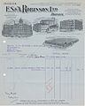 1925 ES&ARobinson Invoice with illustrations.jpg 1,627 × 2,029; 907 KB
-
-
 2-3 Litfield Place, Bristol - geograph.org.uk - 4482231.jpg 1,920 × 1,447; 676 KB
-

-
 20 zone in Eastleigh Road, BS10, Bristol - geograph.org.uk - 3827047.jpg 800 × 600; 116 KB
-
 2010 , South West from Troopers Hill - geograph.org.uk - 2180775.jpg 4,508 × 2,554; 3.69 MB
-
 2010 , The Bristol Avon near Crew's Hole - geograph.org.uk - 2176650.jpg 1,600 × 1,162; 593 KB
-
 2010 , View south on Troopers Hill - geograph.org.uk - 2180766.jpg 4,139 × 2,933; 4.47 MB
-

-
 2011 , Fields north of Broomhill - geograph.org.uk - 2424166.jpg 4,183 × 1,976; 2.17 MB
-
 2011 , River Avon upstream from New Brislington Bridge - geograph.org.uk - 2279517.jpg 4,250 × 3,155; 3.9 MB
-
 2011 , Tide weir on the River Avon - geograph.org.uk - 2279498.jpg 4,687 × 2,536; 4.72 MB
-
 2016, a year on Geograph (Day 304) - geograph.org.uk - 5174030.jpg 640 × 480; 53 KB
-
 2016, a year on Geograph (Day 44) - geograph.org.uk - 4825736.jpg 640 × 480; 68 KB
-
 20191012 city park.jpg 4,160 × 2,340; 2.51 MB
-
 20191012 left handed gaint.jpg 4,160 × 2,340; 2.55 MB
-
 20220509 213224-Baltic Wharf Bristol Harbourside.jpg 2,354 × 2,124; 509 KB
-
-
 25,27 Clare Street, Bristol - geograph.org.uk - 5447187.jpg 1,280 × 1,021; 338 KB
-
 28 Clare Street, Bristol - geograph.org.uk - 5447196.jpg 993 × 1,280; 338 KB
-
 3 Portwall Lane, Bristol - geograph.org.uk - 3722527.jpg 407 × 640; 177 KB
-
 3, Middle Avenue.jpg 1,466 × 2,199; 605 KB
-
 30 And 32, Richmond Park Road.jpg 3,345 × 2,231; 1.55 MB
-
 31 Corn Street, Bristol - geograph.org.uk - 5447318.jpg 969 × 1,280; 353 KB
-
 3351 star quilt (8151693575).jpg 1,080 × 1,317; 1.11 MB
-
 3414 water hyacinth (14844558444).jpg 2,327 × 3,211; 6.95 MB
-
 39-45, St Nicholas Street.jpg 4,000 × 2,667; 5.19 MB
-
 4, Broad Quay.jpg 4,000 × 2,667; 4.5 MB
-
 4282 drying out (8460618398).jpg 1,646 × 1,080; 1.8 MB
-
 4284 family (8460618224).jpg 1,847 × 1,046; 1.76 MB
-
 43-59 And 71-81, Queen's Road.jpg 3,229 × 2,153; 1.11 MB
-
 44 ^ 46 Pembroke Road - geograph.org.uk - 5443922.jpg 1,280 × 967; 272 KB
-
 45, Granby Hill.jpg 2,243 × 3,364; 1.29 MB
-
 46 ^ 438 St Paul's Road, Clifton - geograph.org.uk - 5439798.jpg 1,280 × 949; 360 KB
-
 4642 Stoke Lodge Front Entrance (8677073110).jpg 2,287 × 1,225; 2.77 MB
-
 4664 Stoke Lodge back view (8675966775).jpg 2,096 × 1,175; 1.84 MB
-
 4672 Stoke Lodge kitchen end (8675966565).jpg 1,481 × 1,185; 1.42 MB
-
 48 To 58 (Even) And Attached Basement Area Railings.jpg 2,091 × 3,136; 1.08 MB
-
 4959 burnt out (13788109374).jpg 2,736 × 3,648; 12.99 MB
-
 5 new houses, Crew's Hole Road - geograph.org.uk - 3425150.jpg 640 × 480; 82 KB
-
 59 and 59a Devon Road - geograph.org.uk - 4116335.jpg 640 × 480; 122 KB
-
 6 ^ 7 Clifton Down - geograph.org.uk - 5445307.jpg 1,280 × 990; 291 KB
-
 6199 Cliftonwood door and window (9324205586).jpg 684 × 766; 364 KB
-
 64-66 Pembroke Road, Bristol - geograph.org.uk - 3786200.jpg 640 × 500; 178 KB
-
 6970 scaffold canvas 1 (6338306801).jpg 1,080 × 2,232; 1.48 MB
-
 7167 Winter sunset at Sea Mills (16040333827).jpg 2,387 × 2,947; 5.51 MB
-
 8 ^ 9 Clifton Park - geograph.org.uk - 5444323.jpg 1,280 × 983; 395 KB
-
 8584 late afternoon on the bridge (6732816625).jpg 709 × 1,260; 841 KB
-
 9 And 10, St Augustines Parade.jpg 2,326 × 3,489; 1.59 MB
-
 9 Oakfield Road, Clifton, Bristol - geograph.org.uk - 5445422.jpg 480 × 640; 69 KB
-
 9 ^ 10 Berkeley Place - geograph.org.uk - 5444626.jpg 909 × 1,280; 319 KB
-
 9 ^ 11 Richmond Park Road - geograph.org.uk - 5444503.jpg 976 × 1,280; 344 KB
-
 9. - panoramio.jpg 4,000 × 2,248; 3.99 MB
-
 92 ^ 90 Queen's Road, Clifton - geograph.org.uk - 5444593.jpg 1,280 × 924; 282 KB
-
 9423 my ball (18471437105).jpg 2,150 × 1,853; 2.58 MB
-

-
 @T Bristol planetarium - geograph.org.uk - 4683217.jpg 1,280 × 960; 363 KB
-
 A beautiful front to Bordeaux Quay - geograph.org.uk - 5478511.jpg 2,304 × 1,704; 1.68 MB
-
 A bend in the rhine - geograph.org.uk - 4835838.jpg 3,648 × 2,048; 2.19 MB
-
 A Black-Headed Gull takes a bath (3053813203).jpg 4,033 × 2,696; 3.43 MB
-
 A bridge to the future - geograph.org.uk - 5279440.jpg 2,304 × 1,704; 1.42 MB
-
 A brief reappearance - geograph.org.uk - 4004165.jpg 1,704 × 2,304; 2.19 MB
-
 A bright tattoo parlour - geograph.org.uk - 6263039.jpg 3,296 × 2,472; 3.22 MB
-
 A bug while you wait - geograph.org.uk - 4010174.jpg 2,304 × 1,704; 1.36 MB
-
 A busy night in Za Za's - geograph.org.uk - 4665258.jpg 2,304 × 1,704; 1.48 MB
-
 A changing mix, a changing view - geograph.org.uk - 4010261.jpg 2,304 × 1,704; 1.59 MB
-
 A cheery wave - geograph.org.uk - 5296629.jpg 2,304 × 1,704; 820 KB
-
 A choice of exteriors - geograph.org.uk - 3705052.jpg 2,304 × 1,704; 1.44 MB
-
 A colourful corner in Southmead, Bristol - geograph.org.uk - 3805025.jpg 800 × 633; 148 KB
-
 A concatenation of Traffic Lights^ - geograph.org.uk - 5355269.jpg 4,203 × 2,808; 4.19 MB
-
 A different point of view (3339194108).jpg 903 × 765; 676 KB
-
 A double benchmark - geograph.org.uk - 5425231.jpg 1,600 × 1,510; 575 KB
-
 A dry future^ - geograph.org.uk - 3320699.jpg 2,304 × 1,704; 1.67 MB
-
 A farm now lost - geograph.org.uk - 5752509.jpg 2,304 × 1,704; 1.64 MB
-
 A full covering - geograph.org.uk - 3300383.jpg 1,704 × 2,304; 1.44 MB
-
 A glimpse of the cathedral - geograph.org.uk - 5458470.jpg 4,320 × 3,240; 2.74 MB
-
 A grasping bronze reptile - geograph.org.uk - 5479495.jpg 2,304 × 1,704; 1.81 MB
-
 A green roof - geograph.org.uk - 4676986.jpg 4,662 × 3,090; 5.47 MB
-
 A land of pipes and tanks - geograph.org.uk - 3128620.jpg 2,304 × 1,704; 1.72 MB
-
 A line of missiles - geograph.org.uk - 5696552.jpg 2,304 × 1,704; 1.52 MB
-
-
 A longer wait - geograph.org.uk - 5696527.jpg 1,704 × 2,304; 1.29 MB
-
 A lot of hot air in Small Street - geograph.org.uk - 5443827.jpg 1,704 × 2,304; 1.46 MB
-
 A missing bench mark - geograph.org.uk - 5409643.jpg 1,600 × 1,067; 834 KB
-
 A modern defensive ditch - geograph.org.uk - 5555403.jpg 1,704 × 2,304; 1.74 MB
-
 A monarch and horses along the Avon - geograph.org.uk - 5286556.jpg 1,704 × 2,304; 1.77 MB
-
 A Monstrous Carbuncle - geograph.org.uk - 5445714.jpg 640 × 439; 285 KB
-
 A new kingdom - geograph.org.uk - 3320713.jpg 2,304 × 1,704; 1.49 MB
-
 A new place to live and worship - geograph.org.uk - 4022422.jpg 2,304 × 1,704; 1.83 MB
-
 A notice of thanks - geograph.org.uk - 6469608.jpg 3,296 × 2,472; 1.91 MB
-
 A pair of semis on Wordsworth Road - geograph.org.uk - 3250951.jpg 1,024 × 683; 173 KB
-
 A panorama of boats - geograph.org.uk - 4716752.jpg 5,288 × 3,522; 5.71 MB
-
 A path off Dutton Close - geograph.org.uk - 6457884.jpg 3,296 × 2,472; 1.84 MB
-
 A pedestrian underpass beneath the M49 motorway - geograph.org.uk - 4836139.jpg 3,648 × 2,048; 1.88 MB
-
 A perch, caged - geograph.org.uk - 6457370.jpg 3,296 × 2,472; 1.91 MB
-
 A plaque to Sir Michael Redgrave - geograph.org.uk - 5460259.jpg 1,704 × 2,304; 1.28 MB
-
 A pleasant Spring day in Clifton - geograph.org.uk - 4433664.jpg 2,304 × 1,704; 1.81 MB
-
 A post holder^ - geograph.org.uk - 6433100.jpg 2,472 × 3,296; 1.86 MB
-
 A Rex that is history - geograph.org.uk - 6258707.jpg 3,296 × 2,472; 3.28 MB
-
 A room, with en-suite shower^ - geograph.org.uk - 5460251.jpg 1,704 × 2,304; 1.28 MB
-
 A sinking boundary stone - geograph.org.uk - 5462300.jpg 1,704 × 2,304; 1.93 MB
-
 A slippery road^ - geograph.org.uk - 6274261.jpg 3,296 × 2,472; 3.23 MB
-
 A slow carousel - geograph.org.uk - 3128612.jpg 2,304 × 1,704; 1.68 MB
-

-
 A snowy opening - geograph.org.uk - 5710525.jpg 2,304 × 1,704; 2.25 MB
-
 A solid footing - geograph.org.uk - 5555444.jpg 2,304 × 1,704; 1.67 MB
-
 A special treat - geograph.org.uk - 5535456.jpg 2,304 × 1,704; 1.41 MB
-
 A stag on the wall - geograph.org.uk - 4010239.jpg 1,704 × 2,304; 1.51 MB
-
 A steeplejack's challenge - geograph.org.uk - 4746904.jpg 3,165 × 4,110; 2.96 MB
-
 A striking facade - geograph.org.uk - 4676984.jpg 4,896 × 3,264; 5.32 MB
-
 A summer evening on St Augustine's Reach - geograph.org.uk - 5461892.jpg 2,304 × 1,704; 1.55 MB
-
 A sunny day an no customers - geograph.org.uk - 6457372.jpg 3,296 × 2,472; 1.86 MB
-
 A tall order^ - geograph.org.uk - 4746900.jpg 1,705 × 1,922; 1.4 MB
-
 A Taste of Poland in Bristol - geograph.org.uk - 3793524.jpg 800 × 646; 164 KB
-
 A tasty morsel^ - geograph.org.uk - 4010279.jpg 1,704 × 2,304; 1.6 MB
-
 A tavern without a heart - geograph.org.uk - 5279405.jpg 1,704 × 2,304; 1.58 MB
-
 A thing for heights - geograph.org.uk - 5906867.jpg 2,304 × 1,704; 1.6 MB
-

-
-

-
 A view from the bridge - geograph.org.uk - 4676973.jpg 4,896 × 3,264; 3.77 MB
-
 A view from the windows - geograph.org.uk - 5535513.jpg 2,304 × 1,704; 1.64 MB
-
 A view through the rigging.. (928660203).jpg 2,755 × 2,066; 1.11 MB
-
 A white tunnel - geograph.org.uk - 5710555.jpg 2,304 × 1,704; 2.22 MB
-
 A worn benchmark - geograph.org.uk - 5425259.jpg 1,600 × 1,200; 623 KB
-
 A370 Brunel Way - geograph.org.uk - 5818144.jpg 1,024 × 751; 117 KB
-
 A4 at Hicks Gate - geograph.org.uk - 4947163.jpg 2,375 × 1,280; 615 KB
-
 A4 at Hicks Gate - geograph.org.uk - 4947238.jpg 1,920 × 1,173; 745 KB
-
 A4 Portway ^ Severn Beach Line - geograph.org.uk - 3595690.jpg 2,592 × 1,944; 2.49 MB
-
 A4162 crossroads in Shirehampton - geograph.org.uk - 4783276.jpg 1,600 × 1,200; 210 KB
-
 A4174 crossing the River Avon - geograph.org.uk - 4484446.jpg 1,024 × 768; 117 KB
-
 A4320 flyover - geograph.org.uk - 5003081.jpg 640 × 426; 50 KB
-
 A4320 flyover - geograph.org.uk - 5003085.jpg 640 × 426; 56 KB
-
 Aardman Studios headquarters building - geograph.org.uk - 5124558.jpg 1,600 × 1,200; 908 KB
-
 Aardman Studios headquarters building - geograph.org.uk - 5124571.jpg 1,200 × 1,600; 726 KB
-
 Abbots Gate Bristol - geograph.org.uk - 5309663.jpg 480 × 640; 80 KB
-
 Abbots Pool, Bristol, United Kingdom (Unsplash).jpg 3,500 × 2,333; 5.22 MB
-
 Abbotsford Road, Bristol - geograph.org.uk - 4742725.jpg 1,920 × 1,321; 410 KB
-
 Abbotsford Road, Bristol - geograph.org.uk - 4742898.jpg 1,920 × 1,396; 631 KB
-
 Aberdeen Road, Cotham - geograph.org.uk - 4750053.jpg 1,920 × 1,440; 534 KB
-
 Aboard without leaving dry ground - geograph.org.uk - 5278762.jpg 1,704 × 2,304; 1.4 MB
-
 Access track to the Rock Cottages sewage pumping station - geograph.org.uk - 3521178.jpg 3,648 × 2,736; 4.09 MB
-
 Ace Kitchens, Feeder Road, Bristol - geograph.org.uk - 3217602.jpg 640 × 446; 55 KB
-
 Across Bath Road bridge, Bristol - geograph.org.uk - 3215504.jpg 640 × 427; 67 KB
-
 Across Marsh Bridge, Bristol - geograph.org.uk - 3217247.jpg 640 × 532; 82 KB
-
 Across Netham Park - geograph.org.uk - 5456364.jpg 640 × 427; 199 KB
-

-
 Across the Avon - geograph.org.uk - 5454142.jpg 640 × 427; 197 KB
-
 Across the Avon - geograph.org.uk - 5454149.jpg 640 × 427; 234 KB
-
 Across the floating harbour - geograph.org.uk - 5455174.jpg 640 × 427; 197 KB
-
 Across the Floating Harbour, Bristol - geograph.org.uk - 4299729.jpg 1,920 × 1,466; 606 KB
-
 Across Victoria Square - geograph.org.uk - 4433640.jpg 1,704 × 2,304; 2.06 MB
-
 Action Centre - geograph.org.uk - 2002735.jpg 2,304 × 1,704; 1.13 MB
-
 Adding to the new look of the dockside - geograph.org.uk - 4665702.jpg 1,704 × 2,304; 1.23 MB
-
 Addisons Oak on Sea Mills Square.jpg 2,847 × 1,151; 735 KB
-
 ADP Riot Tour at Trinity (26110752733).jpg 3,264 × 2,448; 1.76 MB
-
 Advertising boards, Temple Gate, Bristol - geograph.org.uk - 5092036.jpg 800 × 715; 140 KB
-
-
 African Textile Boutique, Bristol - geograph.org.uk - 3314787.jpg 640 × 469; 86 KB
-
 Aggregate sacks, Ashton Vale - geograph.org.uk - 3969345.jpg 1,920 × 1,153; 537 KB
-
 AkankshaDaminiJoshi Final23Jan.tif 1,543 × 2,083; 4.96 MB
-
 Al fresco dining at Hanover Quay, Bristol - geograph.org.uk - 2232435.jpg 3,801 × 2,851; 2.65 MB
-
 Alas, no more^ - geograph.org.uk - 5331226.jpg 3,127 × 2,490; 3.63 MB
-
 Albert and Victoria, Bedminster - geograph.org.uk - 3968241.jpg 3,381 × 2,242; 791 KB
-
 Albert Cottage, British Road - geograph.org.uk - 5698799.jpg 640 × 421; 42 KB
-
 Albert Lodge, Victoria Square (detail) - geograph.org.uk - 5445268.jpg 1,280 × 960; 346 KB
-
 Albert Lodge, Victoria Square - geograph.org.uk - 5445265.jpg 899 × 1,280; 376 KB
-
 Albert Road Vicinity, Bristol 2 - geograph.org.uk - 5496635.jpg 1,222 × 1,545; 505 KB
-
 Albert Road Vicinity, Bristol 2 - geograph.org.uk - 5496658.jpg 1,437 × 2,379; 1.17 MB
-
 Albert Road Vicinity, Bristol 2 - geograph.org.uk - 5496977.jpg 1,661 × 1,750; 1.57 MB


.jpg)
.jpg)


.jpg)
.jpg)


.jpg)
.jpg)


_-_geograph.org.uk_-_5174030.jpg)
_-_geograph.org.uk_-_4825736.jpg)


_waiting_for_jobs_in_front_of_the_branch_office_of_American_fast_food_chain_Five_Guys_67_69_Queens_Road,_Clifton,_Bristol.jpg)


.jpg)
.jpg)


.jpg)
.jpg)


.jpg)
.jpg)
.jpg)
_And_Attached_Basement_Area_Railings.jpg)
.jpg)


.jpg)

.jpg)
.jpg)

.jpg)


.jpg)
.jpg)


.jpg)


.jpg)


.jpg)


.jpg)


.jpg)


_-_geograph.org.uk_-_5445268.jpg)


Categories:
- Country subdivisions by name
- Counties of England
- Country subdivisions in Europe
- Cities by name
- Cities in the United Kingdom by name
- Cities in Europe by name
- Populated places in England by name
- Cities in England
- Districts in England by name
- Unparished areas in England
- South West England
- Twin towns of Hannover
- Districts of Avon