Category:Rock County, Wisconsin
Sari la navigare
Sari la căutare
Counties of Wisconsin: Adams · Ashland · Barron · Bayfield · Brown · Buffalo · Burnett · Calumet · Chippewa · Clark · Columbia · Crawford · Dane · Dodge · Door · Douglas · Dunn · Eau Claire · Florence · Fond du Lac · Forest · Grant · Green · Green Lake · Iowa · Iron · Jackson · Jefferson · Juneau · Kenosha · Kewaunee · La Crosse · Lafayette · Langlade · Lincoln · Manitowoc · Marathon · Marinette · Marquette · Menominee · Milwaukee · Monroe · Oconto · Oneida · Outagamie · Ozaukee · Pepin · Pierce · Polk · Portage · Price · Racine · Richland · Rock · Rusk · Sauk · Sawyer · Shawano · Sheboygan · St. Croix · Taylor · Trempealeau · Vernon · Vilas · Walworth · Washburn · Washington · Waukesha · Waupaca · Waushara · Winnebago · Wood
comitat din Statele Unite ale Americii   | |||||
| Încarcă multimedia | |||||
| Este un/o | |||||
|---|---|---|---|---|---|
| Locul actual | Wisconsin, SUA | ||||
| Capitală | |||||
| Înființare |
| ||||
| Populație |
| ||||
| Suprafață |
| ||||
| Altitudine deasupra nivelului mării |
| ||||
| Diferit(ă) de | |||||
| site oficial | |||||
 | |||||
English: Media related to Rock County, Wisconsin, a county in Wisconsin, United States.
Subcategorii
Această categorie conține următoarele 14 subcategorii, dintr-un total de 14.
B
C
- Carver-Roehl State Natural Area (20 F)
F
G
H
L
- Lawrence Prairie (22 F)
M
N
P
R
- Rock County Navy Week (19 F)
T
Fișiere media din categoria „Rock County, Wisconsin”
Următoarele 44 fișiere se află în această categorie, dintr-un total de 44.
-
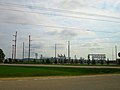
 ATC 345-Kilovolt Line - panoramio.jpg 4.288x3.216; 1,32 MB
-
 ATC Power Line - panoramio (68).jpg 4.000x3.000; 2,16 MB
-
 ATC Power LIne - panoramio.jpg 3.982x2.380; 1,95 MB
-
 ATC Substation - panoramio (1).jpg 4.000x3.000; 2,21 MB
-
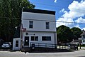 Avalon, WI, post office.jpg 6.000x4.000; 5,46 MB
-
 Barn East of Evansville - panoramio.jpg 4.000x3.000; 2,98 MB
-
 Blackhawk Tech.jpg 412x222; 67 KB
-
-
 Cell Tower North of Janesville - panoramio.jpg 4.000x3.000; 3,18 MB
-
 Communication Tower - panoramio (7).jpg 5.129x3.409; 5,61 MB
-
 The history of Rock County, Wisconsin; its early settlement, growth, development, resources, etc. (IA cu31924028871585).pdf 912 × 1.308, 900 de pagini; 42,18 MB
-
 Dairy Farm near Fulton - panoramio.jpg 5.156x3.151; 4,82 MB
-
 Dairy Farm with Four Silos - panoramio (6).jpg 5.184x3.888; 6,07 MB
-
 Dairy Farm With Three Silos - panoramio.jpg 4.000x3.000; 3,29 MB
-
 Farm East of Evansville - panoramio.jpg 5.184x3.888; 6,64 MB
-
 Farm near Cooksville - panoramio.jpg 5.184x3.888; 4,98 MB
-
 Farm near Evansville - panoramio (2).jpg 5.184x3.888; 5,61 MB
-
 Farm near Janesville - panoramio (1).jpg 5.138x3.151; 4,35 MB
-
 Farm near JCT of Hwys 11 and 14 - panoramio.jpg 4.000x3.000; 3,06 MB
-
 Farm North of Evansville - panoramio.jpg 5.184x3.888; 5,3 MB
-
 Farm with Two Silos - panoramio (17).jpg 4.000x3.000; 2,88 MB
-
 Farmhouse near Evansville - panoramio.jpg 5.184x3.888; 6,19 MB
-
 Farmland near Cooksville - panoramio.jpg 5.184x3.888; 5,99 MB
-
 Farmland Near Cooksville - panoramio.jpg 5.184x3.888; 5,68 MB
-
 Grain Elevator in Evansville - panoramio.jpg 4.608x3.456; 9,76 MB
-
 Grain Elevator Near Evansville - panoramio.jpg 4.608x3.456; 9,42 MB
-
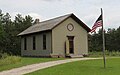 Harmony Town Hall-Old World Wisconsin.jpg 3.877x2.420; 3,35 MB
-
 JoeShear ArtgoWin.jpg 220x147; 22 KB
-
 Map of Wisconsin highlighting Rock County.svg 1.055x1.130; 70 KB
-
 Orfordville Village Hall.jpg 6.000x4.000; 6,79 MB
-
 Prairie Wisconsin.jpg 3.872x2.592; 4,47 MB
-
 Rock County Farmland - panoramio (1).jpg 5.147x3.151; 4,59 MB
-
 Rock County Farmland - panoramio.jpg 5.184x3.888; 8,34 MB
-
 Southern Wisconsin Regional Airport-WI-28Apr1992-USGS.jpg 614x587; 104 KB
-
 Three Silos - panoramio (3).jpg 4.000x3.000; 3,47 MB
-
 Two Barns with Red Roofs - panoramio.jpg 5.184x3.888; 4,99 MB
-
 Union community, Rock County, WI.JPG 4.000x3.000; 3,42 MB
-
 US 14 in Emerald Grove, WI.jpg 6.000x4.000; 5,93 MB
-
 USA Rock County, Wisconsin age pyramid.svg 520x600; 8 KB
-
 Very old truck.jpg 3.607x2.412; 2,79 MB
-
 White Barn with a Silo - panoramio (5).jpg 5.147x3.261; 4,36 MB
-
 WJNW-TV ^ WJVL 99.9 FM Broadcast Tower - panoramio.jpg 4.608x3.456; 7,71 MB
-
 WWHG 105.9 FM The Hog Broadcast Tower - panoramio.jpg 4.608x3.456; 7,75 MB
-
 Yahara River WI map.png 2.518x2.528; 3,46 MB

.jpg)

.jpg)


.jpg)

.jpg)


.jpg)
.jpg)


.jpg)


.jpg)


.jpg)


.jpg)


