Category:Rohr in Niederbayern
Jump to navigation
Jump to search
market municipality of Germany    | |||||
| Upload media | |||||
| Instance of |
| ||||
|---|---|---|---|---|---|
| Part of |
| ||||
| Location | Kelheim, Lower Bavaria, Bavaria, Germany | ||||
| Population |
| ||||
| Area |
| ||||
| Elevation above sea level |
| ||||
| official website | |||||
 | |||||
Subcategories
This category has the following 6 subcategories, out of 6 total.
B
C
J
Media in category "Rohr in Niederbayern"
The following 8 files are in this category, out of 8 total.
-
 Adalbert von Rohr.jpg 530 × 998; 354 KB
-
 DEU Rohr in Niederbayern COA.svg 512 × 518; 44 KB
-
 Historico-Topographica Descriptio. 1. Das Renntambt München 108.jpg 18,313 × 7,777; 22.97 MB
-

-
 Rohr in Niederbayern - Lage im Landkreis.png 148 × 185; 25 KB
-
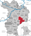 Rohr in Niederbayern in KEH.svg 576 × 664; 590 KB
-
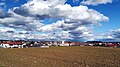 Rohr in Niederbayern.jpg 3,912 × 2,200; 3.79 MB
-
 Wappen Rohr in Niederbayern.png 114 × 118; 7 KB


