Category:Rohrdorf (am Inn)
Jump to navigation
Jump to search
municipality of Germany     | |||||
| Upload media | |||||
| Instance of |
| ||||
|---|---|---|---|---|---|
| Part of |
| ||||
| Location | Rosenheim, Upper Bavaria, Bavaria, Germany | ||||
| Located in or next to body of water | |||||
| Head of government |
| ||||
| Population |
| ||||
| Area |
| ||||
| Elevation above sea level |
| ||||
| Different from | |||||
| official website | |||||
 | |||||
Subcategories
This category has the following 5 subcategories, out of 5 total.
- Symbols of Rohrdorf (am Inn) (5 F)
W
- Winklbach (15 F)
Media in category "Rohrdorf (am Inn)"
The following 12 files are in this category, out of 12 total.
-
 20220612-büchergondel-dorfplatz-rohrdorf-am-inn.jpg 5,184 × 3,888; 11.35 MB
-
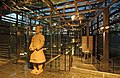 9Tonkrieger.jpg 3,008 × 1,960; 4.54 MB
-
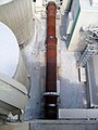 Drehrohrofen Rohrdorf.JPG 1,920 × 2,560; 896 KB
-
 Historico-Topographica Descriptio. 1. Das Renntambt München 476.jpg 9,300 × 7,798; 12.55 MB
-
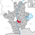
 Rohrdorf - Lage im Landkreis.png 252 × 310; 45 KB
-
 Rohrdorf in RO.svg 836 × 836; 1.28 MB
-
 Rohrdorf-1.jpg 1,400 × 808; 275 KB
-
 Rohrdorfer Achen Thansau Rohrdorf-6.jpg 4,915 × 3,640; 3.57 MB
-
 Rohrdorfer Achen Thansau Rohrdorf-7.jpg 5,345 × 3,460; 3.63 MB
-
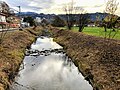 Rohrdorfer Achen.jpg 4,032 × 3,024; 4.69 MB
-
 Schattdecor Nachtlandschaften.jpg 3,307 × 1,960; 4.28 MB
-
 Schattdecor small.jpg 794 × 110; 12 KB


