Category:Rokunohe, Aomori
Jump to navigation
Jump to search
日本語: 日本国青森県上北郡六戸町に関するカテゴリ。
town in Kamikita district, Aomori prefecture, Japan     | |||||
| Upload media | |||||
| Instance of | |||||
|---|---|---|---|---|---|
| Location | Kamikita district, Aomori Prefecture, Japan | ||||
| Legal form |
| ||||
| Inception |
| ||||
| Population |
| ||||
| Area |
| ||||
| Replaced by |
| ||||
| official website | |||||
 | |||||
Subcategories
This category has the following 8 subcategories, out of 8 total.
F
- Furusato Station (1 F)
K
- Komaki Onsen Shibusawa Park (39 F)
O
- Ōmagari Station (Aomori) (3 F)
S
- Sannoko-mae Station (1 F)
- Shichihyaku Station (19 F)
T
- Tsubame Taxi (Aomori) (6 F)
Y
- Yanagisawa Station (Aomori) (1 F)
Media in category "Rokunohe, Aomori"
The following 23 files are in this category, out of 23 total.
-
 Aomori Prefectural Rokunohe High School 1.jpg 4,639 × 3,459; 2.46 MB
-
 Aomorikendo 211 Rokunohe Town.JPG 2,816 × 2,112; 1.54 MB
-
 Emblem of Rokunohe, Aomori.svg 354 × 414; 476 bytes
-
 Flag of Rokunohe Aomori.png 747 × 466; 9 KB
-
 Flag of Rokunohe, Aomori.svg 900 × 600; 546 bytes
-
 JA-Oirase Rokunohe-002.jpg 2,048 × 1,536; 649 KB
-
 JP-Network Rokunohe-84094.jpg 2,048 × 1,536; 641 KB
-
 Kamikita District in Aomori Prefecture.png 1,081 × 801; 38 KB
-
 Kappa Lake, Misawa 三澤河童湖 - panoramio.jpg 1,530 × 2,040; 904 KB
-
 Location of Rokunohe town, Aomori prefecture, Japan.svg 779 × 755; 17 KB
-
 Michinoeki-rokunohe.jpg 800 × 600; 145 KB
-
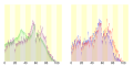 Population distribution of Rokunohe, Aomori, Japan.svg 512 × 256; 22 KB
-
 Rokunohe Aomori chapter.JPG 141 × 153; 9 KB
-
 Rokunohe in Aomori Prefecture Ja.svg 800 × 770; 30 KB
-
 Rokunohe in Aomori Prefecture.png 1,081 × 801; 38 KB
-
 Rokunohe JCT 1.jpg 5,184 × 3,888; 5.09 MB
-
 Rokunohe Sports Park.png 1,175 × 940; 1.62 MB
-
 Rokunohe-Misawa IC 1.jpg 5,184 × 3,888; 5.11 MB
-
 RokunoheTownCommunityBus ERGAmio No.54.jpg 352 × 288; 34 KB
-
 RokunoheTownOffice.jpg 2,048 × 1,536; 638 KB
-
 TowadaShinkinBank Rokunohe-016.jpg 2,048 × 1,536; 652 KB
-
 サテライト六戸 外観イメージ.jpg 1,020 × 1,020; 80 KB
-
 地図-青森県六戸町-2006.png 389 × 260; 7 KB


