Category:Roughlee Booth
Jump to navigation
Jump to search
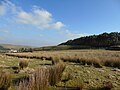
English: Roughlee Booth is a civil parish in the Pendle district, in the county of Lancashire, England.

civil parish in Pendle, Lancashire, England  | |||||
| Upload media | |||||
| Instance of | |||||
|---|---|---|---|---|---|
| Location | Pendle, Lancashire, North West England, England | ||||
 | |||||
Media in category "Roughlee Booth"
The following 110 files are in this category, out of 110 total.
-
 "Alice" - geograph.org.uk - 4961671.jpg 3,014 × 4,592; 7.86 MB
-
 A monumental seat on Pendle Water - geograph.org.uk - 4961385.jpg 4,427 × 2,863; 7.02 MB
-
 Access Lane from Ridgaling Farm - geograph.org.uk - 3177278.jpg 4,320 × 3,240; 4.67 MB
-
 Access Lane to Hollin Top - geograph.org.uk - 3177084.jpg 4,320 × 3,240; 4.43 MB
-
 Alice Nutter come back to haunt us^ - geograph.org.uk - 4961510.jpg 3,991 × 1,944; 7.69 MB
-
 Alice Nutter statue, Roughlee - geograph.org.uk - 6047292.jpg 3,970 × 3,798; 3.79 MB
-
 Barley Bank - geograph.org.uk - 5716104.jpg 5,152 × 3,864; 7.12 MB
-
 Barley New Road - geograph.org.uk - 4869068.jpg 3,072 × 1,728; 1.64 MB
-
 Black Rock - geograph.org.uk - 5716098.jpg 5,152 × 3,864; 7.56 MB
-
 Blacko - geograph.org.uk - 4069193.jpg 3,771 × 2,199; 1.5 MB
-
 Blacko Bar Road - geograph.org.uk - 4340031.jpg 640 × 427; 69 KB
-
 Blacko Foot Farm - geograph.org.uk - 5809997.jpg 1,024 × 768; 227 KB
-
 Blacko Foot Farm - geograph.org.uk - 622716.jpg 640 × 480; 137 KB
-
 Blacko Foot, some sheep - geograph.org.uk - 4455463.jpg 4,608 × 3,456; 6.05 MB
-
 Blacko Water - geograph.org.uk - 2221653.jpg 2,592 × 1,944; 1.74 MB
-
 Bridg over Blacko Water – geograph.org.uk – 622720.jpg 640 × 480; 133 KB
-
 Caravan Park - geograph.org.uk - 4694797.jpg 5,184 × 3,456; 1.62 MB
-
 Caravan site, Roughlee - geograph.org.uk - 1582096.jpg 640 × 480; 67 KB
-
 Crossroads in the Happy Valley - geograph.org.uk - 1141579.jpg 473 × 640; 175 KB
-
 Farm land at Roughlee - geograph.org.uk - 3035000.jpg 1,024 × 768; 694 KB
-
 Farm track off Pasture Lane - geograph.org.uk - 2745903.jpg 3,872 × 2,592; 5.12 MB
-
 Farm track round Brown Hill - geograph.org.uk - 2261164.jpg 1,600 × 1,198; 447 KB
-
 Farmland near Blacko - geograph.org.uk - 144096.jpg 640 × 480; 112 KB
-
 Field edge path near to Thorney Holme - geograph.org.uk - 6217273.jpg 4,000 × 3,000; 3.65 MB
-
 Field path approaching a wall stile - geograph.org.uk - 6217281.jpg 4,000 × 3,000; 3.15 MB
-
 Footpath - Keep dogs on leads - geograph.org.uk - 4960490.jpg 4,589 × 2,502; 7.23 MB
-
 Footpath crossing rough grazing near to Ouzle Rock - geograph.org.uk - 6217228.jpg 4,000 × 3,000; 2.71 MB
-
 Footpath off Pasture Lane - geograph.org.uk - 4961889.jpg 4,592 × 3,056; 6.55 MB
-
 Footpath to Higher Graystones Farm - geograph.org.uk - 4960392.jpg 4,589 × 2,729; 7.77 MB
-
 Footpath to Higher Graystones Farm - geograph.org.uk - 4960417.jpg 4,592 × 2,641; 7.52 MB
-
 Grooms Cottage, Thorney Holme - geograph.org.uk - 622727.jpg 640 × 480; 137 KB
-
 Guiding sheep along Noggarth Road - geograph.org.uk - 2459028.jpg 3,872 × 2,592; 3.83 MB
-
 Heys Lane, Thorney Holme - geograph.org.uk - 1141592.jpg 640 × 480; 91 KB
-
 Higher Spen Farm - geograph.org.uk - 4694799.jpg 5,184 × 3,139; 1.45 MB
-
 Hillside above Pendle Water - geograph.org.uk - 2745915.jpg 3,872 × 2,592; 3.59 MB
-
 Hillside near Ouzle Rock - geograph.org.uk - 2458772.jpg 3,872 × 2,592; 3.66 MB
-
 Hilltop feeding - geograph.org.uk - 2745354.jpg 3,872 × 2,592; 3.81 MB
-
 Houses, Newchurch - geograph.org.uk - 1214711.jpg 640 × 480; 58 KB
-
 Lancashire, Roughlee village - geograph.org.uk - 4126759.jpg 4,186 × 2,993; 5.67 MB
-

-
 Little Marsden - geograph.org.uk - 4069186.jpg 3,888 × 2,040; 1.49 MB
-
 Looking east towards Blacko - geograph.org.uk - 1582079.jpg 640 × 480; 57 KB
-
 Middlewood - geograph.org.uk - 4694812.jpg 5,161 × 3,441; 1.67 MB
-
 Nelson from Noggarth Road - geograph.org.uk - 4869092.jpg 3,072 × 1,728; 1.07 MB
-
 Nelson ILP Clarion Tearooms - geograph.org.uk - 3089083.jpg 640 × 480; 153 KB
-
 Nelson ILP Clarion Tearooms, Nameboard - geograph.org.uk - 3089087.jpg 640 × 480; 130 KB
-
 Newchurch in Pendle - geograph.org.uk - 4068041.jpg 3,687 × 2,513; 1.73 MB
-
 Noggarth Cottage - geograph.org.uk - 2745316.jpg 3,872 × 2,592; 4.46 MB
-
 Noggarth Cottage. - geograph.org.uk - 4068044.jpg 3,846 × 2,564; 1.92 MB
-
 Noggarth Road - geograph.org.uk - 3177289.jpg 4,320 × 3,240; 4.86 MB
-
 North of Brown Hill - geograph.org.uk - 1582093.jpg 640 × 480; 77 KB
-
 Offa Hill - geograph.org.uk - 4694353.jpg 5,162 × 2,970; 2.02 MB
-
 Offa Hill Farm - geograph.org.uk - 4455827.jpg 4,608 × 3,456; 5.99 MB
-
 Old barn in Roughlee - geograph.org.uk - 3034955.jpg 1,024 × 694; 506 KB
-

-
 Old Hall Close, Roughlee - geograph.org.uk - 4340037.jpg 640 × 480; 62 KB
-
 Pendle Hill - Flickr - gailhampshire.jpg 3,712 × 2,088; 1.34 MB
-
 Pendle Water - geograph.org.uk - 3035019.jpg 1,024 × 814; 835 KB
-
 Pendle Water - geograph.org.uk - 4961412.jpg 4,592 × 3,056; 7.65 MB
-
 Pendle Water looking upstream at Roughlee - geograph.org.uk - 1857009.jpg 1,632 × 1,224; 473 KB
-
 Pendle Way approaching Roughlee from the North - geograph.org.uk - 3177103.jpg 4,320 × 3,240; 4.54 MB
-
 Pendle Way heading towards Blacko Foot - geograph.org.uk - 3174264.jpg 4,320 × 3,240; 5.09 MB
-
 Pendle Witches fingerpost at Roughlee Booth, Lancashire.jpg 640 × 480; 104 KB
-
 Pendleway Pointing to Pendlehill - geograph.org.uk - 1825797.jpg 900 × 518; 409 KB
-
 Pennine Pine - geograph.org.uk - 980173.jpg 640 × 480; 60 KB
-
 Phone box on Barley New Road - geograph.org.uk - 4340055.jpg 640 × 427; 49 KB
-
 Public Footpath leading West from Noggarth Road - geograph.org.uk - 3177299.jpg 4,320 × 3,240; 4.37 MB
-
 Ridgaling Farm - geograph.org.uk - 2745299.jpg 3,872 × 2,592; 3.85 MB
-
 Ridge Lane, Roughlee - geograph.org.uk - 2625321.jpg 4,000 × 3,000; 5.66 MB
-
 Ridge-top view - geograph.org.uk - 2745312.jpg 3,872 × 2,592; 3.32 MB
-
 Road to Blacko - geograph.org.uk - 1857020.jpg 1,632 × 1,224; 446 KB
-
 Roughlee Booth, UK - panoramio (1).jpg 1,685 × 1,629; 460 KB
-
 Roughlee Booth, UK - panoramio (10).jpg 1,221 × 1,117; 270 KB
-
 Roughlee Booth, UK - panoramio (2).jpg 1,886 × 1,734; 759 KB
-
 Roughlee Booth, UK - panoramio (3).jpg 1,798 × 1,648; 687 KB
-
 Roughlee Booth, UK - panoramio (4).jpg 2,170 × 1,920; 729 KB
-
 Roughlee Booth, UK - panoramio (5).jpg 2,103 × 1,908; 950 KB
-
 Roughlee Booth, UK - panoramio (7).jpg 1,908 × 1,734; 640 KB
-
 Roughlee Booth, UK - panoramio.jpg 1,462 × 1,465; 532 KB
-
 Roughlee Old Hall - geograph.org.uk - 3034938.jpg 1,024 × 753; 585 KB
-
 Roughlee Old Hall, Roughlee - geograph.org.uk - 3089043.jpg 640 × 480; 125 KB
-
 Roughlee Village - geograph.org.uk - 1857017.jpg 1,632 × 1,224; 192 KB
-
 Roughlee, Bridge over Pendle Water - geograph.org.uk - 4127739.jpg 3,456 × 2,304; 4.03 MB
-
 Roughlee, Pasture Lane - geograph.org.uk - 4127785.jpg 3,456 × 2,304; 3.98 MB
-
 Roughlee, Pendle Water - geograph.org.uk - 4127775.jpg 3,456 × 2,304; 4.41 MB
-
 Roughlee, The 'Bay Horse' - geograph.org.uk - 4127761.jpg 3,456 × 2,304; 3.33 MB
-
 Roughlee, The 'Bay Horse' - geograph.org.uk - 4127769.jpg 3,456 × 2,304; 3.52 MB
-
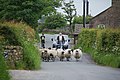
 Sheep at Roughlee Booth, Lancashire, England 1.jpg 2,640 × 1,980; 870 KB
-
 Sheep at Roughlee Booth, Lancashire, England 2.jpg 2,640 × 1,980; 1.08 MB
-
 Sheep at Roughlee Booth, Lancashire, England 3.jpg 2,640 × 1,980; 978 KB
-
 Signs by Noggarth Cottage - geograph.org.uk - 2745329.jpg 3,872 × 2,592; 4.42 MB
-
 Spend End - geograph.org.uk - 4068879.jpg 3,888 × 2,592; 1.39 MB
-
 Stang Top - geograph.org.uk - 4694351.jpg 5,184 × 3,456; 1.82 MB
-
 Statue of Alice Nutter - geograph.org.uk - 3494131.jpg 480 × 640; 144 KB
-
 Stepping stones - panoramio (4).jpg 2,050 × 1,920; 965 KB
-
 Stepping Stones over Pendle Water - geograph.org.uk - 3177093.jpg 3,240 × 4,320; 5.92 MB
-
 The Bay Horse - geograph.org.uk - 4694356.jpg 5,183 × 2,831; 2.02 MB
-
 The Bay Horse Inn, Roughlee - geograph.org.uk - 3034915.jpg 4,000 × 3,000; 5.66 MB
-
 The Bay Horse Inn, Roughlee - geograph.org.uk - 4961859.jpg 4,263 × 2,324; 7.24 MB
-
 The lane from Ouzle Rock down to Noggarth Road - geograph.org.uk - 2459019.jpg 3,872 × 2,592; 4.69 MB
-
 The lane to Ridgaling Farm - geograph.org.uk - 4960465.jpg 4,592 × 3,056; 5.85 MB
-
 The statue of Alice Nutter - geograph.org.uk - 5976352.jpg 4,000 × 3,000; 4.76 MB
-
 The statue of Alice Nutter - geograph.org.uk - 5976354.jpg 4,000 × 3,000; 5.02 MB
-
 This Way To Pendle Hill (geograph 2134686).jpg 1,200 × 769; 818 KB
-
 Thorney Holme (geograph 4068019).jpg 3,587 × 2,391; 1.75 MB
-
 Thornley Holme (geograph 4020020).jpg 4,592 × 2,746; 6.8 MB
-
 Track to Higher Greystones Farm - geograph.org.uk - 2625331.jpg 4,000 × 3,000; 6.07 MB
-
 View over Roughlee - geograph.org.uk - 1640547.jpg 640 × 428; 72 KB
-
 Waterfall on Pendle Water - geograph.org.uk - 4961440.jpg 4,468 × 2,974; 7.77 MB
-
 White Hough Water near Roughlee.jpg 5,344 × 3,008; 8.67 MB


.jpg)
.jpg)
.jpg)
.jpg)
.jpg)
.jpg)
.jpg)


.jpg)


.jpg)
.jpg)
.jpg)


