Category:Roughton, Norfolk
Jump to navigation
Jump to search
English: Roughton is a village and a civil parish in the English county of Norfolk. The village is north-west of North Walsham. The village straddles the A140 between Cromer and Norwich and the B1463. The nearest railway station is at Roughton Road for the Bittern Line, which runs between Sheringham, Cromer and Norwich. The nearest airport is Norwich International Airport. First Eastern Counties, Norfolk Green and Sanders all provide a regular bus services to Norwich, Sheringham, Cromer and Holt.
village and civil parish in Norfolk, England, United Kingdom  | |||||
| Upload media | |||||
| Instance of | |||||
|---|---|---|---|---|---|
| Location | North Norfolk, Norfolk, East of England, England | ||||
| Area |
| ||||
| Said to be the same as | Roughton (Wikimedia duplicated page, civil parish) | ||||
 | |||||
Subcategories
This category has the following 12 subcategories, out of 12 total.
B
C
- Roughton common (8 F)
E
- Environs of Roughton, Norfolk (13 F)
F
- Footpaths in Roughton (5 F)
M
N
P
- Pubs in Roughton, Norfolk (3 F)
R
- Roughton Road railway station (11 F)
S
- Shops in Roughton (11 F)
- Signs in Roughton, Norfolk (4 F)
Media in category "Roughton, Norfolk"
The following 66 files are in this category, out of 66 total.
-
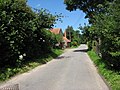
 Back Lane, Roughton - geograph.org.uk - 6160543.jpg 5,568 × 3,712; 7.01 MB
-
 Barns at Grove Farm - geograph.org.uk - 5973153.jpg 1,600 × 1,064; 816 KB
-
 Bungalow on Norwich Road, Roughton - geograph.org.uk - 5412704.jpg 2,048 × 1,536; 1.03 MB
-
 Cereal crop field by Jarvis Farm - geograph.org.uk - 5323432.jpg 640 × 480; 236 KB
-
 Chapel Road, Roughton - geograph.org.uk - 5877384.jpg 1,024 × 684; 256 KB
-
 Converted windmill at Roughton - geograph.org.uk - 3935882.jpg 640 × 480; 111 KB
-
 Cromer Road (B1436) past Hylton - geograph.org.uk - 5323433.jpg 640 × 480; 259 KB
-
 Cromer Road, B1436 - geograph.org.uk - 5877389.jpg 1,024 × 684; 242 KB
-

-
 End of Carr Lane - geograph.org.uk - 5127196.jpg 1,600 × 1,200; 717 KB
-
 Entrance to Roughton - geograph.org.uk - 3816252.jpg 640 × 516; 59 KB
-
 Field of beet - geograph.org.uk - 3682149.jpg 640 × 480; 118 KB
-
 Fields by Roughton Road - geograph.org.uk - 5127195.jpg 1,600 × 1,200; 783 KB
-
 Font, St Mary's church, Roughton - geograph.org.uk - 6165568.jpg 3,393 × 5,549; 5.72 MB
-
 Footpath on Roughton Heath - geograph.org.uk - 5964686.jpg 1,600 × 1,200; 496 KB
-
 Footpath through Heath Plantation - geograph.org.uk - 5964690.jpg 1,600 × 1,200; 757 KB
-
 Footpath towards Roughton - geograph.org.uk - 3682169.jpg 640 × 480; 103 KB
-

-
 House on Church Loke, Roughton - geograph.org.uk - 5973036.jpg 1,600 × 1,064; 904 KB
-
 Junction on Norwich Road, Roughton - geograph.org.uk - 5411681.jpg 2,048 × 1,536; 942 KB
-
 Leaving Old John's Wood - geograph.org.uk - 527245.jpg 640 × 480; 77 KB
-
 Metton Road - geograph.org.uk - 5016891.jpg 1,600 × 1,200; 715 KB
-
 Norfolk Fields - geograph.org.uk - 2565796.jpg 800 × 509; 81 KB
-
 Norwich Road, Northrepps - geograph.org.uk - 5411667.jpg 2,048 × 1,536; 1.56 MB
-
 Petrol station on Norwich Road, Roughton - geograph.org.uk - 5411665.jpg 2,048 × 1,536; 1.5 MB
-
 Petrol station on Norwich Road, Roughton - geograph.org.uk - 5411666.jpg 2,048 × 1,536; 1.52 MB
-
 Roughton Mill Hill Tower Windmill - geograph.org.uk - 4031338.jpg 480 × 640; 67 KB
-
 Roughton Road - geograph.org.uk - 5126462.jpg 1,600 × 1,200; 615 KB
-
 Roughton War Memorial - geograph.org.uk - 4592974.jpg 2,592 × 3,456; 2.06 MB
-
 Roughton, south of Cromer - geograph.org.uk - 5583121.jpg 640 × 480; 77 KB
-
 Someone nicked the footpath sign - geograph.org.uk - 4602677.jpg 640 × 480; 146 KB
-
 St Mary the Virgin Church, Roughton - geograph.org.uk - 5973042.jpg 1,064 × 1,600; 474 KB
-
 St Mary the Virgin Church, Roughton - geograph.org.uk - 5973050.jpg 1,600 × 1,064; 559 KB
-
 St Mary the Virgin Church, Roughton - geograph.org.uk - 5973054.jpg 1,600 × 1,064; 518 KB
-
 St Mary the Virgin Church, Roughton - geograph.org.uk - 5973059.jpg 1,600 × 1,064; 493 KB
-
 St Mary the Virgin Church, Roughton - geograph.org.uk - 5973067.jpg 1,064 × 1,600; 478 KB
-
 St Mary the Virgin Church, Roughton - geograph.org.uk - 5973069.jpg 1,064 × 1,600; 989 KB
-
 St Mary the Virgin Church, Roughton - geograph.org.uk - 5973076.jpg 1,064 × 1,600; 602 KB
-
 St Mary the Virgin Church, Roughton - geograph.org.uk - 5973080.jpg 1,064 × 1,600; 590 KB
-
 St Mary the Virgin Church, Roughton - geograph.org.uk - 5973085.jpg 1,271 × 1,600; 1,003 KB
-
 St Mary the Virgin Church, Roughton - geograph.org.uk - 5973092.jpg 1,600 × 1,064; 756 KB
-

-
 The church car park at Roughton - geograph.org.uk - 4592115.jpg 3,456 × 2,592; 3.79 MB
-
 The New Inn, Roughton - geograph.org.uk - 5411682.jpg 2,048 × 1,536; 1.07 MB
-
 Thorpe Market Road - geograph.org.uk - 4990534.jpg 1,600 × 1,200; 666 KB
-
 To Felbrigg on Cromer Road (B1436) - geograph.org.uk - 5323436.jpg 640 × 582; 457 KB
-
 Topshill Road Thorpe Market - geograph.org.uk - 4602679.jpg 640 × 480; 163 KB
-
 View towards Roughton from churchyard - geograph.org.uk - 521166.jpg 640 × 480; 67 KB
-
 WW1 memorial plaque - geograph.org.uk - 5971248.jpg 1,145 × 1,600; 461 KB
-
 WW2 memorial plaque - geograph.org.uk - 5971247.jpg 1,600 × 1,064; 323 KB
-
 A140 over farmland - geograph.org.uk - 383890.jpg 640 × 480; 107 KB
-
 Approach to Old John's Wood - geograph.org.uk - 527232.jpg 640 × 480; 90 KB
-
 Approaching junction with the A140 - geograph.org.uk - 714921.jpg 640 × 464; 100 KB
-
 Approaching Roughton on Back Lane - geograph.org.uk - 714922.jpg 640 × 480; 99 KB
-
 Back Lane, Roughton - geograph.org.uk - 510133.jpg 640 × 480; 165 KB
-
 Clearing, Old John's Wood - geograph.org.uk - 527242.jpg 640 × 480; 63 KB
-
 Country lane from Metton to Hanworth - geograph.org.uk - 715238.jpg 480 × 640; 160 KB
-
 Danger - Deep Water - geograph.org.uk - 527244.jpg 640 × 480; 79 KB
-
 Electricity poles - geograph.org.uk - 714932.jpg 640 × 480; 117 KB
-
 Farm track leading north - geograph.org.uk - 714936.jpg 480 × 640; 175 KB
-
 Farm track leading south - geograph.org.uk - 715280.jpg 480 × 640; 165 KB
-
 Farmland in all directions - geograph.org.uk - 715256.jpg 640 × 458; 158 KB
-
 Footpath past church - geograph.org.uk - 521162.jpg 480 × 640; 98 KB
-
 Metton Road - geograph.org.uk - 510139.jpg 480 × 640; 89 KB
-
 Public Footpath - geograph.org.uk - 527236.jpg 640 × 480; 74 KB
-
 Wind-blown tree - geograph.org.uk - 383888.jpg 640 × 479; 88 KB


_past_Hylton_-_geograph.org.uk_-_5323433.jpg)

_-_geograph.org.uk_-_5323429.jpg)


_-_geograph.org.uk_-_5583144.jpg)


_-_geograph.org.uk_-_5323436.jpg)


