Category:Roundhay
Vai alla navigazione
Vai alla ricerca
suburb and former civil parish in Leeds, West Yorkshire, UK  | |||||
| Carica un file multimediale | |||||
| Istanza di |
| ||||
|---|---|---|---|---|---|
| Luogo | City of Leeds, West Yorkshire, Yorkshire e Humber, Inghilterra | ||||
| Distinto da | |||||
 | |||||
Sottocategorie
Questa categoria contiene le 10 sottocategorie indicate di seguito, su un totale di 10.
File nella categoria "Roundhay"
Questa categoria contiene 93 file, indicati di seguito, su un totale di 93.
-
 A path leading to West Park Road - geograph.org.uk - 3075820.jpg 800 × 600; 235 KB
-
 Allotments, Roundhay, Leeds - geograph.org.uk - 202534.jpg 640 × 340; 80 KB
-
 Almshouses - Wetherby Road, Roundhay - geograph.org.uk - 552584.jpg 640 × 403; 40 KB
-
 Ascending (2354326543).jpg 3 373 × 1 611; 2,26 MB
-
 Ascent (2354254325).jpg 3 370 × 1 230; 1,97 MB
-
 Asket Hill - Easterly Road - geograph.org.uk - 1128279.jpg 640 × 434; 235 KB
-
 Betfred, Street Lane, Roundhay, Leeds.jpg 3 872 × 2 592; 3,28 MB
-
 Bins (2354182367).jpg 2 651 × 2 534; 1,94 MB
-
 Boundary Wall To St Johns School And Almshouses.jpg 3 456 × 4 608; 4,82 MB
-
 Bus on Prince's Avenue, Roundhay, Leeds - DSC07585.JPG 3 648 × 2 736; 3,54 MB
-
 Caution dangerous jazz (534839705).jpg 640 × 480; 75 KB
-
 Co-operative travel agents on Street Lane, Roundhay.jpg 3 872 × 2 592; 3,01 MB
-
 Cold (2109887733).jpg 2 342 × 3 816; 3,43 MB
-
 Curry Lounge and '@ home', Roundhay.jpg 2 592 × 3 872; 2,7 MB
-
 DeerParkLeeds.jpg 2 973 × 1 664; 1,01 MB
-
 Descent (2354265793).jpg 2 088 × 1 202; 1,1 MB
-
 Dog (2354310799).jpg 1 288 × 1 644; 963 KB
-
 Edward VII Postbox, The Avenue - geograph.org.uk - 5256380.jpg 683 × 1 024; 239 KB
-
 El Ligero's washing (10135325994).jpg 3 264 × 2 176; 1,25 MB
-

-
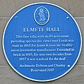 Elmete Hall Plaque 2021.jpg 1 904 × 1 882; 812 KB
-
 Elmete Hill - Asket Hill - geograph.org.uk - 1128282.jpg 640 × 465; 256 KB
-
 Elmete Mount - Asket Hill - geograph.org.uk - 1128280.jpg 640 × 480; 298 KB
-
 Elmete Way - Asket Hill - geograph.org.uk - 1128284.jpg 640 × 430; 227 KB
-
 Fastest way down (2355123258).jpg 2 384 × 1 310; 1,44 MB
-
 Flying Pizza restaurant, Street Lane.jpg 3 872 × 2 592; 3,27 MB
-
 Gate Piers And Walls At South Lodge, Roundhay Hall Hospital.jpg 4 608 × 3 456; 5,14 MB
-
 Hopeful daffs (2355161874).jpg 3 317 × 2 366; 2,92 MB
-
 Jackson Avenue - Gledhow Avenue - geograph.org.uk - 1439930.jpg 640 × 480; 225 KB
-

-

-
 James Avenue - The Drive - geograph.org.uk - 1439968.jpg 640 × 480; 230 KB
-

-
 Ladywell Mead - Asket Hill - geograph.org.uk - 1128283.jpg 640 × 439; 214 KB
-
 Ladywood Grange - Asket Hill - geograph.org.uk - 1128281.jpg 640 × 455; 221 KB
-
 Lake (2355131028).jpg 3 519 × 1 746; 2,63 MB
-
 Lambert Avenue - Gledhow Lane - geograph.org.uk - 1439722.jpg 640 × 480; 242 KB
-
 Lamp post in Roundhay churchyard (3543499810).jpg 1 561 × 2 071; 3,67 MB
-
 Lidgett Avenue - Jackson Lane - geograph.org.uk - 1439777.jpg 640 × 480; 253 KB
-
 Lidgett Court - The Drive - geograph.org.uk - 1439961.jpg 640 × 480; 244 KB
-
 Lidgett Crescent - The Drive - geograph.org.uk - 1439966.jpg 640 × 480; 281 KB
-
 Lidgett Grove - Jackson Avenue - geograph.org.uk - 1439766.jpg 640 × 480; 258 KB
-
 Lidgett Grove - Lidgett Lane - geograph.org.uk - 1439748.jpg 640 × 480; 222 KB
-
 Lidgett Hill - Lidgett Lane - geograph.org.uk - 1439741.jpg 640 × 480; 237 KB
-
 Lidgett Lane - viewed from Gledhow La - geograph.org.uk - 1439735.jpg 640 × 480; 280 KB
-
 Lidgett Park Mews - Lidgett Park Road - geograph.org.uk - 1440399.jpg 640 × 490; 263 KB
-
 Lupton's Field, Asket Hill - geograph.org.uk - 1162280.jpg 640 × 480; 96 KB
-
 Lupton's Field, Asket Hill - geograph.org.uk - 1162300.jpg 640 × 480; 99 KB
-
 Morfitt Shaw estate agents, Roundhay.jpg 3 872 × 2 592; 3,09 MB
-
 Napa bar and restaurant, Roundhay.jpg 3 872 × 2 592; 3 MB
-
 New arms (2354295613).jpg 3 106 × 1 441; 1,36 MB
-

-
 Oakwood Lane - Easterly Road - geograph.org.uk - 1127723.jpg 640 × 469; 244 KB
-
 Oakwood Lane - Easterly Road - geograph.org.uk - 1127727.jpg 640 × 455; 174 KB
-
 Piste (2355145344).jpg 3 528 × 1 513; 2,31 MB
-
 Pizza Express, Roundhay.jpg 3 872 × 2 592; 2,97 MB
-
 Road (2355067678).jpg 2 492 × 3 006; 3,39 MB
-
 Roper Grove - Gledhow Avenue - geograph.org.uk - 1439928.jpg 640 × 480; 232 KB
-
 Round (2355044630).jpg 2 409 × 3 110; 3,67 MB
-
 Roundhay Fox.jpg 3 648 × 2 736; 3,42 MB
-

-
 Roundhay Park Lane - geograph.org.uk - 791295.jpg 640 × 456; 86 KB
-
 Roundhay tram pylons.jpg 2 448 × 3 264; 1 002 KB
-
 Roundhayhousing.jpg 1 600 × 1 200; 677 KB
-
 Santander, Street Lane, Roundhay.jpg 3 872 × 2 592; 2,86 MB
-
 Sheds (25240992980).jpg 3 786 × 2 526; 10,21 MB
-
 Showboat to Roundhay - geograph.org.uk - 1325054.jpg 640 × 467; 57 KB
-

-
 Snow (2354187099).jpg 3 135 × 2 458; 2,54 MB
-
 Snow (2354207571).jpg 2 592 × 3 888; 5,41 MB
-
 Snowscape (2354279979).jpg 3 886 × 1 953; 3,36 MB
-
 Steps (2354286795).jpg 2 181 × 3 381; 3,58 MB
-
 Storm in Roundhay (851944243).jpg 640 × 480; 79 KB
-
 Storm in Roundhay (852806748).jpg 640 × 480; 99 KB
-
 Straight (2354224561).jpg 3 886 × 2 478; 5,08 MB
-
 Stream - Wetherby Road - geograph.org.uk - 1128289.jpg 640 × 423; 299 KB
-
 The only red thing in town (2354250479).jpg 2 579 × 3 779; 4,02 MB
-
 The Roundhay Alp (2355152152).jpg 3 237 × 1 990; 3,68 MB
-
 The White House - Wetherby Road - geograph.org.uk - 1128294.jpg 640 × 477; 310 KB
-
 Thorn Lane - Gledhow Lane - geograph.org.uk - 1439713.jpg 640 × 416; 214 KB
-
 Thorn Lane - Gledhow Lane - geograph.org.uk - 1439717.jpg 640 × 480; 307 KB
-
 Tram pylon in Roundhay 11 September 2018 1.jpg 3 072 × 2 304; 1,2 MB
-
 Tram pylon in Roundhay 11 September 2018 2.jpg 3 072 × 2 304; 1,21 MB
-
 Tram pylons in Roundhay 11 September 2018 1.jpg 2 304 × 3 072; 3,28 MB
-
 Tree Tops Court - Elmete Avenue - geograph.org.uk - 1128293.jpg 640 × 442; 214 KB
-
 Tudor Lawns - Wetherby Road - geograph.org.uk - 1128296.jpg 640 × 431; 244 KB
-
 Walkies (2355094024).jpg 3 465 × 2 519; 5,34 MB
-
 Wetherby Road - viewed from Asket Hill - geograph.org.uk - 1128286.jpg 640 × 453; 172 KB
-
 Wetherby Road - viewed from Asket Hill - geograph.org.uk - 1128287.jpg 640 × 480; 323 KB
-
 White (2354196349).jpg 3 888 × 2 592; 4,59 MB
-
 Woodland Path - Easterly Road - geograph.org.uk - 1128277.jpg 480 × 640; 316 KB
-

-
 Park Edge Close - Roundhay - geograph.org.uk - 552605.jpg 640 × 374; 49 KB


.jpg)


.jpg)


.jpg)

.jpg)


.jpg)
.jpg)

.jpg)


.jpg)


.jpg)


.jpg)

.jpg)


.jpg)


.jpg)

.jpg)

.jpg)

,_Jackson_Avenue,_Leeds_-_geograph.org.uk_-_111623.jpg)


.jpg)


.jpg)
.jpg)
.jpg)
.jpg)
.jpg)
.jpg)
.jpg)

.jpg)
.jpg)


.jpg)


.jpg)


.jpg)