Category:Roydon, King's Lynn and West Norfolk
Jump to navigation
Jump to search
English: Roydon is a small village and civil parish east of King's Lynn in the English county of Norfolk.
village and civil parish near King's Lynn, Norfolk, United Kingdom  | |||||
| Upload media | |||||
| Instance of | |||||
|---|---|---|---|---|---|
| Location | King's Lynn and West Norfolk, Norfolk, East of England, England | ||||
| Population |
| ||||
| Area |
| ||||
| Different from | |||||
 | |||||
Subcategories
This category has the following 3 subcategories, out of 3 total.
A
- All Saints, Roydon, Norfolk (4 F)
G
Media in category "Roydon, King's Lynn and West Norfolk"
The following 78 files are in this category, out of 78 total.
-
 A gorse lined path on Roydon Common - geograph.org.uk - 1855065.jpg 2,848 × 2,136; 3.06 MB
-
 A pond on the common - geograph.org.uk - 1854965.jpg 2,848 × 2,136; 3.16 MB
-
 A148 Eastbound - geograph.org.uk - 4674527.jpg 640 × 480; 514 KB
-
 A148 Parking in half a mile - geograph.org.uk - 3840691.jpg 800 × 533; 88 KB
-

-

-

-
 All Saints' church in Roydon - geograph.org.uk - 2105427.jpg 640 × 480; 184 KB
-
 All Saints' church in Roydon - geograph.org.uk - 2105435.jpg 640 × 480; 115 KB
-

-

-

-

-

-
 All Saints' church in Roydon - view east - geograph.org.uk - 2105451.jpg 640 × 480; 108 KB
-
 All Saints' church in Roydon - view west - geograph.org.uk - 2105469.jpg 640 × 534; 135 KB
-

-
 All Saints' church, Roydon near Kings Lynn - geograph.org.uk - 1855159.jpg 2,848 × 2,136; 3.12 MB
-
 At the end of the lane - geograph.org.uk - 1854345.jpg 2,848 × 2,136; 3.1 MB
-
 Boundary ditch, Roydon Common - geograph.org.uk - 6548337.jpg 1,600 × 1,067; 719 KB
-
 Bungalows at Roydon - geograph.org.uk - 6599884.jpg 1,024 × 768; 151 KB
-
 Car park at Roydon Common - geograph.org.uk - 6548314.jpg 1,600 × 1,067; 594 KB
-
 Church Lane towards Roydon - geograph.org.uk - 5576233.jpg 640 × 480; 77 KB
-
 Church Lane, Roydon - geograph.org.uk - 2105397.jpg 640 × 480; 126 KB
-
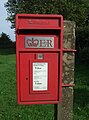 Close up, Elizabeth II postbox on Lynn Road, Roydon - geograph.org.uk - 5579756.jpg 1,760 × 2,373; 819 KB
-
 Cottages in Church Lane, Roydon - geograph.org.uk - 2105392.jpg 640 × 459; 142 KB
-
 Crop field off Lynn Road - geograph.org.uk - 5556669.jpg 640 × 480; 66 KB
-
 Drain beside Station Road, Roydon - geograph.org.uk - 5556685.jpg 640 × 480; 116 KB
-
 Dying tree, Roydon, Norfolk - geograph.org.uk - 2050705.jpg 2,848 × 2,136; 3.06 MB
-

-
 Footpath at Roydon - geograph.org.uk - 6597448.jpg 1,024 × 768; 187 KB
-
 Footpath off Station Road, Roydon - geograph.org.uk - 5556684.jpg 640 × 480; 130 KB
-
 Footpath stile and gateway - geograph.org.uk - 821382.jpg 640 × 426; 146 KB
-
 George VI postbox in Church Lane, Roydon - geograph.org.uk - 2105401.jpg 480 × 640; 166 KB
-
 Grassland, Roydon - geograph.org.uk - 5556667.jpg 640 × 480; 47 KB
-
 Heathland, Roydon Common - geograph.org.uk - 6548247.jpg 1,600 × 1,067; 789 KB
-
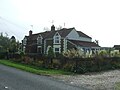 Houses on Lynn Road, Roydon - geograph.org.uk - 5556689.jpg 640 × 480; 63 KB
-
 Looking down a sand hill on Roydon Common - geograph.org.uk - 1854997.jpg 2,848 × 2,136; 3.06 MB
-
 Looking up a sand hill on Roydon Common - geograph.org.uk - 1854983.jpg 2,848 × 2,136; 3.18 MB
-
 Lynn Road - geograph.org.uk - 5556670.jpg 640 × 480; 75 KB
-
 Lynn Road, Roydon - geograph.org.uk - 5579758.jpg 2,848 × 2,136; 1.3 MB
-
 Lynn Road, Roydon Common - geograph.org.uk - 5556677.jpg 640 × 480; 113 KB
-
 Lynn Road, Roydon Common - geograph.org.uk - 5556682.jpg 640 × 480; 103 KB
-
 Newly planted area, Roydon Common - geograph.org.uk - 6548245.jpg 1,600 × 1,067; 616 KB
-
 On Roydon Common - geograph.org.uk - 1854682.jpg 2,848 × 2,136; 3.19 MB
-
 On the edge of Roydon Common - geograph.org.uk - 1855047.jpg 2,848 × 2,136; 3.06 MB
-
 Overgrown railway bridge north of Roydon - geograph.org.uk - 1855119.jpg 2,848 × 2,136; 2.89 MB
-
 Path on dismantled railway line, Roydon - geograph.org.uk - 2050512.jpg 2,848 × 2,136; 3.12 MB
-
 Rolling countryside in north west Norfolk - geograph.org.uk - 1855088.jpg 2,848 × 2,136; 3.12 MB
-
 Rotten stile post - geograph.org.uk - 821394.jpg 640 × 438; 137 KB
-
 Roydon All Saints church - geograph.org.uk - 4353774.jpg 1,024 × 768; 528 KB
-
 Roydon Common - geograph.org.uk - 4132685.jpg 1,600 × 1,200; 591 KB
-
 Roydon Common - geograph.org.uk - 4132688.jpg 1,600 × 1,067; 539 KB
-
 Roydon Common - geograph.org.uk - 4132691.jpg 1,600 × 1,067; 636 KB
-
 Roydon Common - geograph.org.uk - 5556673.jpg 640 × 480; 59 KB
-
 Roydon Common - geograph.org.uk - 5556680.jpg 640 × 480; 72 KB
-
 Roydon Common cattle trough - geograph.org.uk - 1191406.jpg 480 × 640; 99 KB
-
 Roydon Common National Nature Reserve - geograph.org.uk - 2050531.jpg 2,848 × 2,136; 3.01 MB
-

-
 Station Road, Roydon - geograph.org.uk - 5556687.jpg 640 × 480; 71 KB
-
 Stubble field and reservoir - geograph.org.uk - 6599886.jpg 1,024 × 768; 171 KB
-
 Stubble field near Roydon - geograph.org.uk - 6597444.jpg 1,024 × 768; 215 KB
-
 Sugar beet field by Lynn Road - geograph.org.uk - 6548071.jpg 1,600 × 1,067; 671 KB
-
 The Three Horseshoes - geograph.org.uk - 4132678.jpg 1,600 × 1,200; 678 KB
-

-

-
 Track across Roydon Common - geograph.org.uk - 6548252.jpg 1,600 × 1,067; 620 KB
-
 Track across Roydon Common - geograph.org.uk - 6548322.jpg 1,600 × 1,067; 511 KB
-
 Traditional farm buildings, Roydon, Norfolk - geograph.org.uk - 2050687.jpg 2,848 × 2,136; 3.08 MB
-
 Tree on Roydon Common - geograph.org.uk - 6548246.jpg 1,600 × 1,067; 622 KB
-
 Union Jack pub sign - geograph.org.uk - 4589204.jpg 1,024 × 768; 162 KB
-
 Unremarkable knot - but look inside - geograph.org.uk - 821397.jpg 640 × 426; 96 KB
-
 War Memorial in All Saints' church, Roydon near King's Lynn - geograph.org.uk - 6595748.jpg 2,698 × 3,499; 1.78 MB
-
 Wet heathland, Roydon Common - geograph.org.uk - 6548249.jpg 1,600 × 1,067; 581 KB
-
 Winter cereal crop near Roydon - geograph.org.uk - 5576237.jpg 640 × 480; 52 KB
-
 Woodgappe Plantation from Lynn Road - geograph.org.uk - 6548069.jpg 1,600 × 1,067; 673 KB
-
 Woodland beside Lynn Road, Roydon Common - geograph.org.uk - 5556675.jpg 480 × 640; 113 KB
-
 WW2 Memorial in All Saints' church, Roydon near King's Lynn - geograph.org.uk - 6595755.jpg 4,608 × 3,072; 4.95 MB


