Category:Runavík
Zur Navigation springen
Zur Suche springen
Siedlung auf den Färöer-Inseln .JPG)  | |||||
| Medium hochladen | |||||
| Ist ein(e) | |||||
|---|---|---|---|---|---|
| Ort | Kommune Runavík, Q994274 | ||||
| Datum der Gründung, Erstellung, Entstehung, Erbauung |
| ||||
| Einwohnerzahl |
| ||||
| Höhe über dem Meeresspiegel |
| ||||
| Verschieden von | |||||
| offizielle Website | |||||
 | |||||
Unterkategorien
Es werden 4 von insgesamt 4 Unterkategorien in dieser Kategorie angezeigt:
In Klammern die Anzahl der enthaltenen Kategorien (K), Seiten (S), Dateien (D)
Medien in der Kategorie „Runavík“
Folgende 22 Dateien sind in dieser Kategorie, von 22 insgesamt.
-
 Athena Trawler After the Fire in 2011 in the Faroe Islands.jpg 2.446 × 1.642; 829 KB
-
 Eystanstevna 2012 boats in the harbour of Runavik.JPG 4.608 × 3.456; 6,55 MB
-
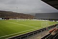
 Faroese handball match 2010 VB vs Tjaldur.JPG 3.648 × 2.736; 2,27 MB
-
 Flag of Runavík Municipality, Faroe Islands.svg 512 × 512; 14 KB
-
 Harbour of Runavík, Faroe Islands (2).JPG 2.560 × 1.704; 2,64 MB
-
 Harbour of Runavík, Faroe Islands.JPG 2.560 × 1.704; 2,33 MB
-
 Heiðabáturin Eystanstevna 2012.jpg 3.088 × 2.374; 2,77 MB
-
 Hotel Runavík.jpg 4.624 × 3.468; 4,05 MB
-
 Logo of Runavík Municipality.svg 512 × 102; 14 KB
-
 Logo-runavik.png 200 × 127; 4 KB
-
 Map-position-runavikar-kommuna-2005.png 600 × 800; 25 KB
-
 Map-position-runavikar-kommuna-2009.png 600 × 800; 33 KB
-
 Runavik on Faroe map.png 688 × 1.035; 24 KB
-
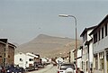 RunavíkMainSt.jpg 1.446 × 973; 799 KB
-
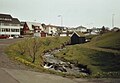 RunavíkPark.jpg 1.392 × 965; 754 KB
-
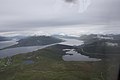
 Skálafjørður and Tangafjørður.jpg 3.888 × 2.592; 2,76 MB
-
 Skálafjørður.jpg 2.048 × 1.365; 256 KB
-
 Spogvin Kapprodrarfelagid NSI.jpg 3.648 × 2.416; 1,68 MB
-
 Tinghella.jpg 739 × 1.460; 607 KB
-
 Vessels in the Harbour of Runavík, Faroe Islands.JPG 2.560 × 1.704; 2,44 MB
-
 Við Løkin.jpg 4.282 × 2.848; 12,57 MB
-
 VSJ.png 541 × 541; 369 KB


