Category:Rundbunker Prielstraße
Jump to navigation
Jump to search
This is the category for an architectural monument.
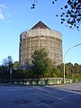
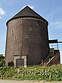
It is on the list of cultural monuments of Hamburg, no. 1421.
It is on the list of cultural monuments of Hamburg, no. 1421.
| Object location | | View all coordinates using: OpenStreetMap |
|---|
Media in category "Rundbunker Prielstraße"
The following 5 files are in this category, out of 5 total.
-
 Bunker Prielstraße mit Elbbrücken.jpg 3,240 × 2,160; 1.71 MB
-
 Bunker Prielstraße.jpg 1,794 × 2,392; 921 KB
-
 Prielstraße 9 (Hamburg-Veddel).jpg 2,736 × 3,648; 3.74 MB
-
 Prielstraße 9 (Hamburg-Veddel).Rundbunker.1.ajb.jpg 2,577 × 3,436; 5.09 MB
-
 Prielstraße 9 (Hamburg-Veddel).Rundbunker.2.ajb.jpg 2,848 × 4,288; 5.98 MB


.jpg)
.Rundbunker.1.ajb.jpg)
.Rundbunker.2.ajb.jpg)