Category:Rushton, Cheshire
Aller à la navigation
Aller à la recherche
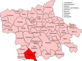
English: Rushton is a village and civil parish in the unitary authority of Cheshire West and Chester and the ceremonial county of Cheshire, in the north west of England, approximately 6 miles west of Winsford and 2 miles north east of Tarporley.
village britannique (Cheshire)  | |||||
| Téléverser des médias | |||||
| Nature de l’élément | |||||
|---|---|---|---|---|---|
| Lieu | Cheshire West and Chester, Cheshire, Angleterre du Nord-Ouest, Angleterre | ||||
 | |||||
Sous-catégories
Cette catégorie comprend seulement la sous-catégorie ci-dessous.
E
Média dans la catégorie « Rushton, Cheshire »
Cette catégorie comprend 66 fichiers, dont les 66 ci-dessous.
-
 "Lion cottages", Rushton - geograph.org.uk - 193596.jpg 640 × 427 ; 74 kio
-
 Boothouse Farm - geograph.org.uk - 5915702.jpg 4 000 × 3 000 ; 2,84 Mio
-
 Buttercup meadow, Rushton - geograph.org.uk - 178393.jpg 640 × 427 ; 73 kio
-
 Cottage on Dogmore Lane, Rushton - geograph.org.uk - 5927642.jpg 4 000 × 3 000 ; 3,4 Mio
-
 Cow path, Parkwall Farm - geograph.org.uk - 6124312.jpg 1 024 × 768 ; 346 kio
-

-
 Dogmore Lane, Rushton - geograph.org.uk - 6124305.jpg 1 024 × 768 ; 390 kio
-
 Early grass - geograph.org.uk - 6124354.jpg 1 024 × 768 ; 351 kio
-
 Eaton Fishery - geograph.org.uk - 3639200.jpg 1 024 × 680 ; 247 kio
-
 Eaton Fishery - geograph.org.uk - 6124362.jpg 1 024 × 768 ; 336 kio
-
 Eaton Village Cross - geograph.org.uk - 5878470.jpg 4 000 × 3 000 ; 3,73 Mio
-
 Eaton Village Cross - geograph.org.uk - 5878475.jpg 4 000 × 3 000 ; 3,99 Mio
-
 Eaton, houses on Edgewell Lane - geograph.org.uk - 6124382.jpg 1 024 × 768 ; 223 kio
-
 Edgewell Lane, Eaton - geograph.org.uk - 6124380.jpg 1 024 × 768 ; 243 kio
-
 Ewe and lambs, Rushton - geograph.org.uk - 6124307.jpg 1 024 × 768 ; 250 kio
-
 Farm buildings near Eaton - geograph.org.uk - 3639189.jpg 1 024 × 680 ; 215 kio
-
 Farmland near Stages Platt - geograph.org.uk - 3639193.jpg 1 024 × 680 ; 221 kio
-
 Farmland near Wettenhall - geograph.org.uk - 3639213.jpg 1 024 × 680 ; 252 kio
-
 Farmland opposite Oxheys - geograph.org.uk - 3639223.jpg 1 024 × 680 ; 263 kio
-
 Field off Winterfold Lane - geograph.org.uk - 6124372.jpg 1 024 × 768 ; 311 kio
-
 Field, Rushton - geograph.org.uk - 6124294.jpg 1 024 × 768 ; 347 kio
-
 Fingerpost near Oultonlowe Farm - geograph.org.uk - 5919434.jpg 3 000 × 4 000 ; 3,07 Mio
-
 Fly tipping on Hickhurst Lane - geograph.org.uk - 5923249.jpg 4 000 × 3 000 ; 3,76 Mio
-
 Footpath across Flaxyard Farm - geograph.org.uk - 5890066.jpg 4 000 × 3 000 ; 4,49 Mio
-
 Footpath to Brownhill - geograph.org.uk - 5875710.jpg 4 000 × 3 000 ; 3,48 Mio
-
 Footpath to Eaton Lane - geograph.org.uk - 5875709.jpg 4 000 × 3 000 ; 3,77 Mio
-
 Footpath to Eaton Lane - geograph.org.uk - 5911779.jpg 4 000 × 3 000 ; 3,85 Mio
-
 Footpath to Hickhurst Lane - geograph.org.uk - 5915718.jpg 4 000 × 3 000 ; 3,92 Mio
-
 Footpath to The Hall Lane - geograph.org.uk - 5923234.jpg 4 000 × 3 000 ; 3,57 Mio
-
 Gates to Eaton Fishery - geograph.org.uk - 3639197.jpg 1 024 × 680 ; 263 kio
-
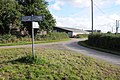
 Hickhurst Lane-Dogmore Lane junction - geograph.org.uk - 3361437.jpg 640 × 480 ; 78 kio
-
 Hunters Close, Eaton - geograph.org.uk - 5878486.jpg 4 000 × 3 000 ; 3,32 Mio
-
 Junction and Fingerpost near Oxheys Farm - geograph.org.uk - 5915709.jpg 4 000 × 3 000 ; 3,47 Mio
-
 King's Lane, Rushton - geograph.org.uk - 6124315.jpg 1 024 × 768 ; 276 kio
-
 Kings Lane at Hickhurst Lane junction - geograph.org.uk - 3361447.jpg 640 × 480 ; 67 kio
-
 Lane Junction at Brownhill - geograph.org.uk - 5875718.jpg 4 000 × 3 000 ; 3,28 Mio
-
 Lane to Oxheys - geograph.org.uk - 6124359.jpg 1 024 × 768 ; 295 kio
-
 Lane, Oxheys - geograph.org.uk - 6124347.jpg 1 024 × 768 ; 294 kio
-
 Maize field, Rushton - geograph.org.uk - 193601.jpg 640 × 427 ; 83 kio
-
 Monk's Well, Portal.jpg 1 800 × 1 350 ; 726 kio
-

-

-

-

-

-
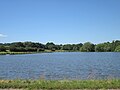 Oulton Mill Pool - geograph.org.uk - 5873759.jpg 4 000 × 3 000 ; 2,4 Mio
-
 Overturned Shed near Eaton - geograph.org.uk - 5915726.jpg 4 000 × 3 000 ; 4,58 Mio
-

-
 Pasture, Oultonlow - geograph.org.uk - 6124337.jpg 1 024 × 768 ; 335 kio
-
 Pasture, Parkwall Farm - geograph.org.uk - 6124317.jpg 1 024 × 768 ; 317 kio
-
 Path to Portal Farm - geograph.org.uk - 5880889.jpg 4 000 × 3 000 ; 5,22 Mio
-
 Portal Golf Course - geograph.org.uk - 5880893.jpg 4 000 × 3 000 ; 3,13 Mio
-
 Road junction at Oxheys - geograph.org.uk - 3639221.jpg 1 024 × 680 ; 255 kio
-
 Royal Lane, Eaton - geograph.org.uk - 3361430.jpg 640 × 480 ; 97 kio
-
 Rushton - view towards Rhuddall Heath - geograph.org.uk - 193592.jpg 640 × 427 ; 64 kio
-
 Signpost, Rushton - geograph.org.uk - 6124299.jpg 768 × 1 024 ; 398 kio
-
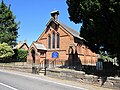 St. Thomas's Church, Eaton - geograph.org.uk - 5878503.jpg 4 000 × 3 000 ; 3,34 Mio
-
 The Hall Lane - geograph.org.uk - 5915725.jpg 4 000 × 3 000 ; 3,66 Mio
-
 The Hall Lane - geograph.org.uk - 6124341.jpg 1 024 × 768 ; 325 kio
-
 The Hall Lane near Eaton - geograph.org.uk - 5915707.jpg 4 000 × 3 000 ; 3,33 Mio
-
 Tree Line and Farmland - geograph.org.uk - 387607.jpg 480 × 640 ; 182 kio
-
 Tree-line road near Oultonlowe Farm - geograph.org.uk - 3639237.jpg 1 024 × 680 ; 322 kio
-
 Vr rushton.png 591 × 443 ; 63 kio
-
 Winterfold Lane, Rushton - geograph.org.uk - 6124368.jpg 1 024 × 768 ; 375 kio
-
 Winterford Lane at Winterford Farm - geograph.org.uk - 5911788.jpg 4 000 × 3 000 ; 3,28 Mio
-
 Winterford Lane at Winterford Farm - geograph.org.uk - 5911790.jpg 4 000 × 3 000 ; 3,97 Mio


