Category:Ruïne Toutenburg (Vollenhove)
Jump to navigation
Jump to search
| Object location | | View all coordinates using: OpenStreetMap |
|---|
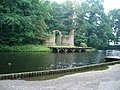
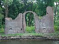
castle in Vollenhove  | |||||
| Upload media | |||||
| Instance of | |||||
|---|---|---|---|---|---|
| Part of | |||||
| Location | Vollenhove, Vollenhove | ||||
| Heritage designation |
| ||||
 | |||||
|
This is a category about rijksmonument number 520762
|
| Address |
|
Media in category "Ruïne Toutenburg (Vollenhove)"
The following 42 files are in this category, out of 42 total.
-
 Atlas Schoemaker-OVERIJSSEL-DEEL2-2894-Overijssel, Toutenburg.jpeg 1,038 × 1,664; 293 KB
-
 Atlas Schoemaker-OVERIJSSEL-DEEL2-2896-Overijssel, Toutenburg.jpeg 1,038 × 1,664; 290 KB
-
 Atlas Schoemaker-OVERIJSSEL-DEEL2-2898-Overijssel, Vollenhove.jpeg 1,031 × 1,656; 266 KB
-
 Atlas Schoemaker-OVERIJSSEL-DEEL2-2899-Overijssel, Vollenhove.jpeg 1,031 × 1,656; 325 KB
-
 Exterieur OVERZICHT - Vollenhove - 20287825 - RCE.jpg 1,200 × 1,183; 388 KB
-
 Exterieur OVERZICHT GANG TEN NOORDEN VAN TOEGANG - Vollenhove - 20287833 - RCE.jpg 1,200 × 1,190; 470 KB
-
 Exterieur OVERZICHT RESTANTEN - Vollenhove - 20287829 - RCE.jpg 1,200 × 1,183; 515 KB
-
 Exterieur OVERZICHT RESTANTEN - Vollenhove - 20287830 - RCE.jpg 1,188 × 1,200; 476 KB
-
 Exterieur OVERZICHT RESTANTEN TEN NOORDEN VAN TOEGANG - Vollenhove - 20287832 - RCE.jpg 1,193 × 1,200; 580 KB
-
 Exterieur OVERZICHT ruïne, RESTANTEN VAN TORENS - Vollenhove - 20287826 - RCE.jpg 1,192 × 1,200; 403 KB
-
 Exterieur OVERZICHT, RESTANTEN VAN TORENS - Vollenhove - 20287827 - RCE.jpg 1,200 × 1,197; 483 KB
-
 Exterieur ruïne, RESTANT - Vollenhove - 20287828 - RCE.jpg 1,197 × 1,200; 440 KB
-
 Exterieur ruïne, RESTANT, DETAIL - Vollenhove - 20287831 - RCE.jpg 1,200 × 1,185; 545 KB
-

-
 Kasteel achter bomen aan water - Vollenhove - 20328343 - RCE.jpg 943 × 1,200; 370 KB
-

-
 Kasteel Toutenburg in Vollenhove, RP-P-OB-2582.jpg 5,814 × 3,804; 3.76 MB
-

-
 Kasteel Toutenburg.jpg 2,560 × 1,920; 2.02 MB
-
 Lambert-van-den-Bos-Schauplatz-des-Krieges MG 9483.tif 5,172 × 3,186; 47.18 MB
-
 Oldruitenborgh, ruïne van Kasteel Toutenburg, Vollenhove.JPG 4,592 × 3,448; 4.17 MB
-
 Overzicht Toutenburg - Vollenhove - 20244907 - RCE.jpg 1,200 × 1,192; 454 KB
-
 Overzicht Toutenburg - Vollenhove - 20244908 - RCE.jpg 1,190 × 1,200; 516 KB
-
 Overzicht Toutenburg - Vollenhove - 20244909 - RCE.jpg 1,200 × 1,185; 491 KB
-
 Reproductie, van tekening exterieur - Vollenhove - 20245095 - RCE.jpg 1,200 × 872; 200 KB
-
 Ruïne kasteel Toutenberg, Vollenhove.jpg 2,308 × 1,733; 1.9 MB
-
 Ruïne van voormalig kasteel Toutenburg - Vollenhove - 20244949 - RCE.jpg 1,200 × 945; 383 KB
-
 Ruïne van voormalig kasteel Toutenburg - Vollenhove - 20244950 - RCE.jpg 1,200 × 957; 422 KB
-
 Ruïne van voormalig kasteel Toutenburg - Vollenhove - 20244951 - RCE.jpg 1,200 × 953; 393 KB
-
 Ruïne van voormalig kasteel Toutenburg - Vollenhove - 20244952 - RCE.jpg 1,200 × 946; 364 KB
-
 Ruïne van voormalig kasteel Toutenburg - Vollenhove - 20244953 - RCE.jpg 957 × 1,200; 395 KB
-
 Ruïne van voormalig kasteel Toutenburg - Vollenhove - 20244954 - RCE.jpg 1,200 × 941; 417 KB
-

-
 Toutenburg Ruine Vollenhove.jpg 1,786 × 1,145; 460 KB
-
 Toutenburg-schilderij.jpg 805 × 591; 91 KB
-
 Toutenburg.jpg 1,196 × 798; 315 KB
-
 Vollenhove 018.JPG 3,264 × 2,448; 2.49 MB
-
 Vollenhove 020.JPG 3,264 × 2,448; 2.61 MB
-
 Vollenhove 022.JPG 3,264 × 2,448; 2.71 MB
-
 Vollenhove 023.JPG 3,264 × 2,448; 2.83 MB
-
 Vollenhove, ruïne Kasteel Toutenburg in park Oldruitenborgh RM520762.jpg 3,648 × 2,736; 9.13 MB
-
 Vollenhove, Toutenburg - panoramio.jpg 5,624 × 2,226; 5.25 MB


,_RP-P-OB-2583.jpg)

,_RP-P-2009-200.jpg)


