Category:SKH Tsoi Kung Po Secondary School
Jump to navigation
Jump to search
| Object location | | View all coordinates using: OpenStreetMap |
|---|
secondary school in Hong Kong .JPG) | |||||
| Upload media | |||||
| Instance of | |||||
|---|---|---|---|---|---|
| Location | Hong Kong, PRC | ||||
| Inception |
| ||||
| official website | |||||
 | |||||
English: Sheng Kung Hui Tsoi Kung Po Secondary School is a school in Hong Kong
中文:聖公會蔡功譜中學
Media in category "SKH Tsoi Kung Po Secondary School"
The following 5 files are in this category, out of 5 total.
-
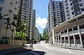 Chung Hau Street.jpg 5,953 × 3,929; 14.41 MB
-
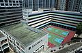 Overlook S.K.H Tsoi Kung Po Secondary School.jpg 5,874 × 3,809; 13.86 MB
-
 S.K.H Tsoi Kung Po Secondary School east side (sky blue version).JPG 2,560 × 1,920; 981 KB
-
 S.K.H Tsoi Kung Po Secondary School east side.jpg 2,541 × 1,885; 2.72 MB
-
 Sheng Kung Hui Tsoi Kung Po Secondary School.JPG 3,648 × 2,736; 2.08 MB


