Category:Saint Dorothy church in Będzin
Jump to navigation
Jump to search
| Object location | | View all coordinates using: OpenStreetMap |
|---|
church building in Grodziec, Poland   | |||||
| Upload media | |||||
| Instance of | |||||
|---|---|---|---|---|---|
| Named after | |||||
| Made from material | |||||
| Location | |||||
| Street address |
| ||||
| Diocese | |||||
| Has use | |||||
| Heritage designation |
| ||||
| Inception |
| ||||
| Religion or worldview | |||||
 | |||||
Media in category "Saint Dorothy church in Będzin"
The following 23 files are in this category, out of 23 total.
-
 Będzin, Kościół św. Doroty - fotopolska.eu (271749).jpg 1,300 × 977; 276 KB
-
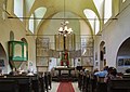 Bedzin St Dorothy church interior 2021.jpg 4,575 × 3,255; 8.13 MB
-
 Będzin A 806 2021 z 2021-04-26.jpg 2,732 × 1,820; 4.82 MB
-
 Będzin Dorota.jpg 2,048 × 1,536; 1.78 MB
-
 Będzin Dorotka (1).jpg 3,865 × 2,899; 1.47 MB
-
 Będzin Dorotka (2).jpg 3,781 × 2,836; 982 KB
-
 Będzin Dorotka (3).jpg 3,865 × 2,899; 2.39 MB
-
 Będzin Dorotka (4).jpg 3,781 × 2,836; 1.62 MB
-
 Będzin Dorotka (5).JPG 3,000 × 4,000; 3.12 MB
-
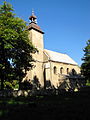
 Będzin Grodziec, kościół Św. Doroty.jpg 1,300 × 975; 1.17 MB
-
 Będzin, Kościół św. Doroty - fotopolska.eu (271748).jpg 1,300 × 927; 247 KB
-
 Będzin, Kościół św. Doroty - fotopolska.eu (271750).jpg 1,300 × 939; 253 KB
-
 Dorota-kosciol.jpg 458 × 600; 53 KB
-
 Dorotka kosciol.JPG 2,560 × 1,920; 2.14 MB
-
 Dorotka pielgrzymka 19.07.2012 2.JPG 1,920 × 2,560; 2.1 MB
-
 Dorotka pielgrzymka 19.07.2012 3.JPG 2,560 × 1,920; 1.73 MB
-
 Dorotka pielgrzymka 19.07.2012.JPG 2,560 × 1,920; 2.14 MB
-
 Kosciol dorotka.jpg 1,024 × 681; 760 KB
-
 Kościół fil. p.w. św. Doroty.JPG 1,600 × 1,200; 922 KB
-
 Kościół św. Doroty, Będzin – Grodziec (2).jpg 4,067 × 2,701; 8.18 MB
-
 Kościół św. Doroty, Będzin – Grodziec.jpg 4,462 × 4,324; 12.48 MB
-
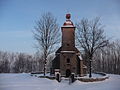
 Kościół Św. Doroty.JPG 1,383 × 1,037; 691 KB
-
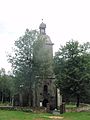
 Kościółek na Górze Św. Doroty.jpg 1,200 × 912; 1.12 MB
.jpg)


.jpg)
.jpg)
.jpg)
.jpg)
.JPG)

.jpg)
.jpg)


.jpg)

