Category:Saint-Léger-en-Gaume
Jump to navigation
Jump to search
municipality in Wallonia, Belgium   .svg)  | |||||
| Upload media | |||||
| Instance of | |||||
|---|---|---|---|---|---|
| Part of |
| ||||
| Location | Arrondissement of Virton, Luxembourg, Walloon Region, Belgium | ||||
| Capital |
| ||||
| Official language |
| ||||
| Head of government |
| ||||
| Legal form |
| ||||
| Population |
| ||||
| Area |
| ||||
| official website | |||||
 | |||||
Subcategories
This category has the following 8 subcategories, out of 8 total.
- Châtillon, Belgium (3 F)
- Meix-le-Tige (1 F)
C
G
- Gaume Natural Park (10 F)
M
- Maps of Saint-Léger-en-Gaume (4 F)
P
S
Media in category "Saint-Léger-en-Gaume"
The following 4 files are in this category, out of 4 total.
-
 Arbre a soldat St-Léger.jpg 218 × 479; 46 KB
-
 Ermitage de Wachet (chapelle).jpg 2,272 × 1,704; 1.14 MB
-
 Les 14 stations du chemin de croix de Wachet Saint-Léger Belgique.JPG 3,122 × 2,250; 1.48 MB
-
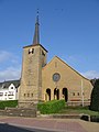 Saint-Léger, Eglise.JPG 1,704 × 2,272; 1.05 MB

.jpg)
