Category:Saint Lawrence River
Sari la navigare
Sari la căutare
fluviu din America de Nord   | |||||
| Încarcă multimedia | |||||
| Este un/o | |||||
|---|---|---|---|---|---|
| Numit(ă) după | |||||
| Locul actual |
| ||||
| Constând în |
| ||||
| Statut al patrimoniului |
| ||||
| Lungime |
| ||||
| Altitudine deasupra nivelului mării |
| ||||
| Originea cursului de apă |
| ||||
| Gura de vărsare a cursului de apă | |||||
| Bazin hidrografic | |||||
| Țări în bazin | |||||
| Afluent |
| ||||
| Lake on watercourse |
| ||||
 | |||||
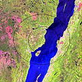
English: Saint Lawrence River is a large river flowing approximately from southwest to northeast in the middle latitudes of North America, connecting the Great Lakes with the Atlantic Ocean
Français : Le Saint-Laurent est un fleuve qui relie les Grands Lacs de l’Amérique du Nord à l’océan Atlantique.
Subcategorii
Această categorie conține următoarele 34 de subcategorii, dintr-un total de 34.
A
- Saint Lawrence River in art (70 F)
B
C
F
I
K
- Quais de Kamouraska (2 F)
L
- Le Grand Rassemblement (16 F)
M
P
- Le Petit Pouvoir (4 F)
R
S
- Saint Lawrence River in Oka (3 F)
- St. Lawrence Reservation (7 F)
- Sunken Rock Light (6 F)
T
W
Pagini din categoria „Saint Lawrence River”
Această categorie conține doar următoarea pagină.
Fișiere media din categoria „Saint Lawrence River”
Următoarele 200 fișiere se află în această categorie, dintr-un total de 516.
(pagina anterioară) (pagina următoare)-
 000730 15a 3545 2367 fleuve I Orleans.jpg 3.545x2.367; 8,74 MB
-
 000730 15aa.jpg 3.550x2.373; 8,78 MB
-
 000730 19aa.jpg 2.364x3.559; 8,11 MB
-
 011 066 Iles Mingan.jpg 4.128x2.719; 6,25 MB
-
 011 078 Iles Mingan.jpg 4.106x2.709; 3,41 MB
-
 011 098 Iles Mingan.jpg 4.095x2.709; 4,2 MB
-
 011 138 Niapiskau.jpg 2.762x4.095; 4,08 MB
-
 012 005 Iles Mingan.jpg 4.127x2.719; 4,31 MB
-
 012 028 Ile Mingan Niapiskau.jpg 2.719x4.085; 4,15 MB
-
 012 031 Ile Mingan Niapiscau.jpg 2.720x4.042; 4,2 MB
-
 012 035 Ile Mingan Niapiscau.jpg 2.698x4.149; 3,98 MB
-
 012 043 Iles Mingan Niapiscau.jpg 2.698x4.117; 4,66 MB
-
 012 049 Iles Mingan Niapiscau flore.jpg 4.106x2.720; 7,59 MB
-
 012 053 Iles Mingan Niapiscau.jpg 2.720x4.095; 7,3 MB
-
 012 060 ile Mingan.jpg 4.095x2.719; 5,62 MB
-
 012 104 Iles Mingan.jpg 4.042x2.570; 3,31 MB
-
 012 120 Iles Mingan.jpg 4.085x2.720; 4,31 MB
-
 012 125 Iles Mingan.jpg 4.117x2.570; 6,13 MB
-
 012 133 Iles Mingan.jpg 4.127x2.570; 3,47 MB
-
 012 137 Havre St Pierre.jpg 4.117x2.709; 3,89 MB
-
 013 011 Havre St Pierre.jpg 4.106x2.720; 4,2 MB
-
 013 012 Havre St Pierre.jpg 4.106x2.719; 3,3 MB
-
 013 014 Havre St Pierre.jpg 4.095x2.730; 3,35 MB
-
 013 016 Havre St Pierre.jpg 4.095x2.709; 4,57 MB
-
 013 017 Havre St Pierre.jpg 4.117x2.720; 4,83 MB
-
 013 021 Havre St Pierre.jpg 4.095x2.709; 4,15 MB
-
 100 2993.JPG 2.080x1.544; 1,01 MB
-
 172 7202.jpg 1.024x768; 202 KB
-
-
 20020613 19a Saint Jean Port Joli.jpg 3.564x2.372; 3,86 MB
-
 20020614 25 Ile Vertea.jpg 3.567x2.360; 6,54 MB
-
 2016-08 Grandes Bergeronnes Saint Lawrence River Harbour porpoise.jpg 5.459x3.639; 7,49 MB
-
 2016-08 Kayak Grandes Bergeronnes Saint Lawrence River 02.jpg 5.403x3.045; 6,32 MB
-
 2016-08 Tadoussac 02.jpg 5.677x3.785; 12,77 MB
-
 2016-08 Tadoussac 06.jpg 6.000x4.000; 10,55 MB
-
 2016-08 Tadoussac 12.jpg 5.209x3.473; 10,69 MB
-
 2016-08 Tadoussac 13.jpg 5.860x3.907; 10,24 MB
-
 2016-08 Tadoussac 14.jpg 6.000x4.000; 9,54 MB
-
 2016-08 Tadoussac 16.jpg 6.000x4.000; 19,82 MB
-
 2016-08 Tadoussac 17.jpg 5.304x3.536; 9,28 MB
-
 2016-08 Tadoussac 18.jpg 5.868x3.912; 11,05 MB
-
 2016-08 Tadoussac 20.jpg 5.904x3.936; 8,68 MB
-
 2016-08 Tadoussac 21.jpg 6.000x4.000; 10,84 MB
-
 2016-08 Tadoussac 24.jpg 5.737x2.537; 7,37 MB
-
 2020 02 01 027 Grondines.jpg 4.032x3.024; 2,93 MB
-
 2020 08 14 046 quai Grondines.jpg 4.032x3.024; 2,96 MB
-
 2020 09 13 001 Panneau.jpg 4.032x3.024; 3,9 MB
-
 2020-09-28 003 Batiscan.jpg 4.032x3.024; 5,43 MB
-
 950703 24a Baie au Caplan.jpg 3.567x2.362; 7,13 MB
-
 950715 E 3545 2324 Pointe Lac.jpg 3.545x2.324; 8,86 MB
-
 A concrete walkway under the water of the St. Lawrence River.jpg 3.024x3.024; 3,14 MB
-

-

-
 A tree stump under water in the St. Lawrence River.jpg 3.024x3.024; 2,47 MB
-
 Alexandria bay saint lawrence 05.07.2012 21-18-32.jpg 4.672x3.104; 7,87 MB
-
 Alexandria bay saint lawrence castle 05.07.2012.jpg 3.052x2.028; 3,37 MB
-
 Alexandria bay saint lawrence ship and flag 5.07.2012.jpg 3.215x2.136; 3,17 MB
-
 Alexandria bay saint lawrence uncle sam 05.07.2012.jpg 4.207x2.795; 7,34 MB
-
 Aluminerie Alouette 1.jpg 800x600; 38 KB
-
 Anse a Caron 050.jpg 5.184x3.456; 7,54 MB
-
 Auberge De La Pointe.jpeg 3.264x2.448; 2,12 MB
-
 Ausblick auf den Fluss.jpg 3.264x2.448; 1,34 MB
-
 Autoportrait, mon ombre sur le rivage.jpg 4.032x3.024; 4,66 MB
-
 Baie Trinite 009.jpg 1.600x1.200; 684 KB
-
 Baie Trinite 029.jpg 1.536x2.048; 1,74 MB
-
 Baie Trinite 031.jpg 2.048x1.536; 944 KB
-
 Baie Trinite 034.jpg 1.536x2.048; 1,16 MB
-
 Baie Trinite 037.jpg 1.536x2.048; 1,26 MB
-
 Baie à l'embouchure de Rivière Noire- St-Siméon-2018-07-23.jpg 4.032x3.024; 6,05 MB
-
 Bas-Saint-Laurent 1.JPG 2.080x1.544; 1.013 KB
-
 Bataille du Saint-Laurent2 couleur.jpg 1.076x902; 379 KB
-
 Batiscan 0002.jpg 4.032x3.024; 3,31 MB
-
 Batiscan 0005.jpg 4.032x3.024; 3,49 MB
-
 BATISCAN 07-2008.jpg 2.560x1.920; 1,73 MB
-
 Batiscan 2020 03 06 009.jpg 3.024x4.032; 3,64 MB
-
 Batiscan sur le Chemin du Roy 001.jpg 3.536x1.792; 5,51 MB
-
 Bay Street Dock (I0015079).jpg 2.487x1.969; 3,42 MB
-
 Belvedere la cime cap tourmente.JPG 5.046x3.365; 11,43 MB
-
 Berge du fleuve - Cap tourmente - mai 2007.jpg 2.032x1.524; 1,39 MB
-
 Berges au nord-est de La Malbaie 01.jpg 6.016x4.000; 7,27 MB
-
 Berges au nord-est de La Malbaie 02.jpg 6.016x4.000; 6,43 MB
-
 Berges au nord-est de La Malbaie 03.jpg 6.016x4.000; 6,56 MB
-
 Berges au nord-est de La Malbaie 04.jpg 6.016x4.000; 6,51 MB
-
 Berges au nord-est de La Malbaie 05.jpg 6.016x4.000; 6,93 MB
-
 Berges au nord-est de La Malbaie 06.jpg 6.016x4.000; 6,11 MB
-
 Berges au nord-est de La Malbaie 07.jpg 6.016x4.000; 6,46 MB
-
 Berges au nord-est de La Malbaie 08.jpg 4.000x6.016; 6,4 MB
-
 Berges au nord-est de La Malbaie 09.jpg 6.016x4.000; 6,47 MB
-
 Berges au nord-est de La Malbaie 10.jpg 6.016x4.000; 6,56 MB
-
 Berges au nord-est de La Malbaie 11.jpg 6.016x4.000; 5,86 MB
-
 Berges au nord-est de La Malbaie 12.jpg 6.016x4.000; 6,34 MB
-
 Berges au nord-est de La Malbaie 13.jpg 4.000x6.016; 6,4 MB
-
 Berges au nord-est de La Malbaie 14.jpg 6.016x4.000; 6,95 MB
-
 Bords du Saint-Laurent (525552981).jpg 3.459x2.214; 1,43 MB
-
 Bouée latérale tribord canadienne Y16 (1).JPG 7.360x4.912; 3,97 MB
-
Breaching minke whale 2.ogv 3,3 s, 960 × 540; 676 KB
-
Breaching minke whale.ogv 3,3 s, 640 × 360; 366 KB
-
 Breakfast in Île d'Orléans 072.jpg 5.109x5.788; 21,26 MB
-
 Brockville waterfront. Municipal harbour at Blockhouse Island.jpg 4.032x2.268; 4,81 MB
-

-
 Brossard (Québec)-Pont Samuel de Champlain illuminé-2022-05-17.jpg 12.000x2.391; 10,92 MB
-
 Brossard Pont Samuel de Champlain page banner.jpg 11.963x1.713; 8,5 MB
-
 BuckelwalTadoussac.jpg 852x481; 186 KB
-
 Buies - La Province de Québec, 1900, illust 02.png 1.442x914; 232 KB
-
 Cacouna-pano.jpg 1.852x525; 416 KB
-
 Cacouna-port.jpg 1.818x728; 263 KB
-
 Calcaires déformés des basses-terres du St-Laurent.jpg 4.000x3.000; 4,66 MB
-
 Campanula rotundifolia 002a.jpg 2.048x1.536; 854 KB
-
 Canada IMG 20170820 061143 (37992190141).jpg 4.032x3.024; 641 KB
-
 Cap a l Aigle 001.jpg 3.456x2.304; 3,38 MB
-
 Cap de Bon Desir (1).jpg 3.648x2.736; 4,35 MB
-
 Cap de Bon Desir (2).jpg 3.648x2.736; 4,97 MB
-
 Cap de Bon Desir (3).jpg 3.516x2.604; 4,48 MB
-
 Cap Lauzon 006.jpg 3.456x2.304; 4,28 MB
-
 Cap Lauzon 008.jpg 3.456x2.304; 3,62 MB
-
 Cap Lauzon 018.jpg 3.456x2.304; 1,55 MB
-
 Cap Lauzon 021.jpg 3.456x2.304; 1,56 MB
-
 Cap Tournente.jpg 2.800x1.866; 4,91 MB
-
 Cap-Chat Rue du Rivage 20-22 in the evening.jpg 3.522x2.460; 4 MB
-
 Cap-Chat Rue du Rivage 20-22 in the morning.jpg 3.144x2.262; 2,89 MB
-
 Cap-Chat Saint Lawrence River seen from Capucins 1.jpg 3.516x2.616; 5,09 MB
-
 Cap-Chat Saint Lawrence River seen from Capucins 2.jpg 3.510x2.610; 4,79 MB
-
 Cap-Chat Saint Lawrence River seen from Capucins 3.jpg 3.648x2.736; 4,82 MB
-
 Cap-Chat Saint Lawrence River seen from Capucins 4.jpg 3.648x2.736; 5,63 MB
-
 CapTourmenteLaCime.JPG 2.272x1.704; 1,53 MB
-
 Carro aereo español,en niagara fall - panoramio.jpg 2.560x1.920; 1,81 MB
-
 Cartier 3rd voyage Hakluyt vol. 3 p. 232.jpg 439x762; 320 KB
-
 Cartier Brief recit 1545.jpg 302x487; 80 KB
-
 Centrale des Cèdres - 1942.jpg 333x204; 24 KB
-
 Centrale nucléaire Gentilly.jpg 2.487x1.134; 392 KB
-
 Chainiere de roches 002.jpg 3.456x2.304; 3,95 MB
-
 Charlevoix cote 2.jpg 3.843x2.499; 5,62 MB
-
 Charlevoix cote.jpg 3.822x2.346; 5,03 MB
-
 Charlevoix Meteorite Crater.jpg 250x250; 36 KB
-
 Chemin de l'Ile du Large 006.jpg 3.456x2.304; 3,82 MB
-
 Chenal du Nord.jpg 4.000x3.000; 5,48 MB
-
 Chutes de Montmagny.jpg 1.920x1.080; 843 KB
-
 Chutes Rivière du Sud, Montmagny 01.jpg 2.592x1.498; 1,86 MB
-
 Chutes Rivière du Sud, Montmagny 02.jpg 2.396x1.044; 742 KB
-
 Château Frontenac, fleuve Saint-Laurent et Laurentides, Québec.jpg 4.486x2.991; 6,29 MB
-
 Complexe Rio Tinto Sorel-1.jpg 3.072x2.304; 650 KB
-
 Coucher de soleil fleuve saint-laurent.jpg 6.000x4.000; 5,28 MB
-
 Couchersoleil 011.JPG 2.848x1.896; 921 KB
-
 Couchersoleil 015.JPG 1.896x2.848; 853 KB
-
 Couchersoleil 020.JPG 2.848x1.896; 858 KB
-
 Couchersoleil 029.JPG 2.848x1.896; 948 KB
-
 The Saint Lawrence, its basin &, border-lands; the story of their discovery, exploration and occupation (IA cu31924028892417).pdf 733 × 1.079, 586 de pagini; 13,21 MB
-
 Cônes de percussion de Cap à la corneille.JPG 3.264x2.448; 2,8 MB
-
 Debris under the water at the former site of Aultsville, Ontario.jpg 3.024x3.024; 2,21 MB
-
 Des reflets bleu-gris sur le Saint-Laurent.jpg 4.608x3.072; 6,51 MB
-
 Deschambault Grondines 007.jpg 1.024x768; 269 KB
-
 Deschambault Grondines 020.jpg 2.496x1.664; 2,17 MB
-
 Deschambault Grondines 068.jpg 4.032x3.024; 4,31 MB
-
 Deschambault Grondines 078.jpg 4.032x3.024; 3,95 MB
-
 Detroit Photographic Company (0937).jpg 1.536x790; 234 KB
-
 Domaine Trottier 005.jpg 5.184x3.456; 10,21 MB
-
 Domaine Trottier 010.jpg 5.184x3.456; 6,26 MB
-
 Double-crested Cormorants, Thousand Islands, St Lawrence River (165475033).jpg 2.048x1.365; 680 KB
-
 Down By The River (IR) (50927219207).jpg 3.892x2.605; 3,1 MB
-
 DSCN4262 rmosesspstlawrence e.jpg 600x314; 45 KB
-
-
 Embouchure rivière Batiscan, Batiscan 001.jpg 1.536x2.048; 1,79 MB
-
 Embouchure rivière Batiscan, Batiscan 003.jpg 1.536x2.048; 913 KB
-
 Embouchure rivière Batiscan, Batiscan 008.jpg 2.048x1.536; 660 KB
-
 Embouchure rivière Batiscan, Batiscan 010.jpg 1.536x2.048; 719 KB
-
 Estuaire du Saint-Laurent, couleurs matinales (Matthieu Gauvain).JPG 2.048x1.536; 650 KB
-
 Fahrrad-Tour am Sankt-Lorenz-Strom bei Quebec City.jpg 3.744x5.616; 9 MB
-
 Fairmont Richelieu - Charlevoix Quebec Canada. St. Lawrence River Canada.jpg 1.936x2.592; 1,49 MB
-
 Ferry Dock at Lévis (3242993856).jpg 3.888x2.323; 2,51 MB
-
 Ferry to Oka - Quebec 1992.jpg 2.970x2.049; 3,18 MB
-
 Fin de journée chaude - panoramio.jpg 2.816x2.112; 1,81 MB
-
 Fleuve Saint Laurent (12392694145).jpg 6.016x4.016; 19,21 MB
-
 Fleuve Saint Laurent (12392695755).jpg 6.016x3.376; 13,75 MB
-
 Fleuve Saint-Laurent - Pont de glace BAnQ P560S1P382.jpg 2.290x1.320; 387 KB
-
 Fleuve Saint-Laurent 1.JPG 2.080x1.544; 1,11 MB
-
 Fleuve Saint-Laurent Trois-Pistoles.JPG 2.080x773; 598 KB
-
 Fleuve Saint-Laurent vu de la passerelle de Lafrance.jpg 5.152x3.864; 4,12 MB
-
 Fleuve Saint-Laurent à Notre-Dame-du-Portage.jpg 2.811x2.022; 5,18 MB
-
 Fleuve Saint-Laurent à Verdun 1910.jpg 1.384x820; 289 KB
-
 Fleuve Saint-Laurent, autoportrait au quai de Batiscan.jpg 4.032x3.024; 3,23 MB
-
 Fleuve Saint-Laurent, Quebec.jpg 8.197x5.453; 23,07 MB
-
 Fleuve st laurent a sainte angele.jpg 1.126x2.002; 449 KB
-
 Fleuve-L'Islet.jpg 3.648x2.736; 716 KB
-

-
 Flintersky (2002).jpg 1.887x1.226; 801 KB
-
 FMIB 33505 Gill Net.jpeg 738x592; 62 KB
-
 FMIB 36226 Fevier Island.jpeg 964x518; 61 KB
-
 FMIB 36228 Lost Channel.jpeg 964x518; 66 KB
-

-
 FMIB 42053 St Lawrence River Maskalonge.jpeg 923x1.548; 218 KB
-
 FMIB 42055 Maskalonge from St Lawrence River.jpeg 914x1.204; 330 KB
-
 FMIB 42064 Maskalonge, Saint Lawrence River.jpeg 685x1.008; 165 KB
-
 FMIB 43278 Looking East from Smoke Island.jpeg 1.655x1.309; 547 KB
-
 FMIB 43280 Lost Channel--Canadian Islands.jpeg 1.672x1.322; 455 KB
-
 FMIB 43284 Looking Southwest from Hart Island.jpeg 1.647x1.343; 352 KB
-
 FMIB 43285 Thousand Island Yacht Club House.jpeg 1.660x1.339; 373 KB
-
 FMIB 43288 St Lawrence River Steamer.jpeg 1.168x606; 98 KB
-
 Fragaria virginiana 030.jpg 3.456x2.304; 2,88 MB
-
 Gananoque Pier.jpg 5.916x3.860; 12,75 MB
-
 Gaspé View from Belvédère de l'Anse-de-l'étang to the north.jpg 3.498x2.604; 4,12 MB


.jpg)


.jpg)
.JPG)


.jpg)

.jpg)
.jpg)
.jpg)


.jpg)


.jpg)
_(50927219207).jpg)


.JPG)


.jpg)


.jpg)
.jpg)


.jpg)


-Pont_Samuel_de_Champlain_illumin%C3%A9-2022-05-17.jpg)