Category:Saline County, Kansas
Vai alla navigazione
Vai alla ricerca
Counties of Kansas: Allen · Anderson · Atchison · Barber · Barton · Bourbon · Brown · Butler · Chase · Chautauqua · Cherokee · Cheyenne · Clark · Clay · Cloud · Coffey · Comanche · Cowley · Crawford · Decatur · Dickinson · Doniphan · Douglas · Edwards · Elk · Ellis · Ellsworth · Finney · Ford · Franklin · Geary · Gove · Graham · Grant · Gray · Greeley · Greenwood · Hamilton · Harper · Harvey · Haskell · Hodgeman · Jackson · Jefferson · Jewell · Johnson · Kearny · Kingman · Kiowa · Labette · Lane · Leavenworth · Lincoln · Linn · Logan · Lyon · Marion · Marshall · McPherson · Meade · Miami · Mitchell · Montgomery · Morris · Morton · Nemaha · Neosho · Ness · Norton · Osage · Osborne · Ottawa · Pawnee · Phillips · Pottawatomie · Pratt · Rawlins · Reno · Republic · Rice · Riley · Rooks · Rush · Russell · Saline · Scott · Sedgwick · Seward · Shawnee · Sheridan · Sherman · Smith · Stafford · Stanton · Stevens · Sumner · Thomas · Trego · Wabaunsee · Wallace · Washington · Wichita · Wilson · Woodson · Wyandotte
contea statunitense del Kansas | |||||
| Carica un file multimediale | |||||
| Istanza di | |||||
|---|---|---|---|---|---|
| Prende il nome da |
| ||||
| Luogo | Kansas, Stati Uniti d'America | ||||
| Capitale | |||||
| Data di fondazione o creazione |
| ||||
| Popolazione |
| ||||
| Superficie |
| ||||
| Distinto da | |||||
| sito web ufficiale | |||||
 | |||||
Sottocategorie
Questa categoria contiene le 17 sottocategorie indicate di seguito, su un totale di 17.
A
- Assaria, Kansas (1 F)
B
- Brookville, Kansas (4 F)
C
- John W. Carlin (18 F)
F
- Falun, Kansas (2 F)
- Adrianna Franch (28 F)
G
- Gypsum, Kansas (1 F)
H
- Steven Hawley (35 F)
L
- Lakewood Park Bridge (1 F)
M
N
- New Cambria, Kansas (1 F)
P
S
- Smolan, Kansas (1 F)
File nella categoria "Saline County, Kansas"
Questa categoria contiene 24 file, indicati di seguito, su un totale di 24.
-
Bavaria Kansas Grain Elevator.jpg 2 408 × 2 400; 407 KB
-
Dakota Formation KS Saline Co, KS 02.jpg 4 032 × 1 334; 2,05 MB
-
Detailed map of Brookville, Kansas.png 575 × 425; 18 KB
-
Detailed map of Gypsum, Kansas.png 575 × 425; 17 KB
-
Detailed map of New Cambria, Kansas.png 575 × 425; 9 KB
-
Detailed map of Salina, Kansas.png 575 × 425; 30 KB
-
Detailed map of Smolan, Kansas.png 575 × 425; 12 KB
-
Female bluebird.JPG 1 058 × 816; 181 KB
-
Bill Graves being presented a plaque, March 23, 2000 - cropped.jpg 227 × 320; 20 KB
-
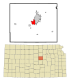
KSMap-doton-Assaria.png 300 × 156; 8 KB
-
KSMap-doton-Gypsum.png 300 × 156; 8 KB
-
KSMap-doton-New Cambria.png 300 × 156; 8 KB
-
KSMap-doton-Salina.png 300 × 156; 8 KB
-
KSMap-doton-Smolan.png 300 × 156; 8 KB
-
Portrait and biographical record of Dickinson, Saline, McPherson and Marion counties (IA portraitbiograph04chic).pdf 850 × 1 145, 618 pagine; 40,2 MB
-
Salina High School Central logo.png 403 × 311; 16 KB
-
Salina High School South logo.PNG 408 × 432; 31 KB
-
Salina Micropolitan Area.png 567 × 308; 18 KB
-
Salina Micropolitan Area.svg 6 607 × 3 388; 27 KB
-
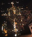
Salina, Kansas aerial photo at night.JPG 2 628 × 3 002; 2,76 MB
-
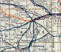
Stouffer's Railroad Map of Kansas 1915-1918 Saline County.png 353 × 301; 220 KB
-
Strange police scanner tones.ogg 24 s; 142 KB
-
USA Saline County, Kansas age pyramid.svg 520 × 600; 7 KB


