Category:Salterhebble
Zur Navigation springen
Zur Suche springen
Siedlung im Vereinigten Königreich | |||||
| Medium hochladen | |||||
| Ist ein(e) | |||||
|---|---|---|---|---|---|
| Ort |
| ||||
 | |||||
Main Wikipedia article: Salterhebble.
Unterkategorien
Es werden 11 von insgesamt 11 Unterkategorien in dieser Kategorie angezeigt:
In Klammern die Anzahl der enthaltenen Kategorien (K), Seiten (S), Dateien (D)
B
- Bankhouse Lane, Salterhebble (1 D)
C
- Crossley Hill, Salterhebble (6 D)
D
- Dryclough Junction (1 D)
H
P
S
- Salterhebble Basin (19 D)
- Salterhebble Tunnels (1 D)
Medien in der Kategorie „Salterhebble“
Folgende 116 Dateien sind in dieser Kategorie, von 116 insgesamt.
-
 Abbey Walk South, Coronation Road - geograph.org.uk - 4191177.jpg 4.608 × 3.456; 3,13 MB
-
 Abbey Walk, Coronation Road - geograph.org.uk - 4191166.jpg 4.608 × 3.456; 3,33 MB
-
 Annabel in the Calder and Hebble Navigation at Salterhebble (8501442336).jpg 3.688 × 2.634; 10,25 MB
-
 Back street behind Abbey Walk, Coronation Road - geograph.org.uk - 4191171.jpg 3.456 × 4.608; 3,03 MB
-

-
 Bankhouse Lane - Wakefield Road - geograph.org.uk - 3571047.jpg 640 × 480; 95 KB
-
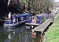
 Barges in Salterhebble Basin (5246984041).jpg 1.599 × 1.066; 1,75 MB
-
 Blue Barge in the Calder and Hebble Navigation (5235188647).jpg 2.473 × 1.905; 4,18 MB
-

-

-
 Bridge and Barge on the Calder and Hebble Navigation (4633326658).jpg 2.454 × 1.742; 4,62 MB
-
 Bridge GRD 4 - Wakefield Road - geograph.org.uk - 714499.jpg 640 × 453; 62 KB
-
 Bridge MRB 6 - Huddersfield Road - geograph.org.uk - 714469.jpg 640 × 480; 65 KB
-
 Bridge MRB 7 - Crossley Hill Lane - geograph.org.uk - 714467.jpg 640 × 404; 63 KB
-
 Bridge over disused Halifax Canal - geograph.org.uk - 680414.jpg 640 × 427; 88 KB
-
 Brookwater Close - Rookery Lane - geograph.org.uk - 3463768.jpg 640 × 480; 61 KB
-
 Calder and Hebble Navigation - geograph.org.uk - 1392833.jpg 640 × 480; 130 KB
-
 Calder and Hebble Navigation - geograph.org.uk - 1392838.jpg 640 × 480; 114 KB
-
-
-

-

-

-

-
 Canal Barges - geograph.org.uk - 1103531.jpg 640 × 480; 86 KB
-
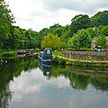 Canal Basin, Salterhebble (2564448045).jpg 1.923 × 1.920; 3,9 MB
-
 Canal Basin, Salterhebble (4648518754).jpg 2.525 × 1.713; 4,03 MB
-
 Canal Basin, Salterhebble, Halifax (2722434921).jpg 2.560 × 1.920; 4,55 MB
-

-
 Chevinedge Crescent - Exley Bank Top - geograph.org.uk - 3571691.jpg 640 × 480; 53 KB
-

-
 Cow Lane - Wakefield Road - geograph.org.uk - 3571049.jpg 640 × 480; 108 KB
-

-
 Disused lock - geograph.org.uk - 1280296.jpg 640 × 480; 102 KB
-
 Doncaster Street - Crossley Hill - geograph.org.uk - 3463759.jpg 640 × 480; 65 KB
-
 Drain and Hebble Brook, Halifax - geograph.org.uk - 6407479.jpg 800 × 600; 230 KB
-
 Dudwell Avenue - Dudwell Lane - geograph.org.uk - 3570933.jpg 640 × 480; 97 KB
-
 Dudwell Grove - Dudwell Lane - geograph.org.uk - 3570926.jpg 640 × 480; 103 KB
-

-

-

-

-

-
 Exeter Street - Crossley Hill - geograph.org.uk - 3463761.jpg 640 × 480; 76 KB
-
 Exeter Street - Park Road - geograph.org.uk - 4014891.jpg 640 × 480; 77 KB
-
 Exley Bank - Huddersfield Road - geograph.org.uk - 3571618.jpg 480 × 640; 118 KB
-

-

-

-
 Exley Gardens - Park Lane - geograph.org.uk - 3571667.jpg 640 × 480; 52 KB
-

-
 Falcon Street - Chapel Lane - geograph.org.uk - 3570937.jpg 640 × 445; 72 KB
-

-
 Footpath - Dryclough Lane - geograph.org.uk - 3700869.jpg 480 × 640; 98 KB
-
 Footpath - Exley Bank - geograph.org.uk - 3571627.jpg 480 × 640; 91 KB
-

-
 Green Park Avenue - Green Park Road - geograph.org.uk - 3570909.jpg 640 × 480; 65 KB
-
 Green Park Drive - Dudwell Lane - geograph.org.uk - 3570919.jpg 640 × 480; 64 KB
-
 Green Park Drive - Green Park Avenue - geograph.org.uk - 3570917.jpg 640 × 480; 53 KB
-
 Green Park Gate - Green Park Road - geograph.org.uk - 3570913.jpg 640 × 480; 56 KB
-

-

-
 Green Park Road- Dudwell Lane - geograph.org.uk - 3570934.jpg 640 × 480; 68 KB
-
 Green Park Street - Green Park Road - geograph.org.uk - 3570899.jpg 640 × 480; 86 KB
-

-
 Halifax FP729 crossing the railway, Skircoat - geograph.org.uk - 4750685.jpg 1.977 × 1.455; 922 KB
-

-
 Hebble Brook at Salterhebble - geograph.org.uk - 2054021.jpg 640 × 480; 129 KB
-
 Hebble Brook Mill - Bottoms - geograph.org.uk - 736617.jpg 640 × 455; 78 KB
-
 Hebble Water - geograph.org.uk - 1843192.jpg 480 × 640; 106 KB
-

-
 Mill Stream, Hebble Brook - geograph.org.uk - 3343604.jpg 640 × 480; 142 KB
-
 Narrowboat Bilbo Baggins in Salterhebble Basin (9111876040).jpg 2.920 × 2.920; 6,9 MB
-
 Narrowboat Oasis in the Halifax Arm (8170367602).jpg 2.684 × 2.564; 4,45 MB
-
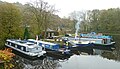
 Narrowboats in Salterhebble Basin (9146040658).jpg 2.519 × 2.519; 4,96 MB
-

-
 Path alongside Hebble Brook - Bottoms - geograph.org.uk - 736595.jpg 640 × 480; 111 KB
-
 Path by Hebble Brook (2565267380).jpg 1.920 × 2.560; 5,41 MB
-
 Railway Bridge, Haigh Lane, Halifax (3331865802).jpg 4.224 × 3.168; 8,57 MB
-
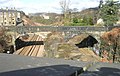
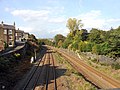 Railway Lines into Halifax from Crossley Hill Bridge - geograph.org.uk - 4198096.jpg 4.608 × 3.456; 3,27 MB
-
 Remains of a canal - geograph.org.uk - 2054039.jpg 480 × 640; 279 KB
-
 Remains of a lock^ - geograph.org.uk - 2054047.jpg 640 × 480; 247 KB
-
 River Calder from Stainland Road - geograph.org.uk - 805300.jpg 640 × 495; 90 KB
-
-
 Salterhebble - geograph.org.uk - 391253.jpg 640 × 486; 125 KB
-

-
 Salterhebble branch of the Calder ^ Hebble Canal - geograph.org.uk - 3631375.jpg 1.600 × 1.200; 957 KB
-
 Salterhebble Hill - geograph.org.uk - 1272061.jpg 640 × 480; 73 KB
-

-
 Salterhebble Junior ^ Infant School, Stafford Square - geograph.org.uk - 4191207.jpg 4.608 × 3.456; 3,31 MB
-
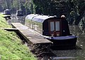
 Salterhebble Lock Visitor Moorings - geograph.org.uk - 391278.jpg 640 × 479; 155 KB
-
 Sewage Works - Huddersfield Road - geograph.org.uk - 3571615.jpg 640 × 480; 97 KB
-

-
 Shell and McDonald's - geograph.org.uk - 2054015.jpg 640 × 480; 133 KB
-
 Stafford Square - Huddersfield Road - geograph.org.uk - 3463726.jpg 640 × 480; 73 KB
-

-
 Steaming Up at Salterhebble Basin (8162193397).jpg 3.738 × 2.156; 5,99 MB
-
 Steps - Exley Bank - geograph.org.uk - 3571620.jpg 480 × 640; 87 KB
-
 Steps - Huddersfield Road - geograph.org.uk - 3571612.jpg 480 × 640; 114 KB
-

-
 The A6026, Wakefield Road, Halifax - geograph.org.uk - 694850.jpg 640 × 479; 102 KB
-

-
-
 The Halifax branch canal, Halifax - geograph.org.uk - 695114.jpg 640 × 480; 147 KB
-
 The Hebble Brook, Halifax - geograph.org.uk - 6407478.jpg 800 × 574; 197 KB
-
 The Hebble Trail - geograph.org.uk - 2054044.jpg 640 × 480; 276 KB
-

-

-

-
 The Watermill at Salterhebble - geograph.org.uk - 2054025.jpg 640 × 480; 121 KB
-

-

-

-
 Wakefield Road bridge - geograph.org.uk - 2054115.jpg 640 × 480; 158 KB
-
 Westbourne Grove - Huddersfield Road - geograph.org.uk - 3463734.jpg 640 × 480; 55 KB
-


.jpg)


.jpg)
.jpg)


.jpg)


.jpg)
.jpg)
.jpg)


.jpg)
.jpg)
.jpg)


.jpg)
.jpg)


.jpg)


