Category:San Juan River (Colorado River tributary)
Zur Navigation springen
Zur Suche springen
Nebenfluss des Colorado River  raft na řece v CDP Mexican Hut  | |||||
| Medium hochladen | |||||
| Ist ein(e) | |||||
|---|---|---|---|---|---|
| Ort | |||||
| Länge |
| ||||
| Höhe über dem Meeresspiegel |
| ||||
| Quelle des Wasserlaufs | |||||
| Mündet in | |||||
| Einzugsgebiet |
| ||||
| Anrainerstaat | |||||
| Nebenfluss |
| ||||
| Verschieden von | |||||
 | |||||
English: Media related to the San Juan River (Colorado River tributary), a river that flows through Colorado, New Mexico, and Utah in the southwestern United States.
- A tributary of the Colorado River, with its mouth on the river in southeastern Utah.
- In the physiographic Navajo Section and Canyon Lands Section, of the Colorado Plateau Province.
Unterkategorien
Es werden 23 von insgesamt 23 Unterkategorien in dieser Kategorie angezeigt:
In Klammern die Anzahl der enthaltenen Kategorien (K), Seiten (S), Dateien (D)
A
B
- Bloomfield, New Mexico (5 D)
F
G
J
K
- Kirtland, New Mexico (3 D)
M
N
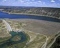
- Navajo Dam (2 D)
- Navajo Lake (8 D)
- Navajo Lake State Park (2 D)
- Nenahnezad, New Mexico (1 D)
O
- San Juan River oil spill (Utah) (52 D)
P
S
- San Juan Generating Station (6 D)
T
- Tselakai Dezza, Utah (2 D)
U
- Upper Fruitland, New Mexico (1 D)
W
Medien in der Kategorie „San Juan River (Colorado River tributary)“
Folgende 106 Dateien sind in dieser Kategorie, von 106 insgesamt.
-
 1911 flood, Pagosa Junction, Pagosa Springs, Colorado.jpg 640 × 460; 131 KB
-
 2009-08-20-01800 USA Utah 316 Goosenecks SP.jpg 7.059 × 2.375; 8,01 MB
-

-
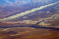 Bluff UT - aerial with San Juan River and Comb Ridge.jpg 3.504 × 2.336; 9,08 MB
-
 Cave ruins in bluffs of San Juan River. Utah - NARA - 517608.jpg 3.000 × 1.880; 1,34 MB
-
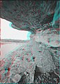 Cave ruins in bluffs of San Juan River. Utah - NARA - 517609 anaglyph.jpg 1.296 × 1.818; 857 KB
-
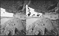 Cave ruins in bluffs of San Juan River. Utah - NARA - 517609.jpg 3.000 × 1.858; 1,24 MB
-

-
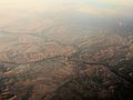
 Confluence of Colorado and San Juan.jpg 3.504 × 2.336; 6,44 MB
-
 Confluence of Mancos and San Juan Rivers, Four Corners Region, New Mexico (14494927711).jpg 4.000 × 3.000; 3,21 MB
-
 Confluence of Mancos and San Juan Rivers, Four Corners Region, New Mexico (14518426023).jpg 4.000 × 3.000; 2,76 MB
-

-

-

-

-

-

-

-

-

-

-

-

-
-

-

-
-

-

-
-

-

-

-
 Four Corners, Southwestern U.S.jpg 2.200 × 2.200; 2,73 MB
-
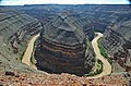
 GooseneckMeandersUtahAerial1.jpg 3.757 × 2.803; 5,99 MB
-
 GooseneckMeandersUtahTopo1.jpg 3.757 × 2.876; 7,09 MB
-
 Goosenecks of the San Juan River (southern Utah, USA) (15870577515).jpg 902 × 569; 284 KB
-
 Goosenecks San Juan River Utah 2020.jpg 2.144 × 1.424; 785 KB
-
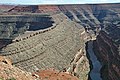
 Goosenecks SP01.jpg 2.520 × 1.680; 3,66 MB
-
 Goosenecks SP02.jpg 2.520 × 1.680; 3,65 MB
-
 Goosenecks SP04.jpg 2.483 × 1.658; 3,64 MB
-
 Goosenecks State Park, San Juan River, Utah.JPG 3.072 × 2.304; 2,11 MB
-
 Goosenecks State Park, Utah, Image of the Day DVIDS860656.jpg 3.000 × 3.010; 1,44 MB
-
 Goosenecks, San Juan River - panoramio (1).jpg 3.008 × 2.000; 4,03 MB
-
 GooseNeckStateParkPanorama.jpg 5.941 × 1.661; 1,88 MB
-
 Grand Staircase 201812 0198 (43703682452).jpg 3.264 × 2.448; 2,18 MB
-
 Grand Staircase 201812 0204 (43036220854).jpg 3.264 × 2.448; 1,95 MB
-

-

-
-

-

-

-

-

-
-

-
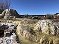
 Hot Springs.jpg 4.928 × 3.264; 12,13 MB
-
 Lower San Juan River.jpg 3.072 × 2.304; 2,8 MB
-
 Map of the Navajo Volcanic Fields.jpg 1.280 × 1.467; 568 KB
-
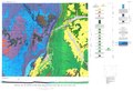
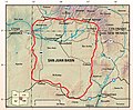
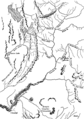
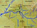 Map of the Upper San Juan Basin.jpg 562 × 423; 140 KB
-
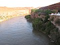
 Mexican Hat San Juanrivier 28-09-2012 15-01-43.jpg 3.734 × 2.100; 4,47 MB
-
 Mexican Hat, Utah, USA (San Juan River) - panoramio (1).jpg 3.648 × 2.736; 1,31 MB
-
 Mexican Hat, Utah, USA (San Juan River) - panoramio.jpg 3.648 × 2.736; 1,48 MB
-
 Mexican Hat, Utah, USA - panoramio (10).jpg 3.648 × 2.736; 1,14 MB
-
 Mexican Hat, Utah, USA - panoramio (13).jpg 3.648 × 2.736; 1,79 MB
-
 Mexican Hat, Utah, USA - panoramio (5).jpg 3.648 × 2.736; 1,14 MB
-
 Mexican Hat, Utah, USA - panoramio (7).jpg 3.648 × 2.736; 1,06 MB
-
 Mikes Mesa, San Juan River, Utah (14180580466).jpg 4.000 × 3.000; 2,41 MB
-
 Navajo Dam 1.jpeg 1.600 × 1.280; 307 KB
-
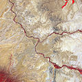
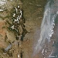
 NE AZ-NW NM NASA.jpg 990 × 830; 645 KB
-
 O'Sullivan 1965 USGS Bulletin 1186 plate-1.jpg 8.600 × 5.900; 4,5 MB
-
 O'Sullivan 1965 USGS Bulletin 1186 plate-1.pdf 6.450 × 4.425; 9,19 MB
-

-
 Pagosa Hot Springs - looking west from Hot Springs Blvd.jpg 4.032 × 3.024; 5,09 MB
-
 Pagosa Hot Springs, soaking pools on the San Juan River.jpg 4.032 × 3.024; 3,91 MB
-

-

-
 San Juan canoeists.jpg 2.025 × 2.025; 5,42 MB
-
 San Juan River (Goosenecks State Park, Utah, USA) 1 (21263340971).jpg 2.918 × 1.982; 7,37 MB
-
 San Juan River (Goosenecks State Park, Utah, USA) 2 (20634177933).jpg 2.946 × 1.899; 3,42 MB
-
 San Juan River (Goosenecks State Park, Utah, USA) 3 (21067202170).jpg 2.931 × 1.893; 3,38 MB
-
 San Juan River at Goosenecks - panoramio.jpg 1.200 × 1.600; 483 KB
-
 San Juan River at Mexican Hat UT - panoramio - Klaus Eltrop.jpg 1.600 × 1.200; 1,18 MB
-
 San Juan River at Mexican Hat UT - panoramio.jpg 1.600 × 1.200; 882 KB
-
 San Juan River at Pagosa Springs with balloons.jpg 2.688 × 1.512; 1,5 MB
-
 San Juan River canyon.png 545 × 834; 842 KB
-
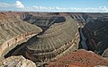
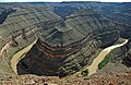
 San juan river entrenched meanders.jpg 4.205 × 2.550; 7,93 MB
-
 San Juan River near Navajo Dam, New Mexico.jpg 3.264 × 2.448; 3,98 MB
-
 San Juan River Utah 1927.jpg 700 × 428; 42 KB
-
 San Juan River, Utah (14017046288).jpg 4.000 × 3.000; 2,36 MB
-
 San Juan River, Utah (14017115957).jpg 4.000 × 3.000; 2,66 MB
-
 SanJuanBasinUSGS.jpg 728 × 601; 160 KB
-
 SanJuanRiver2006.jpg 479 × 321; 32 KB
-
 Sanjuanrivermap-new.png 2.030 × 1.749; 3,91 MB
-
 Sanjuanrivermap.jpg 617 × 429; 247 KB
-
 Sanjuanrivermappiedrahighlighted.jpg 1.612 × 1.160; 466 KB
-
 San Juan River regional coal environmental impact statement - second draft (IA sanjuanriverregi3631unit).pdf 1.250 × 1.614, 636 Seiten; 97,8 MB
-
 SJRcanyon.jpg 2.168 × 1.440; 461 KB
-
 Timpanogos Valley BHoU-p13.png 2.870 × 4.082; 225 KB
-
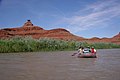
 Trail of the Ancients - Floating the San Juan River - NARA - 7722483.jpg 1.633 × 2.048; 624 KB
-
 USGS Bulletin 1021-E Plate 17.tif 4.245 × 8.389, 5 Seiten; 5,57 MB
-
 NavajoMtn ISS012-E-5172.jpg 1.000 × 697; 501 KB
-
 Wallow fire satphoto, June 7, 2011.jpg 720 × 720; 222 KB
-
 Wolf Creek Pass View on West towards West by Erik Voss IMG 4012.JPG 2.592 × 1.944; 2,05 MB
-
 Wpdms nasa topo san juan river utah.jpg 300 × 300; 60 KB


.jpg)
.jpg)
.jpg)
.jpg)
.jpg)
.jpg)
.jpg)
.jpg)
_1_(49101827468).jpg)
_10_(49102536297).jpg)
_11_(49102340831).jpg)
_12_(49101828898).jpg)
_13_(49102535897).jpg)
_14_(49101828698).jpg)
_15_(49101828358).jpg)
_16_(49102340231).jpg)
_2_(49102341726).jpg)
_3_(49102339486).jpg)
_4_(49101829698).jpg)
_5_(49102341446).jpg)
_6_(49102534982).jpg)
_7_(49102341321).jpg)
_8_(49102341166).jpg)
_9_(49101828088).jpg)


_(15870577515).jpg)


.jpg)
.jpg)
.jpg)
_7_(49103553991).jpg)
_1_(49103741287).jpg)
_10_(49103782522).jpg)
_2_(49103740197).jpg)
_3_(49103550251).jpg)
_4_(49103738037).jpg)
_5_(49103737087).jpg)
_7_(49103546276).jpg)
_8_(49103545376).jpg)
_9_(49103733622).jpg)


_-_panoramio_(1).jpg)
_-_panoramio.jpg)
.jpg)
.jpg)
.jpg)
.jpg)
.jpg)


_BHL39707434.jpg)
_BHL39707464.jpg)

_1_(21263340971).jpg)
_2_(20634177933).jpg)
_3_(21067202170).jpg)


.jpg)
.jpg)


Kategorien:
- Rivers of Colorado
- Rivers of New Mexico
- Rivers of Utah
- Bodies of water on the Navajo Nation
- Rivers of the United States by name
- Tributaries of the Colorado River in Colorado
- Tributaries of the Colorado River in New Mexico
- Tributaries of the Colorado River in Utah
- Colorado Plateau region of Colorado
- Colorado Plateau region of New Mexico
- Colorado Plateau region of Utah
- Colorado Plateau Navajo section
- Canyon Lands of Utah
- Rivers named after Saint John
- Bodies of water in San Juan County, Utah
- Locations along U.S. Route 160 in Archuleta County, Colorado
- Locations along U.S. Route 160 in Montezuma County, Colorado
- Locations along U.S. Route 64 in New Mexico
- Locations along U.S. Route 491 in New Mexico
- Locations along U.S. Route 550 in New Mexico
- Locations along U.S. Route 666 in New Mexico
- Locations along U.S. Route 163 in Utah
- Locations along U.S. Route 163 in Utah (1970-1981) in San Juan County, Utah
- Locations along U.S. Route 191 in San Juan County, Utah
- Locations along New Mexico State Road 170
- Locations along New Mexico State Road 173
- Locations along New Mexico State Road 371
- Locations along New Mexico State Road 511
- Locations along New Mexico State Road 527
- Locations along Utah State Route 47 (1927-1977)
- Locations along Utah State Route 162
- Locations along the Hole in the Rock Trail