Category:Saul Church
Jump to navigation
Jump to search
| Object location | | View all coordinates using: OpenStreetMap |
|---|
|
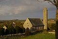
This is a category about a listed building with HB number HB18/08/130. |
Media in category "Saul Church"
The following 27 files are in this category, out of 27 total.
-
 1 saul church (13).JPG 4,000 × 3,000; 4.39 MB
-
 Down (002), October 2009.JPG 4,272 × 2,848; 4.2 MB
-
 Down (010), October 2009.JPG 4,272 × 2,848; 3.28 MB
-
 Down (013), October 2009.JPG 4,272 × 2,848; 6.58 MB
-
 Down (014), October 2009.JPG 4,272 × 2,848; 5.67 MB
-
 Down (015), October 2009.JPG 4,272 × 2,848; 4.1 MB
-
 Down (018), October 2009.JPG 2,848 × 4,272; 5.77 MB
-
 Down (019), October 2009.JPG 4,272 × 2,848; 5.07 MB
-
 Down (020), October 2009.JPG 2,848 × 4,272; 4.17 MB
-
 Down (021), October 2009.JPG 2,848 × 4,272; 5.78 MB
-
 Down (022), October 2009.JPG 2,848 × 4,272; 4.99 MB
-
 Down (023), October 2009.JPG 2,848 × 4,272; 5.32 MB
-
 Down (024), October 2009.JPG 4,272 × 2,848; 2.93 MB
-
 Down (025), October 2009.JPG 4,272 × 2,848; 7.61 MB
-
 Down (026), October 2009.JPG 2,848 × 4,272; 6.72 MB
-
 Down (027), October 2009.JPG 2,848 × 4,272; 5.03 MB
-
 Down (028), October 2009.JPG 4,272 × 2,848; 5.26 MB
-
 Down (029), October 2009.JPG 2,848 × 4,272; 6.48 MB
-
 Down (030), October 2009.JPG 2,848 × 4,272; 5.23 MB
-
 Down (031), October 2009.JPG 4,272 × 2,848; 4.71 MB
-
 Down (032), October 2009.JPG 4,272 × 2,848; 6.01 MB
-
 Down (033), October 2009.JPG 4,272 × 2,848; 3.89 MB
-
 Down (034), October 2009.JPG 2,848 × 4,272; 7.68 MB
-
 Saul church County Down sign.jpg 1,476 × 1,164; 1.11 MB
-
 Saul church County Down.jpg 1,287 × 1,185; 909 KB
-
 Saul church.jpg 1,600 × 1,063; 199 KB
-
 St. Patrick's Memorial church, Saul - geograph.org.uk - 269924.jpg 640 × 426; 121 KB
.JPG)
,_October_2009.JPG)
,_October_2009.JPG)
,_October_2009.JPG)
,_October_2009.JPG)
,_October_2009.JPG)
,_October_2009.JPG)
,_October_2009.JPG)
,_October_2009.JPG)
,_October_2009.JPG)
,_October_2009.JPG)
,_October_2009.JPG)
,_October_2009.JPG)
,_October_2009.JPG)
,_October_2009.JPG)
,_October_2009.JPG)
,_October_2009.JPG)
,_October_2009.JPG)
,_October_2009.JPG)
,_October_2009.JPG)
,_October_2009.JPG)
,_October_2009.JPG)
,_October_2009.JPG)


Categories:
- Anglican churches in County Down
- Saint Patrick churches in Northern Ireland
- Round towers of Northern Ireland
- Saul, County Down
- Saul Road, County Down
- Grade B+ listed churches in County Down
- Churches built in 1932
- 1930s churches in Northern Ireland
- Aisleless churches in Northern Ireland
- History of Christianity in Ireland