Category:Scalby, North Yorkshire
Jump to navigation
Jump to search
village in North Yorkshire, UK  | |||||
| Upload media | |||||
| Instance of | |||||
|---|---|---|---|---|---|
| Location | Newby and Scalby, Scarborough, North Yorkshire, Yorkshire and the Humber, England | ||||
 | |||||
English: Scalby, a village on the north edge of Scarborough, North Yorkshire, England, is part of the civil parish of Newby and Scalby. From 1902 to 1974, Scalby was an urban district in the North Riding of Yorkshire.
Subcategories
This category has the following 5 subcategories, out of 5 total.
Media in category "Scalby, North Yorkshire"
The following 106 files are in this category, out of 106 total.
-
 'Where a river meets the sea.....' - geograph.org.uk - 1582056.jpg 640 × 480; 88 KB
-
 Barmoor House - geograph.org.uk - 1162126.jpg 640 × 480; 94 KB
-
 Barmoor Lane, Scalby - geograph.org.uk - 2698073.jpg 1,024 × 768; 131 KB
-
 Barmoor Lane, Scalsby - geograph.org.uk - 3536486.jpg 4,608 × 3,456; 5.98 MB
-
 Beacon Cottage Farm - geograph.org.uk - 203181.jpg 640 × 426; 145 KB
-
 Beech Drive off the A171, Scalby - geograph.org.uk - 1916465.jpg 640 × 430; 180 KB
-
 Beech Drive, Scalby - geograph.org.uk - 3550662.jpg 3,072 × 2,304; 3.09 MB
-
 Bridge over Church Beck, Scalby - geograph.org.uk - 1905425.jpg 640 × 430; 155 KB
-
 Bungalows on North Street, Scalby - geograph.org.uk - 2698091.jpg 1,024 × 768; 166 KB
-
 Chichester Close - geograph.org.uk - 1905263.jpg 640 × 430; 133 KB
-
 Chichester Close, Scalby - geograph.org.uk - 2178602.jpg 800 × 600; 273 KB
-
 Church House, Scalby - geograph.org.uk - 1905419.jpg 640 × 430; 122 KB
-
 Cock Hollow - geograph.org.uk - 1741592.jpg 640 × 427; 307 KB
-
 Crumbling cliffs, Scalby - geograph.org.uk - 2697001.jpg 1,024 × 641; 287 KB
-
 East Avenue, Scalby - geograph.org.uk - 1904980.jpg 640 × 430; 127 KB
-
 East Mount - geograph.org.uk - 1506500.jpg 640 × 480; 92 KB
-
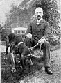
 Edwin Brough and bloodhounds at Scalby Manor.jpg 800 × 487; 165 KB
-
 Edwin Brough with his bloodhound.jpg 800 × 1,074; 291 KB
-
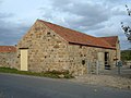
 Farm Buildings at The Pines - geograph.org.uk - 1162192.jpg 640 × 480; 59 KB
-
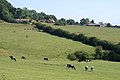
 Farmland near Burniston - geograph.org.uk - 1547087.jpg 640 × 480; 68 KB
-
 Field of dreams (4101981560).jpg 3,008 × 2,000; 3.21 MB
-
 Fieldstead Crescent, Scalby - geograph.org.uk - 2263921.jpg 640 × 480; 71 KB
-
 Foulsyke Farm - geograph.org.uk - 1547086.jpg 640 × 480; 87 KB
-
 Hall, High St, Scalby - geograph.org.uk - 1905292.jpg 640 × 430; 132 KB
-
 Haycliffe Cottage - geograph.org.uk - 1169039.jpg 505 × 640; 89 KB
-
 High Barmer - geograph.org.uk - 1547088.jpg 640 × 480; 68 KB
-
 High St, Scalby - geograph.org.uk - 1905289.jpg 640 × 430; 132 KB
-
 High Street, Scalby - geograph.org.uk - 3662301.jpg 3,648 × 2,736; 3.87 MB
-
 It's 5-37pm at Scalby Village Hall - geograph.org.uk - 4311352.jpg 1,600 × 1,062; 538 KB
-
 Kennels at Scalby Manor 1898.jpg 2,000 × 1,171; 634 KB
-
 Lancaster Cottage, Scalby - geograph.org.uk - 1905318.jpg 640 × 430; 127 KB
-
 Lancaster Way, Scalby - geograph.org.uk - 1474032.jpg 640 × 480; 64 KB
-
 Malcolm Elliot Hodgson.jpg 800 × 836; 194 KB
-
 Mary Gwendolen Hodgson.jpg 800 × 1,074; 308 KB
-
 Methodist Hall, Scalby - geograph.org.uk - 1905313.jpg 640 × 430; 129 KB
-
 Nags Head Inn - geograph.org.uk - 1170238.jpg 640 × 341; 54 KB
-
 Nags Head Inn, Scalby - geograph.org.uk - 1905305.jpg 640 × 430; 127 KB
-

-
 Old Scarborough to Whitby Railway - geograph.org.uk - 1474013.jpg 640 × 480; 104 KB
-

-
 OS Composite map from SE 99 98 TA 08.jpg 8,478 × 5,173; 7.22 MB
-
 Ox Pasture Hotel Car Park - geograph.org.uk - 1547076.jpg 640 × 480; 75 KB
-
 Pillbox alongside North Cliff Avenue, Scalby.jpg 1,024 × 768; 316 KB
-
 Pond in the grounds of Ox Pasture Hall - geograph.org.uk - 1778123.jpg 2,560 × 1,920; 1.48 MB
-
 Postbox, Carr Lane, Scalby - geograph.org.uk - 1905428.jpg 640 × 430; 170 KB
-
 Prehistoric Patterns - Scalby - geograph.org.uk - 1645.jpg 549 × 410; 63 KB
-
 Raincliffe Farm - geograph.org.uk - 1547073.jpg 640 × 480; 67 KB
-
 Rape field (3646724299).jpg 3,008 × 1,516; 1.8 MB
-
 Rape field with poppies (3646722185).jpg 2,488 × 1,708; 2.77 MB
-
 Red Scar Lane - geograph.org.uk - 1547080.jpg 640 × 480; 90 KB
-
 Road Bridge A171 Scalby - geograph.org.uk - 1082030.jpg 640 × 480; 90 KB
-
 Road Bridge over Sea Cut Scalby - geograph.org.uk - 1082002.jpg 640 × 480; 104 KB
-
 Road into Scalby - geograph.org.uk - 1082010.jpg 640 × 480; 82 KB
-
 Rowbrow Wood - geograph.org.uk - 1778120.jpg 2,560 × 1,920; 1.46 MB
-
 Scalby Beck - geograph.org.uk - 403625.jpg 640 × 480; 90 KB
-
 Scalby Beck and the Old Scalby Mills.jpg 640 × 480; 68 KB
-
 Scalby Beck reaches the sea - geograph.org.uk - 403628.jpg 640 × 480; 93 KB
-
 Scalby Cottage - geograph.org.uk - 1171612.jpg 640 × 480; 95 KB
-
 Scalby Ford - geograph.org.uk - 1171611.jpg 640 × 435; 115 KB
-
 Scalby Gateway - geograph.org.uk - 1171147.jpg 640 × 475; 111 KB
-
 Scalby Hall, Scalby - geograph.org.uk - 1905280.jpg 640 × 430; 122 KB
-
 Scalby Lodge - geograph.org.uk - 499387.jpg 640 × 480; 116 KB
-
 Scalby Methodist Hall - geograph.org.uk - 1170239.jpg 640 × 480; 72 KB
-
 Scalby Mills, Scarborough North Yorkshire England 1901 - 1910.jpg 1,449 × 937; 850 KB
-
 Scalby School - geograph.org.uk - 1171613.jpg 640 × 384; 95 KB
-
 Scalby Snowdrops - geograph.org.uk - 1171610.jpg 640 × 480; 112 KB
-
 Scalby Stores - geograph.org.uk - 1916516.jpg 640 × 430; 132 KB
-
 Scalby Stores - geograph.org.uk - 3901444.jpg 1,600 × 1,159; 531 KB
-
 Scalby Sundial - geograph.org.uk - 1169955.jpg 640 × 480; 121 KB
-
 Scalby Village - geograph.org.uk - 1582458.jpg 640 × 480; 65 KB
-
 Scalby village entrance sign - geograph.org.uk - 2263896.jpg 640 × 480; 36 KB
-
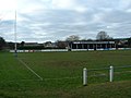 Scarborough Rugby Club - geograph.org.uk - 113831.jpg 640 × 480; 82 KB
-
 Sea Cut looking towards Scalby - geograph.org.uk - 222990.jpg 640 × 480; 97 KB
-

-
 Slippery Descent - geograph.org.uk - 1458423.jpg 480 × 640; 155 KB
-
 Start of the Tabular Hills Walk - geograph.org.uk - 400501.jpg 640 × 480; 145 KB
-
 Station Rd, Scalby - geograph.org.uk - 1904974.jpg 640 × 430; 111 KB
-
 Sunday Afternoon Walk near Burniston - geograph.org.uk - 203237.jpg 640 × 426; 138 KB
-
 The Function Room, Ox Pasture Hall Hotel - geograph.org.uk - 1778110.jpg 2,560 × 1,920; 966 KB
-
 The Ivanhoe public house, Scalby. - geograph.org.uk - 1544567.jpg 640 × 480; 62 KB
-
 The Old Post Office, Scalby - geograph.org.uk - 1916526.jpg 640 × 430; 135 KB
-
 The Park, Scalby - geograph.org.uk - 3952154.jpg 2,256 × 1,496; 537 KB
-
 The Plough, Scalby - geograph.org.uk - 1905297.jpg 640 × 430; 135 KB
-
 Track to East Mount - geograph.org.uk - 1506491.jpg 640 × 480; 115 KB
-
 Tree Covered Area - geograph.org.uk - 455895.jpg 640 × 360; 126 KB
-
 View from Red Scar Lane - geograph.org.uk - 1169036.jpg 640 × 480; 83 KB
-
 Villages Stores, Scalby - geograph.org.uk - 1905302.jpg 640 × 430; 151 KB
-
 War Memorial, St Laurence - geograph.org.uk - 1905388.jpg 640 × 430; 180 KB
-
 Washy Cote Beck - geograph.org.uk - 1162179.jpg 640 × 480; 97 KB
-
 Wet-weather ford, Scalby - geograph.org.uk - 243030.jpg 640 × 480; 102 KB
-
 Woodland beside Ox Pasture Hotel - geograph.org.uk - 1547077.jpg 640 × 480; 146 KB
-
 X93 Whitby to Scarborough bus - geograph.org.uk - 4845600.jpg 640 × 480; 56 KB
-
 Yew Tree Cafe, Scalby - geograph.org.uk - 1905315.jpg 640 × 430; 120 KB
-

-
 Cleveland Way near Scalby Lodge - geograph.org.uk - 659295.jpg 640 × 480; 147 KB
-
 Cumboots - geograph.org.uk - 203189.jpg 640 × 426; 123 KB
-

-
 Lady Edith's Drive - geograph.org.uk - 266381.jpg 640 × 480; 128 KB
-
 Memorial Plaque - geograph.org.uk - 455925.jpg 640 × 360; 105 KB
-
 North of Scalby Ness - geograph.org.uk - 563116.jpg 640 × 480; 140 KB
-
 Scalby Beck - geograph.org.uk - 220164.jpg 640 × 480; 120 KB
-
 Scalby Cricket Club - geograph.org.uk - 203207.jpg 640 × 426; 110 KB
-
 Stream across the green, Scalby - geograph.org.uk - 247962.jpg 480 × 640; 113 KB
-
 Tennis Courts on Station Rd - geograph.org.uk - 113834.jpg 640 × 480; 131 KB
-
 The school, Scalby - geograph.org.uk - 247951.jpg 640 × 480; 162 KB
-
 View towards Scalby Nabs - geograph.org.uk - 266392.jpg 640 × 480; 105 KB


.jpg)


_from_near_Scalby_-_geograph.org.uk_-_221344.jpg)


.jpg)
.jpg)


