Category:Schieweg 168
Jump to navigation
Jump to search
| Object location | | View all coordinates using: OpenStreetMap |
|---|
.jpg) | |||||
| Upload media | |||||
| Instance of | |||||
|---|---|---|---|---|---|
| Part of | |||||
| Location | Delft, South Holland, Netherlands | ||||
| Street address |
| ||||
| Heritage designation |
| ||||
 | |||||
|
This is a category about rijksmonument number 525290
|
| Address |
|
Media in category "Schieweg 168"
The following 6 files are in this category, out of 6 total.
-
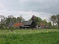 Delft - Schieweg 168 (Boerderijcomplex Veelust).jpg 2,592 × 1,944; 1.45 MB
-
 Delft - Schieweg 168 (hek).jpg 2,592 × 1,944; 2.06 MB
-
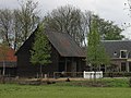 Delft - Schieweg 168 (hooischuur).jpg 1,201 × 901; 391 KB
-
 Delft - Schieweg 168 (schuur rechts).jpg 2,592 × 1,944; 1.81 MB
-
 Delft - Schieweg 168 (schuur).jpg 1,074 × 806; 340 KB
-
 Delft - Schieweg 168 (veeschuur).jpg 2,592 × 1,944; 1.51 MB
.jpg)
.jpg)
.jpg)
.jpg)
.jpg)