Category:School Roelof Hartstraat (Amsterdam)
Jump to navigation
Jump to search
| Object location | | View all coordinates using: OpenStreetMap |
|---|
 | |||||
| Upload media | |||||
| Instance of | |||||
|---|---|---|---|---|---|
| Part of | |||||
| Location | Museumkwartier, Amsterdam-Zuid, Amsterdam, North Holland, Netherlands | ||||
| Street address |
| ||||
| Located on street | |||||
| Occupant | |||||
| Heritage designation |
| ||||
| Inception |
| ||||
 | |||||
|
This is a category about rijksmonumentcomplex number 527767
|
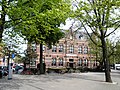
Schoolgebouw
|
This is a category about rijksmonument number 527768
|
Gymnastiekzaal
|
This is a category about rijksmonument number 527769
|
Conciërgewoning
|
This is a category about rijksmonument number 527770
|
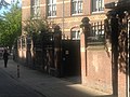
Hek
|
This is a category about rijksmonument number 527771
|
| Address |
|
Media in category "School Roelof Hartstraat (Amsterdam)"
The following 57 files are in this category, out of 57 total.
-
 Amsterdam - Gymnastieklokaal HBS.JPG 2,592 × 1,936; 1.77 MB
-
 Amsterdam - Gymnastieklokaal.JPG 2,592 × 1,936; 1.83 MB
-
 Amsterdam - HBS Gymnastieklokaal.JPG 2,592 × 1,936; 1.66 MB
-
 Amsterdam - Hek HBS.JPG 2,592 × 1,936; 1.34 MB
-
 Amsterdam 0010.jpg 4,288 × 3,216; 2.93 MB
-
 Amsterdam 0011.jpg 4,120 × 2,929; 2.89 MB
-
 Balthasar Floriszstraat 2.JPG 2,304 × 3,072; 1.72 MB
-
 Buitenkant van The College Hotel.jpg 1,024 × 681; 305 KB
-
 Roelof Hartstraat 1.jpg 2,948 × 2,164; 552 KB
-
 School Roelof Hartstraat (Amsterdam), foto 1.JPG 4,608 × 3,456; 7.77 MB
-
 School Roelof Hartstraat (Amsterdam), foto 2.JPG 4,608 × 3,456; 3.42 MB
-
 Stadsarchief Amsterdam, Afb ANWM00202000001.jpg 3,945 × 3,953; 1.23 MB
-
 Stadsarchief Amsterdam, Afb ANWM00202000002.jpg 3,986 × 3,990; 1.38 MB
-
 Stadsarchief Amsterdam, Afb ANWM00202000003.jpg 3,945 × 3,953; 1.29 MB
-
 Stadsarchief Amsterdam, Afb ANWM00202000004.jpg 3,951 × 3,953; 1.01 MB
-
 Stadsarchief Amsterdam, Afb ANWM00202000006.jpg 3,981 × 3,953; 592 KB
-
 Stadsarchief Amsterdam, Afb ANWM00202000008.jpg 3,945 × 3,953; 1.24 MB
-
 Stadsarchief Amsterdam, Afb ANWM00202000009.jpg 3,975 × 3,983; 686 KB
-
 Stadsarchief Amsterdam, Afb ANWM00202000010.jpg 3,981 × 3,972; 870 KB
-
 Stadsarchief Amsterdam, Afb ANWM00202000011.jpg 3,975 × 3,977; 724 KB
-
 Stadsarchief Amsterdam, Afb ANWM00202000012.jpg 3,968 × 3,984; 757 KB
-
 Stadsarchief Amsterdam, Afb ANWM00203000001.jpg 3,945 × 3,953; 1.11 MB
-
 Stadsarchief Amsterdam, Afb ANWM00203000002.jpg 3,945 × 3,953; 641 KB
-
 Stadsarchief Amsterdam, Afb ANWM00203000003.jpg 3,969 × 3,984; 800 KB
-
 Stadsarchief Amsterdam, Afb ANWM00203000004.jpg 3,945 × 3,953; 802 KB
-
 Stadsarchief Amsterdam, Afb ANWM00203000005.jpg 3,969 × 3,953; 856 KB
-
 Stadsarchief Amsterdam, Afb ANWM00203000006.jpg 3,945 × 3,953; 871 KB
-
 Stadsarchief Amsterdam, Afb ANWM00203000007.jpg 3,945 × 3,948; 645 KB
-
 Stadsarchief Amsterdam, Afb ANWM00203000008.jpg 3,969 × 3,977; 1.07 MB
-
 Stadsarchief Amsterdam, Afb ANWM00203000009.jpg 3,945 × 3,953; 806 KB
-
 Stadsarchief Amsterdam, Afb ANWM00203000010.jpg 3,945 × 3,953; 797 KB
-
 Stadsarchief Amsterdam, Afb ANWM00203000011.jpg 3,945 × 3,953; 792 KB
-
 Stadsarchief Amsterdam, Afb ANWM00203000012.jpg 3,957 × 3,953; 839 KB
-
 Stadsarchief Amsterdam, Afb ANWM00203000013.jpg 3,921 × 3,917; 858 KB
-
 Stadsarchief Amsterdam, Afb ANWM00203000014.jpg 4,011 × 3,954; 994 KB
-
 Stadsarchief Amsterdam, Afb ANWM00203000015.jpg 3,999 × 3,953; 1.4 MB
-
 Stadsarchief Amsterdam, Afb ANWM00203000016.jpg 3,981 × 3,953; 1.16 MB
-
 Stadsarchief Amsterdam, Afb ANWM00203000017.jpg 3,981 × 4,001; 1.07 MB
-
 Stadsarchief Amsterdam, Afb ANWM00203000018.jpg 3,945 × 3,953; 1.02 MB
-
 Stadsarchief Amsterdam, Afb ANWM00204000001.jpg 4,016 × 4,003; 588 KB
-
 Stadsarchief Amsterdam, Afb ANWM00204000002.jpg 3,945 × 3,953; 707 KB
-
 Stadsarchief Amsterdam, Afb ANWM00204000003.jpg 3,963 × 3,953; 838 KB
-
 Stadsarchief Amsterdam, Afb ANWM00204000004.jpg 3,945 × 3,953; 959 KB
-
 Stadsarchief Amsterdam, Afb ANWM00204000005.jpg 3,975 × 3,942; 680 KB
-
 Stadsarchief Amsterdam, Afb ANWM00204000006.jpg 3,945 × 3,953; 1.46 MB
-
 Stadsarchief Amsterdam, Afb ANWM00204000007.jpg 3,945 × 3,953; 793 KB
-
 Stadsarchief Amsterdam, Afb ANWM00204000008.jpg 3,945 × 3,912; 752 KB
-
 Stadsarchief Amsterdam, Afb ANWM00204000009.jpg 3,945 × 3,953; 915 KB
-
 Stadsarchief Amsterdam, Afb ANWM00204000010.jpg 3,993 × 3,996; 753 KB
-
 Stadsarchief Amsterdam, Afb ANWM00204000011.jpg 3,945 × 3,953; 679 KB
-
 Stadsarchief Amsterdam, Afb ANWM00204000012.jpg 3,969 × 3,953; 671 KB
-
 Stadsarchief Amsterdam, Afb ANWM00204000013.jpg 3,969 × 3,953; 790 KB
-
 Stadsarchief Amsterdam, Afb ANWM00204000014.jpg 3,945 × 3,953; 689 KB
-
 Stadsarchief Amsterdam, Afb ANWM00204000015.jpg 4,003 × 4,033; 664 KB
-
 Stadsarchief Amsterdam, Afb ANWM00204000017.jpg 3,945 × 3,953; 693 KB
-
 Stadsarchief Amsterdam, Afb ANWM00204000018.jpg 3,987 × 3,953; 821 KB
-
 Stadsarchief Amsterdam, Afb PBKD00172000002.jpg 1,738 × 1,168; 190 KB


,_foto_1.JPG)
,_foto_2.JPG)


