Category:Scotstoun
Перейти до навігації
Перейти до пошуку
historic district of Glasgow, Scotland, UK  | |||||
| Завантажити медіафайл | |||||
| Є одним із | |||||
|---|---|---|---|---|---|
| Місце розташування | Глазго, Шотландія | ||||
 | |||||
Підкатегорії
Показано 7 підкатегорій із 7.
B
- BAE Systems, Scotstoun (40 F)
- Barclay Curle Crane (9 F)
G
S
- Scotstoun Stadium (13 F)
- Scotstounhill railway station (22 F)
Файли в категорії «Scotstoun»
Показано 69 файлів цієї категорії (із 69).
-
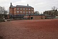
 50 Kingsway Court (geograph 4785092).jpg 360 × 640; 110 КБ
-
 50 Kingsway Court - geograph.org.uk - 4785132.jpg 640 × 480; 101 КБ
-
 A814 Dumbarton Road (geograph 5034919).jpg 3429 × 2214; 2,69 МБ
-
 A814 Dumbarton Road - geograph.org.uk - 5034904.jpg 3504 × 2336; 2,76 МБ
-
 Barclay Curle Titan Crane - geograph.org.uk - 6348975.jpg 1600 × 1200; 306 КБ
-
 Barclay Curle Titan Crane - geograph.org.uk - 6348985.jpg 1257 × 1600; 363 КБ
-
 Beginning of the Clydeside Expressway - geograph.org.uk - 520655.jpg 640 × 480; 133 КБ
-
 Blawart Hill (geograph 2944530).jpg 640 × 480; 186 КБ
-
 Braehead pontoon - geograph.org.uk - 5765611.jpg 640 × 480; 136 КБ
-
 Burnham Road 2C Scotstoun - geograph org uk - 987616 crop.jpg 313 × 191; 18 КБ
-
 Burnham Road, Glasgow - geograph.org.uk - 4135814.jpg 5184 × 3456; 7,04 МБ
-
 Burnham Road, Scotstoun - geograph.org.uk - 987616.jpg 640 × 480; 92 КБ
-
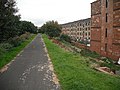
 Cycleway at Scotstoun - geograph.org.uk - 988745.jpg 640 × 480; 104 КБ
-
 Demolition at Scotstoun - geograph.org.uk - 2069277.jpg 640 × 480; 125 КБ
-
 Demolition at Scotstoun - geograph.org.uk - 2069284.jpg 480 × 640; 104 КБ
-
 Disused Railway Bridge over Dumbarton Road (geograph 6369985).jpg 800 × 600; 325 КБ
-
 Dredger Freeway on the Upper Clyde - geograph.org.uk - 5758853.jpg 640 × 480; 124 КБ
-
 Dredger Freeway on the Upper Clyde - geograph.org.uk - 5765163.jpg 640 × 378; 106 КБ
-
 Dredger Freeway on the Upper Clyde - geograph.org.uk - 5765171.jpg 640 × 480; 118 КБ
-
 Dredger Freeway on the Upper Clyde - geograph.org.uk - 5765192.jpg 640 × 480; 176 КБ
-
 Dredger Freeway on the Upper Clyde - geograph.org.uk - 5765561.jpg 640 × 311; 91 КБ
-
 Dumbarton Road - geograph.org.uk - 4785085.jpg 640 × 360; 79 КБ
-
 Dumbarton Road - geograph.org.uk - 5128329.jpg 1600 × 1067; 242 КБ
-
 Dumbarton Road passes under a dismantled railway (geograph 3644985).jpg 1024 × 768; 160 КБ
-
 Glasgow wards 2017 no12 Vic Park.png 2000 × 2040; 504 КБ
-
 Gleneagles Cottages, Scotstoun - geograph.org.uk - 3436061.jpg 3955 × 2655; 3,15 МБ
-
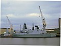 HMS Daring, Scotstoun - geograph.org.uk - 820225.jpg 640 × 485; 57 КБ
-
 Howe Cottages, Earlbank Avenue - geograph.org.uk - 5279638.jpg 1600 × 1127; 394 КБ
-
 Kingsway Court - geograph.org.uk - 4785127.jpg 640 × 360; 105 КБ
-
 Lanarkshire and Dunbartonshire Railway (geograph 2942921).jpg 640 × 480; 384 КБ
-
 Lanarkshire and Dunbartonshire Railway - geograph.org.uk - 1938067.jpg 640 × 480; 102 КБ
-
 Larchfield Avenue, Scotstoun (geograph 3436076).jpg 4608 × 3456; 6,39 МБ
-
 Map of Renfrewshire Sheet 008, Ordnance Survey, 1863-1864.jpg 10 709 × 7168; 9,19 МБ
-
 Map of Renfrewshire Sheet 008, Ordnance Survey, 1863-1864.tiff 10 709 × 7168; 219,62 МБ
-
 National Badminton Academy - geograph.org.uk - 1769343.jpg 640 × 480; 57 КБ
-
 National Badminton Academy - geograph.org.uk - 740884.jpg 640 × 480; 34 КБ
-
 Norse Road - geograph.org.uk - 5279462.jpg 1600 × 1067; 361 КБ
-
 Norse Road - geograph.org.uk - 5279494.jpg 1600 × 1067; 293 КБ
-
 Old building by the Clyde - geograph.org.uk - 5765117.jpg 640 × 353; 98 КБ
-
 Old Railway Bridge. - geograph.org.uk - 740861.jpg 640 × 440; 49 КБ
-

-

-
 Ranfurley, Scotstounhill.png 860 × 625; 940 КБ
-
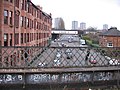
 Remnants of Shipbuilding on the Clyde - geograph.org.uk - 59339.jpg 640 × 480; 74 КБ
-
 Residential street, Scotstoun - geograph.org.uk - 3435993.jpg 4608 × 3456; 6,03 МБ
-
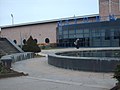
 Scotstoun Leisure Centre - geograph.org.uk - 740877.jpg 640 × 480; 48 КБ
-
 Scotstoun MOT Centre - geograph.org.uk - 47599.jpg 640 × 480; 135 КБ
-
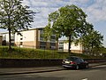
 Scotstoun Primary School - geograph.org.uk - 5279339.jpg 1600 × 1079; 346 КБ
-
 Scotstoun Primary School - geograph.org.uk - 5279582.jpg 1150 × 1600; 520 КБ
-
 Scotstoun shipyard sheds - geograph.org.uk - 5765598.jpg 640 × 480; 137 КБ
-
 Scotstoun swans, The River Clyde - geograph.org.uk - 820251.jpg 480 × 640; 62 КБ
-
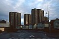
 Scotstoun towerblocks - geograph.org.uk - 5765671.jpg 640 × 480; 117 КБ
-
 Scotstoun West railway station (site), Glasgow (geograph 6070271).jpg 1600 × 1200; 881 КБ
-
-
 Scotstounhill - Kingsway, looking east - geograph.org.uk - 4172332.jpg 2048 × 1536; 1,96 МБ
-
 Scotstounhill - Kingsway, looking west - geograph.org.uk - 4172326.jpg 2048 × 1536; 1,51 МБ
-
 Scotstounhill - Queen Victoria Drive, looking north - geograph.org.uk - 4172352.jpg 2048 × 1536; 1,58 МБ
-
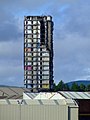
 Scotstounhill Tower Blocks (geograph 2367403).jpg 3648 × 2262; 4,69 МБ
-
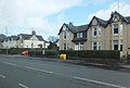
 Scotstounhill, Dumbarton Road (geograph 6369979).jpg 800 × 533; 257 КБ
-
 Shops at the bottom of Kingsway - geograph.org.uk - 904030.jpg 640 × 480; 138 КБ
-
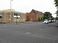
 St. Thomas Aquinas Secondary School - geograph.org.uk - 521185.jpg 640 × 480; 115 КБ
-
 The River Clyde at Renfrew (geograph 6125173).jpg 1024 × 640; 292 КБ
-
 The upper Clyde from the air - geograph.org.uk - 3716019.jpg 640 × 394; 136 КБ
-
 Tower Block UK photo glw2-51 (Kingsway Scotstoun 1982).jpg 2594 × 1731; 819 КБ
-
 Tower Blocks - geograph.org.uk - 382219.jpg 480 × 640; 58 КБ
-
 Tug Tioga B at King George V Dock - geograph.org.uk - 5765547.jpg 640 × 406; 154 КБ
-
 Water Feature at Scotstoun - geograph.org.uk - 740880.jpg 640 × 480; 46 КБ
-
 Wykeham Road - geograph.org.uk - 5293831.jpg 2816 × 2112; 1,17 МБ
-
 Yoker railway depot from the air (geograph 6125180).jpg 768 × 1024; 467 КБ
.jpg)

.jpg)


.jpg)


.jpg)


.jpg)


.jpg)

.jpg)


,_Glasgow_(geograph_6070271).jpg)


.jpg)
.jpg)


.jpg)

.jpg)


.jpg)