Category:Sheet, Hampshire
Jump to navigation
Jump to search
village and civil parish in Hampshire, UK  | |||||
| Upload media | |||||
| Instance of | |||||
|---|---|---|---|---|---|
| Location | East Hampshire, Hampshire, South East England, England | ||||
 | |||||
English: Sheet is a village in the East Hampshire district of Hampshire, England. It is northeast of Petersfield, just off the A3 road.
Subcategories
This category has the following 4 subcategories, out of 4 total.
Media in category "Sheet, Hampshire"
The following 82 files are in this category, out of 82 total.
-

-
 A hedge as partial bridge - geograph.org.uk - 696158.jpg 480 × 640; 54 KB
-
 A new name on the incumbency board - geograph.org.uk - 6243220.jpg 640 × 435; 77 KB
-
 A272 - geograph.org.uk - 5219135.jpg 640 × 349; 33 KB
-
 A272, Sheet - geograph.org.uk - 5219134.jpg 640 × 369; 47 KB
-
 A3 spur, Petersfield - geograph.org.uk - 5219132.jpg 640 × 400; 43 KB
-
 An eclectic line up to say the least - geograph.org.uk - 1346959.jpg 640 × 480; 67 KB
-
 Arch made by a tall hedge - geograph.org.uk - 695939.jpg 480 × 640; 57 KB
-
 Bridge over railway and road at Sheet - geograph.org.uk - 6220521.jpg 1,600 × 1,144; 725 KB
-
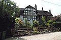
 Broadland Cottages, Sheet - geograph.org.uk - 3758350.jpg 640 × 480; 102 KB
-
 Broadland Cottages, Town Lane - geograph.org.uk - 6140435.jpg 640 × 480; 84 KB
-
 Broadlands just off Ramshill - geograph.org.uk - 1346939.jpg 640 × 480; 111 KB
-
 Circular seat on the village green - geograph.org.uk - 6140439.jpg 640 × 480; 133 KB
-
 Cottages, Mill Lane, Sheet - geograph.org.uk - 3759601.jpg 640 × 480; 162 KB
-
 Durford Bridge - geograph.org.uk - 10750.jpg 640 × 426; 115 KB
-

-
 Farmland near Lord's Farm - geograph.org.uk - 2629965.jpg 640 × 430; 49 KB
-
 Hazelbank Close - geograph.org.uk - 695934.jpg 640 × 480; 77 KB
-

-
 House on London Road, Sheet - geograph.org.uk - 5881514.jpg 1,920 × 1,280; 1.29 MB
-
 Junction of A272 and B2070 - geograph.org.uk - 349.jpg 640 × 480; 73 KB
-
 Junction of Inmans Lane and London Road - geograph.org.uk - 2542282.jpg 1,600 × 1,200; 503 KB
-

-
 Junction of Shear Hill and Ramshill - geograph.org.uk - 1346940.jpg 640 × 480; 87 KB
-
 Lockyer Court, Inmans Lane - geograph.org.uk - 6140434.jpg 640 × 480; 85 KB
-

-

-

-

-
 Looking northwards in Pulens Lane - geograph.org.uk - 6147830.jpg 640 × 480; 91 KB
-
 Looking south-southwest along Town Lane - geograph.org.uk - 6140436.jpg 640 × 480; 119 KB
-
 Love Lane - geograph.org.uk - 695945.jpg 640 × 480; 67 KB
-
 Love Lane in the February sunshine - geograph.org.uk - 696169.jpg 640 × 480; 112 KB
-

-
 Memorial to a village priest - geograph.org.uk - 6140443.jpg 640 × 480; 76 KB
-
 Merryfield Road - geograph.org.uk - 695989.jpg 640 × 480; 68 KB
-
 Nursery school in Inmans Lane - geograph.org.uk - 6140468.jpg 480 × 640; 66 KB
-
 Old Mill Cottages, Sheet.jpg 4,608 × 3,072; 4.51 MB
-
 Paint spattered road sign at Ramshill - geograph.org.uk - 1346949.jpg 480 × 640; 104 KB
-
 Pavement in Farnham Road - geograph.org.uk - 6140464.jpg 482 × 640; 91 KB
-
 Petersfield , London Road A272 - geograph.org.uk - 5739035.jpg 6,000 × 4,000; 6.97 MB
-
 Petersfield , Pulens Lane B2199 - geograph.org.uk - 5739106.jpg 6,000 × 4,000; 5.89 MB
-
 Petersfield bypass - geograph.org.uk - 357284.jpg 640 × 477; 78 KB
-

-
 Postbox in School Lane - geograph.org.uk - 1330188.jpg 640 × 480; 111 KB
-

-
 Pub sign for The Half Moon, Sheet - geograph.org.uk - 3246054.jpg 1,861 × 1,856; 3.72 MB
-
 River Rother - geograph.org.uk - 2393.jpg 480 × 640; 94 KB
-
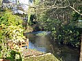 River Rother, Sheet - geograph.org.uk - 3758360.jpg 640 × 480; 202 KB
-
 Roundabout at Ramshill - geograph.org.uk - 1346964.jpg 640 × 480; 68 KB
-
 School Lane level crossing, Sheet - geograph.org.uk - 357275.jpg 640 × 477; 98 KB
-
 Shear Hill in the spring sunshine - geograph.org.uk - 6147823.jpg 640 × 480; 101 KB
-
 Sheet , London Road A272 - geograph.org.uk - 5739057.jpg 6,000 × 4,000; 5.64 MB
-
 Sheet , London Road A272 - geograph.org.uk - 5739108.jpg 6,000 × 4,000; 5.85 MB
-
 Sheet , The A272 - geograph.org.uk - 5739189.jpg 6,000 × 4,000; 7.65 MB
-
 Sheet Parish Church, early May 2019 - geograph.org.uk - 6140418.jpg 480 × 640; 90 KB
-

-
 Sheet Village Green - geograph.org.uk - 348.jpg 640 × 480; 108 KB
-
 Sheet Village Hall - geograph.org.uk - 1195189.jpg 480 × 640; 83 KB
-

-
 The corner of Parsonage Close and Inmans Lane - geograph.org.uk - 2542289.jpg 1,600 × 1,200; 592 KB
-
 The Half Moon, Sheet - geograph.org.uk - 4341805.jpg 3,872 × 2,592; 4.42 MB
-
 The Queens Head, Sheet - geograph.org.uk - 6140438.jpg 640 × 480; 58 KB
-
 Village green, Sheet - geograph.org.uk - 1624947.jpg 640 × 480; 168 KB
-
 Village hall in Village Street - geograph.org.uk - 6140440.jpg 640 × 480; 91 KB
-

-

-
 Weather vane, Sheet - geograph.org.uk - 1624928.jpg 482 × 640; 77 KB
-
 Clare Gardens - geograph.org.uk - 755787.jpg 640 × 480; 66 KB
-
 Entrance to Durleighmarsh Farm - geograph.org.uk - 10751.jpg 640 × 426; 81 KB
-
 Farmland and Birch Copse. - geograph.org.uk - 8579.jpg 640 × 426; 65 KB
-

-
 Footpath from Quebec to Goose Green - geograph.org.uk - 8578.jpg 640 × 426; 74 KB
-
 Footpath to Penns Lane - geograph.org.uk - 755755.jpg 640 × 480; 117 KB
-

-
 Quarry Entrance on West Heath Common - geograph.org.uk - 10747.jpg 640 × 426; 101 KB
-
 Rival Lodge - geograph.org.uk - 10748.jpg 640 × 426; 77 KB
-
 Road Junction and house near "Quebec" - geograph.org.uk - 8576.jpg 640 × 426; 43 KB
-
 Ryefield Cottages - geograph.org.uk - 10746.jpg 640 × 426; 96 KB
-
 Ryefield, Durford, West Sussex - geograph.org.uk - 58180.jpg 640 × 480; 89 KB
-
 Trees on field boundary, Westmark Farm - geograph.org.uk - 97469.jpg 640 × 480; 72 KB
-


_-_geograph.org.uk_-_4341821.jpg)


_-_geograph.org.uk_-_4970664.jpg)
_-_geograph.org.uk_-_4970670.jpg)


