Category:Shelton and Hardwick
Jump to navigation
Jump to search
English: Shelton and Hardwick is a civil parish in South Norfolk, England made up of the villages of Shelton and Hardwick. It lies about 3 km southeast of Long Stratton, about 6 km north of Harleston and 10 km west of Bungay. It covers an area of and had a population of 283 in 107 households as of the 2001 census.
civil parish in South Norfolk, England, UK  | |||||
| Upload media | |||||
| Instance of |
| ||||
|---|---|---|---|---|---|
| Location | South Norfolk, Norfolk, East of England, England | ||||
| Area |
| ||||
 | |||||
Subcategories
This category has the following 3 subcategories, out of 3 total.
H
S
Media in category "Shelton and Hardwick"
The following 200 files are in this category, out of 303 total.
(previous page) (next page)-

-

-
 Access road to Manor Farm, Shelton Green - geograph.org.uk - 3476820.jpg 640 × 438; 238 KB
-
 Ah, there she is^ - geograph.org.uk - 555775.jpg 640 × 465; 102 KB
-
 Alburgh Road sign - geograph.org.uk - 4185482.jpg 3,072 × 2,304; 1.99 MB
-
 Alburgh Road, Shelton Green - geograph.org.uk - 4185480.jpg 3,072 × 2,304; 1.82 MB
-
 Alert rabbit in field bordering footpath - geograph.org.uk - 3475235.jpg 480 × 640; 252 KB
-
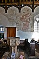
 Altar ^ Stained Glass Window of St.Mary's Church - geograph.org.uk - 4185628.jpg 2,251 × 3,004; 1.14 MB
-
 Anson's Lane junction with Wood Lane - geograph.org.uk - 4354957.jpg 1,024 × 768; 241 KB
-
 Anson's Lane sign - geograph.org.uk - 4269639.jpg 3,072 × 2,304; 2.67 MB
-
 Approaching junction with Mill Lane - geograph.org.uk - 2149608.jpg 640 × 478; 108 KB
-

-

-
 Autumnal trees beside Hardwick Road - geograph.org.uk - 2149603.jpg 640 × 480; 150 KB
-
 Autumnal trees beside Mill Lane - geograph.org.uk - 2149616.jpg 640 × 480; 121 KB
-
 Bend in river - geograph.org.uk - 5204840.jpg 1,024 × 768; 237 KB
-

-
 Bridge over stream in cattle pasture - geograph.org.uk - 3475247.jpg 640 × 480; 251 KB
-
 Bridge over stream in cattle pasture - geograph.org.uk - 3475248.jpg 640 × 480; 253 KB
-
 Burntoak Lane (track) - geograph.org.uk - 5166513.jpg 640 × 480; 74 KB
-
 Buttercups in water meadows, Fritton - geograph.org.uk - 3476809.jpg 640 × 428; 176 KB
-
 Cattle pasture by Shelton Green - geograph.org.uk - 3475246.jpg 640 × 419; 183 KB
-
 Chapel Lane sign - geograph.org.uk - 4186390.jpg 2,948 × 2,214; 1.79 MB
-
 Chapel Lane, Hardwick - geograph.org.uk - 4186386.jpg 3,072 × 2,231; 1.64 MB
-
 Chapel Lane, Hardwick - geograph.org.uk - 4186392.jpg 2,039 × 2,609; 1.57 MB
-
 Close up, Elizabeth II postbox on The Street, Hardwick - geograph.org.uk - 5170006.jpg 1,082 × 2,213; 431 KB
-
 Colourful field margin beside Port Lane - geograph.org.uk - 4043983.jpg 640 × 480; 239 KB
-
 Common Road sign - geograph.org.uk - 4186173.jpg 2,948 × 2,214; 1.85 MB
-
 Common Road, Hardwick - geograph.org.uk - 4186181.jpg 3,072 × 2,304; 1.64 MB
-
 Common Road, Hardwick - geograph.org.uk - 4186339.jpg 3,072 × 2,304; 1.74 MB
-
 Common Road, Shelton - geograph.org.uk - 4186171.jpg 3,072 × 2,304; 1.91 MB
-
 Common Road, Shelton - geograph.org.uk - 4354977.jpg 1,024 × 768; 229 KB
-

-
 Cottage in Shelton Green - geograph.org.uk - 3476830.jpg 640 × 436; 217 KB
-
 Country lane through Shelton Green - geograph.org.uk - 3476839.jpg 640 × 469; 265 KB
-
 Covered Well - geograph.org.uk - 2170255.jpg 1,600 × 1,200; 568 KB
-
 Crop field off Port Road - geograph.org.uk - 5166539.jpg 640 × 480; 97 KB
-
 Crop fields beside Burntoak Lane - geograph.org.uk - 4043894.jpg 640 × 480; 194 KB
-
 Cultivated field south of Boom Lane - geograph.org.uk - 2154146.jpg 640 × 566; 183 KB
-
 Dawn over set-aside, spot the deer^ - geograph.org.uk - 555773.jpg 640 × 470; 87 KB
-

-

-
 Dry Ford - geograph.org.uk - 2171204.jpg 1,600 × 1,200; 773 KB
-

-
 Entering Hardwick on Common Road - geograph.org.uk - 4186179.jpg 3,072 × 2,304; 1.69 MB
-
 Entrance Gate of St.Mary's Church - geograph.org.uk - 4185644.jpg 3,072 × 2,304; 1.87 MB
-
 Entrance to Shelton Hall - geograph.org.uk - 4354981.jpg 1,024 × 768; 607 KB
-
 Farm buildings, Grange Farm - geograph.org.uk - 5166546.jpg 640 × 480; 60 KB
-
 Farm entrance at Shelton Common - geograph.org.uk - 2154122.jpg 640 × 447; 96 KB
-
 Farm track to Shelton Green - geograph.org.uk - 3475237.jpg 640 × 437; 291 KB
-

-
 Farmland near Prospect Farm - geograph.org.uk - 5166531.jpg 640 × 480; 60 KB
-
 Field beside Port Lane - geograph.org.uk - 4043982.jpg 640 × 480; 253 KB
-
 Field beside the path to Steppings Lane - geograph.org.uk - 3475241.jpg 640 × 480; 210 KB
-
 Field boundary ditch, Fritton - geograph.org.uk - 3476791.jpg 640 × 480; 280 KB
-
 Field boundary hedge beside Mill Lane - geograph.org.uk - 2149635.jpg 640 × 603; 217 KB
-
 Field Edge And Footpath - geograph.org.uk - 5204876.jpg 767 × 1,024; 301 KB
-
 Field, Shelton Common - geograph.org.uk - 5166524.jpg 640 × 480; 61 KB
-
 Fields beside Mill Lane - geograph.org.uk - 4043980.jpg 640 × 480; 200 KB
-
 Fields by Grange Farm - geograph.org.uk - 4043905.jpg 640 × 480; 149 KB
-
 Fields by Harris Green Farm - geograph.org.uk - 4043978.jpg 640 × 480; 204 KB
-
 Fields by Sundial Farm - geograph.org.uk - 4043966.jpg 640 × 480; 137 KB
-
 Fields on Shelton Common - geograph.org.uk - 4043931.jpg 640 × 480; 167 KB
-
 Fingerpost on Shelton Common - geograph.org.uk - 4043912.jpg 640 × 444; 174 KB
-
 Flat field, Hardwick - geograph.org.uk - 5166550.jpg 640 × 480; 55 KB
-
 Font of St.Mary's Church - geograph.org.uk - 4185540.jpg 2,304 × 3,072; 1.19 MB
-
 Font ^ Bell Tower of St.Mary's Church - geograph.org.uk - 4185633.jpg 2,233 × 2,980; 1.07 MB
-
 Footpath by Miller's Close, Fritton - geograph.org.uk - 3476782.jpg 640 × 480; 282 KB
-
 Footpath through wheat crop field - geograph.org.uk - 4043919.jpg 640 × 480; 147 KB
-
 Footpath to Fritton Common - geograph.org.uk - 3476811.jpg 480 × 640; 249 KB
-
 Footpath to Primrose Farm - geograph.org.uk - 4043928.jpg 640 × 480; 218 KB
-
 Footpath to Shelton Green - geograph.org.uk - 3476789.jpg 640 × 433; 229 KB
-
 Ford at Shelton, thankfully dry - geograph.org.uk - 4354974.jpg 1,024 × 768; 640 KB
-
 Fritton Hill sign - geograph.org.uk - 4185510.jpg 3,072 × 2,304; 1.88 MB
-
 Gated track into cattle pasture - geograph.org.uk - 3475243.jpg 640 × 443; 231 KB
-
 Give Way - geograph.org.uk - 2170242.jpg 1,600 × 1,200; 617 KB
-
 Grange Farm - geograph.org.uk - 5166542.jpg 640 × 429; 57 KB
-
 Hall Lane sign - geograph.org.uk - 4185686.jpg 3,030 × 2,276; 2.26 MB
-
 Hall Lane sign - geograph.org.uk - 4268702.jpg 3,072 × 2,304; 3.1 MB
-
 Hall Lane, Hardwick - geograph.org.uk - 4268785.jpg 3,072 × 2,304; 2.38 MB
-
 Hall Lane, Shelton - geograph.org.uk - 4185681.jpg 2,930 × 1,955; 869 KB
-
 Hardwick Road, Hardwick - geograph.org.uk - 4186415.jpg 3,072 × 2,190; 1.44 MB
-
 Hardwick Road, Hardwick - geograph.org.uk - 4186419.jpg 3,072 × 2,304; 1.82 MB
-
 Hardwick Village Hall - geograph.org.uk - 2170257.jpg 1,600 × 1,200; 410 KB
-
 Hardwick Village Hall - geograph.org.uk - 4268719.jpg 3,072 × 2,304; 1.97 MB
-
 Hardwick Village Hall - geograph.org.uk - 4268758.jpg 3,030 × 2,276; 2.07 MB
-
 Hardwick Village Hall - geograph.org.uk - 4268794.jpg 3,072 × 2,304; 1.95 MB
-
 Hardwick Village Name sign on Common Road - geograph.org.uk - 4186180.jpg 2,182 × 2,922; 1.28 MB
-
 Hardwick village sign (detail) - geograph.org.uk - 4541483.jpg 745 × 745; 161 KB
-
 Hardwick Village Sign - geograph.org.uk - 2170252.jpg 1,200 × 1,600; 227 KB
-
 Hardwick Village sign - geograph.org.uk - 4268775.jpg 2,270 × 3,030; 2.27 MB
-
 Hardwick Village sign - geograph.org.uk - 4268777.jpg 2,279 × 3,042; 1.26 MB
-
 Hardwick village sign and well - geograph.org.uk - 4541478.jpg 986 × 740; 266 KB
-
 Hardwick, Junction of Ansons Lane and Mill Lane - geograph.org.uk - 6040723.jpg 6,128 × 4,085; 5.16 MB
-
 Hardwick, St. Margaret's Church - geograph.org.uk - 6039514.jpg 5,928 × 3,952; 4.87 MB
-
 Hardwick, St. Margaret's Church - geograph.org.uk - 6039518.jpg 4,475 × 2,984; 3.1 MB
-
 Hardwick, St. Margaret's Church, Altar rails - geograph.org.uk - 6039541.jpg 5,518 × 3,678; 3.67 MB
-
 Hardwick, St. Margaret's Church, Eastern aspect - geograph.org.uk - 6039521.jpg 6,741 × 4,494; 6.48 MB
-
 Hardwick, St. Margaret's Church, Part of the churchyard - geograph.org.uk - 6039563.jpg 5,373 × 3,582; 6.94 MB
-
 Hardwick, St. Margaret's Church, Piscina - geograph.org.uk - 6039543.jpg 6,503 × 4,336; 4.11 MB
-

-
 Hardwick, St. Margaret's Church, South entrance doorway - geograph.org.uk - 6039528.jpg 7,265 × 4,843; 6.5 MB
-

-

-

-
 Hardwick, St. Margaret's Church, South porch - geograph.org.uk - 6039525.jpg 3,425 × 5,138; 4.55 MB
-

-

-

-

-
 Hardwick, St. Margaret's Church, The font - geograph.org.uk - 6039551.jpg 7,639 × 5,092; 5.64 MB
-
 Hardwick, St. Margaret's Church, The font - geograph.org.uk - 6039552.jpg 6,520 × 4,346; 5.51 MB
-
-
 Hardwick, St. Margaret's Church, The nave - geograph.org.uk - 6039536.jpg 6,705 × 4,470; 3.87 MB
-
 Hardwick, St. Margaret's Church, The nave - geograph.org.uk - 6039556.jpg 5,638 × 3,759; 3.02 MB
-
 Hardwick, St. Margaret's Church, The screen (detail) 1 - geograph.org.uk - 6039539.jpg 6,982 × 4,654; 5.51 MB
-
 Hardwick, St. Margaret's Church, The screen (detail) 2 - geograph.org.uk - 6039546.jpg 6,489 × 4,325; 5.33 MB
-

-
 Hardwick, St. Margaret's Church, The screen - geograph.org.uk - 6039537.jpg 5,093 × 3,395; 2.91 MB
-

-
 Hardwick, St. Margaret's Church, Western aspect - geograph.org.uk - 6039523.jpg 6,579 × 4,386; 5.69 MB
-
 Hardwick, Where Hall Lane meets The Street - geograph.org.uk - 6039568.jpg 5,763 × 3,842; 3.78 MB
-
 Harris Green - geograph.org.uk - 5166537.jpg 640 × 480; 94 KB
-
 Harris Green Farm - geograph.org.uk - 6004686.jpg 5,845 × 3,897; 4.31 MB
-

-
 Heading north west on Room Lane - geograph.org.uk - 5166528.jpg 640 × 480; 108 KB
-
 High grass on field margin - geograph.org.uk - 4043971.jpg 640 × 480; 242 KB
-
 Inside of St.Mary's Church - geograph.org.uk - 4185546.jpg 2,304 × 3,072; 1.04 MB
-
 Intruders remains will be prosecuted ^ - geograph.org.uk - 4354983.jpg 1,024 × 768; 367 KB
-
 Lane to North Green - geograph.org.uk - 2149638.jpg 640 × 480; 142 KB
-
 Large puddle in field - geograph.org.uk - 2154154.jpg 640 × 480; 155 KB
-
 Looking Out - geograph.org.uk - 2171195.jpg 1,200 × 1,600; 368 KB
-
 Low Road sign - geograph.org.uk - 4185488.jpg 2,911 × 2,187; 2.02 MB
-
 Low Road sign - geograph.org.uk - 4185690.jpg 3,072 × 2,304; 3.19 MB
-
 Low Road sign - geograph.org.uk - 4269702.jpg 3,072 × 2,304; 2.76 MB
-
 Low Road, Shelton - geograph.org.uk - 4185491.jpg 3,072 × 2,304; 1.86 MB
-
 Low Road, Shelton - geograph.org.uk - 4185520.jpg 3,072 × 2,223; 1.03 MB
-
 Low Road, Shelton - geograph.org.uk - 4185654.jpg 3,072 × 2,304; 1.81 MB
-
 Low Road, Shelton - geograph.org.uk - 4185670.jpg 3,072 × 2,304; 1.85 MB
-
 Low Road, Shelton - geograph.org.uk - 4185672.jpg 3,072 × 2,304; 1.79 MB
-
 Low Road, Shelton - geograph.org.uk - 4185675.jpg 2,948 × 2,214; 855 KB
-
 Low Road, Shelton - geograph.org.uk - 4185697.jpg 3,072 × 2,304; 1.8 MB
-

-
 Mill Lane - geograph.org.uk - 5166553.jpg 640 × 480; 102 KB
-
 Mill Lane sign - geograph.org.uk - 4268403.jpg 3,072 × 2,304; 3.16 MB
-
 Mill Lane sign - geograph.org.uk - 4268686.jpg 3,072 × 2,304; 1.78 MB
-
 Mill Lane sign - geograph.org.uk - 4269644.jpg 3,072 × 2,304; 3.72 MB
-
 Mill Lane, Hardwick - geograph.org.uk - 4268405.jpg 3,072 × 2,304; 2.38 MB
-
 Mill Lane, Hardwick - geograph.org.uk - 4268663.jpg 3,072 × 2,304; 3.14 MB
-
 Mill Lane, Hardwick - geograph.org.uk - 4268793.jpg 3,072 × 2,304; 1.98 MB
-
 Mill Lane, Hardwick - geograph.org.uk - 4339845.jpg 640 × 480; 150 KB
-
 Mill Lane, Hardwick - geograph.org.uk - 4339847.jpg 640 × 460; 150 KB
-
 Mill Road sign - geograph.org.uk - 4268675.jpg 3,072 × 2,304; 2.35 MB
-
 Mill Road ^ Hardwick Village sign - geograph.org.uk - 4268780.jpg 3,072 × 2,304; 2.7 MB
-
 Mill Road, Hardwick - geograph.org.uk - 4268671.jpg 3,072 × 2,304; 3.75 MB
-
 Mill Road, Hardwick - geograph.org.uk - 4268694.jpg 3,072 × 2,164; 2.08 MB
-
 Mill Road, Hardwick - geograph.org.uk - 4268789.jpg 3,072 × 2,168; 2.28 MB
-
 Minor road at Harris Green - geograph.org.uk - 4043976.jpg 640 × 480; 234 KB
-
 Minor road junction on Mill Lane - geograph.org.uk - 5166555.jpg 640 × 480; 73 KB
-
 Minor road through Shelton Common - geograph.org.uk - 4043909.jpg 640 × 480; 134 KB
-

-
 North Green Road, Hardwick - geograph.org.uk - 4268391.jpg 3,072 × 2,304; 1.38 MB
-
 North Green Road, North Green - geograph.org.uk - 4261727.jpg 2,983 × 2,241; 2.89 MB
-
 Oilseed rape field, Fritton - geograph.org.uk - 3476787.jpg 640 × 431; 279 KB
-
 Old concrete track off Room Lane - geograph.org.uk - 4043901.jpg 640 × 480; 231 KB
-
 Overgrown pillbox at Fritton Common - geograph.org.uk - 3476777.jpg 640 × 480; 219 KB
-
 Overgrown pillbox at Fritton Common - geograph.org.uk - 3476779.jpg 640 × 480; 231 KB
-
 Path along a field's edge - geograph.org.uk - 3475230.jpg 640 × 427; 230 KB
-
 Path through wheat crop field - geograph.org.uk - 4043969.jpg 640 × 480; 136 KB
-
 Plank bridge on footpath to Shelton - geograph.org.uk - 4043917.jpg 640 × 480; 271 KB
-

-
 Pond on a field's edge - geograph.org.uk - 3475238.jpg 640 × 480; 227 KB
-
 Port Road - geograph.org.uk - 5166541.jpg 640 × 480; 56 KB
-
 Port Road sign - geograph.org.uk - 4186404.jpg 2,914 × 2,189; 1.88 MB
-
 Port Road, Grange Farm - geograph.org.uk - 5166545.jpg 640 × 480; 98 KB
-
 Port Road, Hardwick - geograph.org.uk - 4186400.jpg 3,072 × 2,179; 776 KB
-
 Primrose Lane junction - geograph.org.uk - 4354984.jpg 1,024 × 768; 475 KB
-
 Primrose Lane sign - geograph.org.uk - 4185478.jpg 3,011 × 2,262; 1.89 MB
-
 Primrose Lane, Shelton Green - geograph.org.uk - 3476850.jpg 640 × 408; 222 KB
-
 Primrose Lane,Shelton Green - geograph.org.uk - 4185474.jpg 3,072 × 2,304; 1.84 MB
-
 Prospect Farm on Shelton Common - geograph.org.uk - 4043908.jpg 640 × 480; 164 KB
-
 Pulpit ^ Lectern of St.Mary's Church - geograph.org.uk - 4185619.jpg 2,304 × 3,072; 1,009 KB
-

-

-
 Ripening wheat by Grange Farm - geograph.org.uk - 4043906.jpg 640 × 480; 188 KB
-
 Ripening wheat on Shelton Common - geograph.org.uk - 4043923.jpg 640 × 480; 216 KB
-
 Road Junction - geograph.org.uk - 2171214.jpg 1,600 × 1,200; 608 KB
-
 Road junction to Harris Green Farm - geograph.org.uk - 4339859.jpg 640 × 480; 120 KB
-
 Road to Harris Green Farm - geograph.org.uk - 4339862.jpg 640 × 480; 115 KB
-
 Roadsign on Anson's Lane - geograph.org.uk - 4269650.jpg 2,206 × 2,944; 1.84 MB
-
 Roadsign on Low Road - geograph.org.uk - 4185518.jpg 2,304 × 3,072; 1.78 MB
-
 Roadsign on Low Road - geograph.org.uk - 4185694.jpg 2,304 × 3,072; 1.84 MB
-
 Roadsign on Mill Lane - geograph.org.uk - 4268681.jpg 2,046 × 2,675; 3.35 MB
-
 Roadsign on Room Lane - geograph.org.uk - 4185465.jpg 2,888 × 2,169; 2.04 MB
-
 Room Lane - geograph.org.uk - 5166518.jpg 640 × 480; 113 KB
-
 Room Lane - geograph.org.uk - 5166526.jpg 640 × 480; 87 KB
-
 Room Lane sign - geograph.org.uk - 4185457.jpg 2,948 × 2,214; 2.9 MB
-
 Room Lane ^ Hard Standing - geograph.org.uk - 4185162.jpg 2,872 × 2,157; 1.14 MB
-
 Room Lane, Shelton - geograph.org.uk - 4339951.jpg 640 × 480; 177 KB
-
 Room Lane, Shelton - geograph.org.uk - 4339955.jpg 640 × 480; 203 KB


_-_geograph.org.uk_-_5166513.jpg)


_-_geograph.org.uk_-_4541483.jpg)


_1_-_geograph.org.uk_-_6039539.jpg)
_2_-_geograph.org.uk_-_6039546.jpg)
_3_-_geograph.org.uk_-_6039547.jpg)


