Category:Sheringham
Vai alla navigazione
Vai alla ricerca
seaside town in Norfolk, England .JPG) | |||||
| Carica un file multimediale | |||||
| Istanza di | |||||
|---|---|---|---|---|---|
| Luogo | North Norfolk, Norfolk, Est dell'Inghilterra, Inghilterra | ||||
| Situato sul mare / lago / fiume | |||||
| Superficie |
| ||||
 | |||||
Sottocategorie
Questa categoria contiene le 20 sottocategorie indicate di seguito, su un totale di 20.
?
A
C
- Commerce in Sheringham (empty)
E
- Equipment in Sheringham (1 F)
F
- Food of Sheringham (6 F)
G
H
M
N
O
P
S
- Sheringham skylines (21 F)
T
Pagine nella categoria "Sheringham"
Questa categoria contiene un'unica pagina, indicata di seguito.
File nella categoria "Sheringham"
Questa categoria contiene 200 file, indicati di seguito, su un totale di 533.
(pagina precedente) (pagina successiva)-

-
 "Welcome to Sheringham" - geograph.org.uk - 5383341.jpg 640 × 480; 78 KB
-
 Annie L. Pressland Poppyland Sheringham Norfolk J Salmon postcard.jpg 1 064 × 761; 1,06 MB
-
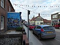
 1940's weekend, Church Street - geograph.org.uk - 5540348.jpg 3 456 × 4 608; 4,49 MB
-
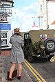
 1940's weekend, High Street - geograph.org.uk - 5540349.jpg 4 000 × 3 000; 2,71 MB
-
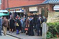
 1940's weekend, High Street - geograph.org.uk - 5540368.jpg 2 501 × 3 335; 2,72 MB
-
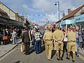
 1940's weekend, High Street - geograph.org.uk - 5540369.jpg 3 456 × 4 608; 5,15 MB
-
 1940's weekend, High Street - geograph.org.uk - 5540370.jpg 3 456 × 5 184; 6,05 MB
-
 1940's weekend, High Street - geograph.org.uk - 5540373.jpg 3 418 × 2 564; 2,67 MB
-
 1940's weekend, High Street - geograph.org.uk - 5540410.jpg 5 184 × 3 456; 6,03 MB
-
 1940's weekend, New Road - geograph.org.uk - 5540416.jpg 5 184 × 3 456; 5,58 MB
-
 1940's weekend, Roy's Boy's Café - geograph.org.uk - 5540376.jpg 4 152 × 3 114; 4,01 MB
-
 1940's weekend, Sheringham Railway Station - geograph.org.uk - 5540419.jpg 5 184 × 3 456; 6,16 MB
-
 1940's weekend, Sheringham Railway Station - geograph.org.uk - 5540420.jpg 5 184 × 3 456; 4,89 MB
-
 1940's weekend, Sheringham Railway Station - geograph.org.uk - 5540422.jpg 5 184 × 3 456; 7,93 MB
-
 1940's weekend, Sheringham Railway Station - geograph.org.uk - 5540424.jpg 4 000 × 3 000; 2,96 MB
-
 1940's weekend, Station Road - geograph.org.uk - 5540378.jpg 4 000 × 3 000; 3,4 MB
-
 1940's weekend, Station Road - geograph.org.uk - 5540406.jpg 4 000 × 3 000; 2,99 MB
-
 1940's weekend, Station Road - geograph.org.uk - 5540409.jpg 4 000 × 3 000; 3,09 MB
-
 1940's weekend, Station Road - geograph.org.uk - 5540412.jpg 4 000 × 3 000; 3,45 MB
-
 1940's weekend, Station Road - geograph.org.uk - 5540413.jpg 4 000 × 3 000; 3,48 MB
-
 1940's weekend, Station Road - geograph.org.uk - 5540415.jpg 5 184 × 3 456; 5,39 MB
-
 1940's weekend, Station Road - geograph.org.uk - 5540433.jpg 4 000 × 3 000; 3,57 MB
-
 1940's weekend, Station Road - geograph.org.uk - 5540434.jpg 4 000 × 3 000; 3,38 MB
-
 1940's weekend, The Chocolate Box - geograph.org.uk - 5540428.jpg 5 184 × 3 456; 5,51 MB
-
 1940's weekend, The Lobster - geograph.org.uk - 5540350.jpg 4 000 × 3 000; 2,65 MB
-
 1940's weekend, The Lobster - geograph.org.uk - 5540362.jpg 3 280 × 2 460; 2,28 MB
-
 1940's weekend, The Lobster - geograph.org.uk - 5540365.jpg 4 000 × 3 000; 2,79 MB
-
 3 and 5, Holway Road, Sheringham - geograph.org.uk - 6222957.jpg 3 854 × 2 890; 3,5 MB
-
 90775 on the North Norfolk Railway - geograph.org.uk - 5543276.jpg 800 × 520; 118 KB
-
 90775 on the North Norfolk Railway - geograph.org.uk - 5628995.jpg 800 × 598; 105 KB
-
 A bracing walk on The Promenade - geograph.org.uk - 5383367.jpg 640 × 480; 50 KB
-
 A149 Cromer Road, Sheringham - geograph.org.uk - 5877558.jpg 1 024 × 684; 207 KB
-
 A149 Weybourne Road near Sheringham - geograph.org.uk - 5620299.jpg 800 × 554; 99 KB
-
 Abbey Road - geograph.org.uk - 5540497.jpg 5 184 × 3 456; 7,65 MB
-
 Age UK in Station Road - geograph.org.uk - 5383319.jpg 480 × 640; 70 KB
-
 Allotments west of Sheringham, north of the cemetery - geograph.org.uk - 6097428.jpg 3 264 × 2 448; 1,67 MB
-
 Along Cromer Road in Sheringham - geograph.org.uk - 6248803.jpg 3 264 × 2 448; 4,83 MB
-

-
 An empty fountain - geograph.org.uk - 4909025.jpg 1 600 × 1 200; 751 KB
-
-
 Approaching Otterdorf Green - geograph.org.uk - 5383222.jpg 640 × 480; 70 KB
-

-
 Arch on the West Promenade in Sheringham - geograph.org.uk - 5483728.jpg 4 608 × 3 456; 5,86 MB
-

-
 Arnolds Keys in Station Road - geograph.org.uk - 5383355.jpg 480 × 640; 62 KB
-
 Augusta Street - geograph.org.uk - 5382439.jpg 640 × 480; 50 KB
-
 Auto-Loco, Station Road Sheringham - geograph.org.uk - 5383353.jpg 480 × 640; 73 KB
-
 B ^ B in St Peter's Road - geograph.org.uk - 5382517.jpg 480 × 640; 63 KB
-
 Baffling remains below Beeston Bump - geograph.org.uk - 5555809.jpg 1 600 × 1 200; 401 KB
-
 Balloon stopper and ribbon, Sheringham beach - geograph.org.uk - 5311785.jpg 1 600 × 1 200; 976 KB
-
 Barclays, High Street Sheringham - geograph.org.uk - 5381644.jpg 480 × 640; 66 KB
-
 Barford Road, Sheringham - geograph.org.uk - 4953409.jpg 640 × 480; 65 KB
-
 Beach and caravans toward Cromer - geograph.org.uk - 5927740.jpg 4 608 × 3 456; 3,44 MB
-
 Beach huts along the East Promenade Sheringham - geograph.org.uk - 5929646.jpg 4 608 × 3 456; 3,4 MB
-
 Beach Huts on Sheringham East Promenade - geograph.org.uk - 4608735.jpg 640 × 481; 393 KB
-

-
 Beach near Sheringham - geograph.org.uk - 4984162.jpg 1 600 × 1 200; 726 KB
-
 Beach towards Sheringham - geograph.org.uk - 5365128.jpg 1 600 × 1 200; 345 KB
-
 Beach west of Sheringham - geograph.org.uk - 4616364.jpg 1 600 × 900; 352 KB
-
 Beach west of Sheringham - geograph.org.uk - 4616375.jpg 1 067 × 1 600; 446 KB
-
 Beach, Sheringham - geograph.org.uk - 5879450.jpg 1 024 × 768; 185 KB
-
 Beach, Sheringham - geograph.org.uk - 5879452.jpg 1 024 × 768; 180 KB
-
 Beach, Sheringham - geograph.org.uk - 5879477.jpg 1 024 × 768; 196 KB
-
 Beach, Sheringham - geograph.org.uk - 5879610.jpg 1 024 × 768; 237 KB
-
 Beeston Bump by Sheringham - geograph.org.uk - 5311966.jpg 1 600 × 1 200; 755 KB
-
 Beeston Bump, Sheringham - geograph.org.uk - 5081914.jpg 5 184 × 3 456; 4,56 MB
-
 Beeston Regis Common - geograph.org.uk - 5311822.jpg 1 600 × 1 200; 720 KB
-
 Beeston Regis Common - geograph.org.uk - 5311923.jpg 1 600 × 1 200; 646 KB
-
 Beeston Regis putting green - geograph.org.uk - 4809969.jpg 1 600 × 1 200; 713 KB
-
 Beeston Road, Sheringham - geograph.org.uk - 4953408.jpg 640 × 480; 67 KB
-
 Beeston Road, Sheringham - geograph.org.uk - 4953412.jpg 640 × 480; 60 KB
-
 Benches by the lookout station - geograph.org.uk - 4909106.jpg 1 600 × 1 200; 918 KB
-
 Bend in Weybourne Road (A149) - geograph.org.uk - 5559488.jpg 640 × 480; 52 KB
-
 Bertram A Watts Bookseller - geograph.org.uk - 5365142.jpg 1 600 × 1 323; 228 KB
-

-
 Bike racks at Sheringham - geograph.org.uk - 5157365.jpg 1 600 × 1 433; 685 KB
-
 Black Bikes, Sheringham - geograph.org.uk - 5388527.jpg 1 600 × 1 200; 294 KB
-
 Blue fountain and pool, The Lees, Sheringham - geograph.org.uk - 5879582.jpg 1 024 × 768; 291 KB
-
 Boardwalk on Beeston Regis Common - geograph.org.uk - 5311815.jpg 1 600 × 1 200; 953 KB
-
 Boats at Sheringham - geograph.org.uk - 5012942.jpg 1 600 × 1 200; 826 KB
-
 Boats at Sheringham slipway - geograph.org.uk - 5540474.jpg 4 000 × 3 000; 3,25 MB
-
 Boats on The Promenade - geograph.org.uk - 5383369.jpg 640 × 480; 64 KB
-
 Boats on the seafront, Sheringham - geograph.org.uk - 4953395.jpg 640 × 480; 56 KB
-
 Bookies in Station Road - geograph.org.uk - 5383343.jpg 480 × 640; 63 KB
-
 Bookies in the High Street - geograph.org.uk - 5381653.jpg 480 × 640; 68 KB
-
 Bookshop in St Peter's Road - geograph.org.uk - 5382507.jpg 480 × 640; 79 KB
-

-
 Break, Station Road Sheringham - geograph.org.uk - 5383354.jpg 480 × 640; 59 KB
-

-
 Building at junction of High Street ^ Promenade - geograph.org.uk - 5540441.jpg 4 000 × 3 000; 2,67 MB
-
 Building Work at Sheringham.jpg 3 264 × 2 448; 2,99 MB
-
 Cantina Adelita - geograph.org.uk - 4850898.jpg 1 600 × 1 370; 348 KB
-
 Carousel, High Street Sheringham - geograph.org.uk - 5381452.jpg 640 × 480; 81 KB
-
 Cedar Grove, Sheringham - geograph.org.uk - 5311933.jpg 1 600 × 1 200; 499 KB
-
 Chai-Yo, High Street Sheringham - geograph.org.uk - 5381491.jpg 640 × 480; 93 KB
-
 Chalk base to the cliff - geograph.org.uk - 5365105.jpg 1 200 × 1 600; 560 KB
-
 Chalk base to the cliff - geograph.org.uk - 5365115.jpg 1 600 × 1 181; 393 KB
-
 Chalk outcrop - geograph.org.uk - 4909042.jpg 1 600 × 1 200; 656 KB
-
 Chalk stump on the beach - geograph.org.uk - 5574322.jpg 4 000 × 3 000; 5,82 MB
-
 Charity shop in Station Road - geograph.org.uk - 5383285.jpg 480 × 640; 66 KB
-
 Chinacraft in Station Road - geograph.org.uk - 5383324.jpg 480 × 640; 64 KB
-
 Chippie in Church Street - geograph.org.uk - 5382472.jpg 640 × 480; 79 KB
-
 Church Hall, Cromer Road - geograph.org.uk - 4871334.jpg 1 600 × 1 200; 291 KB
-
 Churchill Crescent, Sheringham - geograph.org.uk - 4871123.jpg 1 600 × 1 158; 358 KB
-
 Clares, Station Road Sheringham - geograph.org.uk - 5383273.jpg 480 × 640; 69 KB
-
 Cliff fall below Beeston Bump - geograph.org.uk - 5555828.jpg 1 600 × 1 200; 420 KB
-
 Cliff Road - geograph.org.uk - 5540463.jpg 5 184 × 3 456; 6,22 MB
-
 Cliff top along the North Sea coast - geograph.org.uk - 5629129.jpg 800 × 521; 113 KB
-
 Clock in the High Street - geograph.org.uk - 5381655.jpg 640 × 480; 79 KB
-
 Clock tower, Sheringham - geograph.org.uk - 6194156.jpg 1 024 × 768; 191 KB
-
 Close to the station - geograph.org.uk - 6229435.jpg 1 711 × 1 203; 348 KB
-
 Club House, Sheringham Golf Club - geograph.org.uk - 4608832.jpg 640 × 480; 409 KB
-
 Co-Operative Street - geograph.org.uk - 5381473.jpg 480 × 640; 50 KB
-
 Coast below Beeston Bump - geograph.org.uk - 6247175.jpg 1 600 × 1 067; 392 KB
-
 Coastal defences at Sheringham - geograph.org.uk - 5628511.jpg 800 × 600; 126 KB
-
 Coastal defences below Beeston Bump - geograph.org.uk - 5555807.jpg 1 600 × 1 200; 432 KB
-
 Coastal defences, Sheringham - geograph.org.uk - 5555822.jpg 1 600 × 1 200; 336 KB
-
 Coastal defences, Sheringham - geograph.org.uk - 5555829.jpg 1 600 × 1 200; 385 KB
-

-
 Coasthopper bus by Sheringham Station - geograph.org.uk - 4850865.jpg 1 600 × 1 212; 313 KB
-
 Coffee House Café - geograph.org.uk - 5383225.jpg 480 × 640; 58 KB
-
 Coffee shop and shelter, Sheringham - geograph.org.uk - 5879326.jpg 1 024 × 684; 222 KB
-
 Converting the Burlington Hotel - geograph.org.uk - 6247189.jpg 1 229 × 1 600; 309 KB
-

-
 Creativity, High Street - geograph.org.uk - 5540488.jpg 4 000 × 3 000; 2,84 MB
-
 Creativity, High Street Sheringham - geograph.org.uk - 5381454.jpg 480 × 640; 64 KB
-
 Cromer Road (A149) - geograph.org.uk - 4953420.jpg 640 × 480; 58 KB
-
 Cromer Road, Sheringham - geograph.org.uk - 4608792.jpg 640 × 481; 461 KB
-
 Cromer Road, Sheringham - geograph.org.uk - 5882118.jpg 1 024 × 684; 218 KB
-
 David Barber painting the Neolithic Mural - geograph.org.uk - 5311753.jpg 1 600 × 1 200; 561 KB
-
 Dawn Fresh, Station Road Sheringham - geograph.org.uk - 5383284.jpg 480 × 640; 74 KB
-
 Decorated houses, Lifeboat Plain, Sheringham - geograph.org.uk - 5879459.jpg 1 024 × 684; 180 KB
-
 Deserted promenade Sheringham - geograph.org.uk - 4767388.jpg 1 000 × 656; 530 KB
-

-

-

-

-
 Empty house, Sheringham - geograph.org.uk - 4871370.jpg 1 600 × 1 200; 543 KB
-
 End of the sea wall - geograph.org.uk - 5931135.jpg 1 600 × 1 170; 241 KB
-
 Enjoying the beach at Sheringham - geograph.org.uk - 5311775.jpg 1 600 × 1 200; 635 KB
-
 Enjoying the sea at Sheringham - geograph.org.uk - 4850861.jpg 1 600 × 1 116; 329 KB
-
 Evening squalls at Sheringham - geograph.org.uk - 5515136.jpg 1 600 × 1 200; 231 KB
-
 Exit from the cemetery onto Weybourne Road, A149 - geograph.org.uk - 6097426.jpg 3 264 × 2 214; 1,74 MB
-
 Fan of sand and shingle - geograph.org.uk - 5931126.jpg 1 600 × 1 200; 301 KB
-

-
 Fast Lane, Station Road, Sheringham - geograph.org.uk - 5383236.jpg 480 × 640; 76 KB
-
 Fellas, Station Road Sheringham - geograph.org.uk - 5383309.jpg 480 × 640; 68 KB
-
 Fenced off building by Cromer Road - geograph.org.uk - 4871169.jpg 1 600 × 1 200; 364 KB
-
 First groyne at Sheringham - geograph.org.uk - 5364941.jpg 1 600 × 1 200; 394 KB
-
 Fishing boats on the slipway - geograph.org.uk - 4671835.jpg 1 600 × 1 067; 284 KB
-
 Florists in Church Street - geograph.org.uk - 5382484.jpg 640 × 480; 87 KB
-

-
-
 Football pitch, Sheringham - geograph.org.uk - 5311969.jpg 1 600 × 1 200; 499 KB
-
 Footpath to the coast east of Sheringham - geograph.org.uk - 5927730.jpg 4 608 × 3 456; 4,75 MB
-
 Former allotments - geograph.org.uk - 4909113.jpg 1 600 × 1 200; 996 KB
-
 Former allotments - geograph.org.uk - 4909117.jpg 1 600 × 1 200; 822 KB
-
 Former co-op, Sheringham - geograph.org.uk - 4850880.jpg 1 600 × 1 200; 397 KB
-
 Former police station, Sheringham - geograph.org.uk - 4850839.jpg 1 600 × 1 200; 424 KB
-
 Fudgetastic, High Street Sheringham - geograph.org.uk - 5381494.jpg 640 × 480; 66 KB
-
 Funky Mackerel cafe moved - geograph.org.uk - 6194682.jpg 1 600 × 1 067; 298 KB
-
 Gardens and shelters by The Esplanade - geograph.org.uk - 5515122.jpg 1 600 × 1 116; 194 KB
-
 Goss Cottage Antiques - geograph.org.uk - 4850874.jpg 1 600 × 1 207; 298 KB
-
 Goss Cottage Antiques closed - geograph.org.uk - 5987914.jpg 1 600 × 1 250; 236 KB
-
 Groyne at Sheringham - geograph.org.uk - 6247158.jpg 1 600 × 1 067; 468 KB
-
 Groyne below Beeston Bump - geograph.org.uk - 6247181.jpg 1 600 × 1 067; 346 KB
-
 Groyne on the beach at Sheringham - geograph.org.uk - 5628533.jpg 800 × 600; 149 KB
-
 Groynes at Sheringham - geograph.org.uk - 6247193.jpg 1 600 × 1 067; 388 KB
-
 Gun Street - geograph.org.uk - 5540483.jpg 3 456 × 5 184; 4,93 MB
-
 Hairdressers in Station Road - geograph.org.uk - 5383317.jpg 480 × 640; 73 KB
-
 Hairport, Station Road Sheringham - geograph.org.uk - 5383247.jpg 640 × 480; 103 KB
-
 Harveys, Station Road Sheringham - geograph.org.uk - 5383352.jpg 640 × 480; 76 KB
-
 Hastings, High Street Sheringham - geograph.org.uk - 5381637.jpg 480 × 640; 69 KB
-
 Heirloom, High Street Sheringham - geograph.org.uk - 5381437.jpg 640 × 480; 85 KB
-
 Henries garage, Sheringham - geograph.org.uk - 4850835.jpg 1 600 × 1 200; 459 KB
-
 High Street shops and bank, Sheringham - geograph.org.uk - 5879335.jpg 1 024 × 684; 217 KB
-
 High tide, Sheringham - geograph.org.uk - 4953389.jpg 640 × 480; 60 KB
-
 High tide, Sheringham - geograph.org.uk - 4953403.jpg 640 × 480; 71 KB
-

-
 Holway Road, Sheringham - geograph.org.uk - 4943882.jpg 640 × 480; 65 KB
-
 Hooray henrys - geograph.org.uk - 4871366.jpg 1 600 × 1 200; 467 KB
-
 Houses and cars on New Street, Sheringham - geograph.org.uk - 6248834.jpg 3 264 × 2 448; 4,83 MB
-
 Houses and flats, Holway Road, Sheringham - geograph.org.uk - 5877549.jpg 1 024 × 684; 233 KB
-
 Houses on Beeston Road - geograph.org.uk - 5449915.jpg 640 × 422; 72 KB
-
 Houses on Beeston Road, Sheringham - geograph.org.uk - 4953406.jpg 640 × 480; 88 KB
-
 Houses on Cromer Road (A149) - geograph.org.uk - 4953422.jpg 640 × 480; 65 KB
-
 Houses on Holway Road, Sheringham - geograph.org.uk - 4943879.jpg 640 × 480; 68 KB
-
 Houses on St Peters Road, Sheringham - geograph.org.uk - 5879631.jpg 1 024 × 768; 258 KB
-
 Houses on Station Road, Sheringham - geograph.org.uk - 4792399.jpg 1 920 × 1 280; 555 KB
-

-
 Identity, Station Road Sheringham - geograph.org.uk - 5383348.jpg 480 × 640; 61 KB
-
 Information board below Beeston Bump - geograph.org.uk - 5929629.jpg 3 456 × 4 608; 3,75 MB
-
 Inn sign, The Two Lifeboats, Sheringham - geograph.org.uk - 5879403.jpg 1 024 × 1 024; 267 KB
-
 IRB Station at Sheringham - geograph.org.uk - 4608754.jpg 640 × 480; 397 KB
-
 Ironmongers in Station Road - geograph.org.uk - 5383320.jpg 640 × 480; 89 KB
-

-

-

-
 Joyful West's Shellfish Bar, Sheringham - geograph.org.uk - 4608719.jpg 640 × 480; 422 KB


_-_geograph.org.uk_-_5559488.jpg)


_-_geograph.org.uk_-_4953420.jpg)


_-_geograph.org.uk_-_4953422.jpg)


,_Sheringham_-_geograph.org.uk_-_5559497.jpg)


