Category:Sheringham
Jump to navigation
Jump to search
seaside town in Norfolk, England .JPG) | |||||
| Upload media | |||||
| Instance of | |||||
|---|---|---|---|---|---|
| Location | North Norfolk, Norfolk, East of England, England | ||||
| Located in or next to body of water | |||||
| Area |
| ||||
 | |||||
Subcategories
This category has the following 20 subcategories, out of 20 total.
?
A
C
- Commerce in Sheringham (empty)
E
- Equipment in Sheringham (1 F)
F
- Food of Sheringham (6 F)
G
H
M
N
O
P
S
- Sheringham skylines (21 F)
T
Media in category "Sheringham"
The following 200 files are in this category, out of 536 total.
(previous page) (next page)-

-
 "Welcome to Sheringham" - geograph.org.uk - 5383341.jpg 640 × 480; 78 KB
-
 Annie L. Pressland Poppyland Sheringham Norfolk J Salmon postcard.jpg 1,064 × 761; 1.06 MB
-
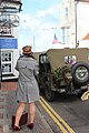
 1940's weekend, Church Street - geograph.org.uk - 5540348.jpg 3,456 × 4,608; 4.49 MB
-
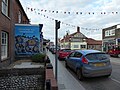
 1940's weekend, High Street - geograph.org.uk - 5540349.jpg 4,000 × 3,000; 2.71 MB
-
 1940's weekend, High Street - geograph.org.uk - 5540368.jpg 2,501 × 3,335; 2.72 MB
-
 1940's weekend, High Street - geograph.org.uk - 5540369.jpg 3,456 × 4,608; 5.15 MB
-
 1940's weekend, High Street - geograph.org.uk - 5540370.jpg 3,456 × 5,184; 6.05 MB
-
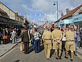
 1940's weekend, High Street - geograph.org.uk - 5540373.jpg 3,418 × 2,564; 2.67 MB
-
 1940's weekend, High Street - geograph.org.uk - 5540410.jpg 5,184 × 3,456; 6.03 MB
-
 1940's weekend, New Road - geograph.org.uk - 5540416.jpg 5,184 × 3,456; 5.58 MB
-
 1940's weekend, Roy's Boy's Café - geograph.org.uk - 5540376.jpg 4,152 × 3,114; 4.01 MB
-
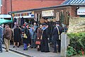
 1940's weekend, Sheringham Railway Station - geograph.org.uk - 5540419.jpg 5,184 × 3,456; 6.16 MB
-
 1940's weekend, Sheringham Railway Station - geograph.org.uk - 5540420.jpg 5,184 × 3,456; 4.89 MB
-
 1940's weekend, Sheringham Railway Station - geograph.org.uk - 5540422.jpg 5,184 × 3,456; 7.93 MB
-
 1940's weekend, Sheringham Railway Station - geograph.org.uk - 5540424.jpg 4,000 × 3,000; 2.96 MB
-
 1940's weekend, Station Road - geograph.org.uk - 5540378.jpg 4,000 × 3,000; 3.4 MB
-
 1940's weekend, Station Road - geograph.org.uk - 5540406.jpg 4,000 × 3,000; 2.99 MB
-
 1940's weekend, Station Road - geograph.org.uk - 5540409.jpg 4,000 × 3,000; 3.09 MB
-
 1940's weekend, Station Road - geograph.org.uk - 5540412.jpg 4,000 × 3,000; 3.45 MB
-
 1940's weekend, Station Road - geograph.org.uk - 5540413.jpg 4,000 × 3,000; 3.48 MB
-
 1940's weekend, Station Road - geograph.org.uk - 5540415.jpg 5,184 × 3,456; 5.39 MB
-
 1940's weekend, Station Road - geograph.org.uk - 5540433.jpg 4,000 × 3,000; 3.57 MB
-
 1940's weekend, Station Road - geograph.org.uk - 5540434.jpg 4,000 × 3,000; 3.38 MB
-
 1940's weekend, The Chocolate Box - geograph.org.uk - 5540428.jpg 5,184 × 3,456; 5.51 MB
-
 1940's weekend, The Lobster - geograph.org.uk - 5540350.jpg 4,000 × 3,000; 2.65 MB
-
 1940's weekend, The Lobster - geograph.org.uk - 5540362.jpg 3,280 × 2,460; 2.28 MB
-
 1940's weekend, The Lobster - geograph.org.uk - 5540365.jpg 4,000 × 3,000; 2.79 MB
-
 3 and 5, Holway Road, Sheringham - geograph.org.uk - 6222957.jpg 3,854 × 2,890; 3.5 MB
-
 90775 on the North Norfolk Railway - geograph.org.uk - 5543276.jpg 800 × 520; 118 KB
-
 90775 on the North Norfolk Railway - geograph.org.uk - 5628995.jpg 800 × 598; 105 KB
-
 A bracing walk on The Promenade - geograph.org.uk - 5383367.jpg 640 × 480; 50 KB
-
 A149 Cromer Road, Sheringham - geograph.org.uk - 5877558.jpg 1,024 × 684; 207 KB
-
 A149 Weybourne Road near Sheringham - geograph.org.uk - 5620299.jpg 800 × 554; 99 KB
-
 Abbey Road - geograph.org.uk - 5540497.jpg 5,184 × 3,456; 7.65 MB
-
 Age UK in Station Road - geograph.org.uk - 5383319.jpg 480 × 640; 70 KB
-
 Allotments west of Sheringham, north of the cemetery - geograph.org.uk - 6097428.jpg 3,264 × 2,448; 1.67 MB
-
 Along Cromer Road in Sheringham - geograph.org.uk - 6248803.jpg 3,264 × 2,448; 4.83 MB
-

-
 An empty fountain - geograph.org.uk - 4909025.jpg 1,600 × 1,200; 751 KB
-
-
 Approaching Otterdorf Green - geograph.org.uk - 5383222.jpg 640 × 480; 70 KB
-

-
 Arch on the West Promenade in Sheringham - geograph.org.uk - 5483728.jpg 4,608 × 3,456; 5.86 MB
-

-
 Arnolds Keys in Station Road - geograph.org.uk - 5383355.jpg 480 × 640; 62 KB
-
 Augusta Street - geograph.org.uk - 5382439.jpg 640 × 480; 50 KB
-
 Auto-Loco, Station Road Sheringham - geograph.org.uk - 5383353.jpg 480 × 640; 73 KB
-
 B ^ B in St Peter's Road - geograph.org.uk - 5382517.jpg 480 × 640; 63 KB
-
 Baffling remains below Beeston Bump - geograph.org.uk - 5555809.jpg 1,600 × 1,200; 401 KB
-
 Balloon stopper and ribbon, Sheringham beach - geograph.org.uk - 5311785.jpg 1,600 × 1,200; 976 KB
-
 Barclays, High Street Sheringham - geograph.org.uk - 5381644.jpg 480 × 640; 66 KB
-
 Barford Road, Sheringham - geograph.org.uk - 4953409.jpg 640 × 480; 65 KB
-
 Beach and caravans toward Cromer - geograph.org.uk - 5927740.jpg 4,608 × 3,456; 3.44 MB
-
 Beach huts along the East Promenade Sheringham - geograph.org.uk - 5929646.jpg 4,608 × 3,456; 3.4 MB
-
 Beach Huts on Sheringham East Promenade - geograph.org.uk - 4608735.jpg 640 × 481; 393 KB
-

-
 Beach near Sheringham - geograph.org.uk - 4984162.jpg 1,600 × 1,200; 726 KB
-
 Beach towards Sheringham - geograph.org.uk - 5365128.jpg 1,600 × 1,200; 345 KB
-
 Beach west of Sheringham - geograph.org.uk - 4616364.jpg 1,600 × 900; 352 KB
-
 Beach west of Sheringham - geograph.org.uk - 4616375.jpg 1,067 × 1,600; 446 KB
-
 Beach, Sheringham - geograph.org.uk - 5879450.jpg 1,024 × 768; 185 KB
-
 Beach, Sheringham - geograph.org.uk - 5879452.jpg 1,024 × 768; 180 KB
-
 Beach, Sheringham - geograph.org.uk - 5879477.jpg 1,024 × 768; 196 KB
-
 Beach, Sheringham - geograph.org.uk - 5879610.jpg 1,024 × 768; 237 KB
-
 Beeston Bump by Sheringham - geograph.org.uk - 5311966.jpg 1,600 × 1,200; 755 KB
-
 Beeston Bump, Sheringham - geograph.org.uk - 5081914.jpg 5,184 × 3,456; 4.56 MB
-
 Beeston Regis Common - geograph.org.uk - 5311822.jpg 1,600 × 1,200; 720 KB
-
 Beeston Regis Common - geograph.org.uk - 5311923.jpg 1,600 × 1,200; 646 KB
-
 Beeston Regis putting green - geograph.org.uk - 4809969.jpg 1,600 × 1,200; 713 KB
-
 Beeston Road, Sheringham - geograph.org.uk - 4953408.jpg 640 × 480; 67 KB
-
 Beeston Road, Sheringham - geograph.org.uk - 4953412.jpg 640 × 480; 60 KB
-
 Benches by the lookout station - geograph.org.uk - 4909106.jpg 1,600 × 1,200; 918 KB
-
 Bend in Weybourne Road (A149) - geograph.org.uk - 5559488.jpg 640 × 480; 52 KB
-
 Bertram A Watts Bookseller - geograph.org.uk - 5365142.jpg 1,600 × 1,323; 228 KB
-

-
 Bike racks at Sheringham - geograph.org.uk - 5157365.jpg 1,600 × 1,433; 685 KB
-
 Black Bikes, Sheringham - geograph.org.uk - 5388527.jpg 1,600 × 1,200; 294 KB
-
 Blue fountain and pool, The Lees, Sheringham - geograph.org.uk - 5879582.jpg 1,024 × 768; 291 KB
-
 Boardwalk on Beeston Regis Common - geograph.org.uk - 5311815.jpg 1,600 × 1,200; 953 KB
-
 Boats at Sheringham - geograph.org.uk - 5012942.jpg 1,600 × 1,200; 826 KB
-
 Boats at Sheringham slipway - geograph.org.uk - 5540474.jpg 4,000 × 3,000; 3.25 MB
-
 Boats on The Promenade - geograph.org.uk - 5383369.jpg 640 × 480; 64 KB
-
 Boats on the seafront, Sheringham - geograph.org.uk - 4953395.jpg 640 × 480; 56 KB
-
 Bookies in Station Road - geograph.org.uk - 5383343.jpg 480 × 640; 63 KB
-
 Bookies in the High Street - geograph.org.uk - 5381653.jpg 480 × 640; 68 KB
-
 Bookshop in St Peter's Road - geograph.org.uk - 5382507.jpg 480 × 640; 79 KB
-

-
 Break, Station Road Sheringham - geograph.org.uk - 5383354.jpg 480 × 640; 59 KB
-

-
 Building at junction of High Street ^ Promenade - geograph.org.uk - 5540441.jpg 4,000 × 3,000; 2.67 MB
-
 Building Work at Sheringham.jpg 3,264 × 2,448; 2.99 MB
-
 Cantina Adelita - geograph.org.uk - 4850898.jpg 1,600 × 1,370; 348 KB
-
 Carousel, High Street Sheringham - geograph.org.uk - 5381452.jpg 640 × 480; 81 KB
-
 Cedar Grove, Sheringham - geograph.org.uk - 5311933.jpg 1,600 × 1,200; 499 KB
-
 Chai-Yo, High Street Sheringham - geograph.org.uk - 5381491.jpg 640 × 480; 93 KB
-
 Chalk base to the cliff - geograph.org.uk - 5365105.jpg 1,200 × 1,600; 560 KB
-
 Chalk base to the cliff - geograph.org.uk - 5365115.jpg 1,600 × 1,181; 393 KB
-
 Chalk outcrop - geograph.org.uk - 4909042.jpg 1,600 × 1,200; 656 KB
-
 Chalk stump on the beach - geograph.org.uk - 5574322.jpg 4,000 × 3,000; 5.82 MB
-
 Charity shop in Station Road - geograph.org.uk - 5383285.jpg 480 × 640; 66 KB
-
 Chinacraft in Station Road - geograph.org.uk - 5383324.jpg 480 × 640; 64 KB
-
 Chippie in Church Street - geograph.org.uk - 5382472.jpg 640 × 480; 79 KB
-
 Church Hall, Cromer Road - geograph.org.uk - 4871334.jpg 1,600 × 1,200; 291 KB
-
 Churchill Crescent, Sheringham - geograph.org.uk - 4871123.jpg 1,600 × 1,158; 358 KB
-
 Clares, Station Road Sheringham - geograph.org.uk - 5383273.jpg 480 × 640; 69 KB
-
 Cliff fall below Beeston Bump - geograph.org.uk - 5555828.jpg 1,600 × 1,200; 420 KB
-
 Cliff Road - geograph.org.uk - 5540463.jpg 5,184 × 3,456; 6.22 MB
-
 Cliff top along the North Sea coast - geograph.org.uk - 5629129.jpg 800 × 521; 113 KB
-
 Clock in the High Street - geograph.org.uk - 5381655.jpg 640 × 480; 79 KB
-
 Clock tower, Sheringham - geograph.org.uk - 6194156.jpg 1,024 × 768; 191 KB
-
 Close to the station - geograph.org.uk - 6229435.jpg 1,711 × 1,203; 348 KB
-
 Club House, Sheringham Golf Club - geograph.org.uk - 4608832.jpg 640 × 480; 409 KB
-
 Co-Operative Street - geograph.org.uk - 5381473.jpg 480 × 640; 50 KB
-
 Coast below Beeston Bump - geograph.org.uk - 6247175.jpg 1,600 × 1,067; 392 KB
-
 Coastal defences at Sheringham - geograph.org.uk - 5628511.jpg 800 × 600; 126 KB
-
 Coastal defences below Beeston Bump - geograph.org.uk - 5555807.jpg 1,600 × 1,200; 432 KB
-
 Coastal defences, Sheringham - geograph.org.uk - 5555822.jpg 1,600 × 1,200; 336 KB
-
 Coastal defences, Sheringham - geograph.org.uk - 5555829.jpg 1,600 × 1,200; 385 KB
-

-
 Coasthopper bus by Sheringham Station - geograph.org.uk - 4850865.jpg 1,600 × 1,212; 313 KB
-
 Coffee House Café - geograph.org.uk - 5383225.jpg 480 × 640; 58 KB
-
 Coffee shop and shelter, Sheringham - geograph.org.uk - 5879326.jpg 1,024 × 684; 222 KB
-
 Converting the Burlington Hotel - geograph.org.uk - 6247189.jpg 1,229 × 1,600; 309 KB
-

-
 Creativity, High Street - geograph.org.uk - 5540488.jpg 4,000 × 3,000; 2.84 MB
-
 Creativity, High Street Sheringham - geograph.org.uk - 5381454.jpg 480 × 640; 64 KB
-
 Cromer Road (A149) - geograph.org.uk - 4953420.jpg 640 × 480; 58 KB
-
 Cromer Road, Sheringham - geograph.org.uk - 4608792.jpg 640 × 481; 461 KB
-
 Cromer Road, Sheringham - geograph.org.uk - 5882118.jpg 1,024 × 684; 218 KB
-
 David Barber painting the Neolithic Mural - geograph.org.uk - 5311753.jpg 1,600 × 1,200; 561 KB
-
 Dawn Fresh, Station Road Sheringham - geograph.org.uk - 5383284.jpg 480 × 640; 74 KB
-
 Decorated houses, Lifeboat Plain, Sheringham - geograph.org.uk - 5879459.jpg 1,024 × 684; 180 KB
-
 Deserted promenade Sheringham - geograph.org.uk - 4767388.jpg 1,000 × 656; 530 KB
-

-

-

-

-
 Empty house, Sheringham - geograph.org.uk - 4871370.jpg 1,600 × 1,200; 543 KB
-
 End of the sea wall - geograph.org.uk - 5931135.jpg 1,600 × 1,170; 241 KB
-
 Enjoying the beach at Sheringham - geograph.org.uk - 5311775.jpg 1,600 × 1,200; 635 KB
-
 Enjoying the sea at Sheringham - geograph.org.uk - 4850861.jpg 1,600 × 1,116; 329 KB
-
 Evening squalls at Sheringham - geograph.org.uk - 5515136.jpg 1,600 × 1,200; 231 KB
-
 Exit from the cemetery onto Weybourne Road, A149 - geograph.org.uk - 6097426.jpg 3,264 × 2,214; 1.74 MB
-
 Fan of sand and shingle - geograph.org.uk - 5931126.jpg 1,600 × 1,200; 301 KB
-

-
 Fast Lane, Station Road, Sheringham - geograph.org.uk - 5383236.jpg 480 × 640; 76 KB
-
 Fellas, Station Road Sheringham - geograph.org.uk - 5383309.jpg 480 × 640; 68 KB
-
 Fenced off building by Cromer Road - geograph.org.uk - 4871169.jpg 1,600 × 1,200; 364 KB
-
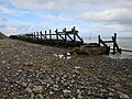
 First groyne at Sheringham - geograph.org.uk - 5364941.jpg 1,600 × 1,200; 394 KB
-
 Fishing boats on the slipway - geograph.org.uk - 4671835.jpg 1,600 × 1,067; 284 KB
-
 Florists in Church Street - geograph.org.uk - 5382484.jpg 640 × 480; 87 KB
-

-
-
 Football pitch, Sheringham - geograph.org.uk - 5311969.jpg 1,600 × 1,200; 499 KB
-
 Footpath to the coast east of Sheringham - geograph.org.uk - 5927730.jpg 4,608 × 3,456; 4.75 MB
-
 Former allotments - geograph.org.uk - 4909113.jpg 1,600 × 1,200; 996 KB
-
 Former allotments - geograph.org.uk - 4909117.jpg 1,600 × 1,200; 822 KB
-
 Former co-op, Sheringham - geograph.org.uk - 4850880.jpg 1,600 × 1,200; 397 KB
-
 Former police station, Sheringham - geograph.org.uk - 4850839.jpg 1,600 × 1,200; 424 KB
-
 Fudgetastic, High Street Sheringham - geograph.org.uk - 5381494.jpg 640 × 480; 66 KB
-
 Funky Mackerel cafe moved - geograph.org.uk - 6194682.jpg 1,600 × 1,067; 298 KB
-
 Gardens and shelters by The Esplanade - geograph.org.uk - 5515122.jpg 1,600 × 1,116; 194 KB
-
 Goss Cottage Antiques - geograph.org.uk - 4850874.jpg 1,600 × 1,207; 298 KB
-
 Goss Cottage Antiques closed - geograph.org.uk - 5987914.jpg 1,600 × 1,250; 236 KB
-
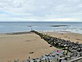
 Groyne at Sheringham - geograph.org.uk - 6247158.jpg 1,600 × 1,067; 468 KB
-
 Groyne below Beeston Bump - geograph.org.uk - 6247181.jpg 1,600 × 1,067; 346 KB
-
 Groyne on the beach at Sheringham - geograph.org.uk - 5628533.jpg 800 × 600; 149 KB
-
 Groynes at Sheringham - geograph.org.uk - 6247193.jpg 1,600 × 1,067; 388 KB
-
 Gun Street - geograph.org.uk - 5540483.jpg 3,456 × 5,184; 4.93 MB
-
 Hairdressers in Station Road - geograph.org.uk - 5383317.jpg 480 × 640; 73 KB
-
 Hairport, Station Road Sheringham - geograph.org.uk - 5383247.jpg 640 × 480; 103 KB
-
 Harveys, Station Road Sheringham - geograph.org.uk - 5383352.jpg 640 × 480; 76 KB
-
 Hastings, High Street Sheringham - geograph.org.uk - 5381637.jpg 480 × 640; 69 KB
-
 Heirloom, High Street Sheringham - geograph.org.uk - 5381437.jpg 640 × 480; 85 KB
-
 Henries garage, Sheringham - geograph.org.uk - 4850835.jpg 1,600 × 1,200; 459 KB
-
 High Street shops and bank, Sheringham - geograph.org.uk - 5879335.jpg 1,024 × 684; 217 KB
-
 High tide, Sheringham - geograph.org.uk - 4953389.jpg 640 × 480; 60 KB
-
 High tide, Sheringham - geograph.org.uk - 4953403.jpg 640 × 480; 71 KB
-

-
 Holway Road, Sheringham - geograph.org.uk - 4943882.jpg 640 × 480; 65 KB
-
 Hooray henrys - geograph.org.uk - 4871366.jpg 1,600 × 1,200; 467 KB
-
 Houses and cars on New Street, Sheringham - geograph.org.uk - 6248834.jpg 3,264 × 2,448; 4.83 MB
-
 Houses and flats, Holway Road, Sheringham - geograph.org.uk - 5877549.jpg 1,024 × 684; 233 KB
-
 Houses on Beeston Road - geograph.org.uk - 5449915.jpg 640 × 422; 72 KB
-
 Houses on Beeston Road, Sheringham - geograph.org.uk - 4953406.jpg 640 × 480; 88 KB
-
 Houses on Cromer Road (A149) - geograph.org.uk - 4953422.jpg 640 × 480; 65 KB
-
 Houses on Holway Road, Sheringham - geograph.org.uk - 4943879.jpg 640 × 480; 68 KB
-
 Houses on St Peters Road, Sheringham - geograph.org.uk - 5879631.jpg 1,024 × 768; 258 KB
-
 Houses on Station Road, Sheringham - geograph.org.uk - 4792399.jpg 1,920 × 1,280; 555 KB
-

-
 Identity, Station Road Sheringham - geograph.org.uk - 5383348.jpg 480 × 640; 61 KB
-
 Information board below Beeston Bump - geograph.org.uk - 5929629.jpg 3,456 × 4,608; 3.75 MB
-
 Inn sign, The Two Lifeboats, Sheringham - geograph.org.uk - 5879403.jpg 1,024 × 1,024; 267 KB
-
 IRB Station at Sheringham - geograph.org.uk - 4608754.jpg 640 × 480; 397 KB
-
 Ironmongers in Station Road - geograph.org.uk - 5383320.jpg 640 × 480; 89 KB
-

-

-

-
 Joyful West's Shellfish Bar, Sheringham - geograph.org.uk - 4608719.jpg 640 × 480; 422 KB


_-_geograph.org.uk_-_5559488.jpg)


_-_geograph.org.uk_-_4953420.jpg)


_-_geograph.org.uk_-_4953422.jpg)


,_Sheringham_-_geograph.org.uk_-_5559497.jpg)


