Category:Shibecha, Hokkaido
Zur Navigation springen
Zur Suche springen

Ort in der Präfektur Hokkaidō, Japan     | |||||
| Medium hochladen | |||||
| Ist ein(e) | |||||
|---|---|---|---|---|---|
| Ort |
| ||||
| Rechtsform |
| ||||
| Datum der Gründung, Erstellung, Entstehung, Erbauung |
| ||||
| Einwohnerzahl |
| ||||
| Fläche |
| ||||
| Ersetzt |
| ||||
| offizielle Website | |||||
 | |||||
Unterkategorien
Es werden 12 von insgesamt 12 Unterkategorien in dieser Kategorie angezeigt:
In Klammern die Anzahl der enthaltenen Kategorien (K), Seiten (S), Dateien (D)
A
- Aurora Onsen (2 D)
G
- Gojikkoku Station (9 D)
I
- Isobunnai Station (10 D)
K
- Kayanuma Station (11 D)
N
- Numahoro Station (3 D)
R
S
T
- Tawa Station (1 D)
- Tōro Station (31 D)
Medien in der Kategorie „Shibecha, Hokkaido“
Folgende 36 Dateien sind in dieser Kategorie, von 36 insgesamt.
-
 202403091412 DSCN8159.jpg 5.184 × 3.888; 4,54 MB
-
 Akan-bus Shibecha information desk.JPG 3.456 × 2.592; 3,83 MB
-
 Emblem of Shibecha, Hokkaido.svg 512 × 488; 2 KB
-
 Flag map of Shibecha.png 2.560 × 1.440; 40 KB
-
 Flag of Shibecha Hokkaido.JPG 329 × 202; 7 KB
-
 Flag of Shibecha, Hokkaido.svg 900 × 600; 245 Bytes
-
 Front of JR Senmo-Main-Line Gojikkoku Station.jpg 4.592 × 2.576; 10,09 MB
-
 Fukuhara Shibecha, Hokkaido pref Japan(6004944559).jpg 4.000 × 3.000; 3,14 MB
-
 Hokkaido pref road 1060 Kottaro.JPG 1.600 × 1.200; 725 KB
-
 Hokkaido Shibecha-town.png 300 × 152; 14 KB
-
 Kottaro situgen 2009.jpg 1.190 × 893; 310 KB
-
 Lake Shirarutoro Aerial photograph.1977.jpg 4.283 × 4.351; 13,89 MB
-
 Lake shirarutoro.jpg 640 × 480; 50 KB
-
 Lake toro.jpg 640 × 480; 49 KB
-
 Population distribution of Shibecha, Hokkaido, Japan.svg 512 × 256; 22 KB
-
 Senmo Line Lake Touro.jpg 3.200 × 2.400; 688 KB
-
 Shibeccha Hokkaido chapter.png 152 × 145; 1 KB
-
 Shibecha Hire No102.jpg 3.648 × 2.736; 2,39 MB
-
 Shibecha in Hokkaido Prefecture Ja.svg 800 × 872; 44 KB
-
 Shibecha in Kushiro Subprefecture.gif 600 × 425; 32 KB
-
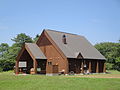
 Shibecha Kyodokan.jpg 4.000 × 3.000; 5 MB
-
 Shibetya town hall.JPG 4.000 × 2.251; 3,59 MB
-
 Toro YH 2011.JPG 2.560 × 1.920; 1,15 MB
-
 Touro rake.jpg 3.648 × 2.736; 1,44 MB
-
 Touroko Eco Meseum Center.jpg 4.000 × 3.000; 4,96 MB
-
 コッタロ湿原展望台 - panoramio.jpg 2.642 × 1.648; 2,16 MB
-
 モセウシ踏切 - panoramio.jpg 2.812 × 1.775; 2,34 MB
-
 中茶安別中学校 - panoramio.jpg 1.600 × 900; 157 KB
-
 基礎自治体位置図 01664.svg 519 × 505; 8 KB
-
 塘路駅前 - panoramio.jpg 2.812 × 1.755; 1,24 MB
-
 標茶ルルランテレビ送信所.jpeg 1.536 × 2.048; 935 KB
-
 標茶交叉点 - panoramio.jpg 3.961 × 2.673; 4,41 MB
-
 道道1060号線 - panoramio - Yobito KAYANUMA (2).jpg 1.600 × 1.068; 329 KB
-
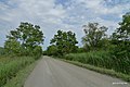
 道道959号線 - panoramio.jpg 1.600 × 1.068; 313 KB
-
 釧路川 - panoramio - Yobito KAYANUMA.jpg 1.600 × 1.068; 260 KB
-
 釧路湿原 - panoramio (1).jpg 1.600 × 1.200; 1,02 MB


.jpg)


.jpg)


.jpg)