Category:Oshamanbe, Hokkaido
Jump to navigation
Jump to search

town in Yamakoshi district, Hokkaido, Japan     | |||||
| Upload media | |||||
| Instance of | |||||
|---|---|---|---|---|---|
| Location | Yamakoshi district, Oshima Subprefecture, Hokkaido, Japan | ||||
| Located in or next to body of water | |||||
| Legal form |
| ||||
| Inception |
| ||||
| Population |
| ||||
| Area |
| ||||
| Replaces |
| ||||
| official website | |||||
 | |||||
Subcategories
This category has the following 12 subcategories, out of 12 total.
A
- Asahihama Station (4 F)
C
- Chayagawa Station (1 F)
F
- Futamata Station (Hokkaido) (7 F)
- Futamata-Radium Onsen (6 F)
K
- Kita-Toyotsu Signal Base (2 F)
- Kunnui Fishing Port (4 F)
- Kunnui Station (13 F)
N
- Nakanosawa Station (13 F)
O
- Oshamambe Station (35 F)
S
- Shizukari Station (6 F)
W
- Warabitai Station (5 F)
Media in category "Oshamanbe, Hokkaido"
The following 42 files are in this category, out of 42 total.
-
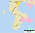
 Oshamanbe in Oshima Subprefecture.gif 600 × 387; 40 KB
-
 Aerial photograph of Kunnui 02.jpg 3,721 × 2,255; 1.83 MB
-
 Aerial photograph of Kunnui.jpg 8,576 × 4,864; 5.09 MB
-
 Emblem of Oshamanbe, Hokkaido (1953–1973).png 257 × 256; 6 KB
-
 Emblem of Oshamanbe, Hokkaido (1953–1973).svg 512 × 510; 3 KB
-
 Emblem of Oshamanbe, Hokkaido.svg 512 × 481; 3 KB
-
 Emblem of Oshimanbe, Hokkaido (1913–1953).png 282 × 277; 6 KB
-
 Emblem of Oshimanbe, Hokkaido (1913–1953).svg 512 × 503; 4 KB
-
 Flag of Oshamanbe Hokkaido.png 388 × 232; 6 KB
-
 Flag of Oshamanbe, Hokkaido (1913–1953).png 424 × 287; 3 KB
-
 Flag of Oshamanbe, Hokkaido (1913–1953).svg 324 × 216; 5 KB
-
 Flag of Oshamanbe, Hokkaido (1953–1973).png 424 × 287; 4 KB
-
 Flag of Oshamanbe, Hokkaido (1953–1973).svg 324 × 216; 4 KB
-
 Flag of Oshamanbe, Hokkaido.svg 324 × 216; 7 KB
-
 Hokkaido Oshamanbe-town.png 300 × 152; 14 KB
-
-
 Iinari Jinja 1.jpg 4,032 × 3,024; 5.73 MB
-
 Iinari Jinja 2.jpg 4,032 × 3,024; 9.72 MB
-
 Oshamambe in Hokkaido Prefecture Ja.svg 800 × 872; 42 KB
-
 Oshamanbe HIgh School.jpg 4,608 × 3,456; 3.7 MB
-
 Oshamanbe Hokkaido chapter.JPG 179 × 168; 15 KB
-
 Oshamanbe IC.JPG 3,648 × 2,052; 2.87 MB
-
 Oshamanbe Post Office.jpg 2,016 × 1,512; 431 KB
-
 Oshamanbe town center area Aerial photograph.1976.jpg 4,551 × 5,732; 20.64 MB
-
 Oshamanbe Town Cultural Center.jpg 4,608 × 3,456; 3.69 MB
-
 Oshamanbe Town Hall.jpg 1,852 × 776; 213 KB
-
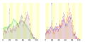 Population distribution of Oshamanbe, Hokkaido, Japan.svg 512 × 256; 22 KB
-
 Shizukari Parking Area - For Hakodate.jpg 1,632 × 1,224; 691 KB
-
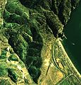 Shizukari Pass and Area Aerial Photograph.JPG 2,985 × 3,103; 5.47 MB
-
 Stone monument of hot spring of OSHAMANBE Hokkaido,JAPAN.jpg 1,024 × 768; 412 KB
-
 Sunset - panoramio - toward.jpg 1,555 × 1,166; 1.06 MB
-
 Uchiura-bay Oshamanbe.jpg 768 × 614; 88 KB
-
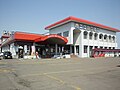
 かにめし本舗かなや かにめし(ドライブインかなや).JPG 4,000 × 3,000; 1.87 MB
-
 かにめし本舗かなや(ドライブインかなや).JPG 4,000 × 3,000; 2.15 MB
-
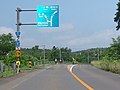
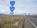 国道230号・国道37号との重複区間を示す標識、奥側に重複路線表示の案内標識・方面及び距離(106-A)(長万部町旭浜、2019年3月撮影).jpg 3,072 × 2,304; 1.32 MB
-
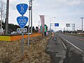 国道230号・国道5号との重複区間を示す標識、奥側に重複路線表示の案内標識・方面及び距離(106-A)(長万部町中の沢、2019年3月撮影).jpg 3,072 × 2,304; 1.07 MB
-
 国道230号・国道5号交点(重複終了点)長万部町国縫(2018年7月撮影).jpg 1,440 × 1,080; 146 KB
-
 基礎自治体位置図 01347.svg 531 × 493; 5 KB
-
 手水場 2 (49955386328).jpg 4,800 × 3,200; 8 MB
-
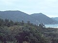 礼文華.jpg 640 × 480; 35 KB
-
 長万部 Oshamambe - panoramio.jpg 1,628 × 1,221; 737 KB
-
 長万部町消防本部全体外観写真.jpg 800 × 600; 62 KB


.png)
.svg)

.png)
.svg)
.png)
.svg)


.jpg)


.png)
.svg)