Category:Shishapangma
Zur Navigation springen
Zur Suche springen
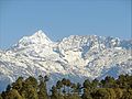
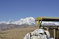
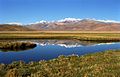
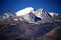
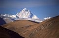
English: Shishapangma is the 14th highest mountain in the world at 8,013 metres (26,289 ft). Located in the Himalayas of Tibet, China.
Berg im Himalaya und mit 8027 m der vierzehnthöchste Berg der Erde  | |||||
| Medium hochladen | |||||
| Ist ein(e) | |||||
|---|---|---|---|---|---|
| Ort | Xigazê, Autonomes Gebiet Tibet, China | ||||
| Schlüsselereignis |
| ||||
| Gebirgszug | |||||
| Schartenhöhe |
| ||||
| Dominanz |
| ||||
| Höhe über dem Meeresspiegel |
| ||||
 | |||||
Medien in der Kategorie „Shishapangma“
Folgende 37 Dateien sind in dieser Kategorie, von 37 insgesamt.
-
 1964-07 1964年 中国登山队攀岩希夏邦马峰.jpg 1.205 × 821; 206 KB
-
 1964-07 1964年 中国登山队登顶希夏邦马峰.jpg 2.146 × 1.517; 520 KB
-
 8,013m Shishapangma 5,126m Tong La Tibet China 西藏 通拉山垭口 希夏邦马峰 - panoramio (1) (3to4).jpg 1.830 × 1.373; 1,74 MB
-

-
 8,013m Shishapangma 5,126m Tong La Tibet China 西藏 通拉山垭口 希夏邦马峰 - panoramio.jpg 2.400 × 1.800; 2,57 MB
-
 8,013m Shishapangma Tibet China 西藏 希夏邦马峰 - panoramio (1).jpg 2.400 × 1.800; 2,27 MB
-
 8,013m Shishapangma Tibet China 西藏 希夏邦马峰 - panoramio (3).jpg 2.400 × 1.800; 2,18 MB
-
 8,013m Shishapangma Tibet China 西藏 希夏邦马峰 - panoramio.jpg 2.400 × 1.800; 2,94 MB
-
 Christian Rottenegger.jpg 1.800 × 1.323; 477 KB
-
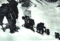
 Climbing on Mt Xixabangma.jpg 2.604 × 3.903; 17,1 MB
-
 Kurt boeck indien nepal 255A.jpg 2.872 × 1.280; 300 KB
-
 Kurt boeck indien nepal 313B.jpg 1.419 × 819; 169 KB
-
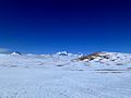
 Labuche Kang (4to3).jpg 614 × 460; 43 KB
-
 Labuche Kang and Shishapangma from Cho Oyu.jpg 2.592 × 1.944; 365 KB
-
 Lafaille.gif 760 × 625; 279 KB
-
 Langtang and Shisapanma.jpg 720 × 498; 48 KB
-
 Langtang Ri (3to4).jpg 362 × 272; 23 KB
-
 Le Gan Chenpo (Himalaya, Népal) (8446635289).jpg 1.365 × 1.024; 1,28 MB
-
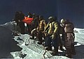
 LH on Xixabangma 1987.jpg 2.243 × 2.867; 2,81 MB
-
 Map China 1-250,000 Tile NH 45-14 Tingri Dzong.jpg 5.000 × 3.802; 4,75 MB
-
 Molamenqing (3to4).jpg 196 × 147; 15 KB
-
 Shisha grimpe.jpg 2.520 × 3.528; 1,84 MB
-
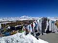
 Shisha longue vue.jpg 3.264 × 2.203; 1,4 MB
-
 SHISHA PANGMA - panoramio.jpg 4.288 × 2.848; 6,04 MB
-
 Shisha Pangma 2006.jpg 800 × 533; 102 KB
-
 SHISHA PANGMA DESDE LA CARRETERA HACIA NEPAL - panoramio.jpg 4.288 × 2.848; 5,76 MB
-
 Shishapangma 2012-6-7.jpg 720 × 480; 101 KB
-
 Shishapangma.jpg 702 × 469; 80 KB
-
 Shishapangma1.jpg 1.100 × 707; 856 KB
-
 Shishapangma2.jpg 1.096 × 715; 826 KB
-
 Shishapangma3.jpg 1.109 × 722; 774 KB
-
 Shishapangma4.jpg 1.333 × 749; 689 KB
-
 Shishapangma5.jpg 1.300 × 791; 995 KB
-
 Shishapangma7.jpg 3.888 × 2.592; 1,92 MB
-
 ShishapangmaandGangBenchen.jpg 3.072 × 2.048; 1,04 MB
-
 Ski Shishapangma.jpg 1.280 × 960; 155 KB
-
 Summit of peak Kyungya Ri (6506m).jpg 3.155 × 2.019; 2,88 MB


_(3to4).jpg)
.jpg)

.jpg)
.jpg)


.jpg)


.jpg)
_(8446635289).jpg)


.jpg)


.jpg)