Category:Sierra Morena
ナビゲーションに移動
検索に移動
Català: La Sierra Morena és una serralada que constitueix el contrafort meridional de la Meseta Central. S'estén 400 km al nord d'Andalusia i en direcció est a oest, de la Sierra de Alcaraz fins a la frontera amb Portugal.
English: The Sierra Morena is one of the main systems of mountain ranges in Spain. It stretches for 450 kilometres from east to west across the south of the Iberian Peninsula, forming the southern border of the Meseta Central plateau and providing the watershed between the valleys of the Guadiana to the north and the west, and the Guadalquivir to the south.
Español: Sierra Morena es una cordillera del sur de España, que separa la Meseta Central de la Depresión Bética. Tiene una longitud de 600 km y se extiende de este a oeste en gran parte de Andalucía, acabando en el océano Atlántico.
|
This is a category about a Special Area of Conservation in Spain with the ID: ES0000090. Natura2000 entry, EEA entry
|
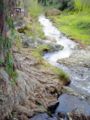
mountain range in Spain  Vista de la Sierra de Andújar que forma parte de Sierra Morena  | |||||
| メディアをアップロード | |||||
| 分類 | |||||
|---|---|---|---|---|---|
| 材料 | |||||
| 位置する保護区 |
| ||||
| 場所 | |||||
| 全幅 |
| ||||
| 全長 |
| ||||
| 最も高い地点 | |||||
| 標高 |
| ||||
 | |||||
下位カテゴリ
このカテゴリに属する 13 個のサブカテゴリのうち、 13 個を表示しています。
A
C
- Castillo de Aroche (2ファイル)
D
N
P
- Sierra del Pedroso (2ファイル)
R
S
- Sierra de Andújar Natural Park (1ページ、43ファイル)
- Sierra de Tentudía (3ファイル)
V
- Venta de Borondo (13ファイル)
カテゴリ「Sierra Morena」にあるメディア
このカテゴリに属する 45 個のファイルのうち、 45 個を表示しています。
-

-

-
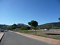
 Aroche, Spain.jpg 800 × 332;94キロバイト
-
 Aroche-P1040763.JPG 2,048 × 1,536;1.42メガバイト
-
 AVE Andalusie 2.jpg 3,600 × 2,400;748キロバイト
-
 AVE Andalusie 3.jpg 2,399 × 3,599;765キロバイト
-
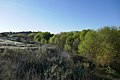 Bosque de ribera en el Rio Guadiato.jpg 1,800 × 1,200;538キロバイト
-
 CAMPOS DE ANDALUCIA EN PRIMAVERA - panoramio.jpg 1,600 × 1,200;459キロバイト
-
 Cerdos en Montanera.jpg 1,280 × 960;596キロバイト
-

-

-
 Don Quijote, Luis Tasso, (1894?) "Abrióle, y lo primero que halló en él..." (5789901964).jpg 2,580 × 3,282;3.77メガバイト
-
 ETH-BIB-Bahnfahrt Sevilla-Madrid, vor Tunnel-Landschaft (Sierra Morena)-Dia 247-15883.tif 3,752 × 2,875;30.97メガバイト
-

-
 Feria sierra pueblo y castillo07 036.jpg 2,591 × 766;124キロバイト
-
 Finca SierraMorena.jpg 1,354 × 899;948キロバイト
-
 Fregenaldesdearriba.jpg 1,846 × 913;472キロバイト
-
 Grabando en el Rio Guadiato.jpg 1,800 × 1,200;587キロバイト
-
 Guadiato.jpg 3,641 × 2,578;5.27メガバイト
-
 Jardín Botanico el Robledo.JPG 2,896 × 1,944;1.65メガバイト
-
 La Carolina, Jaén, Spain - panoramio.jpg 3,648 × 2,736;2.1メガバイト
-
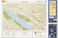
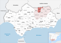
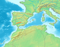 Location Sierra Morena.PNG 472 × 372;125キロバイト
-
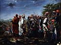
 Madrid - 12-M 2012 demonstration - 194548.jpg 4,335 × 2,890;2.38メガバイト
-
 Madrid - 12-M 2012 demonstration - 194618.jpg 2,981 × 3,975;2.35メガバイト
-
 Miranda-fernando III.JPG 1,416 × 1,050;202キロバイト
-
 Monolitosantuario.jpg 2,848 × 2,144;1.55メガバイト
-
 MTN25-0881c2-2013-Villanueva de Cordoba.jpg 7,445 × 5,210;19.76メガバイト
-
 MTN25-0901c2-2005-Villaharta.jpg 7,764 × 5,179;8.46メガバイト
-
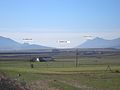
 Paisaje típico de Obejo (Sierra Morena).JPG 6,016 × 4,000;12.49メガバイト
-
 Pass to Sierra Morena. Calatrava La Nueva..jpg 2,288 × 1,712;542キロバイト
-
 Picachocarmona.JPG 3,488 × 2,616;2.18メガバイト
-
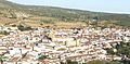
 Pueblo de Feria.jpg 3,648 × 2,736;2.17メガバイト
-
 Romeros cuzando el rio con la chiquinina-1-.jpg 2,048 × 1,536;645キロバイト
-
 Serapias Lingua.jpg 3,456 × 5,184;6.35メガバイト
-
 Sierra de Huelva.JPG 960 × 1,280;544キロバイト
-
 Sierra Morena (Obejo).jpg 800 × 600;78キロバイト
-
 Sierra Morena 2022.png 3,000 × 2,119;1.29メガバイト
-
 Sierra Morena copper engraving, 1790.jpg 188 × 250;16キロバイト
-
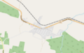 Sierra Morena OSM.png 513 × 325;55キロバイト
-
 SIERRA MORENA, ESPAGNE.png 420 × 313;262キロバイト
-
 SierraMorenaCRealSolanadelPino.jpg 3,648 × 2,736;3.6メガバイト
-
 Silene mariana.JPG 2,272 × 1,704;1.12メガバイト
-
 Valles típicos de Obejo, Sierra Morena.JPG 6,016 × 4,000;2.04メガバイト
-
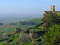
 Via Verde de la Sierra Norte.jpg 4,608 × 3,456;6.29メガバイト
-
 Vista de Feria.jpg 2,736 × 3,648;3.6メガバイト
.jpg)


_%22...Iba_saltando_un_hombre_de_risco_en_risco...%22_(5789347827).jpg)
_%22...Y_guiando_Sancho_sobre_su_asno,_se_entraron_por_una_parte_de_Sierra_Morena%22._(5789901174).jpg)
_%22Abri%C3%B3le,_y_lo_primero_que_hall%C3%B3_en_%C3%A9l...%22_(5789901964).jpg)


.JPG)


.jpg)


カテゴリ:
- Special Areas of Conservation in Spain by ID
- Mountain ranges of Spain
- Mountains of the province of Huelva
- Mountains of the province of Seville
- Mountains of the province of Córdoba, Spain
- Mountain ranges of Andalusia
- Mountains of the province of Jaén
- Mountain ranges of Extremadura
- Mountain ranges of Castile-La Mancha