Category:Singleton, Lancashire
Jump to navigation
Jump to search
English: Singleton is a village and civil parish in Lancashire, England. It is situated on the coastal plain called The Fylde. It is located south-east of Poulton le Fylde, and as of the 2001 census had a population of 877. The parish is sometimes referred to as two parts – Great Singleton is the larger part containing the village, and Little Singleton is a small area north of the village bordering the River Wyre. (→Singleton, Lancashire)
Nederlands: Singleton is een plaats en civil parish in het bestuurlijke gebied Fylde, in het Engelse graafschap Lancashire met 877 inwoners. (→Singleton (Lancashire))
Polski: Singleton – wieś w Anglii, w hrabstwie Lancashire, w dystrykcie Fylde. Leży 63 km na północny zachód od miasta Manchester i 321 km na północny zachód od Londynu. W 2001 miejscowość liczyła 877 mieszkańców. (→Singleton (Lancashire))
village in Lancashire, England  | |||||
| Upload media | |||||
| Instance of | |||||
|---|---|---|---|---|---|
| Location | Fylde, Lancashire, North West England, England | ||||
 | |||||
Subcategories
This category has the following 3 subcategories, out of 3 total.
L
- Little Singleton, Lancashire (4 F)
S
- Shard Bridge (12 F)
Media in category "Singleton, Lancashire"
The following 128 files are in this category, out of 128 total.
-
 A 586, east of Singleton Crossroads - geograph.org.uk - 1860779.jpg 640 × 473; 62 KB
-
 A bend in Lodge Lane - geograph.org.uk - 5876904.jpg 4,589 × 2,439; 6.94 MB
-
 A drilling rig - geograph.org.uk - 5877035.jpg 4,453 × 2,964; 6.65 MB
-
 A rural scene in Singleton Park - geograph.org.uk - 5877021.jpg 4,305 × 2,973; 7.99 MB
-
 A seat in Singleton Park - geograph.org.uk - 5877005.jpg 4,057 × 2,699; 6.36 MB
-
 A585 Mains Lane looking west - geograph.org.uk - 3292502.jpg 640 × 480; 58 KB
-
 A585 near Windy Harbour - geograph.org.uk - 1860785.jpg 640 × 463; 71 KB
-
 A585, looking southeast - geograph.org.uk - 3734380.jpg 4,085 × 2,727; 1.77 MB
-
 A585,Skippool - geograph.org.uk - 2307541.jpg 1,600 × 1,181; 419 KB
-
 Access off Mains Lane, Poulton-le-Fylde - geograph.org.uk - 2557229.jpg 480 × 640; 118 KB
-
 B5260 approaching mini roundabout, Singleton - geograph.org.uk - 2361502.jpg 1,024 × 768; 188 KB
-
 B5266 near Avenham Hall - geograph.org.uk - 2361595.jpg 1,024 × 721; 77 KB
-
 BlackpoolBUA.png 413 × 850; 422 KB
-
 Blue sky over the Wyre - geograph.org.uk - 3751469.jpg 4,608 × 3,456; 5.51 MB
-
 Brakenscales Farm - geograph.org.uk - 5887560.jpg 4,592 × 3,056; 7.74 MB
-
 Carr Lane and gated entrance to Mount Farm - geograph.org.uk - 2374879.jpg 1,600 × 1,200; 459 KB
-
 Cottages, Singleton - geograph.org.uk - 4228693.jpg 640 × 480; 78 KB
-

-
 Entering Singleton - geograph.org.uk - 4228717.jpg 640 × 405; 48 KB
-
 Entrance to Windy Harbour Caravan Park - geograph.org.uk - 1817041.jpg 640 × 426; 324 KB
-
 Farm track leading to Knowle Wood and Long Wood - geograph.org.uk - 5876891.jpg 4,522 × 2,607; 7.57 MB
-
 Farm, Singleton - geograph.org.uk - 4228701.jpg 640 × 480; 53 KB
-
 Farmland near Little Singleton - geograph.org.uk - 109727.jpg 640 × 480; 74 KB
-
 Fields near Game Farm - geograph.org.uk - 5997927.jpg 640 × 427; 315 KB
-
 Fisher's Slack Wood - geograph.org.uk - 5877061.jpg 4,592 × 2,831; 7.96 MB
-
 Game Farm - geograph.org.uk - 5997925.jpg 640 × 427; 305 KB
-
 Garstang New Road (A585) - geograph.org.uk - 4262326.jpg 640 × 480; 71 KB
-
 Garstang New Road - geograph.org.uk - 2744701.jpg 640 × 452; 58 KB
-
 Garstang New Road - geograph.org.uk - 2744704.jpg 640 × 453; 61 KB
-
 Garstang Road (A585T) - geograph.org.uk - 2583152.jpg 640 × 480; 176 KB
-
 Garstang Road (A586) - geograph.org.uk - 4262315.jpg 640 × 480; 61 KB
-
 Garstang Road in Little Paulton - geograph.org.uk - 5666501.jpg 2,700 × 2,025; 602 KB
-
 Garstang Road in Little Singleton - geograph.org.uk - 5666495.jpg 2,700 × 1,986; 572 KB
-
 Glasform - Master glassblowers - geograph.org.uk - 5877679.jpg 4,376 × 2,646; 7.32 MB
-
 Glass sculpture - geograph.org.uk - 3596591.jpg 640 × 631; 191 KB
-
 Glass sculpture 1 (3332252575).jpg 2,352 × 3,537; 4.38 MB
-
 Glass sulpture 1a (3333117090).jpg 2,016 × 3,209; 3.63 MB
-
 Glass sulpture 2a (3332256677).jpg 2,408 × 4,208; 5.58 MB
-
 Glass sulpture 3 (3333100126).jpg 3,168 × 4,752; 10.09 MB
-
 Grazing and Round Wood - geograph.org.uk - 4228720.jpg 640 × 480; 87 KB
-
 Grazing off Shard Road - geograph.org.uk - 3974311.jpg 640 × 480; 94 KB
-
 Grazing off Station Road (B5260) - geograph.org.uk - 4228708.jpg 640 × 480; 49 KB
-
 Grazing off Station Road (B5260) - geograph.org.uk - 4228711.jpg 640 × 480; 56 KB
-
 Grazing Summerer Farm - geograph.org.uk - 4228648.jpg 640 × 480; 52 KB
-
 House on Weeton Road, Singleton - geograph.org.uk - 2361422.jpg 1,024 × 768; 107 KB
-
 Housing estate near Singleton - geograph.org.uk - 1413998.jpg 568 × 640; 102 KB
-
 Lancashire County Council Engineering Services storage depot - geograph.org.uk - 5877720.jpg 4,592 × 2,528; 6.89 MB
-
 Lodge Lane B5260 - geograph.org.uk - 5876868.jpg 4,379 × 2,890; 7.87 MB
-
 Lodge Lane by Singleton Hall - geograph.org.uk - 5666488.jpg 2,700 × 2,025; 455 KB
-
 Lodge Lane heading to Little Singleton - geograph.org.uk - 5666482.jpg 2,700 × 2,025; 635 KB
-
 Lodge Lane heading to Little Singleton - geograph.org.uk - 5666484.jpg 2,700 × 2,025; 377 KB
-
 Main Dyke - geograph.org.uk - 3974307.jpg 640 × 480; 145 KB
-
 Mains Hall, Little Singleton - geograph.org.uk - 109728.jpg 640 × 480; 135 KB
-
 Mains Lane approaching petrol station - geograph.org.uk - 2298113.jpg 1,600 × 1,200; 354 KB
-
 Mains Lane in Skippool - geograph.org.uk - 5952778.jpg 2,700 × 1,984; 484 KB
-
 Mains Lane junction - geograph.org.uk - 5103064.jpg 1,000 × 1,107; 974 KB
-
 Mains Lane to Thornton - geograph.org.uk - 4327123.jpg 1,500 × 999; 173 KB
-
 Mile Lane Singleton - geograph.org.uk - 94262.jpg 426 × 640; 60 KB
-
 Mile Road (B5269) - geograph.org.uk - 4228721.jpg 640 × 480; 60 KB
-
 Mile Road entering Singleton - geograph.org.uk - 5662734.jpg 2,700 × 2,025; 825 KB
-
 Mile Road heading to Singleton - geograph.org.uk - 5662729.jpg 2,700 × 2,025; 392 KB
-
 Mile Road heading to Singleton - geograph.org.uk - 5662731.jpg 2,700 × 2,025; 477 KB
-
 Miller Arms, Singleton.jpg 540 × 720; 62 KB
-

-
 Old Gatehouse onto Singleton Park - geograph.org.uk - 483903.jpg 640 × 480; 202 KB
-
 Old Singleton Fire Station.jpg 794 × 830; 409 KB
-
 Pigeon House - geograph.org.uk - 1211696.jpg 640 × 426; 116 KB
-
 Pond near Singleton Church - geograph.org.uk - 2374898.jpg 3,264 × 2,448; 3.42 MB
-
 Pond off Garstang Road - geograph.org.uk - 4262312.jpg 640 × 426; 50 KB
-
 Poolfoot Lane at Bankfield Manor - geograph.org.uk - 5881047.jpg 4,461 × 2,572; 7.92 MB
-
 Rickety Landings in Skippool - geograph.org.uk - 2638420.jpg 4,320 × 3,240; 3.64 MB
-
 River Wyre - geograph.org.uk - 5103038.jpg 1,000 × 626; 374 KB
-
 Road heading towards Singleton - geograph.org.uk - 1413932.jpg 640 × 480; 57 KB
-
 Rogue Wood - geograph.org.uk - 5886927.jpg 4,366 × 2,905; 7.58 MB
-
 Rough grazing off Garstang Road - geograph.org.uk - 4262314.jpg 640 × 470; 46 KB
-
 School Cottage, Singleton - geograph.org.uk - 4103548.jpg 4,000 × 3,000; 4.41 MB
-

-
 Service station, Little Singleton - geograph.org.uk - 4262320.jpg 640 × 427; 57 KB
-
 Shard Bridge from Skippool - geograph.org.uk - 4659851.jpg 1,600 × 1,200; 464 KB
-
 Shard Road (A588) - geograph.org.uk - 3974313.jpg 640 × 480; 66 KB
-
 Shard Road A588 - geograph.org.uk - 5894935.jpg 4,592 × 3,056; 7.56 MB
-
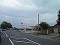 Shell garage Little Singleton - geograph.org.uk - 2974722.jpg 1,024 × 768; 105 KB
-
 Sign for the Miller Arms, Singleton - geograph.org.uk - 4228690.jpg 703 × 889; 187 KB
-
 Singleton boundary on Garstang Road - geograph.org.uk - 2744691.jpg 640 × 452; 80 KB
-
 Singleton Hall front view.jpg 4,032 × 3,024; 4.59 MB
-
 Singleton Hall grave of Honest Tom.jpg 2,048 × 1,536; 695 KB
-
 Singleton Hall grave of Lincoln.jpg 1,536 × 2,048; 658 KB
-
 Singleton Hall grave of the Miller dogs.jpg 2,048 × 1,536; 716 KB
-
 Singleton Hall rear view.jpg 1,918 × 1,077; 601 KB
-
 Singleton Hall side view.jpg 2,048 × 1,536; 665 KB
-
 Singleton railway station (site), Lancashire (geograph 3201533).jpg 800 × 600; 172 KB
-
 Singleton St Anne's Parish Church - geograph.org.uk - 5876913.jpg 2,898 × 4,447; 7.96 MB
-

-
 Skippool Creek at low tide - geograph.org.uk - 2735796.jpg 1,500 × 986; 140 KB
-
 Skippool Tidal Creek - geograph.org.uk - 2638411.jpg 4,320 × 3,240; 4.58 MB
-
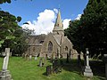 St. Anne's church, Singleton - geograph.org.uk - 4103543.jpg 4,000 × 3,000; 4.25 MB
-
 Station Road (B5260) - geograph.org.uk - 4228714.jpg 640 × 480; 60 KB
-

-
 Station Road - geograph.org.uk - 5887884.jpg 4,592 × 2,916; 7.97 MB
-
 Station Road in Singleton - geograph.org.uk - 5662741.jpg 2,700 × 2,025; 462 KB
-
 Station Road, Singleton - geograph.org.uk - 4228696.jpg 640 × 480; 62 KB
-
 The A585 at Little Singleton - geograph.org.uk - 109732.jpg 640 × 480; 94 KB
-
 The Miller Arms, Singleton - geograph.org.uk - 4228689.jpg 640 × 480; 42 KB
-
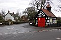 The Old Fire Station - geograph.org.uk - 94281.jpg 640 × 426; 156 KB
-
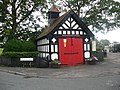 The old fire station in Singleton - geograph.org.uk - 1413946.jpg 640 × 480; 108 KB
-
 The old fire station, Singleton - geograph.org.uk - 4103551.jpg 2,667 × 1,998; 2.59 MB
-
 The Old Fire Station, Singleton - geograph.org.uk - 4228718.jpg 640 × 480; 107 KB
-
 The old fire station, Singleton - geograph.org.uk - 941281.jpg 640 × 425; 116 KB
-
 The River Wyre - geograph.org.uk - 2174944.jpg 1,500 × 1,000; 135 KB
-
 The River Wyre - geograph.org.uk - 3734314.jpg 2,896 × 2,097; 744 KB
-
 The Shard Bridge over the River Wyre - geograph.org.uk - 5875873.jpg 4,526 × 2,794; 7.86 MB
-
 Track (footpath) into woodland - geograph.org.uk - 4262321.jpg 640 × 480; 153 KB
-
 Track (footpath) to Singleton Grange - geograph.org.uk - 4262324.jpg 640 × 480; 67 KB
-
 Track to Summerer Farm - geograph.org.uk - 4228683.jpg 640 × 480; 69 KB
-
 Turn right off the A586 onto the A585T - geograph.org.uk - 2974728.jpg 1,024 × 760; 92 KB
-
-
 Weeton Road (B5260) - geograph.org.uk - 4228685.jpg 640 × 480; 53 KB
-
 Weeton Road in Singleton - geograph.org.uk - 5662738.jpg 2,700 × 2,025; 333 KB
-
 Wyre Way between Shard Bridge and Skippool - geograph.org.uk - 2638268.jpg 4,320 × 3,240; 4.54 MB
-

-

-
 Farm buildings at Avenham Hall - geograph.org.uk - 1413917.jpg 640 × 480; 55 KB
-
 Footpath to Moss House Farm - geograph.org.uk - 426577.jpg 640 × 480; 152 KB
-
 Looking up Church Road towards the Church - geograph.org.uk - 484063.jpg 640 × 480; 135 KB
-
 Mallard Hall - geograph.org.uk - 303253.jpg 640 × 427; 63 KB
-

-
 Phlox on the bank of the Wyre - geograph.org.uk - 483911.jpg 640 × 480; 243 KB
-
 View across Mile Rd. - geograph.org.uk - 426573.jpg 640 × 480; 188 KB


_-_geograph.org.uk_-_4262326.jpg)


_-_geograph.org.uk_-_2583152.jpg)
_-_geograph.org.uk_-_4262315.jpg)


.jpg)
.jpg)
.jpg)
.jpg)


_-_geograph.org.uk_-_4228708.jpg)
_-_geograph.org.uk_-_4228711.jpg)


_-_geograph.org.uk_-_4228721.jpg)


_-_geograph.org.uk_-_3974313.jpg)


,_Lancashire_(geograph_3201533).jpg)


_-_geograph.org.uk_-_4228714.jpg)
_leaving_Singleton_-_geograph.org.uk_-_4228704.jpg)


_into_woodland_-_geograph.org.uk_-_4262321.jpg)
_to_Singleton_Grange_-_geograph.org.uk_-_4262324.jpg)


_-_geograph.org.uk_-_4228685.jpg)


