Category:Sint Geertruikerkhof 4, 's-Hertogenbosch
Jump to navigation
Jump to search
| Object location | | View all coordinates using: OpenStreetMap |
|---|
building in 's-Hertogenbosch, Netherlands  | |||||
| Upload media | |||||
| Instance of | |||||
|---|---|---|---|---|---|
| Location | 's-Hertogenbosch, North Brabant, Netherlands | ||||
| Street address |
| ||||
| Located on street |
| ||||
| Heritage designation |
| ||||
 | |||||
|
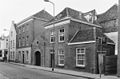
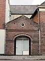
This is a category about rijksmonument number 21830
|
| Address |
|
Media in category "Sint Geertruikerkhof 4, 's-Hertogenbosch"
The following 4 files are in this category, out of 4 total.
-
 Overzicht - 's-Hertogenbosch - 20109953 - RCE.jpg 1,200 × 788; 209 KB
-
 Sint Geertruikerkhof.4.DenBosch.jpg 3,000 × 4,000; 5.47 MB
-
 Voorgevels - 's-Hertogenbosch - 20109954 - RCE.jpg 788 × 1,200; 195 KB
-
 Voorgevels - 's-Hertogenbosch - 20109955 - RCE.jpg 1,200 × 788; 201 KB


