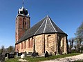
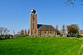
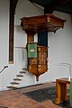
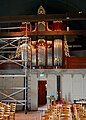
Category:Sint Janskerk (Deinum)
Jump to navigation
Jump to search
Nederlands: Sint Jan, Deinum - anno 12de eeuw
|
This is a category about rijksmonument number 28586
|
| Address |
|
| Object location | | View all coordinates using: OpenStreetMap |
|---|
church  | |||||
| Upload media | |||||
| Instance of | |||||
|---|---|---|---|---|---|
| Dedicated to | |||||
| Location | Deinum, Waadhoeke, Friesland, Netherlands | ||||
| Street address |
| ||||
| Located on street |
| ||||
| Heritage designation |
| ||||
| Inception |
| ||||
| official website | |||||
 | |||||
Media in category "Sint Janskerk (Deinum)"
The following 85 files are in this category, out of 85 total.
-
 20190409 Van Harinxmakanaal1.jpg 3,840 × 2,560; 1.67 MB
-
 20190409 Zicht op Deinum vanuit het noordoosten1.jpg 4,906 × 3,268; 4.27 MB
-
 20190409 Zicht op Deinum vanuit het noordoosten2.jpg 4,971 × 3,315; 3.31 MB
-
 20190419 Sint Janskerk siepelvormige torenspits1 Deinum.jpg 3,456 × 5,184; 3.04 MB
-
 20190419 Sint Janskerk siepelvormige torenspits2 Deinum.jpg 3,456 × 5,184; 3.14 MB
-
 20190419 Sint Janskerk1 Deinum.jpg 3,837 × 2,876; 2.06 MB
-
 20190419 Sint Janskerk2 Deinum.jpg 5,184 × 3,456; 3.22 MB
-
 20190419 Sint Janskerk3 Deinum.jpg 5,058 × 3,372; 3.43 MB
-
 20190419 zicht op Deinum vanuit Boksum.jpg 4,911 × 3,275; 3.7 MB
-
 20190419 zicht op Deinum1 met Sint Janskerk vanuit het zuidwesten.jpg 4,985 × 3,325; 2.73 MB
-
 20190419 zicht op Deinum2 met Sint Janskerk vanuit het zuidwesten.jpg 4,883 × 3,252; 3.37 MB
-
 Deinum, Sint Jan (protestanske tsjerke), kânsel.jpg 4,000 × 6,000; 7.55 MB
-
 Deinum, Sint Jan (protestanske tsjerke).jpg 6,000 × 4,000; 10.83 MB
-
 Deinum, Sint Jan, kânselbibel.jpg 5,108 × 3,650; 8.22 MB
-
 Deinum, Sint Jan, oargel yn restauraasje.jpg 3,643 × 5,095; 8.69 MB
-
 Deinum, Sint Jan, raam yn koer.jpg 3,255 × 4,890; 6.22 MB
-
 Deinum, Sint Jan, romaanske finsters.jpg 4,931 × 3,290; 8.03 MB
-
 Deinum, Sint Jan, ynterieur rjochting koer.jpg 5,022 × 3,589; 7.58 MB
-
 Deinum, Sint-Janstsjerke (2022).jpg 2,252 × 2,255; 2.2 MB
-
 Deinum, Sint-Janstsjerke, oargel (2022).jpg 1,763 × 2,439; 1.3 MB
-

-
 Deinum.jpg 2,048 × 1,536; 565 KB
-
 Dorpsgezicht, KNHM 2226 - Deinum - 20522024 - RCE.jpg 1,200 × 900; 182 KB
-
 Exterieur - Deinum - 20047939 - RCE.jpg 755 × 1,200; 165 KB
-
 Exterieur - Deinum - 20047940 - RCE.jpg 754 × 1,200; 149 KB
-
 Exterieur - Deinum - 20047941 - RCE.jpg 758 × 1,200; 192 KB
-
 Exterieur naar het noord-oosten - Deinum - 20047924 - RCE.jpg 882 × 1,200; 170 KB
-
 Exterieur naar het noord-oosten - Deinum - 20047925 - RCE.jpg 1,200 × 894; 173 KB
-
 Exterieur naar het noorden - Deinum - 20047927 - RCE.jpg 884 × 1,200; 214 KB
-
 Exterieur naar het noorden - Deinum - 20047928 - RCE.jpg 1,200 × 889; 247 KB
-
 Exterieur naar het noorden - Deinum - 20047929 - RCE.jpg 887 × 1,200; 258 KB
-
 Exterieur naar het westen - Deinum - 20047930 - RCE.jpg 1,200 × 878; 204 KB
-
 Exterieur naar het westen - Deinum - 20047933 - RCE.jpg 958 × 1,200; 320 KB
-
 Exterieur naar het westen - Deinum - 20047934 - RCE.jpg 1,200 × 963; 329 KB
-
 Exterieur naar het zuid-westen - Deinum - 20047931 - RCE.jpg 1,200 × 874; 334 KB
-
 Exterieur noordgevel - Deinum - 20047963 - RCE.jpg 1,193 × 1,200; 413 KB
-
 Exterieur oost-zijde - Deinum - 20047942 - RCE.jpg 956 × 1,200; 247 KB
-
 Exterieur zuid-gevel - Deinum - 20047944 - RCE.jpg 957 × 1,200; 397 KB
-
 Exterieur zuid-gevel oost-zijde - Deinum - 20047943 - RCE.jpg 958 × 1,200; 353 KB
-
 Exterieur zuid-oost gevel - Deinum - 20047962 - RCE.jpg 1,193 × 1,200; 240 KB
-
 Exterieur zuid-zijde - Deinum - 20047932 - RCE.jpg 966 × 1,200; 256 KB
-
 Exterieur zuid-zijde - Deinum - 20047946 - RCE.jpg 1,200 × 956; 333 KB
-
 Exterieur zuid-zijde kap - Deinum - 20047945 - RCE.jpg 1,200 × 954; 297 KB
-
 Exterieur zuid-zijde kap - Deinum - 20047947 - RCE.jpg 1,200 × 946; 306 KB
-
 Exterieur zuid-zijde kap - Deinum - 20047948 - RCE.jpg 1,200 × 946; 320 KB
-
 Exterieur zuid-zijde kap - Deinum - 20047949 - RCE.jpg 1,200 × 950; 319 KB
-
 Exterieur zuidgevel - Deinum - 20047964 - RCE.jpg 1,200 × 1,200; 269 KB
-
 Interieur grafzerken tegen de noord wand - Deinum - 20047938 - RCE.jpg 1,200 × 895; 201 KB
-
 Interieur naar het noord-oosten - Deinum - 20047937 - RCE.jpg 1,200 × 880; 170 KB
-
 Interieur naar het oosten - Deinum - 20047935 - RCE.jpg 1,200 × 955; 227 KB
-
 Interieur naar het oosten - Deinum - 20047950 - RCE.jpg 957 × 1,200; 273 KB
-
 Interieur naar het oosten - Deinum - 20047972 - RCE.jpg 975 × 1,200; 187 KB
-
 Interieur naar het westen - Deinum - 20047936 - RCE.jpg 1,200 × 948; 237 KB
-
 Interieur naar het westen - Deinum - 20047952 - RCE.jpg 955 × 1,200; 284 KB
-
 Interieur naar het westen - Deinum - 20047973 - RCE.jpg 968 × 1,200; 174 KB
-
 Interieur naar het westen - Deinum - 20047974 - RCE.jpg 1,200 × 955; 192 KB
-
 Interieur zuid-zijde kap - Deinum - 20047953 - RCE.jpg 1,200 × 1,200; 257 KB
-
 Interieur zuid-zijde kap - Deinum - 20047954 - RCE.jpg 1,195 × 1,200; 301 KB
-
 Interieur zuid-zijde kap - Deinum - 20047955 - RCE.jpg 1,190 × 1,200; 324 KB
-
 Interieur zuid-zijde kap - Deinum - 20047956 - RCE.jpg 1,200 × 1,198; 356 KB
-
 Interieur zuid-zijde kap - Deinum - 20047957 - RCE.jpg 1,200 × 1,188; 238 KB
-
 Interieur zuid-zijde kap - Deinum - 20047958 - RCE.jpg 1,195 × 1,200; 264 KB
-
 Interieur zuid-zijde kap - Deinum - 20047959 - RCE.jpg 1,189 × 1,200; 266 KB
-
 Interieur zuid-zijde kap - Deinum - 20047960 - RCE.jpg 1,200 × 1,191; 279 KB
-
 Interieur zuid-zijde kap - Deinum - 20047961 - RCE.jpg 1,193 × 1,200; 209 KB
-
 Interieur, aanzicht orgel, orgelnummer 301 - Deinum - 20370394 - RCE.jpg 941 × 1,200; 185 KB
-
 Interieur, detail van de zuidzijde van de kap - Deinum - 20383882 - RCE.jpg 1,200 × 1,200; 219 KB
-

-
 Interieur, gedeelte van de zuidzijde van de kap - Deinum - 20383881 - RCE.jpg 1,200 × 1,198; 255 KB
-
 Interieur, gedeelte van de zuidzijde van de kap - Deinum - 20383902 - RCE.jpg 1,200 × 1,200; 238 KB
-
 INTERIEUR, GRAFZERK VAN HESSEL VAN FEITSMA (1581) - Deinum - 20289858 - RCE.jpg 1,192 × 1,200; 401 KB
-
 Kerk deinum.jpg 1,573 × 1,764; 546 KB
-
 Noord-oost gevel - Deinum - 20047968 - RCE.jpg 947 × 1,200; 325 KB
-
 Noordgevel - Deinum - 20047971 - RCE.jpg 1,200 × 958; 358 KB
-
 Noordgevel naar het oosten - Deinum - 20047970 - RCE.jpg 1,200 × 941; 335 KB
-
 Overzicht - Deinum - 20047965 - RCE.jpg 1,200 × 967; 207 KB
-
 Overzicht zuidoostgevel met kerkhof en kerktoren - Deinum - 20345418 - RCE.jpg 943 × 1,200; 247 KB
-
 Preekstoel - Deinum - 20047951 - RCE.jpg 957 × 1,200; 223 KB
-
 Preekstoel - Deinum - 20047975 - RCE.jpg 967 × 1,200; 184 KB
-
 Sint-Jan-Kerk in Deinum.jpg 3,500 × 4,200; 7.6 MB
-
 Sint-Janstsjerke, Deinum (2022).jpg 2,098 × 1,400; 1.12 MB
-
 Sint-Johannes de Doperkerk (Deinum).JPG 4,032 × 3,024; 2.08 MB
-
 Toren, zuid-oost zijde - Deinum - 20047967 - RCE.jpg 964 × 1,200; 251 KB
-
 Toren, zuid-west zijde - Deinum - 20047966 - RCE.jpg 1,200 × 968; 226 KB
-
 Zuid-oost gevel - Deinum - 20047969 - RCE.jpg 1,200 × 957; 305 KB


,_k%C3%A2nsel.jpg)
.jpg)


.jpg)
.jpg)


_-_Deinum_-_20289858_-_RCE.jpg)


.jpg)
.JPG)


