Category:Sint Vincentiuskerk, Deursen
Jump to navigation
Jump to search
| Object location | | View all coordinates using: OpenStreetMap |
|---|
 | |||||
| Upload media | |||||
| Instance of | |||||
|---|---|---|---|---|---|
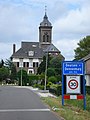
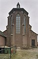
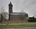
| Location | Deursen-Dennenburg, Oss, North Brabant, Netherlands | ||||
| Street address |
| ||||
| Located on street |
| ||||
| Heritage designation |
| ||||
| Inception |
| ||||
 | |||||
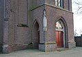
Nederlands: Vincentiuskerk, Deursen - anno 1877
|
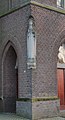
This is a category about rijksmonument number 32384
|
| Address |
|
Subcategories
This category has the following 2 subcategories, out of 2 total.
B
Media in category "Sint Vincentiuskerk, Deursen"
The following 23 files are in this category, out of 23 total.
-
 Deursen, l'église.jpg 2,304 × 3,072; 2.33 MB
-
 Deursen-Dennenburg, à Deursen.JPG 2,304 × 3,072; 2.91 MB
-
 Overzicht - Deursen - 20339382 - RCE.jpg 1,200 × 774; 220 KB
-
 Overzicht noordgevel en kerktoren met omgeving - Deursen - 20339377 - RCE.jpg 1,200 × 958; 205 KB
-
 Overzicht noordgevel en kerktoren met omgeving - Deursen - 20339378 - RCE.jpg 1,200 × 956; 282 KB
-

-
 Overzicht noordgevel met zicht op kerkhof - Deursen - 20339380 - RCE.jpg 1,200 × 777; 245 KB
-
 Overzicht oostgevel - Deursen - 20339381 - RCE.jpg 775 × 1,200; 217 KB
-

-
 Overzicht westgevel met kerktoren en noordgevel - Deursen - 20339383 - RCE.jpg 778 × 1,200; 161 KB
-

-
 Overzicht zuidgevel met kerktoren - Deursen - 20339376 - RCE.jpg 1,200 × 957; 239 KB
-
 Sint Vincentiuskerk Deursen 2.jpg 2,268 × 3,686; 6.48 MB
-
 Sint Vincentiuskerk Deursen 3.jpg 2,268 × 3,217; 2.61 MB
-
 Sint Vincentiuskerk Deursen 4.jpg 2,268 × 3,158; 2.49 MB
-
 Sint Vincentiuskerk Deursen.jpg 2,207 × 2,942; 4.38 MB
-
 Sint Vincentiuskerk, Deursen (cropped).jpg 1,209 × 2,238; 1.46 MB
-
 Sint Vincentiuskerk, Deursen 2.jpg 3,538 × 2,786; 5.29 MB
-
 Sint Vincentiuskerk, Deursen.jpg 3,707 × 2,592; 5.12 MB
-
 St. Vincentiuskerk Deursen schuin rechts voor.jpg 3,021 × 2,266; 3.4 MB
-
 St. Vincentiuskerk Deursen toren raam boven deur.jpg 3,843 × 2,234; 6.21 MB
-
 St. Vincentiuskerk Deursen toren schuin.jpg 2,268 × 3,470; 3.96 MB
-
 St. Vincentiuskerk Deursen toren vertikaal.jpg 2,268 × 3,024; 5.28 MB


.jpg)


