Category:Sint-Martinuskerk (Arnhem)
Jump to navigation
Jump to search
| Object location | | View all coordinates using: OpenStreetMap |
|---|
church in Arnhem  | |||||
| Upload media | |||||
| Instance of | |||||
|---|---|---|---|---|---|
| Named after | |||||
| Location | Arnhem, Gelderland, Netherlands | ||||
| Street address |
| ||||
| Architect | |||||
| Heritage designation |
| ||||
| Inception |
| ||||
| Religion or worldview | |||||
 | |||||
|
This is a category about rijksmonument number 8363
|
| Address |
|
Subcategories
This category has only the following subcategory.
S
Media in category "Sint-Martinuskerk (Arnhem)"
The following 40 files are in this category, out of 40 total.
-
 8363 St Martinus church in Arnhem.jpg 3,575 × 5,362; 11.49 MB
-
 Anhem. Sint-Martinuskerk vanaf Hommelstraat.jpg 4,705 × 5,882; 5.74 MB
-
 Arnhem - Steenstraat 7-1.jpg 1,728 × 2,592; 1.21 MB
-
 Arnhem - Steenstraat 7-2.jpg 1,728 × 2,592; 1.25 MB
-
 Arnhem - Steenstraat 7-3.jpg 1,728 × 2,592; 986 KB
-
 Arnhem - Steenstraat 7-4.jpg 1,728 × 2,592; 1.14 MB
-
 Arnhem - Steenstraat 7-5.jpg 1,728 × 2,592; 901 KB
-
 Arnhem - Steenstraat 7-6.jpg 1,728 × 2,592; 975 KB
-
 Arnhem - Steenstraat 7.jpg 1,728 × 2,592; 702 KB
-
 Arnhem - Steenstraat.jpg 1,536 × 2,048; 790 KB
-
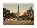
 Arnhem - Velperplein 1900.jpg 3,197 × 2,337; 2.39 MB
-
 Arnhem, Sint Martinuskerk foto3 2009-01-26 12.21.JPG 2,304 × 3,072; 2.09 MB
-
 Madonnabeeld - Martinuskerk, Arnhem - 20024933 - RCE.jpg 948 × 1,200; 261 KB
-
 Martinuskerk - Arnhem - 20024929 - RCE.jpg 961 × 1,200; 198 KB
-
 Martinuskerk - Arnhem 1.JPG 3,264 × 2,448; 1.63 MB
-
 Martinuskerk - Arnhem 2.JPG 2,448 × 3,264; 1.5 MB
-
 Martinuskerk - Arnhem 3.JPG 2,448 × 3,264; 1.47 MB
-
 Martinuskerk - Arnhem 4.JPG 2,448 × 3,264; 1.43 MB
-
 Martinuskerk - Arnhem 5.JPG 2,448 × 3,264; 1.38 MB
-
 Martinuskerk, aanzicht sacramentsaltaar - Arnhem - 20360107 - RCE.jpg 1,183 × 1,200; 281 KB
-
 Martinuskerk, deel van lichtbeuk en gewelf - Arnhem - 20024931 - RCE.jpg 975 × 1,200; 231 KB
-
 Martinuskerk, interieur naar het oosten - Arnhem - 20024930 - RCE.jpg 968 × 1,200; 231 KB
-
 Martinuskerk, interieur naar het orgel - Arnhem - 20024932 - RCE.jpg 957 × 1,200; 233 KB
-

-
 Martinuskerk, interieur, ciborie - Arnhem - 20360105 - RCE.jpg 1,192 × 1,200; 225 KB
-
 Martinuskerk, interieur, monstrans - Arnhem - 20360101 - RCE.jpg 1,195 × 1,200; 227 KB
-
 Martinuskerk, interieur, overzicht naar het oosten - Arnhem - 20371132 - RCE.jpg 1,193 × 1,200; 188 KB
-

-
 Martinuskerk, interieur, wierookvat - Arnhem - 20360106 - RCE.jpg 1,200 × 1,194; 215 KB
-
 Martinuskerk, interieur, wierookvat met schepje - Arnhem - 20360108 - RCE.jpg 1,196 × 1,200; 224 KB
-
 Overzicht, noord-westzijde van Martinuskerk en toren - Arnhem - 20371076 - RCE.jpg 1,196 × 1,200; 227 KB
-
 Sint-Martinus Arnhem.JPG 576 × 768; 57 KB
-
 Sint-Martinuskerk, Arnhem-9314.jpg 3,530 × 3,530; 8.81 MB
-
 Spire of Sint-Martinuskerk.JPG 1,024 × 768; 277 KB
-
 Steenstraat - panoramio.jpg 1,536 × 2,048; 1.06 MB
-

-
 The Lauwersgracht Park and Musis Sacrum at 27 March 2013 - panoramio.jpg 4,928 × 3,264; 6.72 MB
-
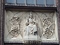 Tympanum of Sint-Martinus.JPG 1,024 × 768; 277 KB
-
 Velper Square Arnhem Holland.jpg 992 × 759; 136 KB
-
 Velper Square, Arnhem, Holland-LCCN2001698774.jpg 3,367 × 2,434; 2.44 MB


