Category:Sint-Willibrorduskerk (Sint Willebrord)
Jump to navigation
Jump to search
| Object location | | View all coordinates using: OpenStreetMap |
|---|
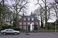
Nederlands: Afbeeldingen van de Sint-Willibrorduskerk (Sint Willebrord), Pastoor Bastiaansensingel 30, 4711 EC Sint Willebrord.
Gelegen in Sint Willebrord behorende tot de gemeente Rucphen in de provincie Noord-Brabant in het zuiden van Nederland. Het is een rijksmonument (bron [1];[2])
|
This is a category about rijksmonumentcomplex number 517058
|
Kerk:
|
This is a category about rijksmonument number 517059
|
Park:
|
This is a category about rijksmonument number 517060
|
Lourdesgrot:
|
This is a category about rijksmonument number 525726
|
church in Sint Willebrord, Netherlands  | |||||
| Upload media | |||||
| Instance of | |||||
|---|---|---|---|---|---|
| Part of | |||||
| Dedicated to | |||||
| Location | Sint Willebrord, Rucphen, North Brabant, Netherlands | ||||
| Street address |
| ||||
| Located on street |
| ||||
| Architect | |||||
| Heritage designation |
| ||||
| Inception |
| ||||
| Religion or worldview | |||||
 | |||||
Subcategories
This category has the following 3 subcategories, out of 3 total.
L
P
- Processiepark St Willebrord (21 F)
Media in category "Sint-Willibrorduskerk (Sint Willebrord)"
The following 13 files are in this category, out of 13 total.
-

-
 Overzicht - Sint Willebrord - 20413096 - RCE.jpg 1,200 × 798; 328 KB
-

-

-

-
-

-
 Overzicht van het kerkhof - Sint Willebrord - 20413084 - RCE.jpg 1,200 × 798; 263 KB
-
 Overzicht van het kerkhof - Sint Willebrord - 20413085 - RCE.jpg 1,200 × 798; 270 KB
-
 Overzicht van het kerkhof - Sint Willebrord - 20413086 - RCE.jpg 1,200 × 798; 264 KB
-

-
 Sint-Willibrorduskerk (Sint Willebrord) P1040664.JPG 2,448 × 3,264; 3.8 MB
-
 Sint-Willibrorduskerk (Sint Willebrord) P1040665.JPG 2,448 × 3,264; 3.46 MB


_P1040664.JPG)
_P1040665.JPG)