Category:Skagit County, Washington
Salti al navigilo
Salti al serĉilo
Counties of Washington (state): Adams · Asotin · Benton · Chelan · Clallam · Clark · Columbia · Cowlitz · Douglas · Ferry · Franklin · Garfield · Grant · Grays Harbor · Island · Jefferson · King · Kitsap · Kittitas · Klickitat · Lewis · Lincoln · Mason · Okanogan · Pacific · Pend Oreille · Pierce · San Juan · Skagit · Skamania · Snohomish · Spokane · Stevens · Thurston · Wahkiakum · Walla Walla · Whatcom · Whitman · Yakima
county in the state of Washington, United States   | |||||
| Alŝuti plurmedion | |||||
| Estas | |||||
|---|---|---|---|---|---|
| Nomita laŭ |
| ||||
| Loko | Vaŝingtonio, Pacifika nordokcidento, Vaŝingtonio, Pacific States Region | ||||
| Ĉefurbo | |||||
| Dato de fondo aŭ kreo |
| ||||
| Loĝantaro |
| ||||
| Areo |
| ||||
| oficiala retejo | |||||
 | |||||
Subkategorioj
Ĉi tiu kategorio havas la 50 jenajn subkategoriojn, el 50 entute.
A
- Allan Island, Washington (3 D)
B
- Bay View, Washington (1 P, 13 D)
- Burrows Island, Washington (1 P, 4 D)
C
- Cascade Trail (6 D)
- Craft Island, Washington (1 P, 114 D)
- Cypress Island (12 D)
D
E
- Edison, Washington (62 D)
F
- Mount Formidable (1 P, 16 D)
G
- Guemes Island (4 D)
H
- Hamilton, Washington (4 D)
- Hidden Lake (Skagit County, Washington) (1 P, 23 D)
J
- Johannesburg Mountain (10 D)
- John G. Young Landing (5 D)
K
- Kiket Island (2 D)
L
- Lake McMurray, Washington (5 D)
- Lake Shannon (1 D)
M
P
R
- Rainy Pass (6 D)
S
- Streets in Skagit County (44 D)
U
Dosieroj en kategorio “Skagit County, Washington”
La jenaj 186 dosieroj estas en ĉi tiu kategorio, el 186 entute.
-
 Along the Cascade Trail through Sedro Woolley on the way out there. (27402063491).jpg 2 048 × 1 536; 3,28 MB
-
 An Illustrated History of Skagit and Snohomish Counties.djvu 2 283 × 3 265, 1 150 paĝoj; 51,11 MB
-
 Artist painting near Skagit dams, 1960 (52262092712).jpg 1 429 × 1 822; 802 KB
-

-
-

-
 Avalanche Chute - Flickr - brewbooks (1).jpg 2 448 × 3 264; 4,01 MB
-
 Avalanche Chute - Flickr - brewbooks (2).jpg 3 264 × 2 448; 2,54 MB
-
 Avalanche Chute - Flickr - brewbooks (3).jpg 3 264 × 2 448; 4,38 MB
-
 Avalanche Chute.jpg 3 264 × 2 448; 3,76 MB
-
 Barn on WA SR-11 just south of Bow 01.jpg 4 288 × 2 848; 5,79 MB
-
 Barn on WA SR-11 just south of Bow 02.jpg 4 288 × 2 848; 5,37 MB
-
 Beaver pond and lodge - Flickr - brewbooks.jpg 4 128 × 3 096; 5,78 MB
-
 Biking back from Anacortes Ferry (29402973822).jpg 2 048 × 1 536; 1,8 MB
-
 Bow Hill Blueberry Farm (34855577243).jpg 2 306 × 1 730; 1,54 MB
-
 Bow Hill Blueberry Farm Skagit County (35479084252).jpg 2 304 × 1 728; 1,38 MB
-
 Bow Hill Blueberry Farm Skagit County (35607987436).jpg 2 304 × 1 728; 1,28 MB
-

-
-
 Chuckanut Tea Garden in Blanchard, WA. (8611981760).jpg 2 304 × 1 728; 816 KB
-
 Closer toward center of town the trail is paved. (27473876355).jpg 2 048 × 1 536; 2,75 MB
-
 Crossing Swinomish Channel. (29403040252).jpg 2 048 × 1 536; 1,69 MB
-
 Dairy barn (26866472253).jpg 2 048 × 1 536; 2,17 MB
-
 Eagle in flight, Skagit County, Washington (cropped).jpg 2 359 × 1 291; 1,2 MB
-
 Eagle in flight, Skagit County, Washington (tightly cropped).jpg 959 × 1 227; 545 KB
-
 Eagle in flight, Skagit County, Washington.jpg 6 000 × 4 000; 9,07 MB
-
 Eagles and nest, Skagit County, Washington.jpg 6 000 × 4 000; 13,65 MB
-
 Eagles in tree, Skagit County, Washington (cropped).jpg 1 063 × 777; 471 KB
-
 Eagles in tree, Skagit County, Washington.jpg 6 000 × 4 000; 9,87 MB
-
 Early spring at Chuckanut Tea Garden in Blanchard, WA. (8610853899).jpg 2 304 × 1 728; 1,1 MB
-
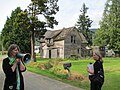
 Entering the depot - community hall for more birthday celebration (6984233722).jpg 1 536 × 1 152; 510 KB
-
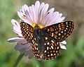
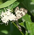
 Euphydryas anicia hopfingeri P1050203c.jpg 1 877 × 1 341; 570 KB
-
 Euphydryas anicia hopfingeri P1050204b.jpg 2 430 × 1 824; 658 KB
-
 Euphydryas anicia hopfingeri P1050206b.jpg 2 608 × 2 064; 1,09 MB
-
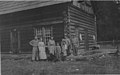 Family at ranch cabin near Skagit River, 1913 (48800062416).jpg 1 200 × 750; 215 KB
-

-
 Farm in Skagit County near Bow 01.jpg 4 288 × 2 848; 4,92 MB
-
 Farm in Skagit County near Bow 02.jpg 4 288 × 2 848; 4,47 MB
-

-
 Flickr - Hugo90 - Skagit.jpg 4 000 × 3 000; 3,5 MB
-
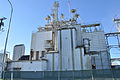 Food processing facility on WA SR-20 - 01.jpg 4 288 × 2 848; 4,52 MB
-
 Foreground Red (41859957771).jpg 2 048 × 1 459; 1,99 MB
-
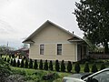
 Fredonia, WA Grange 01.jpg 4 288 × 2 848; 4,84 MB
-
 Fredonia, WA Grange 02.jpg 4 191 × 2 700; 3,87 MB
-

-
 Girl and dog with tent, 1913.jpg 1 200 × 730; 183 KB
-
 Glad I have my bicycle so I can get there without being a driver (26864680554).jpg 2 048 × 1 536; 2,71 MB
-
 Grange Building in Birdsview WA.jpg 2 508 × 1 791; 2,59 MB
-

-

-

-

-

-
 Helicopter ride, Skagit Tulip Festival (1836036930).jpg 901 × 641; 252 KB
-
 Inside dairy barn (26864671384).jpg 800 × 600; 293 KB
-
 Johannesburg Mountain (I think) - Flickr - brewbooks (1).jpg 3 264 × 2 448; 3,44 MB
-
 Johannesburg Mountain (I think) - Flickr - brewbooks (2).jpg 3 264 × 2 448; 3,08 MB
-
 Johannesburg Mountain (I think) - Flickr - brewbooks (3).jpg 3 264 × 2 448; 2,89 MB
-
 Johannesburg Mountain (I think) - Flickr - brewbooks.jpg 3 264 × 2 448; 3,15 MB
-
 Kind of spooky (27473860585).jpg 2 048 × 1 536; 2,25 MB
-
 Kool-Aid Lake.jpg 4 320 × 2 432; 4,86 MB
-

-

-

-
-

-

-

-

-
 Logging in Skagit County, 1920 (5477232480).jpg 1 200 × 901; 235 KB
-
 Looking north from Washington SR 20 from just west of SR 530.jpg 4 288 × 2 848; 6,11 MB
-
 Looking up an old silo (27473866785).jpg 2 048 × 1 536; 1,78 MB
-
 Lower Sauk Boat Launch parking lot 01.jpg 4 288 × 2 848; 6,32 MB
-
 Lower Sauk River 01.jpg 4 288 × 2 848; 6,41 MB
-
 Lower Sauk River 02.jpg 2 848 × 4 288; 6,27 MB
-

-

-
 Macy family ready for the trail, Skagit County, Washington, 1913.jpg 1 200 × 751; 214 KB
-
 Map of Washington highlighting Skagit County.svg 5 936 × 3 863; 215 KB
-
 Marblemount, United States (Unsplash).jpg 5 184 × 3 456; 22,67 MB
-
 Mary Ellen on Skagit Float Trip - Flickr - brewbooks.jpg 4 608 × 3 072; 3,45 MB
-
 Melody in Bloom Photography.jpg 5 472 × 3 648; 12,42 MB
-
 Mess hall crew, Hamilton Logging Company, ca 1912 (KINSEY 247).jpeg 748 × 600; 71 KB
-
 Morning window view Big Lake WA - panoramio.jpg 1 024 × 768; 473 KB
-
 NCNP.jpg 4 032 × 3 024; 2,82 MB
-
 North extension of Snohomish Centennial Trail is not yet finished (7965481376).jpg 1 536 × 1 152; 887 KB
-
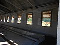
 Northern State hallway (27439518456).jpg 2 048 × 1 536; 1,95 MB
-
 Northern State Recreation Area (27402113831).jpg 2 048 × 1 536; 2,12 MB
-
 Northern State Recreation Area (27473970955).jpg 2 048 × 1 536; 2,28 MB
-
 Not a bad road walk - Flickr - brewbooks.jpg 2 448 × 3 264; 2,99 MB
-
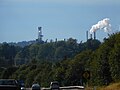 Oil refinery from Highway 20, Anacortes (28886692564).jpg 2 048 × 1 536; 1,95 MB
-
 Old man's beard (Dolichousnea longissima) - Flickr - brewbooks.jpg 4 608 × 3 072; 5,48 MB
-
 On the way there, one of my favorite roads. F&S Grade (27439465076).jpg 2 048 × 1 536; 2,3 MB
-
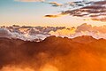 Orange clouds over mountains (Unsplash).jpg 3 300 × 2 200; 4,55 MB
-
 Pacific Northwest Trail.jpg 6 000 × 4 000; 16,75 MB
-
 Packhorses on trail, Skagit County, Washington, 1913.jpg 1 200 × 731; 264 KB
-
 Padilla Bay Trail in Bayview area of Skagit County. (33380956593).jpg 633 × 589; 161 KB
-
 Past the sights of blanchard (6984241684).jpg 1 536 × 1 152; 546 KB
-
 Power line near Sedro Wooley, WA. (36441413433).jpg 2 048 × 1 536; 1,15 MB
-

-
 Rainy Pass, Highway 20 (1666883829).jpg 948 × 621; 296 KB
-
 Redcedar logs, Skagit County, Washington, 1910 (INDOCC 525).jpg 768 × 653; 196 KB
-

-
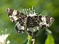
 Rheumaptera hastata P1050586b.jpg 969 × 983; 289 KB
-
 Rheumaptera hastata P1050590b.jpg 2 477 × 2 575; 1,16 MB
-
 Rheumaptera P1050599b.jpg 1 825 × 1 341; 589 KB
-
 Rheumaptera P1050601d.jpg 3 546 × 2 626; 1,76 MB
-
 Rocky Mountain Peaks (Unsplash).jpg 3 278 × 1 591; 3,88 MB
-
 Rode my bicycle from Bellingham to Blanchard (6984241754).jpg 1 519 × 971; 344 KB
-
 Sahale Mountain, United States (Unsplash).jpg 6 729 × 3 785; 9,95 MB
-
 Sakgit Valley Tulip Festival 02.jpg 2 112 × 2 816; 1,09 MB
-
 Sakgit Valley Tulip Festival 03.jpg 2 816 × 2 112; 1,27 MB
-
 Sakgit Valley Tulip Festival 04.jpg 2 816 × 2 112; 2,01 MB
-
 Sakgit Valley Tulip Festival 05.jpg 2 816 × 2 112; 2,16 MB
-
 San Juan Islands from Blanchard Mountain - panoramio.jpg 5 150 × 1 135; 933 KB
-
-
-

-

-
 Short helicopter ride during Skagit Tulip Festival (1835206179).jpg 888 × 581; 238 KB
-
 Sibley Creek - Flickr - brewbooks.jpg 3 264 × 2 448; 3,84 MB
-
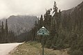
 Sign entering Skagit County on Washington State Route 9 northbound.jpg 6 000 × 4 000; 9,87 MB
-
 Skagit County, Washington; a magazine edition published by the Mount Vernon Herald.pdf 5 643 × 7 447, 100 paĝoj; 141,96 MB
-
 Skagit fish hatchery, circa 1980s (49870304908).jpg 699 × 463; 66 KB
-
 Skagit Tulip Festival (5663281797).jpg 4 752 × 3 168; 4,35 MB
-
 Skagit Tulip Festival (5663846888).jpg 3 168 × 4 752; 4,68 MB
-
 Skagit Tulip Festival - Macro (5663280077).jpg 4 108 × 3 005; 3,59 MB
-
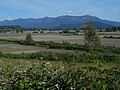
 Skagit view 01.jpg 4 288 × 2 848; 4,82 MB
-
 Skagit view 02.jpg 4 288 × 2 848; 5,03 MB
-
 Skagit view 03.jpg 4 288 × 2 848; 5,16 MB
-
 Snee-Oosh Road sign.jpg 3 120 × 4 160; 1,63 MB
-
 Snow Bridge - Flickr - brewbooks.jpg 3 264 × 2 448; 5,65 MB
-
 Snow layers - Flickr - brewbooks.jpg 3 264 × 2 448; 3,06 MB
-
 Snowy mountains at dusk (Unsplash).jpg 3 300 × 2 200; 4,77 MB
-
 Somewhere over there (6984241654).jpg 1 536 × 1 152; 380 KB
-

-
 Sunset 1 - panoramio.jpg 800 × 600; 115 KB
-
 Sunset 2 - panoramio.jpg 800 × 600; 110 KB
-
 Sunset 3 - panoramio.jpg 800 × 600; 102 KB
-
 Sunset 4 - panoramio.jpg 800 × 600; 126 KB
-
 Sunset 5 - panoramio.jpg 800 × 600; 134 KB
-
 Sunset 6 - panoramio.jpg 800 × 600; 149 KB
-
 Sunset from Deception Pass Bridge Anacortes WA - panoramio (1).jpg 1 941 × 1 456; 1,43 MB
-
 Sunset from Deception Pass Bridge Anacortes WA - panoramio.jpg 1 587 × 1 188; 640 KB
-
 The Net since 1955 is still on Memorial Highway just west of Mount Vernon (15240779206).jpg 2 048 × 1 536; 2,07 MB
-
 The point of no return - Flickr - brewbooks.jpg 4 608 × 3 072; 4,84 MB
-
 Then there was a walking tour (6984241686).jpg 1 536 × 1 152; 481 KB
-
 There are bears in the area (27197328230).jpg 2 048 × 1 536; 2,39 MB
-
 There was music and a train rolled by (6984233708).jpg 1 536 × 1 152; 273 KB
-
 Thunder Creek.jpg 3 264 × 2 448; 4,93 MB
-

-
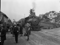 Train at Rockport station, 1938 (3250982839).gif 1 200 × 912; 916 KB
-

-

-
 Travel through the woods - Flickr - brewbooks.jpg 4 288 × 3 216; 4,07 MB
-
 Tree ring close-up (6086827694).jpg 1 000 × 667; 562 KB
-
 Tulip Festival (41698006081).jpg 2 048 × 1 365; 3,11 MB
-
 Tulips (5193894721).jpg 1 000 × 932; 122 KB
-
 Tulips-11 (5194494830).jpg 1 000 × 667; 166 KB
-
 Tulips-5 (5193894955).jpg 1 000 × 667; 413 KB
-
 Two way bike path along Highway 20 Bridge to Anacortes on Fidalgo Island (28889331433).jpg 2 048 × 1 536; 1,72 MB
-

-
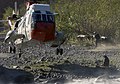
 US Navy 030922-N-6436W-002 rappels out of a UH-3H Sea King helicopter.jpg 1 960 × 3 008; 2,04 MB
-
-
 US Navy 030922-N-6436W-004 treats a simulated victim.jpg 2 100 × 1 799; 3,09 MB
-

-
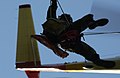
 US Navy 030922-N-6436W-007 rappels out of a UH-3H Sea King helicopter.jpg 3 000 × 1 955; 2,27 MB
-
-

-
 US Navy 030923-N-6436W-002 simulates a survivor of an ejection scenario.jpg 3 000 × 1 955; 1,7 MB
-
 US Navy 030923-N-6436W-003 simulates a survivor of an ejection scenario.jpg 3 000 × 1 955; 2,08 MB
-
 US Navy 030923-N-6436W-004 simulates a survivor of an ejection scenario.jpg 2 100 × 1 606; 1,24 MB
-

-
-

-
-
 USA Skagit County, Washington age pyramid.svg 520 × 600; 7 KB
-
 USGS South Cascade Glacier.jpg 603 × 566; 186 KB
-

-
 View to north from Highway 20 Bridge to Anacortes (29477365316).jpg 2 048 × 1 536; 1,78 MB
-
 Walking tour ended at Blanchard Depot (6984241646).jpg 1 536 × 1 152; 371 KB
-

-
 Washington SR 530 meets SR 20.jpg 4 288 × 2 848; 6,32 MB
-
 White Mount Baker slope (Unsplash).jpg 2 464 × 1 848; 3,03 MB
-
 Who's in there. Voices echoing. (27439477096).jpg 2 048 × 1 536; 1,01 MB
-
 Wreck of La Merced - panoramio.jpg 1 225 × 873; 562 KB
.jpg)
.jpg)
.jpeg)
.jpeg)
.jpeg)
.jpg)
.jpg)
.jpg)


.jpg)
.jpg)
.jpg)
.jpg)
.jpg)
.jpg)
.jpg)
.jpg)
.jpg)
.jpg)
.jpg)
.jpg)


.jpg)

.jpg)
.jpg)


.jpg)
.jpeg)


.jpg)


.jpg)


.jpg)

.jpg)

.jpeg)
.jpg)
.jpg)
.jpeg)
.jpeg)
.jpg)
.jpg)
_-_Flickr_-_brewbooks_(1).jpg)
_-_Flickr_-_brewbooks_(2).jpg)
_-_Flickr_-_brewbooks_(3).jpg)
_-_Flickr_-_brewbooks.jpg)
.jpg)

.jpeg)
.jpeg)
.jpeg)
.jpeg)
.jpeg)
.jpeg)
.jpeg)
.jpeg)
.jpg)

.jpg)


.jpg)


.jpg)


.jpeg)


.jpg)
.jpg)
.jpg)
.jpg)

.jpg)
_-_Flickr_-_brewbooks.jpg)
.jpg)
.jpg)


.jpg)
.jpg)
.jpg)
.jpeg)
.jpg)
.jpg)


.jpg)
.jpg)
.jpg)


.jpg)
.jpg)
.jpg)
.jpeg)
.jpg)


.jpg)
.jpg)
.jpg)
.jpg)


.jpg)
.jpg)
.jpg)


.jpg)

.jpg)

.jpg)
.jpg)
.jpg)

.jpeg)
.gif)
.jpg)
.jpg)

.jpg)
.jpg)
.jpg)
.jpg)
.jpg)
.jpg)


_Whidbey_Island,_Search_and_Rescue_(SAR)_team_conduct_rescue_exercises.jpg)
_and_Hospital_Corpsman_2nd_Class_Eric_Lemke_evaluate_a_simulated_victim.jpg)


_team_conduct_rescue_exercises.jpg)
_team,_Naval_Air_Station_(NAS)_Whidbey_Island_conducts_rescue_exercises_in_a_riverbed_in_Washington_state.jpg)
,_pops_smoke_to_signal_his_location_to_the_rescue_helicopter.jpg)


.jpg)
.jpg)
.jpg)
.jpeg)

.jpg)
.jpg)
