Category:Slapton, Northamptonshire
Jump to navigation
Jump to search
English: Slapton is a small village in the South Northamptonshire district of the Shire county of Northamptonshire, England, about from Towcester and the same from Silverstone. It is close to the A43 road which links the M40 motorway junction 10 with the M1 junction 15A at Northampton. Central London is about 60 miles south of M40 junction 10.
village and civil parish in Northamptonshire, UK  | |||||
| Upload media | |||||
| Instance of | |||||
|---|---|---|---|---|---|
| Location | West Northamptonshire, Northamptonshire, East Midlands, England | ||||
 | |||||
Subcategories
This category has only the following subcategory.
B
Media in category "Slapton, Northamptonshire"
The following 54 files are in this category, out of 54 total.
-
-
 Avenue near Slapton Hill Farm - geograph.org.uk - 5171973.jpg 1,024 × 768; 199 KB
-
 Boxes Farm, Slapton - geograph.org.uk - 5608710.jpg 640 × 360; 80 KB
-
 Bridge over dismantled railway - geograph.org.uk - 3543717.jpg 1,600 × 1,068; 482 KB
-
 Bridleway at Slapton Hill Farm - geograph.org.uk - 5196374.jpg 1,024 × 768; 270 KB
-
 Bridleway comes out onto the road - geograph.org.uk - 3544660.jpg 1,200 × 1,600; 806 KB
-
 Bridleway from Slapton - geograph.org.uk - 3544663.jpg 1,600 × 1,067; 521 KB
-
 Bridleway into Slapton - geograph.org.uk - 3544687.jpg 1,200 × 1,600; 549 KB
-
 Bridleway off the road from Blakesley - geograph.org.uk - 3545033.jpg 1,600 × 1,068; 555 KB
-
 Bridleway to Chapel Lane - geograph.org.uk - 3544683.jpg 1,600 × 1,068; 667 KB
-
 Bridleway to Slapton - geograph.org.uk - 3545040.jpg 1,600 × 1,067; 500 KB
-
 Bridleway to Slapton - geograph.org.uk - 5196376.jpg 1,024 × 768; 185 KB
-
-
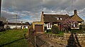
 Cottage in Slapton - geograph.org.uk - 3544677.jpg 1,600 × 1,067; 456 KB
-
 Country house in Slapton - geograph.org.uk - 784427.jpg 640 × 369; 87 KB
-
 Country Road - geograph.org.uk - 4044708.jpg 1,024 × 768; 152 KB
-

-
 Curious cattle on the footpath to the road - geograph.org.uk - 3545042.jpg 1,600 × 1,068; 676 KB
-
 Derelict farm buildings near Slapton - geograph.org.uk - 5171962.jpg 1,024 × 768; 205 KB
-
 Dilapidated barn by the bridleway - geograph.org.uk - 3544662.jpg 1,600 × 1,068; 653 KB
-
 Dog Rose, close to Slapton Hill Farm - geograph.org.uk - 460993.jpg 640 × 640; 87 KB
-
 Fields below Slapton Hill - geograph.org.uk - 5196451.jpg 1,024 × 768; 170 KB
-
 Footpath to Bradden - geograph.org.uk - 3545035.jpg 1,200 × 1,600; 687 KB
-
 Footpath to Bradden - geograph.org.uk - 6241848.jpg 800 × 600; 175 KB
-
 Footpath to Weedon Lois - geograph.org.uk - 5171980.jpg 1,024 × 768; 223 KB
-
 House across the stream, Slapton - geograph.org.uk - 5191959.jpg 1,024 × 768; 208 KB
-
 Lane between Slapton Hill and Abthorpe - geograph.org.uk - 5196458.jpg 1,024 × 768; 195 KB
-
 Large Old House in Slapton - geograph.org.uk - 5711801.jpg 640 × 427; 244 KB
-
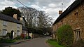
 Main Street, Slapton - geograph.org.uk - 5216359.jpg 640 × 480; 181 KB
-
 Main Street, Slapton - geograph.org.uk - 5608692.jpg 640 × 360; 89 KB
-
 Main Street, Slapton - geograph.org.uk - 5608695.jpg 640 × 360; 70 KB
-
 Minor road towards Blakesley - geograph.org.uk - 6241847.jpg 640 × 480; 79 KB
-
 Minor road towards Blakesley - geograph.org.uk - 6241854.jpg 800 × 600; 209 KB
-
 Pond by the church - geograph.org.uk - 3544681.jpg 1,600 × 1,068; 578 KB
-
 River Tove - geograph.org.uk - 3544685.jpg 1,600 × 1,068; 740 KB
-
 Road junction and grass triangle - geograph.org.uk - 5472623.jpg 800 × 600; 125 KB
-
-
 Slapton Hill Farm - geograph.org.uk - 3545037.jpg 1,600 × 1,068; 336 KB
-
 Slapton Hill Farm sign - geograph.org.uk - 460977.jpg 640 × 525; 117 KB
-
 Slapton Manor - geograph.org.uk - 5192454.jpg 1,024 × 768; 305 KB
-
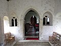 St, Botolph, Slapton - chancel arch - geograph.org.uk - 5192050.jpg 1,024 × 768; 129 KB
-
 St.Botolph's church, Slapton - geograph.org.uk - 5192000.jpg 1,024 × 768; 326 KB
-

-
 The beginning of a footpath to Bradden - geograph.org.uk - 5196380.jpg 1,024 × 768; 364 KB
-
 The Boxes, Slapton - geograph.org.uk - 5608703.jpg 640 × 360; 71 KB
-
 Bridge over dismantled railway - geograph.org.uk - 328726.jpg 640 × 480; 170 KB
-
 Bridge over small stream - geograph.org.uk - 461026.jpg 640 × 458; 117 KB
-
 Entrance to Slapton Hill Farm - geograph.org.uk - 460965.jpg 640 × 494; 82 KB
-
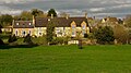
 Houses at Green's Park - geograph.org.uk - 461013.jpg 640 × 425; 99 KB
-
 Junction - geograph.org.uk - 328712.jpg 640 × 480; 93 KB
-
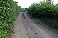
 Lane from Green's Park - geograph.org.uk - 461029.jpg 480 × 640; 117 KB
-
 Large house at Green's Park - geograph.org.uk - 461004.jpg 640 × 410; 100 KB
-
 Ruins near Slapton Hill Farm - geograph.org.uk - 460984.jpg 640 × 397; 80 KB
-
 Winter field - geograph.org.uk - 328718.jpg 640 × 480; 97 KB


