Category:Smith's Wood
Jump to navigation
Jump to search
English: Smith's Wood is a residential area in the north of the Metropolitan Borough of Solihull in the West Midlands of England. It is a civil parish with a population of 10,943, according to the 2001 census.
village in United Kingdom | |||||
| Upload media | |||||
| Instance of | |||||
|---|---|---|---|---|---|
| Location | Solihull, West Midlands, England | ||||
 | |||||
Media in category "Smith's Wood"
The following 56 files are in this category, out of 56 total.
-
 A footbridge over the M6 - geograph.org.uk - 4511163.jpg 1,500 × 983; 121 KB
-
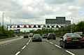 A motorway speed gantry over the M6 - geograph.org.uk - 4511164.jpg 1,500 × 983; 133 KB
-
 Approaching the M42 from the M6 - geograph.org.uk - 1887986.jpg 640 × 480; 55 KB
-
 Bosworth Centre - geograph.org.uk - 2811360.jpg 3,648 × 2,048; 2.54 MB
-
 Bridge over the M6 - geograph.org.uk - 3703298.jpg 4,468 × 2,284; 1.97 MB
-
 Bridge over the M6 - geograph.org.uk - 3703299.jpg 4,608 × 2,480; 2.08 MB
-
 Buckingham Road, Kingshurst - geograph.org.uk - 4355941.jpg 1,240 × 930; 418 KB
-
 Chelmer Close - geograph.org.uk - 4074804.jpg 640 × 480; 87 KB
-

-
 Chester Road at Kingshurst - geograph.org.uk - 4347415.jpg 1,142 × 857; 324 KB
-
 Chester Road, Kingshurst - geograph.org.uk - 3336728.jpg 640 × 480; 66 KB
-
 Clare House, Kingshurst - geograph.org.uk - 4688215.jpg 1,102 × 1,469; 365 KB
-
 Eastern part of Lanchester Way, Smith's Wood - geograph.org.uk - 5703670.jpg 1,024 × 768; 157 KB
-
 Estate roundabout in Kingshurst - geograph.org.uk - 4347391.jpg 1,142 × 857; 276 KB
-
 Footpath to Auckland Drive, Smith's Wood - geograph.org.uk - 5703686.jpg 1,024 × 768; 199 KB
-
 Houses off Sunbeam Close, Smith's Wood - geograph.org.uk - 5703699.jpg 1,024 × 768; 112 KB
-
 In the middle of the A452 - geograph.org.uk - 4688169.jpg 1,142 × 857; 442 KB
-
 Junction on the A452, Kingshurst - geograph.org.uk - 3336736.jpg 640 × 480; 57 KB
-
 Kingshurst, Laburnum Avenue - geograph.org.uk - 4347402.jpg 1,142 × 857; 310 KB
-
 Lanchester Way bus turning circle, Smith's Wood - geograph.org.uk - 5703681.jpg 1,024 × 768; 109 KB
-

-
 M6 approaching J4a - geograph.org.uk - 3125215.jpg 640 × 430; 38 KB
-

-
 M6 heading south towards Junction 4 - geograph.org.uk - 4688085.jpg 3,428 × 2,107; 1.23 MB
-
 M6 motorway - geograph.org.uk - 4688297.jpg 1,142 × 857; 308 KB
-

-
 M6 North, bridges at junction 4a - geograph.org.uk - 2104666.jpg 640 × 384; 308 KB
-
 M6 northbound at Kingshurst - geograph.org.uk - 2841961.jpg 640 × 481; 47 KB
-
 M6 northbound nears Junction 4A - geograph.org.uk - 2841970.jpg 640 × 481; 44 KB
-
 M6 south of Junction 4A - geograph.org.uk - 4688080.jpg 1,600 × 958; 330 KB
-
 M6, J4a - geograph.org.uk - 3125217.jpg 640 × 379; 35 KB
-
 New Housing, Castle Bromwich - geograph.org.uk - 2810198.jpg 3,648 × 2,736; 2.28 MB
-
 Newly-built town centre facilities in Kingshurst - geograph.org.uk - 4688217.jpg 1,306 × 979; 448 KB
-
 OS benchmark - Castle Bromwich, Lanchester Way - geograph.org.uk - 4831589.jpg 857 × 1,142; 521 KB
-

-

-
 OS benchmark - Kingshurst, 15 Ellice Drive - geograph.org.uk - 4688177.jpg 1,142 × 857; 485 KB
-
 OS benchmark - Kingshurst, 168 Alvis Walk - geograph.org.uk - 4355965.jpg 857 × 1,142; 543 KB
-
 OS benchmark - Kingshurst, 418 Chester Road - geograph.org.uk - 4347407.jpg 857 × 1,142; 450 KB
-
 OS benchmark - Kingshurst, building on Arran Way - geograph.org.uk - 4688198.jpg 799 × 1,067; 459 KB
-

-

-
 OS rivet ^ benchmark - Kingshurst, Tamar Drive - geograph.org.uk - 4355950.jpg 857 × 1,142; 435 KB
-
 Parting of the ways, M6 junction 4a - geograph.org.uk - 2801849.jpg 640 × 480; 62 KB
-
 Pembroke House, Kingshurst - geograph.org.uk - 4688211.jpg 1,102 × 1,469; 392 KB
-
 Red Wing Walk, Smith's Wood - geograph.org.uk - 5703683.jpg 1,024 × 768; 195 KB
-
 Silver Birch Road, Kingshurst - geograph.org.uk - 4347375.jpg 1,142 × 857; 281 KB
-
 Smith's Wood - geograph.org.uk - 4688204.jpg 1,142 × 857; 405 KB
-
 St Barnabas church, Kingshurst - geograph.org.uk - 4347366.jpg 1,142 × 857; 309 KB
-
 Sunbeam Close, Smith's Wood - geograph.org.uk - 5703702.jpg 1,024 × 768; 136 KB
-
 Swift Close, Smith's Wood - geograph.org.uk - 5703689.jpg 1,024 × 768; 125 KB
-
 Tamar Drive, Kingshurst - geograph.org.uk - 4355959.jpg 1,306 × 979; 403 KB
-
 Waveney Croft - geograph.org.uk - 4074807.jpg 640 × 480; 51 KB
-
 Windward Way - geograph.org.uk - 2811378.jpg 3,648 × 2,048; 1.72 MB
-
 Wolseley Close, Smith's Wood - geograph.org.uk - 5703659.jpg 1,024 × 768; 164 KB
-
 The Farthings Public House - geograph.org.uk - 226548.jpg 640 × 480; 131 KB


