Category:Smithtown, New York
Пређи на навигацију
Пређи на претрагу
English: Smithtown, New York is a historic hamlet and census-designated place near the Long Island Sound, in northern central Suffolk County on Long Island in New York. The hamlet is the town seat of the Town of Smithtown, New York, which has a category of its own.
census-designated place in Suffolk County, New York   | |||||
| Отпремање медија | |||||
| Је | |||||
|---|---|---|---|---|---|
| Локација | Округ Сафок, Њујорк, САД | ||||
| Насељеност |
| ||||
| Површина |
| ||||
| Надморска висина |
| ||||
 | |||||
Поткатегорије
Приказано је 8 поткатегорија; укупно 8.
B
- Bank of Smithtown (2 F)
- Blydenburgh County Park (7 F)
F
S
- Smithtown (LIRR station) (1 P, 11 F)
T
W
- Whisper the Bull (Smithtown) (5 F)
Медији у категорији „Smithtown, New York”
Следећих 44 датотека је у овој категорији, од укупно 44.
-
 American Legion Post 833; Smithtown, New York.jpg 3.648 × 2.736; 2,07 MB
-
 Anchor Canvas; NY 25 near Caleb Smith State Park.jpg 3.648 × 2.736; 2,08 MB
-
 Arthur Kunz County Park Sign.jpg 3.648 × 2.736; 2,01 MB
-
 Church in Smithtown Long Island.JPG 960 × 720; 161 kB
-
 Jericho Tpke Cycle Company; Caleb Smith Park.jpg 3.648 × 2.736; 2,09 MB
-
 Landscaped Median Along NY 347, Smithtown, NY April 14, 2024 A.jpg 4.032 × 3.024; 4,41 MB
-
 Landscaped Median Along NY 347, Smithtown, NY April 14, 2024 B.jpg 4.032 × 3.024; 4,98 MB
-
 Landscaped Median Along NY 347, Smithtown, NY April 14, 2024 C.jpg 4.032 × 3.024; 4,01 MB
-
 New York - Smithtown through Stony Brook - NARA - 68145599 (cropped).jpg 5.313 × 4.009; 12,27 MB
-
 New York - Smithtown through Stony Brook - NARA - 68145599.jpg 6.998 × 5.452; 19,66 MB
-
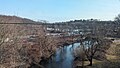 Nissequogue River from LIRR.jpg 1.560 × 878; 501 kB
-
 Noel Place, Smithtown Hills, Smithtown, Long Island New York July 18, 2021.jpg 4.032 × 3.024; 5,78 MB
-
 NY 25 Approaching W End NY 25A Overlap.jpg 3.648 × 2.736; 2,05 MB
-
 NY 25-25A near Paul Givens Park Entrance, Smithtown.jpg 3.648 × 2.736; 2,08 MB
-
 NY 347 in Smithtown, NY April 14, 2024 A.jpg 4.032 × 3.024; 1,99 MB
-
 NY 347 in Smithtown, NY April 14, 2024 B.jpg 4.032 × 3.024; 1,96 MB
-
 NY 347 in Smithtown, NY April 14, 2024 C.jpg 4.032 × 3.024; 2 MB
-
 NY 347 in Smithtown, NY April 14, 2024 D.jpg 4.032 × 3.024; 2,21 MB
-
 Old NY 25-25A Bridge over Nissequogue River-1.jpg 3.648 × 2.736; 2,04 MB
-
 Old NY 25-25A Bridge over Nissequogue River-2.jpg 3.648 × 2.736; 2,1 MB
-
 Old NY 25-25A Bridge over Nissequogue River-3.jpg 3.648 × 2.736; 2,07 MB
-
 Old NY 25-25A Bridge over Nissequogue River-4.jpg 3.648 × 2.736; 2,08 MB
-
 Old NY 25A East of Willow Ridge-Stone Gate.jpg 3.648 × 2.736; 2,04 MB
-
 Old NY 25A West of Willow Ridge Drive-1.jpg 3.648 × 2.736; 2,09 MB
-
 Old NY 25A West of Willow Ridge Drive-2.jpg 3.648 × 2.736; 2,1 MB
-
 Old NY 25A West of Y with NY 25.jpg 3.648 × 2.736; 2,05 MB
-
 Old Smithtown LIRR Station.jpg 3.648 × 2.736; 2,03 MB
-
 Shsw.jpg 3.072 × 2.304; 1,75 MB
-
 Smith Town Branch NYPL1633982.tiff 7.230 × 4.960; 102,6 MB
-
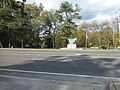 Smithtown Bull Across from NY 25.jpg 3.648 × 2.736; 2,08 MB
-
 Smithtown Cemetery exit - Route 25A.jpg 4.032 × 2.268; 4,64 MB
-
 Smithtown Landing Golf Club-1.jpg 3.648 × 2.736; 2,02 MB
-
 Smithtown Landing Golf Club-2.jpg 3.648 × 2.736; 2,07 MB
-
 Smithtown, NY Town Seal.png 600 × 591; 368 kB
-
 Smithtown-village-map.gif 575 × 425; 71 kB
-
 Smithtown-village-map.PNG 581 × 430; 111 kB
-
 Stownmainstreet.jpg 3.072 × 2.304; 1,84 MB
-
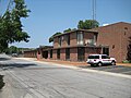 Stownvfd.jpg 3.072 × 2.304; 2,01 MB
-
 Suffolk County, V. 2, Double Page Plate No. 24 (Map bounded by Mount Sinai and Crystal Brook Park, Smith Town) NYPL2055512.tiff 7.150 × 5.363, 2 странице; 109,97 MB
-

-
 Summerset Drive, Smithtown Hills, Smithtown, Long Island New York July 18, 2021 A.jpg 2.100 × 1.574; 1,74 MB
-
 Summerset Drive, Smithtown Hills, Smithtown, Long Island New York July 18, 2021 B.jpg 4.032 × 3.024; 4,75 MB
-
 The American Museum journal (c1900-(1918)) (17538130984).jpg 1.720 × 1.862; 701 kB
-
 William Arthur House (1752); Smithtown, NY.jpg 3.648 × 2.736; 2,09 MB


.jpg)


)_(17538130984).jpg)
;_Smithtown,_NY.jpg)